



Central Midwest Water Science Center
Central Midwest Water Science Center
Central Midwest Water Science Center
Central Midwest Water Science Center
Welcome to the Central Midwest Water Science Center’s (CMWSC) Website. We offer information on streamflow, water quality, water-use, and groundwater data for Illinois, Iowa, and Missouri. We conduct unbiased, scientific hydrologic investigations & research projects to effectively manage CMWSC and our Nation's water resources through joint efforts with our partners.


News
Harvesting Knowledge: A Recap of the USGS-NPS-Tribal Collaboration at Effigy Mounds National Monument
Harvesting Knowledge: A Recap of the USGS-NPS-Tribal Collaboration at Effigy Mounds National Monument
Friday's Findings: Environmental Contaminants and Agricultural Production
Friday's Findings: Environmental Contaminants and Agricultural Production
StreamStats regression equation updates for Illinois
StreamStats regression equation updates for Illinois
Publications
Evaluating chlorophyll fluorescence sensors as a proxy for chlorophyll a concentrations in the Illinois River, Illinois, water years 2018–24 Evaluating chlorophyll fluorescence sensors as a proxy for chlorophyll a concentrations in the Illinois River, Illinois, water years 2018–24
The U.S. Geological Survey deployed instream chlorophyll fluorescence sensors on the Illinois River in Illinois to better understand the formation, dynamics, and persistence of riverine algal blooms. At five sensor locations across four U.S. Geological Survey streamgages, chlorophyll fluorescence (fChl) sensors were set to measure instantaneous fChl in micrograms per liter as chlorophyll...
Re-examining the growing degree day minimum for grass carp spawning initiation in Lake Erie: Have we missed the mark? Re-examining the growing degree day minimum for grass carp spawning initiation in Lake Erie: Have we missed the mark?
Understanding the timing of life history processes of invasive fish species, such as adult aggregations during spawning, allows natural resource managers to optimize targeted population control efforts. Temperature-based estimates of the timing of spawning initiation for grass carp (Ctenopharyngodon idella) exist from its native range, but have not previously been developed for grass...
Simulation of groundwater flow in the Silurian aquifer, eastern Iowa, 2020–45 Simulation of groundwater flow in the Silurian aquifer, eastern Iowa, 2020–45
The Silurian aquifer is an important water source for municipalities, industry, and rural households and communities in eastern Iowa, including Johnson County. Increasing demand for groundwater from the aquifer indicated that analytical tools may be beneficial to quantify groundwater resources and inform water-management decisions for the aquifer. The U.S. Geological Survey, in...
Science
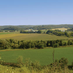
Land application of waste to US farmland: Understanding the scope and environmental implications to aid best practices
USGS is studying how different waste materials are reused on farmland and what they might mean for people and the environment. These wastes can offer benefits, but they can also carry substances we don’t fully understand. Because little is known about what’s in these waste materials or how they move through soil and water, more information is needed. USGS research helps fill these gaps so...

Real-Time Fish Telemetry
The USGS real-time fish telemetry network is operated in collaboration with partner agencies including the U.S. Fish and Wildlife Service, the U.S. Army Corps of Engineers, and the States of Illinois, Ohio, and Michigan. The primary function of this network is to monitor the movement of invasive carp in priority rivers. When invasive carp are detected at one of our receivers, subscribers at...

Assessment of Groundwater and Quality - Cedar River Project
Assessment of Groundwater and Quality: Cedar River Alluvium, Cedar Rapids, Iowa Period of Project: Since 1992 Project Managers: Shannon Meppelink & Emilia Bristow Study Area: Linn County Cooperating Agency: City of Cedar Rapids (Water Division)