
Eyes on Earth: Landsat
Landsat satellites have imaged our planet for over 50 years, capturing data for scientists for a variety of applications. The program has become invaluable to the world.
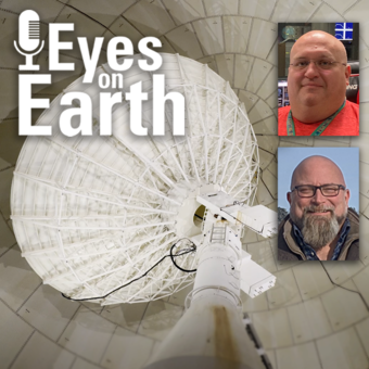
Episode 136 – The EROS Test Site

Landsat has been accurate and reliable for over 50 years because of the diligent calibration and validation work done by the team at EROS. One of the ways the team validates what they have so carefully calibrated is to take measurements on the ground while Landsat passes by overhead. For this Eyes on Earth podcast episode, we go out to the EROS test site during a Landsat pass to get a sense of what that work is like. Learn about the instruments used for this work and why it’s important to keeping Landsat as the gold standard for Earth observations.
Guests:
Jeff Irwin, USGS EROS
Travis Kropuenske, KBR, contractor for USGS EROS
Host: Tom Adamson (contractor for USGS EROS)
Release date: Thursday, June 12, 2025
Episode 134 – Data Accuracy: The Calibration and Validation of Landsat

Landsat is the longest-running, continuously operating record of Earth observations, and it’s the gold standard reference point that other civil and commercial satellite programs trust. If a researcher is studying multiple Landsat images of the same spot on Earth, and there is something in those images that suggests a change, that researcher needs to have the confidence that that change is a real change on the landscape and not because of something that changed or degraded in the sensor. Think of it this way. We are using a system to quantify changes on the Earth—we need to make sure the system itself is not changing.
Guest: Cody Anderson, USGS EROS
Host: Tom Adamson (contractor for USGS EROS)
Release date: Monday, May 5, 2025
Episode 130 – NLCD Accuracy

Every pixel has a story. At least that’s how land remote sensing scientist Jo Horton sees it. The new Annual National Land Cover Database (NLCD) was just released in October 2024. NLCD is widely used for land cover and change research in the U.S. That’s why the Reference and Validation team provides accuracy metrics to users, and this work allows EROS to move land cover mapping science forward. Learn about what the Reference and Validation team does and what they are looking for when they closely examine thousands of Landsat sample pixels across the conterminous U.S. It sometimes involves some detective work as they figure out the stories of each pixel across time.
Guest: Jo Horton (contractor for USGS EROS)
Host: Tom Adamson (contractor for USGS EROS)
Release date: Monday, January 6, 2025
Episode 129 – What Happens During a Landsat Pass?
In this episode, we talk to ground station technicians to find out how Landsat satellite data gets from the spacecraft to EROS and then to the archive. We see what it’s like in EROS’s Landsat operations room and what the technicians do before, during, and after a Landsat pass. The task of making sure those bits of data make their way to the archive so it can be used for land change science occurs for them several times a day. As routine as it might be sometimes, they are a small but important part of a large mission that is documenting global land change.
Guests:
Aaron Hensley (contractor for USGS EROS)
Eric Gaspar (contractor for USGS EROS)
Host: Tom Adamson (contractor for USGS EROS)
Release date: Monday, December 9, 2024

Episode 128 – Fall Poster Session
In this episode, we mingle at the 2024 EROS Fall Poster Session. A poster session is a way for scientists to share their work with their colleagues in a public forum. About 30 posters were on display in the EROS atrium from EROS staff and several students from local universities.
Guests:
Natalie Liberati (South Dakota State University)
Brenden Elwer (South Dakota State University)
Madison DeJarlais (South Dakota State University)
Abhinav Chandel (University of South Dakota)
Jo Horton (KBR, contractor for USGS EROS)
Hua Shi (ASRC Federal Data Solutions, contractor for USGS EROS)
Lei Ji (ASRC Federal Data Solutions, contractor for USGS EROS)
Tim Smith (KBR, contractor for USGS EROS)
Brent Nelson (KBR, contractor for USGS EROS)
Brent Johnson (KBR, contractor for USGS EROS)
Host: Tom Adamson (contractor for USGS EROS)
Release date: Monday, November 25, 2024
Episode 127 – The Historic Landsat 7 Mission

In this episode, we talk about the incredible career of Landsat 7, which collected science imagery of the Earth for nearly 25 years. The Flight Operations Team at NASA Goddard Space Flight Center and engineers at EROS work together to collect imagery, send commands to the satellite, and keep it healthy. After over 133,000 orbits and 3.3 million images collected, Landsat 7 stopped acquiring imagery in 2024. We talked with some of the people who helped keep Landsat 7 flying to make sure it could keep doing its job during its long life. They talk about the close calls, different types of maneuvers, working on holidays, and creatively solving problems to keep it flying and operating.
Guests:
Tammy Vajo, KBR, contractor to USGS
Tom Cooke, KBR, contractor to USGS
Jim Lacasse, USGS EROS
Pat Scaramuzza, KBR, contractor to USGS
Jon Christopherson, KBR, contractor to USGS
Host: Tom Adamson, contractor for USGS EROS
Release date: Tuesday, November 12, 2024
Episode 126 – Annual NLCD

In this episode, we talk about the latest release of the National Land Cover Database (NLCD). More than just a map, NLCD is a stack of maps—a database. It has long been the foundational land cover source for scientists, resource managers, and decision-makers across the United States, and now the next generation of USGS land cover mapping is here. This new release includes land cover data of the United States for every year back to 1985, so it is now called Annual NLCD.
Guests:
Jesslyn Brown, USGS EROS
Jon Dewitz, USGS EROS
Host: Tom Adamson, contractor for USGS EROS
Release date: Monday, October 28, 2024
Episode 123 – Bathymetry Mapping

This episode is the third in our series on using Landsat for coastal studies. We talk to physical geographer Jeff Danielson about bathymetry and how it is critical for coastal modeling. Bathymetry captures the shape of underwater topography, and satellite-derived bathymetry helps fill in areas where there are data gaps. Even though Landsat was designed to image land, it’s a big part of this work because of its systematic temporal coverage. Besides that, high-resolution data from sonar and lidar are too labor intensive to collect everywhere. Therefore, they use all these sources together to get a better picture of bathymetry, especially in remote areas. This modeling helps with studying changes to shorelines such as storm surge, sediment transport, and flood damage.
Guest: Jeff Danielson, USGS EROS
Host: Tom Adamson, contractor for USGS EROS
Release date: Thursday, September 12, 2024
Episode 121 – Mapping the Australia Coastline

This episode is the second in a series about how Landsat is helping researchers study coastal changes. The first one was about mapping changes to beaches in California and using Landsat to create models to predict how the coastline may change in the future because of sea level rise and coastal erosion. For this episode, we talk with Robbi Bishop-Taylor, coastal Earth observation scientist at Geoscience Australia, about how he takes advantage of one of Landsat’s best features—time. Using Landsat data back to the 1980s and Open Data Cube to make the dataset openly available, researchers can see where shorelines are eroding and where they are growing around the entire coastline of Australia. Using sub-pixel mapping, they can make Landsat’s 30-meter pixels even more detailed while taking advantage of Landsat’s long archive.
Guest: Robbi Bishop-Taylor, Geoscience Australia
Host: Tom Adamson (contractor for USGS EROS)
Release date: Monday, July 29, 2024
Episode 120 – Mapping the California Coastline

In this episode, we begin a series on Landsat’s usefulness in coastal studies. First, we talk with Sean Vitousek, a USGS research oceanographer, about changes to beaches in California and how he is using Landsat and other data to create models that can predict how the coastline may change in the future because of sea level rise and coastal erosion. Landsat’s global reach stretches back decades—that, along with its free availability, can help in planning for the prevention and adaptation to future hazards along the coast. See how Landsat complements other data and ground truth studies, and how machine learning plays a part in this study as well.
Guest: Sean Vitousek, USGS Pacific Coastal and Marine Science Center
Host: Tom Adamson (contractor for USGS EROS)
Release date: Monday, July 15, 2024
Episode 119 – Kristi Kline: EROS Career Reflections

In this episode, we talk with Kristi Kline about the constant changes and innovations that have been needed at EROS to keep up with changes in computer tech and data processing. Kline has been a part of helping to implement these changes over the past 27 years and is now retiring at the end of May 2024. We discuss her favorite memories like attending the Landsat 8 launch, and being there when Google first approached EROS to help them create an early version of Google Earth with Landsat images.
Guest: Kristi Kline, USGS EROS New Missions Branch Chief
Host: Tom Adamson (contractor for USGS EROS)
Release date: Monday, May 20, 2024
Episode 118 – Preparing for Landsat Next, Part 2

In this episode, we talk with several people involved with the next Landsat mission, targeted for launch around 2030. While that may seem like a ways into the future, it takes a lot of work to prepare for such a big mission. In Part 2 of this two-part series on Landsat Next, we’ll hear about what needs to be done before launch to prepare the ground system, data processing and data calibration. Be sure to also listen to Part 1, where we talk about how different Landsat Next will be from previous Landsat missions, and what scientists are really looking forward to with this mission.
Guests: Brian Sauer, USGS Landsat Next Project Manager at EROS; Chris Engebretson, USGS Acting Ground System Manager for Landsat Next at EROS; Cody Anderson, USGS EROS Calibration and Validation Center of Excellence Project Manager
Host: Tom Adamson (contractor for USGS EROS)
Release date: Monday, May 6, 2024
Episode 117 – Preparing for Landsat Next, Part 1

In this episode, we talk with several people involved with the next Landsat mission. In Part 1, we’ll hear about how different Landsat Next will be from previous Landsat missions and how its additional spectral bands, higher resolution, and 6-day revisit will benefit science and society. Addressing the needs of the Landsat user community was a high priority in developing the mission, so we talk about what scientists are really looking forward to with Landsat Next. The Part 2 episode shares details about technical preparations, such as the ground system and data processing and validation.
Guests: Tim Newman, USGS Program Coordinator for National Land Imaging; Zhuoting Wu, USGS Earth Observation Applications Coordinator for National Land Imaging; Chris Crawford, USGS Research Physical Scientist
Host: Tom Adamson (contractor for USGS EROS)
Release date: Monday, April 22, 2024
Episode 116 – Landsat Images the Twilight Zone

Landsat has documented changes all over the world for over 50 years. Changes in polar regions are happening especially rapidly. But it’s dark in polar regions much of the time. Therefore, a new acquisition scheme is adding more imagery of these dark, polar regions so these changes can be studied in more detail, even in polar twilight. In this episode, we learn about this project, called the Landsat Extended Acquisition of the Poles (LEAP).
Guest: Dr. Chris Crawford, USGS Research Physical Scientist
Host: Tom Adamson (contractor for USGS EROS)
Release date: Monday, April 8, 2024
Episode 114 – The Color of Water with Landsat

Typically, we use Landsat data to study changes on the land—you know, Landsat. In this episode, we learn how satellite images and pixels of water, along with actual water samples, are helpful in determining the productivity of lakes across the United States. We talk with Mendenhall Fellow and Research Geographer Dr. Michael Meyer about a recently released, freely accessible dataset that uses a metric called lake trophic state to validate the Landsat observations of thousands of lakes. The dataset was also named a USGS Open Science Success Story as part of the White House Office of Science and Technology Policy’s 2023 “Year of Open Science” campaign.
Guest: Dr. Michael Meyer, Mendenhall Fellow and Research Geographer, USGS
Host: Tom Adamson (contractor for USGS EROS)
Release date: Monday, March 11, 2024
Episode 113 – EROS Science Leader’s Vision

Terry Sohl helped develop the National Land Cover Database, NLCD, when he first arrived, and now he’s overseeing significant improvements to the widely used product. But that’s just one part of his new role. In this episode, Sohl provides an overview of the science efforts at EROS and how artificial intelligence and machine learning help scientists focus more on the work that helps society. He also shares his vision for the future.
Guest: Terry Sohl, Chief of the USGS EROS Integrated Science and Applications Branch
Host: Jane Lawson (contractor for USGS EROS)
Release date: Monday, February 26, 2023
Episode 111 – Mendenhall Fellow’s Drought Forecasting

In this episode, we spoke to Mikael Hiestand, a Mendenhall Postdoctoral Fellow. Using algorithms developed at EROS, Mikael is working on near-term drought forecasting. With synthetic Landsat data, he found that predicting evapotranspiration could be used as a means of drought prediction and monitoring. The Mendenhall Fellowship allows people who have just completed their PhD an opportunity to work on research with USGS scientists and prepare for their career.
Guest: Mikeal Hiestand, USGS Mendenhall Postdoctoral Fellow and Research Physical Scientist
Host: Tom Adamson (contractor for USGS EROS)
Release date: Monday, January 22, 2024
Episode 108 – Landsat 8’s 100th Drag Make-Up Maneuver

The Landsat Program is considered the gold standard for satellite Earth-observation imagery. To keep it that way, the USGS EROS Flight Operations Team continually monitors the flight paths of the Landsat satellites to make sure they stay at a consistent 705-kilometer altitude. That means frequently speeding it up to counter the effects of atmospheric drag. But that’s not all. The team accounts for solar activity, space junk, and other factors to keep the satellites safe. Landsat 8’s 100th Drag Make-Up maneuver in October 2023 gives us the opportunity, in this episode, to talk about these and the other maneuvers the flight team executes and how they work.
Guest: Larry Tornabene, Flight Systems Manager for Landsat 8
Host: Tom Adamson (contractor for USGS EROS)
Release date: Monday, November 20, 2023
Episode 97 – EROS 50th: Earth As Art

Satellites capture an incredible variety of views of Earth. In this episode, we talk with the three engineers at USGS EROS who started the USGS Earth As Art project. The Earth As Art origin story is an example of the initiative and creativity of EROS staff. This stunningly visual product grabs the public’s attention—and then leads to conversations about the value of remote sensing with satellites.
*Be sure to listen to the bonus material (second audio file below), in which our guests talk about their favorite Earth As Art images.
Guests: Jon Christopherson, Principal System Engineer, contractor for USGS EROS; Ron Hayes, Digital Data Technical Lead, contractor for USGS EROS; Pat Scaramuzza, Senior Scientist, contractor for USGS EROS
Host: Tom Adamson (contractor for USGS EROS)
Release date: Monday, July 3, 2023
Episode 96 – Generational Science

In this episode, we talk with Peder Nelson about generational science and the responsibility we have to future generations to study our changing planet. It takes more than just data to make sense of land change. And while remote sensing scientists work with the deep archive of Landsat and other land data available from the USGS EROS Center, everyone can put themselves on the timeline of Landsat data. Citizen science projects allow anyone to participate in the observations that help us understand the world around us.
Guest: Peder Nelson, Oregon State University
Host: Tom Adamson (contractor for USGS EROS)
Release date: Tuesday, June 20, 2023
Episode 95 – EROS 50th: Landsat Science Team

The members of the five-year Landsat Science Teams, led jointly by the USGS and NASA with a strong tie to EROS, have brought a wide breadth of expertise, backgrounds and geographic locations to the table. In this episode, we learn how members have explored strategies for the effective use of archived Landsat data and integration of future data, and how they have helped identify Landsat user needs for upcoming satellite sensors, including those on the future Landsat Next.
Guests: Curtis Woodcock, Boston University and 4 terms on Landsat Science Team; Mike Wulder, Canadian Forest Service and 3 terms on Landsat Science Team; David Roy, Michigan State University professor and 2 terms on Landsat Science Team
Host: Jane Lawson (contractor for USGS EROS)
Release date: Wednesday, June 7, 2023
Episode 90 – Landsat 8 Turns 10

Originally called the Landsat Data Continuity Mission, Landsat 8 launched on February 11, 2013. In this episode of Eyes on Earth, we talk about the 10th anniversary of Landsat 8 being in orbit and its value to the remote sensing community. While we cannot predict the future, it does look promising that Landsat 8 can sustain that continuity for more years to come.
Guest: Keith Alberts, Acting Landsat Flight Operations Project Manager, EROS
Host: Tom Adamson
Release date: Tuesday, February 21, 2023
Episode 88 – Landsat 5’s Significance, Part 2

In this episode, we learn about how the Landsat 5 flight operations team managed to keep the satellite going as it collected data into its 20s and an award the team recently received. Designed to last three years, Landsat 5 launched in 1984 and transmitted data until the launch of Landsat 8 in 2013. In this episode, we learn about some of the challenges—and adrenaline rushes—Landsat 5 gave the flight operations team as it aged, as well as the fondness our two guests came to have for the satellite’s unique personality and the whole team as they served on it during the satellite’s twilight years. In October 2022, the Flight Operations Team won the 2020 Group Pecora Award during the 22nd William T. Pecora Memorial Remote Sensing Symposium.
Guests: Steve Covington, former Landsat 5 flight manager, now Aerospace Corp. contractor serving as the principal systems engineer for the USGS National Land Imaging Program; and Jeff Devine, former Landsat 5 lead operations engineer, now KBR contractor leading the Fermi Gamma-ray Space Telescope Flight Operations Team at NASA Goddard Space Flight Center
Host: Jane Lawson
Release date: Monday, January 23, 2023
Episode 87 – Landsat 5’s Significance, Part 1

In this episode, we learn about the significance of the fifth satellite in the 50-year-old Landsat program and its remarkable ability to observe the Earth for nearly 29 years. Designed to last three years, Landsat 5 launched in 1984 and transmitted data until the launch of Landsat 8 in 2013. In this episode, we learn about the significance of this satellite, which set a Guinness World Record for “Longest Operating Earth Observation Satellite.” Our two guests served on the flight operations team in the satellite’s twilight years and describe its importance to the unbroken record of Landsat data. They also share their personal connections with the satellite—including a journey from watching the launch on a monitor at EROS to eventually leading the team.
Guests: Steve Covington, former Landsat 5 flight manager, now Aerospace Corp. contractor serving as the principal systems engineer for the USGS National Land Imaging Program; and Jeff Devine, former Landsat 5 lead operations engineer, now KBR contractor leading the Fermi Gamma-ray Space Telescope Flight Operations Team at NASA Goddard Space Flight Center
Host: Jane Lawson
Release date: Monday, January 9, 2023
Episode 85 – Landsat 7 Extended Science Mission

In this episode, we learn more about Landsat 7’s extended science mission and the resulting circumstance of collecting data from three Landsat satellites. Landsat 7’s nominal science mission ended in April 2022 after nearly 23 years of acquiring Earth imagery from 705 kilometers above the Earth. Landsat 7 is now in an extended science mission after having its orbit lowered by about 8 kilometers to make way for Landsat 9. In this episode, we discuss why Landsat 7 continues to collect imagery, the quality of the extended science mission imagery, and the advantages of having three Landsats operating at the same time.
Guest: Chris Crawford, USGS Research Physical Scientist, Landsat Project Scientist, Co-chair of the Landsat Science Team, Landsat Science Data Acquisition Manager
Host: Tom Adamson
Release date: Monday, December 5, 2022
Episode 79 – Landsat Global Archive Consolidation

In this episode, we learn about the process that has gradually added millions of earlier Landsat scenes to the 50-year archive. The Landsat archive at EROS contains an unparalleled 50 years of Earth observation data. But with earlier technologies, some Landsat scenes were collected and stored only by international ground receiving stations rather than in the central archive at EROS. More than 10 years ago, to help make that far-flung data available to scientists interested in land change over time, the Landsat Global Archive Consolidation (LGAC) project began having the reels and tapes sent to EROS to digitize that information. In this episode of Eyes on Earth, we learn how that project has deepened the archive dramatically.
Guests: Todd Taylor, EROS contract task lead for Sustaining Land Imaging partnership support, and contractor Jayson Holter, EROS task manager for the Landsat Missions Operations Project, Ground Operations
Host: Tom Adamson
Release date: August 29, 2022
Episode 78 – Landsat 50 Lookback

In this episode, we look back at how past guests viewed the value of Landsat satellites and their 50-year history. Government officials and scientists had high hopes for Landsat when the first experimental satellite launched July 23, 1972. Those hopes were soon realized when imagery came back depicting features never before seen. Since then, an archive of imagery surpassing 10 million scenes has amassed at EROS, collected from eight different Landsat satellites. Agencies, scientists, researchers, and data analysts use Landsat in a variety of ways to learn more about our planet, preserve its resources, and benefit its people. On this episode of Eyes on Earth, we spotlight how several guests from past Eyes on Earth episodes value the Landsat imagery and archive, from forests and fires to lakes and cities.
Guests: Bob Schuchman of the Michigan Tech Research Institute, Sara Hart of Colorado State University, Rob Skakun of Natural Resources Canada, Andres Espejo of the World Bank, James Cottone on the New York City Council staff, Christian Braneon of NASA’s Goddard Institute for Space Studies, Frank Fay of the USDA Forest Service, former EROS Science Branch Chief John Dwyer
Host: John Hult
Release date: July 25, 2022
Episode 74 – A Satellite Cross Calibration Mission

In this episode, we hear how a new mission will make it easier to use satellite datasets interchangeably. When the first Landsat satellite launched 50 years ago, it was the only game in town in terms of civilian land remote sensing. In the years that followed, a host of satellites have launched to serve similar purposes. But that data doesn't always play well together. Subtle differences between the measurements taken by satellites make it difficult to do apples to apples comparisons of land change.
On this episode of Eyes on Earth, we hear from the USGS partners working with partners in Australia to launch a satellite cross calibration mission that will offer a common reference post and serve as a sort of “translation tool” to help remote sensing scientists to use datasets together to study changes to the Earth’s surface.
Guests: Greg Stensaas, USGS EROS, Grant Mah, USGS EROS, Jon Christopherson, USGS EROS contractor
Host: John Hult
Release date: May 31, 2022
Episode 62 – Landsat 9 Launch Part 3

In this episode, we hear from a pioneer in remote sensing. For our third and final episode of Eyes on Earth from the September launch of Landsat 9, we hear from Virginia Norwood. She blazed a trail for women in remote sensing in the 1960s and 70s while working for Hughes Aircraft, a contractor for NASA. Norwood is known as the “Mother of Landsat” for her design of the Multispectral Scanner, or MSS, the sensor used to image the Earth’s surface by early Landsat satellites. Norwood met her fans during a Q&A a few hours after the launch sponsored by the USGS and Ladies of Landsat. The episode also features an appearance from Kass Green, who founded a company in the 1980s that used Landsat data to map landscape change.
Guests: Virginia Norwood, physicist, Kass Green, Kass Green and Associates
Hosts: John Hult, Kate Fickas
Release date: November 30, 2021
Episode 61 – Landsat 9 Launch Part 2

In this episode, we hear interviews with international partners on the day of the Landsat 9 launch. Hundreds of scientists, officials, international representatives, and others witnessed the launch of Landsat 9 on September 27, 2021, from a handful of viewing sites around Santa Barbara County, California. Their interests were as varied as their backgrounds, but the new satellite’s extension of the Landsat program’s invaluable 50-year record of Earth observations was top of mind for the international partners who help the USGS collect Landsat data and the scientists who rely on those data to monitor the health of the planet. In this episode of Eyes on Earth, we talk with guests from around the world about their role in the Landsat program, and the importance of the program to their work.
Guests: Andres Espejo, Senior Forest Carbon Specialist, World Bank; Naikoa Aguilar-Amuchasegui, Senior Director of Forest Carbon Science and MRV Lead, World Wildlife Fund; Ann Bray, Minister-Counsellor for Industry, Science, Energy and Resources, Australian Embassy; Marc Jochemich, Head of Washington, D.C. office, German Aerospace Center
Host: John Hult
Release date: November 15, 2021
Episode 60 – Landsat 9 Launch Part 1

In this episode, we hear interviews with some of the various agency officials gathered before the Landsat 9 launch. Landsat 9 launched into orbit from Vandenberg Space Force Base on Monday, September 27, 2021, to carry on the legacy of a nearly 50-year record of continuous Earth observation that began in 1972. The days leading up to the event saw guests from around the world descend upon Santa Barbara County in California to watch the historic event take place. Over the next few weeks, we’ll bring you some of the interviews we collected with scientists, government officials and Mission partners. This episode of Eyes on Earth focuses on the day before the launch, when we spoke about the importance of the Landsat program with guests at the launchpad and a Landsat for Climate event.
Guests: Tanya Trujillo, Department of Interior Assistant Secretary for Water and Science; Tony Willardson, Director of the Western States Water Council; Joaquin Esquivel, Chair of the California Water Resources Control Board; Kevin Gallagher, Associate Director of USGS Core Science Systems
Host: John Hult
Release date: October 13, 2021
Episode 19 – 100 Million Landsat Downloads

In this episode, we celebrate the 100 millionth scene downloaded and discuss the open data policy that made the milestone possible. For decades, each Landsat image had a price tag – a hefty one at times, ranging from 400 dollars to as much as 4,000 dollars. That all changed in 2008 with the enactment of an open data policy that made the entire Landsat archive available for download at no cost to the user. In this episode of Eyes on Earth, we talk with one of the architects of that policy, as well as an EROS data manager who saw the post-2008 spike in Landsat data use in real time. The 100 millionth Landsat scene was recently downloaded from the EROS archive, marking a major milestone for a policy shift that opened the door to previously impossible wide-scale research projects and generated billions of dollars in returns worldwide.
Guests: Barb Ryan, former Secretariat-Director for the Group on Earth Observations (GEO) and former Associate Director of Geography for USGS; Kristi Kline, Project Manager for the Landsat Archive.
Host: Steve Young
Producer: Brian Hauge
Release date: March 13, 2020