

Nearly four inches of rain in 30 hours drenched the second-largest city in Afghanistan at the beginning of March, causing flash floods that killed at least 20 people, collapsed homes and swept away moving vehicles.
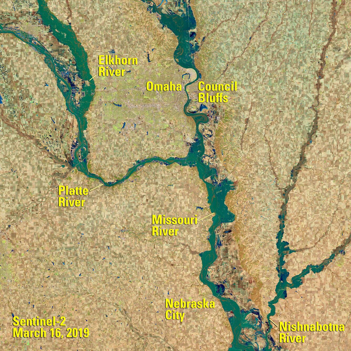
Missouri River Flooding
Heavy snowfall and frigid temperatures in the Midwestern United States were followed by a late winter storm in mid-March of 2019. The combined effect produced heavy flooding along the Missouri River and its tributaries throughout Nebraska and Iowa.
The Landsat and Sentinel satellites, whose data is housed at the U.S. Geological Survey’s Earth Resources Observation and Science (EROS) Center near Sioux Falls, SD, each captured clear views of the flooding on March 16, 2019.


Sources/Usage: Public Domain. View Media Details

Sources/Usage: Public Domain. View Media Details


Sources/Usage: Public Domain. View Media Details
Related
Nearly four inches of rain in 30 hours drenched the second-largest city in Afghanistan at the beginning of March, causing flash floods that killed at least 20 people, collapsed homes and swept away moving vehicles.
Related
Flash Floods Soak Kandahar
Nearly four inches of rain in 30 hours drenched the second-largest city in Afghanistan at the beginning of March, causing flash floods that killed at least 20 people, collapsed homes and swept away moving vehicles.
Nearly four inches of rain in 30 hours drenched the second-largest city in Afghanistan at the beginning of March, causing flash floods that killed at least 20 people, collapsed homes and swept away moving vehicles.