



Our team of biologists, ecologists, and social scientists focuses on coproducing actionable science products to support natural resource planning and management. Broadly, our research involves working to better understand and bridge the research-management gap through a variety of mechanisms, including coproduction and relationship-building, science synthesis and summary, and identification of priority science needs for public land managers. We strive to develop products that are useful for natural resource planners and managers at key points in their decision processes. To do this, we collaborate with public land managers, planners, and other practitioners to incorporate their knowledge, experience, and perspectives into our work.
Science Synthesis & Summary
Identifying Priority science needs
Habitat modeling for Rare plants
Land Health
Monitoring and Managing Landscapes
Supporting wildlife management
Coproduction
Highlighted News
Science Synthesis & Summary
We are working with resource management agencies to develop new types of science synthesis products that can facilitate science use in public lands decisions. We are also developing methods to rapidly identify and characterize the best available science on priority topics for land managers, supporting consistency and defensibility of management decisions.
Comprehensive synthesis products
Rapid response summary products

Identifying Priority Science Needs
In this series of projects, we worked with the BLM and other agencies to identify specific needs for data, science, methods, and mitigation actions that can strengthen the science foundation for resource planning and management decisions on public lands.
Science Strategies for National Conservation Lands
We are working with BLM to develop science strategies to identify priority science needs to support management of resources, objects, and values on BLM National Conservation Lands.
Developing habitat models for rare plants
Understanding resource managers' use of habitat models
Fostering greater use of habitat models
Land Health
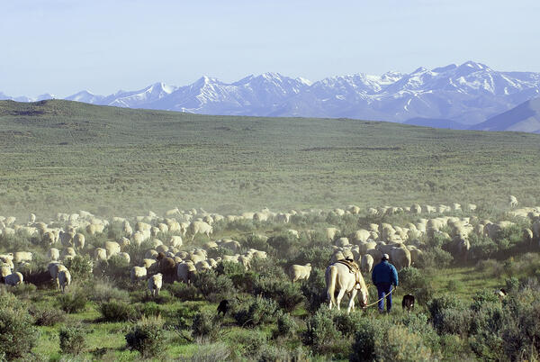
We develop methods that integrate remotely sensed data into the Bureau of Land Management's land health process, providing broad spatial and temporal context that supports the Bureau's multi-scale assessment of more than 100 million acres of public rangelands managed for multiple uses—from grazing and wildlife to recreation, mineral extraction, timber harvest, and scenic and cultural values.
Recommendations for landscape assessments
Strengthening effects analysis
Quantifying Ecological Integrity in Terrestrial systems
Broad Scale Indicators for Ecosystem Monitoring
A landscape approach to resource management
Assessing Threats to Conservation Priority Areas
Pygmy Rabbits in Wyoming
Desert Tortoise Habitat Management
Coproduction
Coproduction is a collaborative approach to conducting science that focuses on producing actionable products that are used to inform natural resource management decisions. Our group coproduces many of our projects with public land managers, and we develop tools, trainings and research to assist other groups in implementing coproduction with their research teams.
A coproduction toolkit
Trainings for coproduction of actionable science
-
FORT Science in Action 2026, Part 8: Rapid response science summary products to support natural resource managers FORT Science in Action 2026, Part 8: Rapid response science summary products to support natural resource managers
Natural resource managers often look to summary and synthesis products to find the science they need for decision making. However, decision timelines are often short, so there is a need to produce such products quickly. In 2026, a FORT team developed a process and software, KWICer, to meet that need.
-

National Conservation Lands: A hub for scientific discovery National Conservation Lands: A hub for scientific discovery
Last year marked the 25th anniversary of America’s National Conservation Lands, a group of over 900 landscapes managed by the Bureau of Land Management (BLM) for cultural, ecological, and scientific values. As part of a special edition of Park Stewardship Forum celebrating this anniversary, USGS and BLM collaborated on a piece highlighting key science opportunities on National Conservation Lands.
-

New habitat suitability model to inform decision making and recover rare species in New Mexico New habitat suitability model to inform decision making and recover rare species in New Mexico
In collaboration with multiple land management agencies, FORT scientists developed a new habitat suitability model to inform decision making on public lands and help conserve a rare plant.

Synthesis of sage-grouse genetic information to support conservation and land management actions

KWIC Science: Rapid response products to meet resource managers’ priority science needs

Developing Science Plans for the Bureau of Land Management’s National Landscape Conservation System

Developing structured science syntheses for use in NEPA analyses and decision making in the Bureau of Land Management

Recommendations for conducting landscape assessments to inform decision making on multiple-use public lands

USGS Science Syntheses for Public Lands Management

Skill-building workshops for researchers on the coproduction of actionable science

Developing science syntheses to facilitate climate-informed land management decisions and NEPA analyses on rangelands in the sagebrush biome

Fostering greater use of habitat models for managing rare and invasive plants on public lands

Identifying priority science needs for strengthening decision making on public lands

Developing a step-by-step process for assessing cumulative effects in the Bureau of Land Management

Developing fire science syntheses for wildland fire managers
Our team of biologists, ecologists, and social scientists focuses on coproducing actionable science products to support natural resource planning and management. Broadly, our research involves working to better understand and bridge the research-management gap through a variety of mechanisms, including coproduction and relationship-building, science synthesis and summary, and identification of priority science needs for public land managers. We strive to develop products that are useful for natural resource planners and managers at key points in their decision processes. To do this, we collaborate with public land managers, planners, and other practitioners to incorporate their knowledge, experience, and perspectives into our work.
Science Synthesis & Summary
Identifying Priority science needs
Habitat modeling for Rare plants
Land Health
Monitoring and Managing Landscapes
Supporting wildlife management
Coproduction
Highlighted News
Science Synthesis & Summary
We are working with resource management agencies to develop new types of science synthesis products that can facilitate science use in public lands decisions. We are also developing methods to rapidly identify and characterize the best available science on priority topics for land managers, supporting consistency and defensibility of management decisions.
Comprehensive synthesis products
Rapid response summary products
Identifying Priority Science Needs
In this series of projects, we worked with the BLM and other agencies to identify specific needs for data, science, methods, and mitigation actions that can strengthen the science foundation for resource planning and management decisions on public lands.
Science Strategies for National Conservation Lands
We are working with BLM to develop science strategies to identify priority science needs to support management of resources, objects, and values on BLM National Conservation Lands.
Developing habitat models for rare plants
Understanding resource managers' use of habitat models
Fostering greater use of habitat models
Land Health
We develop methods that integrate remotely sensed data into the Bureau of Land Management's land health process, providing broad spatial and temporal context that supports the Bureau's multi-scale assessment of more than 100 million acres of public rangelands managed for multiple uses—from grazing and wildlife to recreation, mineral extraction, timber harvest, and scenic and cultural values.
Recommendations for landscape assessments
Strengthening effects analysis
Quantifying Ecological Integrity in Terrestrial systems
Broad Scale Indicators for Ecosystem Monitoring
A landscape approach to resource management
Assessing Threats to Conservation Priority Areas
Pygmy Rabbits in Wyoming
Desert Tortoise Habitat Management
Coproduction
Coproduction is a collaborative approach to conducting science that focuses on producing actionable products that are used to inform natural resource management decisions. Our group coproduces many of our projects with public land managers, and we develop tools, trainings and research to assist other groups in implementing coproduction with their research teams.
A coproduction toolkit
Trainings for coproduction of actionable science
-
-
FORT Science in Action 2026, Part 8: Rapid response science summary products to support natural resource managers FORT Science in Action 2026, Part 8: Rapid response science summary products to support natural resource managers
Natural resource managers often look to summary and synthesis products to find the science they need for decision making. However, decision timelines are often short, so there is a need to produce such products quickly. In 2026, a FORT team developed a process and software, KWICer, to meet that need.
-
-
National Conservation Lands: A hub for scientific discovery National Conservation Lands: A hub for scientific discovery
Last year marked the 25th anniversary of America’s National Conservation Lands, a group of over 900 landscapes managed by the Bureau of Land Management (BLM) for cultural, ecological, and scientific values. As part of a special edition of Park Stewardship Forum celebrating this anniversary, USGS and BLM collaborated on a piece highlighting key science opportunities on National Conservation Lands.
-
-
New habitat suitability model to inform decision making and recover rare species in New Mexico New habitat suitability model to inform decision making and recover rare species in New Mexico
In collaboration with multiple land management agencies, FORT scientists developed a new habitat suitability model to inform decision making on public lands and help conserve a rare plant.
Synthesis of sage-grouse genetic information to support conservation and land management actions
KWIC Science: Rapid response products to meet resource managers’ priority science needs
Developing Science Plans for the Bureau of Land Management’s National Landscape Conservation System
Developing structured science syntheses for use in NEPA analyses and decision making in the Bureau of Land Management
Recommendations for conducting landscape assessments to inform decision making on multiple-use public lands
USGS Science Syntheses for Public Lands Management
Skill-building workshops for researchers on the coproduction of actionable science
Developing science syntheses to facilitate climate-informed land management decisions and NEPA analyses on rangelands in the sagebrush biome
Fostering greater use of habitat models for managing rare and invasive plants on public lands
Identifying priority science needs for strengthening decision making on public lands
Developing a step-by-step process for assessing cumulative effects in the Bureau of Land Management