
Land Management
Land Management
Learn more about FORT research on land management.
Land management research in support of the Department of the Interior
Land management research in support of the Department of the Interior
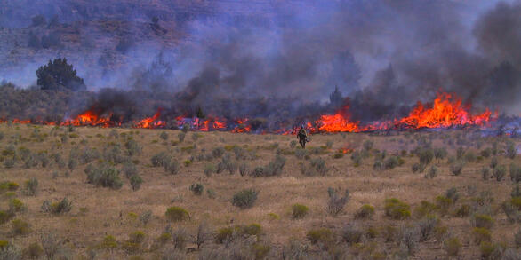
FORT researchers provide sound science to support the Department of the Interior in its efforts to streamline reliable energy development, enhance cost efficiency in public lands management, and manage fire-prone habitats for public safety.
Filter Total Items: 136

Smart Energy Development: Tools for Informed Development & Successful Reclamation
The USGS is developing science and decision support tools to inform policy and management decisions about various aspects of the energy development life cycle.

Higher and Farther: Patterns of Development within Protected Areas
There is a well-known bias in the location of protected areas both within the US and globally. Lands protected for conservation tend to be located on less productive soils at high elevations far from cities. USGS is exploring whether this ‘high and far’ paradigm applies within protected areas as well. That is, does human modification within lands that already have some degree of protection, also...

Informing Habitat Management for Desert Tortoise
There is increasing support for adopting landscape approaches to resource management, including monitoring threats that affect multiple resources across broad extents. However, there remains a need to assess potential threats to individual species of conservation concern. USGS is evaluating the extent to which a generalized indicator of terrestrial development can be used to inform and evaluate...

Quantifying Ecological Integrity in Terrestrial systems
Ecological integrity describes the condition of ecological systems, and has been quantified in aquatic systems for decades. The U.S. Forest Service is now required to monitor ecological integrity, and the Bureau of Land Management has an interest in doing so as well. As a result, USGS is working to define and quantify the concept of ecological integrity in terrestrial, multiple use landscapes to...

Developing Broad Scale Indicators for Monitoring Ecosystems and Landscapes
Many issues currently facing the Bureau of Land Management (BLM) and other large land managers span large landscapes, including sage-grouse conservation, wildfires, and energy development. Such challenges involve changes at both local and broad scales, but monitoring has typically focused at the scale of individual sites. The USGS is working to develop broad-scale indicators for monitoring...

Science Support for Implementing a Landscape Approach to Resource Management in the Bureau of Land Management
The Bureau of Land Management (BLM) is committed to implementing a landscape approach to resource management to help achieve sustainable social, environmental, and economic outcomes on the public lands it manages. USGS is providing science support for the effort, including identifying core principles of a landscape approach, demonstrating the benefits of multiscale data for evaluating potential...

Erosion and Invasive Saltcedar
Formation of arroyos in the late 1800s greatly increased erosion across the southwestern United States. Since the 1930s, however, this erosion has decreased, partly because of bank stabilization by introduced saltcedar. With Isleta Pueblo Indian Nation, the Aquatic Systems Branch developed a new sediment dating method using saltcedar tree rings. We applied the method in a landmark study of arroyo...

Riparian Ecology
Riparian ecologists at the Fort Collins Science Center study interactions among flow, channel change, and vegetation along rivers across the western United States and worldwide. Our work focuses on issues relevant to the management of water and public lands, including dam operation, invasive species, and ecological restoration. Investigations take place on a range of scales. For example...

Riparian Vegetation Response to Dam Removal
Dam removal is an approach to river restoration that is becoming increasingly common. In most cases, dam removal is driven by considerations other than river restoration like dam safety, but how dam removal affects aquatic and riparian systems is of great interest in many dam removals. Scientists work in this area has had two areas of focus thus far: 1) studies of vegetation and geomorphic change...

Large-scale streamflow experiments
Because the underlying cause of riparian system alteration is often attributed to the effects of dams on flow regime, managing flow releases, particularly high flows, from dams is an often-advocated approach to river and riparian restoration. Our work has focused on understanding effects of managed high flow releases (a.k.a., pulse flows, controlled floods) from dams along rivers in the lower...

Science to Inform Riparian Ecosystem Restoration and Management
Throughout the world, riparian habitats have been dramatically modified from their natural condition. Dams, non-native species and climate change are often principal drivers of these changes, via their alteration of water and sediment regimes that determine key resources for riparian plants.

Biological Invasions of Riparian Ecosystems
Beginning in the early twentieth century, non-native trees and shrubs, including tamarisk (also commonly known as saltcedar) and Russian-olive, were introduced to the United States for use as ornamental plants and in erosion-control plantings. These plants spread extensively, becoming the third and fourth most frequently occurring woody riparian plants in the American West.