
Land Management
Land Management
Learn more about FORT research on land management.
Land management research in support of the Department of the Interior
Land management research in support of the Department of the Interior
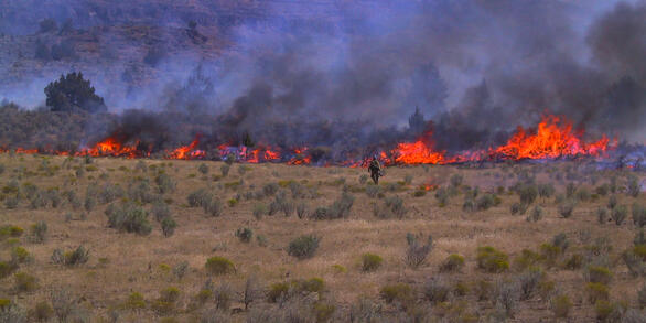
FORT researchers provide sound science to support the Department of the Interior in its efforts to streamline reliable energy development, enhance cost efficiency in public lands management, and manage fire-prone habitats for public safety.
Filter Total Items: 136

Contributions to the development of the Western Association of Fish and Wildlife Agencies Sagebrush Conservation Strategy
USGS scientists are contributing to the development of the Western Association of Fish and Wildlife Agencies Sagebrush Conservation Strategy, a strategy intended to provide guidance so that efforts to conserve the iconic greater sage-grouse can be expanded to the entire sagebrush biome to benefit the people and wildlife that depend on it.

Bureau of Land Management Recreational Visitor Data Program Review
The Bureau of Land Management Recreation and Visitor Services Program regularly conducts recreational visitor satisfaction surveys. The USGS Social and Economic Analysis Branch is assessing the visitor survey effort and recommending updates to the current effort.

Annotated Bibliography of Scientific Research on Greater Sage-Grouse
The greater sage-grouse has been a focus of scientific investigation and management action for the past two decades. The sheer number of scientific publications can be a challenge for managers tasked with evaluating and determining the need for potential updates to existing planning documents.

Informing the Habitat Assessment Framework Process—An Assessment to Understand Habitat Patch Composition and Configuration Requirements for Range-Wide Sage-Grouse Persistence
USGS scientists are developing multiple products to directly inform the Bureau of Land Management's Sage-grouse Habitat Assessment Framework process.

Integration of Genetic and Demographic Data to Assess the Relative Importance of Connectivity and Habitat in Sage-Grouse Populations
Using the existing rangewide genetic and demographic data, scientists from the USGS, USDA Forest Service, and University of Waterloo will assess the relative contributions of habitat and genetic connectivity to lek size and stability.

Forecasting the Spatiotemporal Dynamics of Sagebrush in Wyoming Under a Changing Climate
Prioritizing landscapes for sage-grouse habitat conservation is complicated by long-term changes in climate.

Defining Multi-Scaled Functional Landscape Connectivity for the Sagebrush Biome to Support Management and Conservation Planning of Multiple Species
USGS and Colorado State University scientists are modelling multispecies connectivity through intact and disturbed areas of the sagebrush landscape.

Greater Sage-Grouse and Mule Deer Population Viability Analysis Across Scales
USGS and Colorado State University scientists will use data about sage-grouse and mule deer population data across Wyoming to evaluate the effectiveness of disturbance thresholds and investigate the efficacy of other disturbance metrics.

Building the Sage-Grouse Umbrella with Songbird Habitat Models
USGS and Colorado State University scientists are using data and hierarchical community models to create predictive surfaces of bird use by habitat type and comparing these predictions to habitat prioritization derived from sage-grouse locations.

Using the Past and the Present To Understand Fire Ecology in the Range of the Gunnison Sage-Grouse
Little is known about the role of fire in the sagebrush ecosystem within the range of the Gunnison sage-grouse ( Centrocercus minimus), and fire has been mostly absent from these systems in the 20th century, partially owing to active fire suppression.

Using Long-Term Remote Sensing and an Automated Reference Toolset To Estimate and Predict Post-Development Recovery Potential
USGS scientists are using a time-varying approach to monitor and predict recovery of sagebrush ecosystems following disturbance.

Greater Sage-Grouse Science (2015–17): Synthesis and Potential Management Implications
USGS led an interagency team of Federal and State agency biologists to develop a report that synthesizes greater sage-grouse scientific literature.