
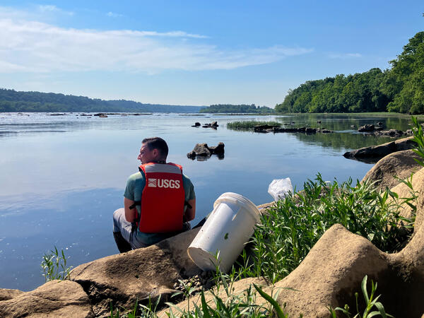
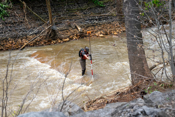
Hydrologic technician Jeremy Malen services a water-quality sensor along the Susquehanna River in Maryland.
Images
Explore photos of USGS water science in Maryland, Delaware, and Washington, D.C.
Filter Total Items: 107
Susquehanna River near Darlington Water Quality
Hydrologic technician Jeremy Malen services a water-quality sensor along the Susquehanna River in Maryland.
Physical scientist collecting water samples at the Hydrologic Instrumentation Facility (HIF)
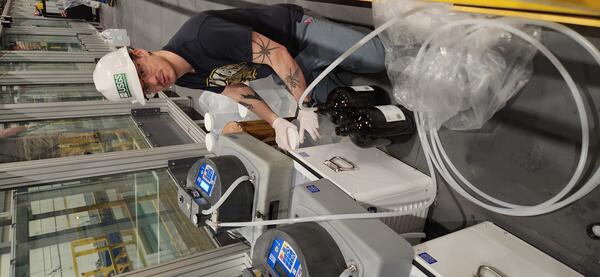
Physical scientist collecting water samples at the Hydrologic Instrumentation Facility (HIF)Tyler Bowser, Physical Scientist with the USGS Maryland-Delaware-D.C. Water Science Center, collecting water samples during 6PPD-quinone (6PPD-Q) transport experiments in the HIF tilting flume.
Physical scientist collecting water samples at the Hydrologic Instrumentation Facility (HIF)
Physical scientist collecting water samples at the Hydrologic Instrumentation Facility (HIF)Tyler Bowser, Physical Scientist with the USGS Maryland-Delaware-D.C. Water Science Center, collecting water samples during 6PPD-quinone (6PPD-Q) transport experiments in the HIF tilting flume.
UAS Aerial Imagery Testing Day
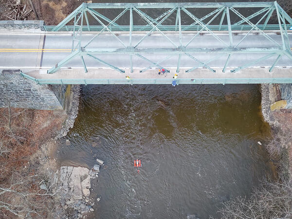
An aerial view of hydrologic technicians on a truss bridge above Brandywine Creek measuring streamflow with an ADCP.
An aerial view of hydrologic technicians on a truss bridge above Brandywine Creek measuring streamflow with an ADCP.
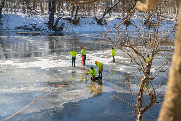
Northwest Branch Anacostia River Ice Measurement Composite
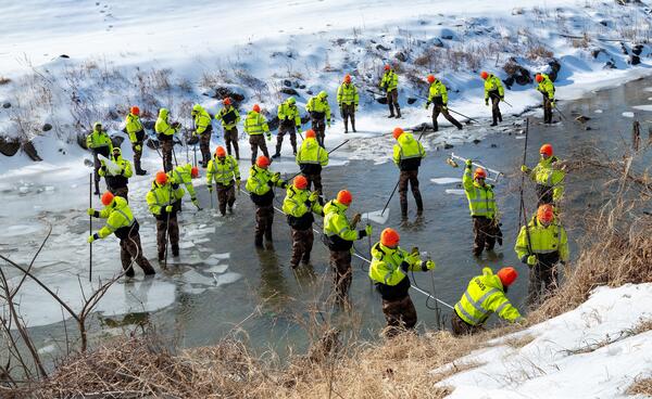
Northwest Branch Anacostia River Ice Measurement CompositeA photo composite of 31 images showing hydrologic technicians Nick Giro, Ashley Ryan, and Augustine Barquin breaking up an icy river and measuring streamflow in the Northwest Branch Anacostia River at Brentwood, MD (USGS-01651003).
Northwest Branch Anacostia River Ice Measurement Composite
Northwest Branch Anacostia River Ice Measurement CompositeA photo composite of 31 images showing hydrologic technicians Nick Giro, Ashley Ryan, and Augustine Barquin breaking up an icy river and measuring streamflow in the Northwest Branch Anacostia River at Brentwood, MD (USGS-01651003).
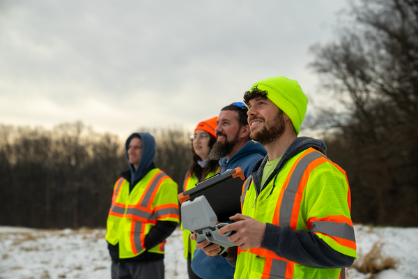
NGWOS Small Drone Training in Maryland
Nick Giro, Chris Lewis, Leah Staub, and Jeremy Malen observing a small aerial drone (off camera) during training.
Nick Giro, Chris Lewis, Leah Staub, and Jeremy Malen observing a small aerial drone (off camera) during training.
Streamflow Measurement at West Herring Branch
Hydrologic technician Mike Geissel obtains a streamflow measurement at West Branch Herring Run at Idlewylde, MD, USGS-01585200.
Fall 2025 Photo Contest Winner: David Fisher, Honorable Mention category.
Hydrologic technician Mike Geissel obtains a streamflow measurement at West Branch Herring Run at Idlewylde, MD, USGS-01585200.
Fall 2025 Photo Contest Winner: David Fisher, Honorable Mention category.
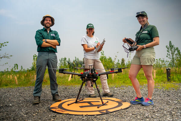
Amit Millo, Sandy Brosnahan, and Jennifer Cramer of the USGS Woods Hole Aerial Imaging and Mapping (AIM) group stand with their drone during sUAS data collection at the Darby Creek Superfund site in Darby Creek, PA
Amit Millo, Sandy Brosnahan, and Jennifer Cramer of the USGS Woods Hole Aerial Imaging and Mapping (AIM) group stand with their drone during sUAS data collection at the Darby Creek Superfund site in Darby Creek, PAFrom left to right, Amit Millo, Sandy Brosnahan, and Jennifer Cramer of the USGS Woods Hole Aerial Imaging and Mapping (AIM) group stand with their drone during sUAS data collection at the Darby Creek Superfund site in Darby Creek, PA.
Amit Millo, Sandy Brosnahan, and Jennifer Cramer of the USGS Woods Hole Aerial Imaging and Mapping (AIM) group stand with their drone during sUAS data collection at the Darby Creek Superfund site in Darby Creek, PA
Amit Millo, Sandy Brosnahan, and Jennifer Cramer of the USGS Woods Hole Aerial Imaging and Mapping (AIM) group stand with their drone during sUAS data collection at the Darby Creek Superfund site in Darby Creek, PAAmit Millo, Sandy Brosnahan, and Jennifer Cramer of the USGS Woods Hole Aerial Imaging and Mapping (AIM) group stand with their drone during sUAS data collection at the Darby Creek Superfund site in Darby Creek, PA
Amit Millo, Sandy Brosnahan, and Jennifer Cramer of the USGS Woods Hole Aerial Imaging and Mapping (AIM) group stand with their drone during sUAS data collection at the Darby Creek Superfund site in Darby Creek, PAFrom left to right, Amit Millo, Sandy Brosnahan, and Jennifer Cramer of the USGS Woods Hole Aerial Imaging and Mapping (AIM) group stand with their drone during sUAS data collection at the Darby Creek Superfund site in Darby Creek, PA.
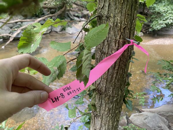
High Water Marks at Sligo Creek
A high-water mark flagged at Sligo Creek Near Takoma Park, MD (USGS-01650800) on July 21, 2025, following flooding on July 19, 2025.
A high-water mark flagged at Sligo Creek Near Takoma Park, MD (USGS-01650800) on July 21, 2025, following flooding on July 19, 2025.
Georges Creek Survey
Hydrologic technician Eric Boyd surveys Georges Creek near Westernport Maryland as part of a survey for high water marks following severe flooding in the area in May 2025.
Hydrologic technician Eric Boyd surveys Georges Creek near Westernport Maryland as part of a survey for high water marks following severe flooding in the area in May 2025.
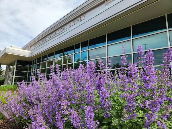
Maryland WSC Building in Spring
Purple flowers in front of the Maryland-Delaware-Washington, D.C. Water Science Center Baltimore building.
Purple flowers in front of the Maryland-Delaware-Washington, D.C. Water Science Center Baltimore building.
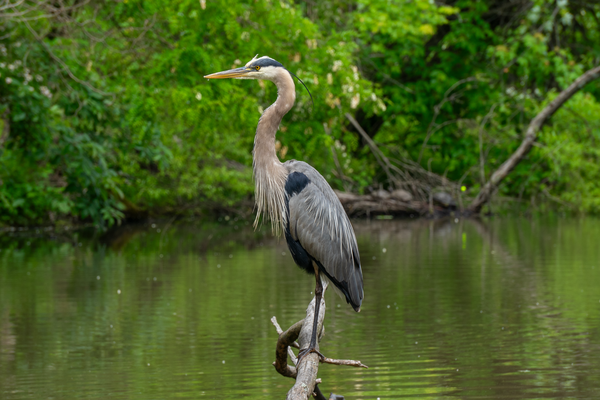
Great Blue Heron in Maryland
A great blue heron seen perching over a pond near the USGS Maryland Catonsville office.
A great blue heron seen perching over a pond near the USGS Maryland Catonsville office.
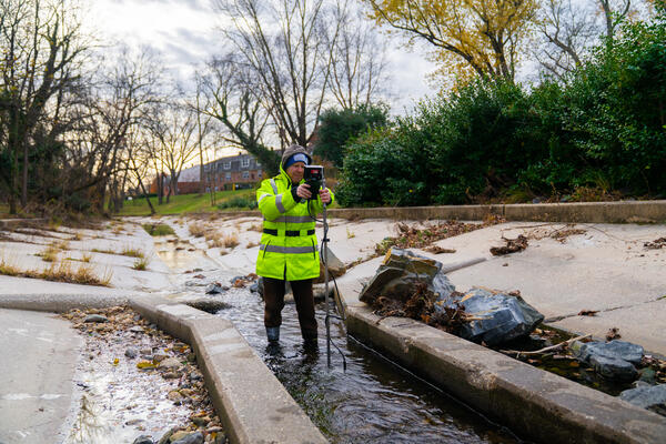
Anacostia River Water Quality Sample
Hydrologic technician Jeremy Malen collects a water-quality sample from the Anacostia River at Kenilworth at Washington, DC (01651760).
Hydrologic technician Jeremy Malen collects a water-quality sample from the Anacostia River at Kenilworth at Washington, DC (01651760).
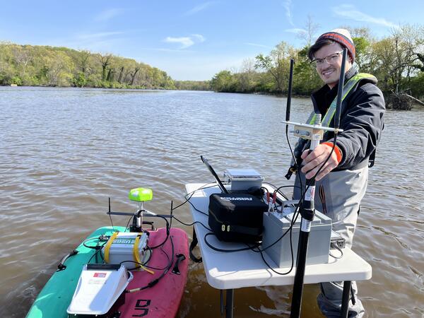
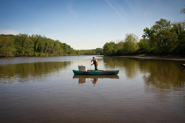
Autonomous Boat in the Anacostia
Hydrologic technician Tyler Bowser poses for a photo with an autonomous miniature boat used to collect data on the Anacostia River.
Hydrologic technician Tyler Bowser poses for a photo with an autonomous miniature boat used to collect data on the Anacostia River.
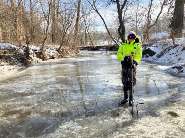
Ice Measurement Training along the Monocacy River
Ice measurement training along the Monocacy River at Monocacy Blvd at Frederick, MD (USGS-01642190).
Ice measurement training along the Monocacy River at Monocacy Blvd at Frederick, MD (USGS-01642190).

Rustin Pare, Technician, uses a chainsaw to acquire ice measurements with Jacob Mavrogeorge on the Monocacy River in Fredrick, Maryland
Rustin Pare, Technician, uses a chainsaw to acquire ice measurements with Jacob Mavrogeorge on the Monocacy River in Fredrick, MarylandRustin Pare, Technician, uses a chainsaw to acquire ice measurements with Jacob Mavrogeorge on the Monocacy River in Fredrick, Maryland.
Winter 2025 Photo Contest Winner: Neel Hodgkinson, USGS at Work category
Cattail Creek Ice Measurement
Hydrologic technician Augustine Barquin takes streamflow measurements below the ice at Cattail Creek near Glenwood, MD (01591400).
Photo credit: Brett McFarland
Hydrologic technician Augustine Barquin takes streamflow measurements below the ice at Cattail Creek near Glenwood, MD (01591400).
Photo credit: Brett McFarland

Sediment Lab Low Light
Physical scientist Zach Clifton studies sediment samples in a dark room.
Photo credit: Neel Hodgkinson
Physical scientist Zach Clifton studies sediment samples in a dark room.
Photo credit: Neel Hodgkinson
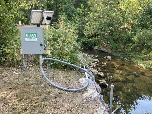
Meetinghouse Branch at Camp Springs
An image of the streamgage at Meetinghouse Branch at Camp Springs, Maryland (01653620).
An image of the streamgage at Meetinghouse Branch at Camp Springs, Maryland (01653620).

Tristan Mohs Forest Buffer
Physical Scientist Tristan Mohs walks through a forest buffer area.
Fencing and riparian forest-buffer planting are essential tools for managers and provide numerous benefits to streams.
Physical Scientist Tristan Mohs walks through a forest buffer area.
Fencing and riparian forest-buffer planting are essential tools for managers and provide numerous benefits to streams.

Series of maps showing modeled stream incision levels for 2002 and 2018 in Montgomery County, MD
Series of maps showing modeled stream incision levels for 2002 and 2018 in Montgomery County, MDExtent of each study watershed exhibiting characteristics of no incision (blue), moderate incision (orange), and severe incision (red) for the 2002 and 2018 time periods. Boxes A–D on stream networks correspond to photo examples shown below. Photo A taken November 2016, photos B and C taken October 2016, and photo D taken April 2022.

Hydrologic technician uses a cableway to collect a water-quality sample from the Choptank River
Hydrologic technician uses a cableway to collect a water-quality sample from the Choptank RiverHydrologic technician Michael Brownley of the MD-DE-DC Dover field office uses a cableway to collect a water-quality sample from the Choptank River on Maryland's Eastern Shore in Greensboro following weekend rain.
Spring 2024 Photo Contest: David Fisher, Honorable Mention category