Tree canopy and ground cover in a forest in Goshen, Connecticut. This site is one sampling area where USGS is collecting soil to test for the occurrence of per- and polyfluoroalkyl substances (PFAS) in soils and shallow groundwater.

Official websites use .gov
A .gov website belongs to an official government organization in the United States.
Secure .gov websites use HTTPS
A lock () or https:// means you’ve safely connected to the .gov website. Share sensitive information only on official, secure websites.
Click through our gallery of photographs showcasing New England Water Science Center research projects and monitoring work throughout the region.
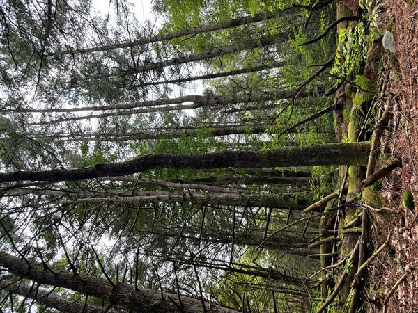
Tree canopy and ground cover in a forest in Goshen, Connecticut. This site is one sampling area where USGS is collecting soil to test for the occurrence of per- and polyfluoroalkyl substances (PFAS) in soils and shallow groundwater.
Tree canopy and ground cover in a forest in Goshen, Connecticut. This site is one sampling area where USGS is collecting soil to test for the occurrence of per- and polyfluoroalkyl substances (PFAS) in soils and shallow groundwater.
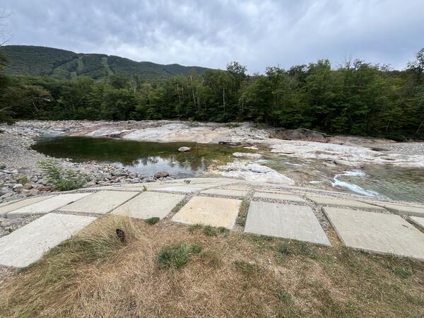
A view of the East Branch Pemigewasset River during a drought in the summer of 2025 near USGS monitoring station 01074520 near Lincoln, New Hampshire. Loon Mountain can be seen in the background.
A view of the East Branch Pemigewasset River during a drought in the summer of 2025 near USGS monitoring station 01074520 near Lincoln, New Hampshire. Loon Mountain can be seen in the background.
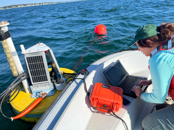
Hydrologic technician Kate Laabs downloads water quality data from a buoy in Kingston Bay near South Duxbury, Massachusetts. The water-quality monitoring is a part of a larger project.
Hydrologic technician Kate Laabs downloads water quality data from a buoy in Kingston Bay near South Duxbury, Massachusetts. The water-quality monitoring is a part of a larger project.
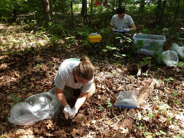
A USGS physical scientist collects shallow soil and a USGS hydrologist logs site information and sample data at a site in Ellington, Connecticut. This sampling is part of a larger statewide investigation on the presence of PFAS in soils and shallow groundwater.
A USGS physical scientist collects shallow soil and a USGS hydrologist logs site information and sample data at a site in Ellington, Connecticut. This sampling is part of a larger statewide investigation on the presence of PFAS in soils and shallow groundwater.
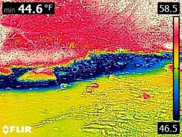
A thermal image taken with a handheld FLIR camera showing approximate water temperature, where warmer temperatures are represented as red and cooler temperatures as blue. This image presents an approximately 20-foot area where cooler groundwater (blue) may be discharging from a bank into a warm stream in early September.
A thermal image taken with a handheld FLIR camera showing approximate water temperature, where warmer temperatures are represented as red and cooler temperatures as blue. This image presents an approximately 20-foot area where cooler groundwater (blue) may be discharging from a bank into a warm stream in early September.

A view of the Lemon Fair River at USGS monitoring station 04282538 near Shoreham, Vermont, during a drought in the summer of 2025.
A view of the Lemon Fair River at USGS monitoring station 04282538 near Shoreham, Vermont, during a drought in the summer of 2025.
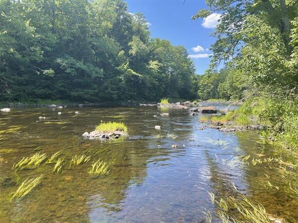
A view of the Missisquoi River from the perspective of streamgage 04293500 in East Berkshire, Vermont, in August 2025 during a period of drought.
A view of the Missisquoi River from the perspective of streamgage 04293500 in East Berkshire, Vermont, in August 2025 during a period of drought.
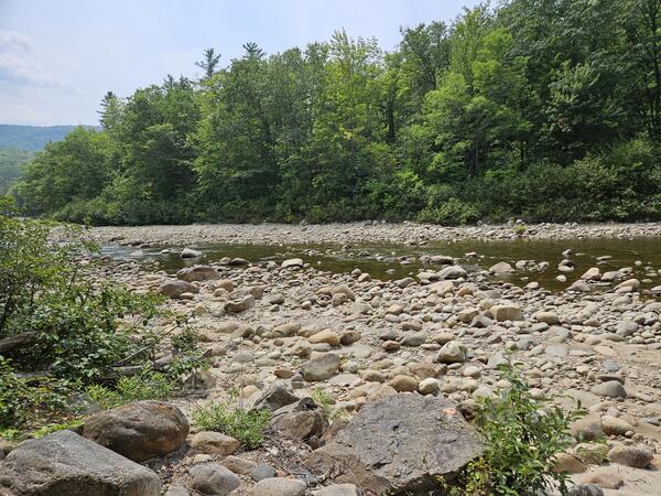
A view of low flows and exposed rocks in Otter Creek at Center Rutland, Vermont, near monitoring station 04282000. This photo was taken during a drought in the summer of 2025.
A view of low flows and exposed rocks in Otter Creek at Center Rutland, Vermont, near monitoring station 04282000. This photo was taken during a drought in the summer of 2025.

A view of Austin Stream in Binghamton, Maine, during a period of moderate drought in the summer of 2025.
A view of Austin Stream in Binghamton, Maine, during a period of moderate drought in the summer of 2025.
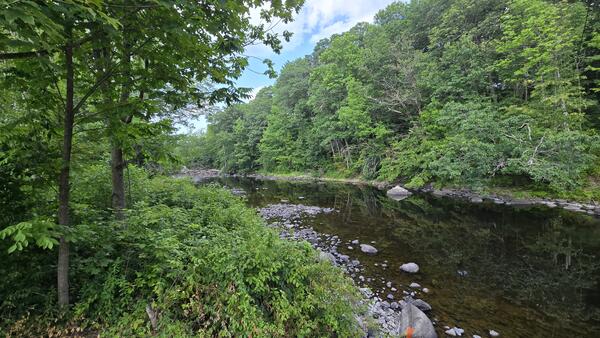
A view of the Poultney River near the USGS monitoring station 04280000 near Fair Haven, Vermont, during a drought event in summer 2025.
A view of the Poultney River near the USGS monitoring station 04280000 near Fair Haven, Vermont, during a drought event in summer 2025.

A view of the Ellis River in South Andover, Maine, near streamgage 01054300.
A view of the Ellis River in South Andover, Maine, near streamgage 01054300.
Wild River at Gilead, Maine, experienced low water levels during a drought event in the summer of 2025.
Wild River at Gilead, Maine, experienced low water levels during a drought event in the summer of 2025.
Nezinscot River at Turner Center, Maine, experienced low water levels during a drought event in the summer of 2025.
Nezinscot River at Turner Center, Maine, experienced low water levels during a drought event in the summer of 2025.
A view of the Sheepscot River in Maine taken by USGS hydrologic technicians while surveying the channel for the purpose of updating floodplain maps.
A view of the Sheepscot River in Maine taken by USGS hydrologic technicians while surveying the channel for the purpose of updating floodplain maps.

A view of the Sheepscot River in Maine taken by USGS hydrologic technicians while surveying the river. The surveyed cross-section data is used to update flood insurance rate maps for FEMA.
A view of the Sheepscot River in Maine taken by USGS hydrologic technicians while surveying the river. The surveyed cross-section data is used to update flood insurance rate maps for FEMA.
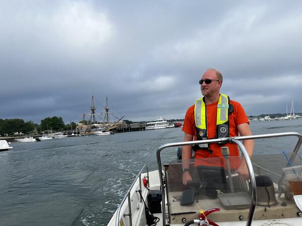
Phil Woodford (Hydro Tech) driving a boat to service a water quality buoy located in Kingston Bay, Plymouth, MA. The Mayflower replica is in the background.
Summer 2025 Photo Contest Winner: Kaitlin Laabs, USGS at Work category
Phil Woodford (Hydro Tech) driving a boat to service a water quality buoy located in Kingston Bay, Plymouth, MA. The Mayflower replica is in the background.
Summer 2025 Photo Contest Winner: Kaitlin Laabs, USGS at Work category

Hydrologic Technician Conner Caridad observing the purge of a groundwter well located in the Army Base Camp Nett. Groundwater samples were taken and analyzed from this well for a study measuring nitrogen concentrations in groundwater before, during, and after sewering.
Hydrologic Technician Conner Caridad observing the purge of a groundwter well located in the Army Base Camp Nett. Groundwater samples were taken and analyzed from this well for a study measuring nitrogen concentrations in groundwater before, during, and after sewering.
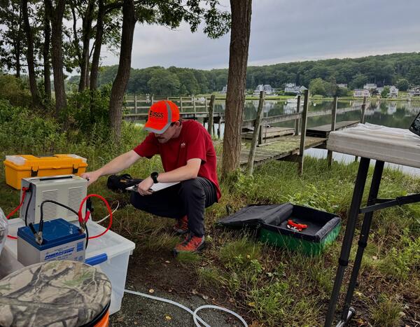
Hydrologic Technician Danny Hansen adjusts the speed of peristaltic pump at a groundwater well in the Pine Grove community Grove in Niantic, CT. Groundwater samples were being taken during 2025 as a part of a broader study looking at nitrogen concentrations in groundwater before and after sewer installation.
Hydrologic Technician Danny Hansen adjusts the speed of peristaltic pump at a groundwater well in the Pine Grove community Grove in Niantic, CT. Groundwater samples were being taken during 2025 as a part of a broader study looking at nitrogen concentrations in groundwater before and after sewer installation.

A USGS hydrologic technician uses a Van Dorn sampler to collect water quality samples from the Farm River at fixed depths.
A USGS hydrologic technician uses a Van Dorn sampler to collect water quality samples from the Farm River at fixed depths.
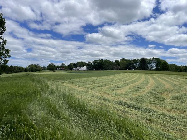
A photograph of a plowed hay field at Shaws Hill Farm in Kensington, New Hampshire. USGS, in cooperation with the U.S.
A photograph of a plowed hay field at Shaws Hill Farm in Kensington, New Hampshire. USGS, in cooperation with the U.S.
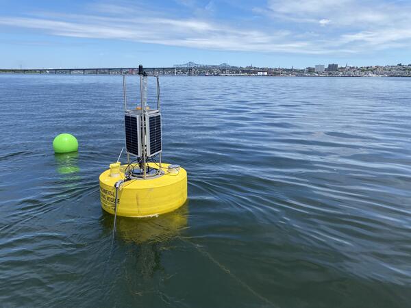
A buoy carrying water quality monitoring equipment is deployed in Mount Hope Bay, Massachusetts, as part of a larger water-quality monitoring project.
A buoy carrying water quality monitoring equipment is deployed in Mount Hope Bay, Massachusetts, as part of a larger water-quality monitoring project.