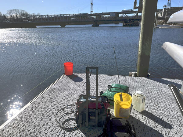
U.S. flag

An official website of the United States government

Images

Click through our gallery of photographs showcasing New England Water Science Center research projects and monitoring work throughout the region.

Filter Total Items: 601
Collection of a discrete water quality sample

Discrete water quality sample collection at Thames River at Groton, CT (USGS Site ID 01127768).

A streamgage in the woods.
East Branch Penobscot River Streamgage in Maine

The streamgage at East Branch Penobscot River below Grand Lake Matagamon in Patton, Maine (01029100) is operated in cooperation with the Penobscot Nation.

The streamgage at East Branch Penobscot River below Grand Lake Matagamon in Patton, Maine (01029100) is operated in cooperation with the Penobscot Nation.

Continuous Monitor Maintenance
Continuous monitor maintenance

Continuous water quality monitor servicing event at Saugatuck River US Rt 136 Bridge, CT (USGS Site ID 410724073221001).

Continuous water quality monitor servicing event at Saugatuck River US Rt 136 Bridge, CT (USGS Site ID 410724073221001).

A woman standing next to a poster.
Janet Barclay Poster Presentation at the 2024 Northeast Section Meeting of GSA

Hydrologist Janet Barclay held a poster presentation at the 2024 Northeast Section of the Geological Society of America in Manchester, New Hampshire.

A man stands at a podium in front of rows of chairs and people with a presentation.
Hydrologist Richard Moore Presents Study at 2024 GSA Meeting

Research Hydrologist Richard Moore presents work at a technical session on groundwater and surface water characterization at the 2024 Northeast Section Meeting of the Geological Society of America.

Research Hydrologist Richard Moore presents work at a technical session on groundwater and surface water characterization at the 2024 Northeast Section Meeting of the Geological Society of America.

A man standing at a podium and a man and woman sitting behind him at a table.
Hydrologist Max Meadows Speaking at 2024 Northeast Section Meeting of GSA

Hydrologist Maxwell Meadows speaks about a New Hampshire PFAS study at a technical session at the 2024 Northeast Section Meeting of the Geological Society of America.

An auditorium with hanging posters and people.
Northeast Section Meeting of the Geological Society of America Poster Sessions

The poster sessions at the 2024 Northeast Section Meeting of the Geological Society of America in Manchester, New Hampshire.

A view of the bridge over Neponset River near Canton, Massachusetts
A view of the Neponset River near Canton, Massachusetts

A view of the Neponset River flowing under Greenlodge Street bridge near Canton, Massachusetts, at a USGS 01105554 streamgage.

photograph tan loose ground with cactus and other desert plants under a partly cloudy blue sky
USGS scientists mapping vegetation and land use in Los Planes watershed, Baja California Sur, Mexico
Two scientists at the edge of the river holding the cableway rope
Two scientists taking a critical ADCP measurement at Shetucket River in Taftville, CT

Two scientists taking a critical ADCP measurement at Shetucket River in Taftville, CT. This measurement was the highest flow measured at this site at 11,400 cfs. Due to high velocities the measurement required two people manning the cableway to maintain a smooth and consistent track across the river.

Two scientists taking a critical ADCP measurement at Shetucket River in Taftville, CT. This measurement was the highest flow measured at this site at 11,400 cfs. Due to high velocities the measurement required two people manning the cableway to maintain a smooth and consistent track across the river.

Allison standing in snow next at groundwater well site with three large buildings in the background
Hydrologic Technician Allison Carter taking a water level measurement with a calibrated electric tape at the real-time groundwater well station located in Orange, Massachusetts

Hydrologic Technician Allison Carter taking a water level measurement with a calibrated electric tape at the real-time groundwater well station located in Orange, Massachusetts. (Station ID#: 423441072170701 MA-ORW 63)

Winter 2024 Photo Contest Winner: Sam Banas, Where We Work category

Water spurts out of the top of a groundwater well.
Groundwater Well Ejects Water from Air Sparging at Savage Municipal Water Supply Superfund Site

A groundwater well at the Savage Municipal Water Supply Superfund Site ejects water as a result of air sparging taking place in an adjacent well. Air sparging is a technique used in soil remediation that sneds pressurized air into the ground to remove soil contaminants.

A groundwater well at the Savage Municipal Water Supply Superfund Site ejects water as a result of air sparging taking place in an adjacent well. Air sparging is a technique used in soil remediation that sneds pressurized air into the ground to remove soil contaminants.

A man in a neon yellow jacket measures a high water mark on a wall with a river in the background.
Measuring a High-Water Mark at the Androscoggin River in Topsham, Maine

A hydrologic technician measures a high-water mark near the Androscoggin River in Topsham, Maine days after a significant flood event in late December 2023. A combination of heavy rainfall and snowmelt prompted the flooding.

A hydrologic technician measures a high-water mark near the Androscoggin River in Topsham, Maine days after a significant flood event in late December 2023. A combination of heavy rainfall and snowmelt prompted the flooding.

A woman in a neon yellow jacket and orange hat stands in front of a tree in winter.
Recording a High-Water Mark After Maine Flooding

A USGS hydrologist records a high-water mark on a tree near the Crooked River in Waterford, Maine in the days following a significant flood event.

A USGS hydrologist records a high-water mark on a tree near the Crooked River in Waterford, Maine in the days following a significant flood event.

A man is on a ladder measuring a height line on the exterior wall of an auto body shop.
High-Water Mark on Building in Anson, Maine

A hydrologic technician measures a high-water mark on a business in Anson, Maine after a significant flood event in late December 2023 flooded the Kennebec River.

A hydrologic technician measures a high-water mark on a business in Anson, Maine after a significant flood event in late December 2023 flooded the Kennebec River.

Discrete Sample Collected using Van Dorn Sampler
Discrete sample collected using Van Dorn sampler

Discrete sample collected at Connecticut River at Old Lyme, CT (USGS Site ID 01194796) during high flow and high turbidity conditions. 

Discrete sample collected at Connecticut River at Old Lyme, CT (USGS Site ID 01194796) during high flow and high turbidity conditions. 

Shannon kneeling on ground next to groundwater observation well using calibrated electric tape; pickup truck in background
Physical Scientist Shannon Fisher taking a water level measurement with a calibrated electric tape at the monthly discrete groundwater observation well located in Foster, Rhode Island

Physical Scientist Shannon Fisher taking a water level measurement with a calibrated electric tape at the monthly discrete groundwater observation well located in Foster, Rhode Island. (Station ID#: 414420071422301 RI-FOW 40)

Winter 2024 Photo Contest: Sam Banas, Honorable Mention category

A USGS streamgage in the foreground with a choppy, flooding river in the background with pine trees on either side.
High Flows on Dead River in Northwest Somerset, Maine, Following Flood Event

A heavy rainstorm, saturated ground, and pre-existing snowpack prompted flooding in Maine in late December 2023. USGS researchers manually measured streamflows after the flood event to validate real-time streamgage data.

A heavy rainstorm, saturated ground, and pre-existing snowpack prompted flooding in Maine in late December 2023. USGS researchers manually measured streamflows after the flood event to validate real-time streamgage data.

Was this page helpful?