



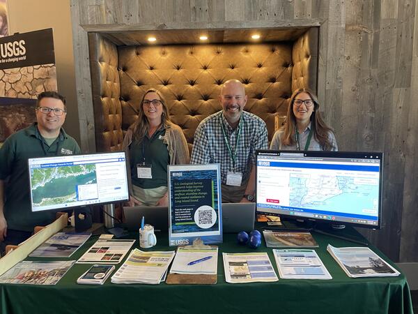
USGS scientists (left to right) Seth Ackerman, Rachel Henderson, Chris Schubert, and Gina Groseclose hosting a booth at the 2026 Long Island Sound Research Conference.
Images
Click through our gallery of photographs showcasing New England Water Science Center research projects and monitoring work throughout the region.
Filter Total Items: 603
2026 Long Island Sound Research Conference
USGS scientists (left to right) Seth Ackerman, Rachel Henderson, Chris Schubert, and Gina Groseclose hosting a booth at the 2026 Long Island Sound Research Conference.
2026 Long Island Sound Research Conference
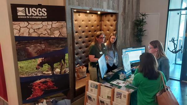
The 2026 Long Island Sound Research Conference brings together researchers, managers, academia, and community partners to share the latest science and strengthen collaborations focused on the future of Long Island Sound. This year, the U.S.
The 2026 Long Island Sound Research Conference brings together researchers, managers, academia, and community partners to share the latest science and strengthen collaborations focused on the future of Long Island Sound. This year, the U.S.
2026 Long Island Sound Research Conference
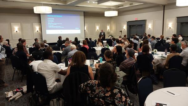
The 2026 Long Island Sound Research Conference brings together researchers, managers, academia, and community partners to share the latest science and strengthen collaborations focused on the future of Long Island Sound. This year, the U.S.
The 2026 Long Island Sound Research Conference brings together researchers, managers, academia, and community partners to share the latest science and strengthen collaborations focused on the future of Long Island Sound. This year, the U.S.
2026 Long Island Sound Research Conference
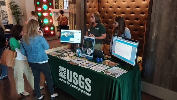
The 2026 Long Island Sound Research Conference brings together researchers, managers, academia, and community partners to share the latest science and strengthen collaborations focused on the future of Long Island Sound. This year, the U.S.
The 2026 Long Island Sound Research Conference brings together researchers, managers, academia, and community partners to share the latest science and strengthen collaborations focused on the future of Long Island Sound. This year, the U.S.
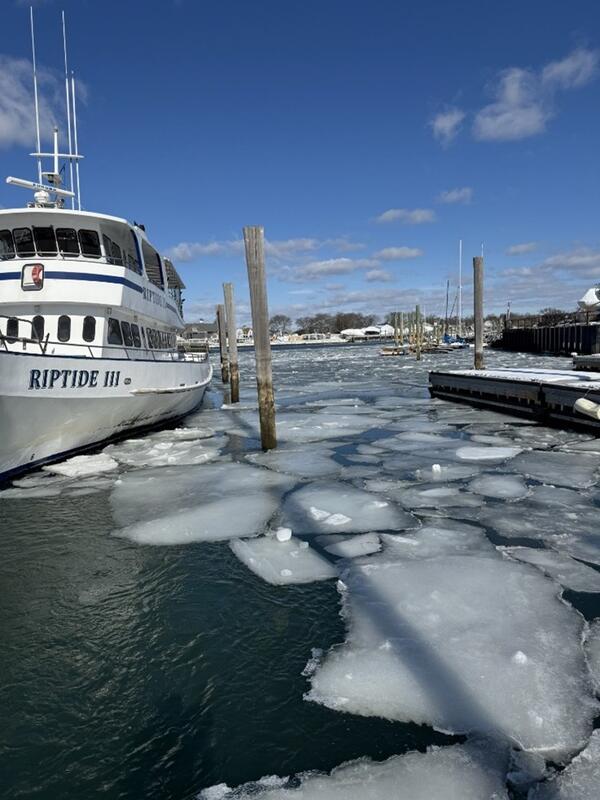
Broken Ice near the Norwalk Cove Marina
Ice break up near the floating dock within the Norwalk Cove Marina looking upstream of a USGS sampling station.
Ice break up near the floating dock within the Norwalk Cove Marina looking upstream of a USGS sampling station.
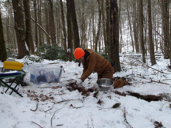
Hydrologist Collects Shallow Soil from a Site in Goshen, Connecticut
Hydrologist Collects Shallow Soil from a Site in Goshen, ConnecticutA USGS hydrologist collects a shallow soil sample from a site in Goshen, Connecticut. This soil sample collection is part of a larger investigation in the state of Connecticut for the occurrence of per- and polyfluoroalkyl substances (PFAS) in soils and shallow groundwater.
Hydrologist Collects Shallow Soil from a Site in Goshen, Connecticut
Hydrologist Collects Shallow Soil from a Site in Goshen, ConnecticutA USGS hydrologist collects a shallow soil sample from a site in Goshen, Connecticut. This soil sample collection is part of a larger investigation in the state of Connecticut for the occurrence of per- and polyfluoroalkyl substances (PFAS) in soils and shallow groundwater.
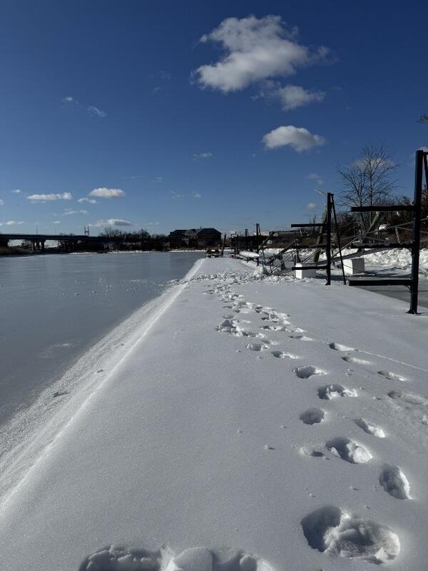
Snowy Walk at Ferry Point on the Norwalk River
A snowy walk at Ferry Point in Norwalk, Connecticut, along the Norwalk River. Water quality parameters are collected by USGS streamgage 410643073243700 here.
A snowy walk at Ferry Point in Norwalk, Connecticut, along the Norwalk River. Water quality parameters are collected by USGS streamgage 410643073243700 here.
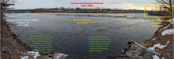
USGS Streamgage on the Connecticut River with Infrastructure
USGS Streamgage on the Connecticut River with InfrastructureA view looking across the Connecticut River from a USGS streamgage in Suffield, Connecticut.
USGS Streamgage on the Connecticut River with Infrastructure
USGS Streamgage on the Connecticut River with InfrastructureA view looking across the Connecticut River from a USGS streamgage in Suffield, Connecticut.
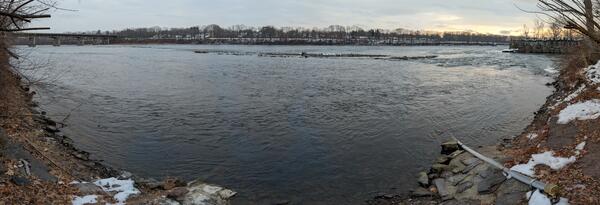
USGS Streamgage on the Connecticut River
A view looking across the Connecticut River from a USGS streamgage in Suffield, Connecticut.
A view looking across the Connecticut River from a USGS streamgage in Suffield, Connecticut.
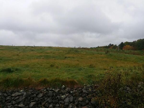
The Coakley Landfill Superfund Site
A view of the nort-facing slope of the Coakley Landfill Superfund Site in Northampton, New Hampshire. Pipes used to vent landfill gases can be seen in the distance.
A view of the nort-facing slope of the Coakley Landfill Superfund Site in Northampton, New Hampshire. Pipes used to vent landfill gases can be seen in the distance.
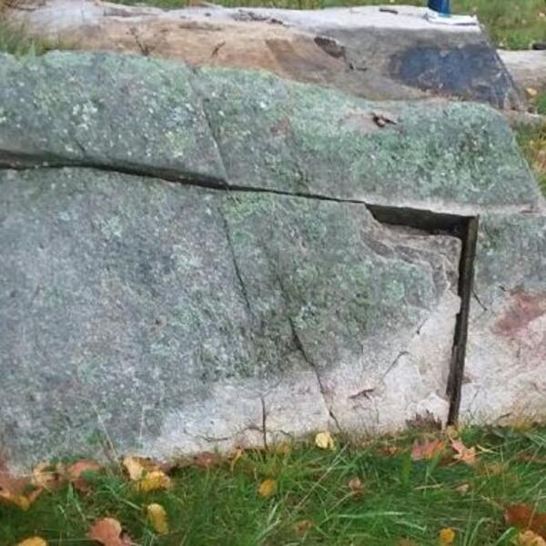
Fractures in the Breakfast Hill granite of the Rye Complex
Fractures in the Breakfast Hill granite of the Rye ComplexA fracture in granite within New Hampshire's Rye Complex, one of two lithotectonic belts in the state's coastal region.
Fractures in the Breakfast Hill granite of the Rye Complex
Fractures in the Breakfast Hill granite of the Rye ComplexA fracture in granite within New Hampshire's Rye Complex, one of two lithotectonic belts in the state's coastal region.
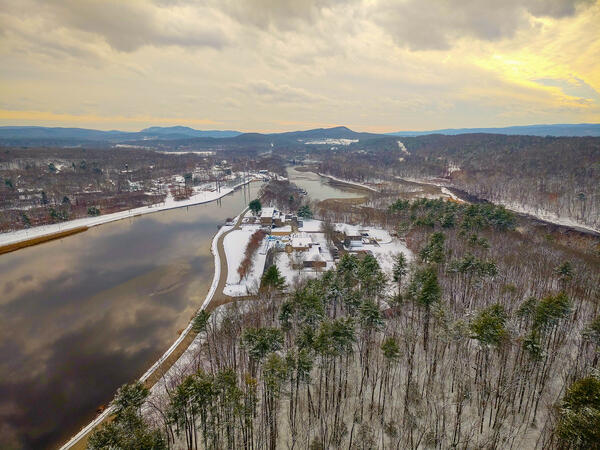
Aerial view of a fish research laboratory
Aerial view of the USGS S.O. Conte Anadromous Fish Research Laboratory and Connecticut River at Turners Falls, Massachusetts.
Fall 2025 Photo Contest Winner: Shannon Fisher, Honorable Mention category
Aerial view of the USGS S.O. Conte Anadromous Fish Research Laboratory and Connecticut River at Turners Falls, Massachusetts.
Fall 2025 Photo Contest Winner: Shannon Fisher, Honorable Mention category
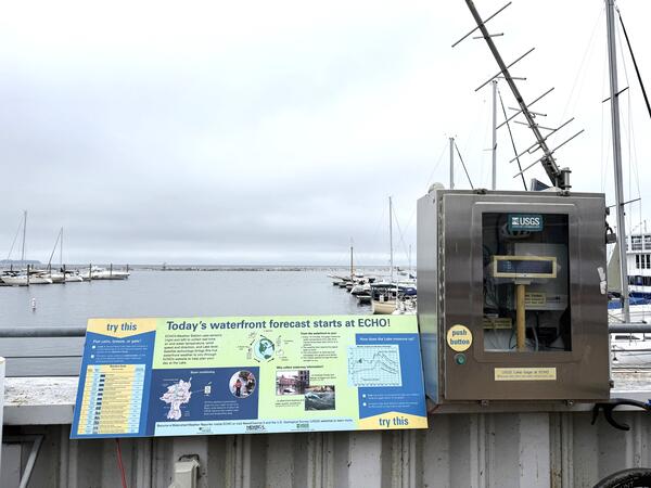
Lake Champlain Streamgage in Burlington, Vermont
The USGS streamgage on Lake Champlain in Burlington, Vermont, is near the ECHO Leahy Center, Vermont’s Science and Nature Museum.
The USGS streamgage on Lake Champlain in Burlington, Vermont, is near the ECHO Leahy Center, Vermont’s Science and Nature Museum.
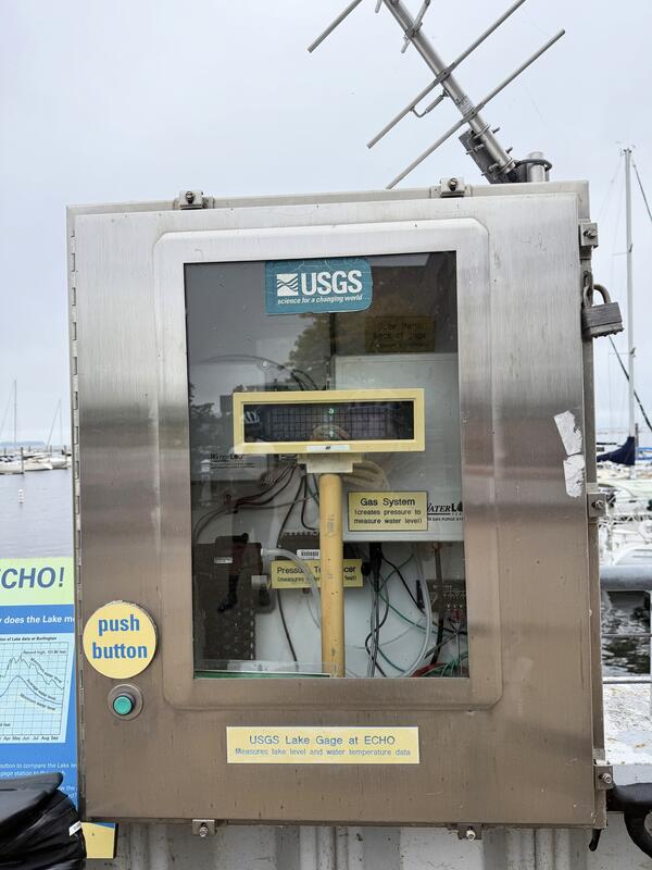
USGS Streamgage on Lake Champlain in Burlington, Vermont
USGS Streamgage on Lake Champlain in Burlington, VermontThe USGS New England Water Science Center operates a streamgage on Lake Champlain in Burlington, Vermont.
USGS Streamgage on Lake Champlain in Burlington, Vermont
USGS Streamgage on Lake Champlain in Burlington, VermontThe USGS New England Water Science Center operates a streamgage on Lake Champlain in Burlington, Vermont.
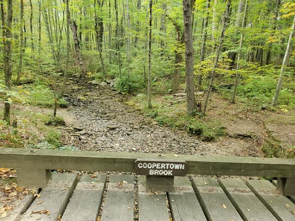
Dry Coopertown Brook in Douglas State Forest in Massachusetts
Dry Coopertown Brook in Douglas State Forest in MassachusettsCoopertown Brook, located in Douglas State Forest, Massachusetts, is completely dry in late September 2025.
Dry Coopertown Brook in Douglas State Forest in Massachusetts
Dry Coopertown Brook in Douglas State Forest in MassachusettsCoopertown Brook, located in Douglas State Forest, Massachusetts, is completely dry in late September 2025.
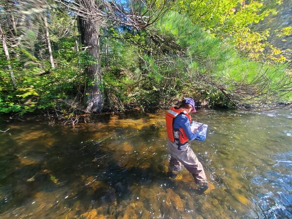
Locating a Groundwater Seep in Namekagon River in Cable, Wisconsin
Locating a Groundwater Seep in Namekagon River in Cable, WisconsinUSGS New England Water Science Center physical scientist Shannon Fisher documenting the location of a groundwater seep under a pine tree on the Namekagon River near Cable, Wisconsin.
Locating a Groundwater Seep in Namekagon River in Cable, Wisconsin
Locating a Groundwater Seep in Namekagon River in Cable, WisconsinUSGS New England Water Science Center physical scientist Shannon Fisher documenting the location of a groundwater seep under a pine tree on the Namekagon River near Cable, Wisconsin.
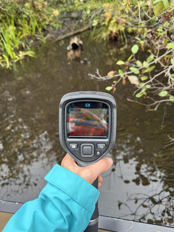
Using a Thermal Infrared Camera to Identify Groundwater Seeps in the Namegagon River
Using a Thermal Infrared Camera to Identify Groundwater Seeps in the Namegagon RiverCold groundwater seep identified using a handheld thermal infrared camera (FLIR E8) on the upper Namekagon River near Cable, Wisconsin. The groundwater discharge area was about 7-8 degrees cooler than the main channel of the Namekagon.
Using a Thermal Infrared Camera to Identify Groundwater Seeps in the Namegagon River
Using a Thermal Infrared Camera to Identify Groundwater Seeps in the Namegagon RiverCold groundwater seep identified using a handheld thermal infrared camera (FLIR E8) on the upper Namekagon River near Cable, Wisconsin. The groundwater discharge area was about 7-8 degrees cooler than the main channel of the Namekagon.
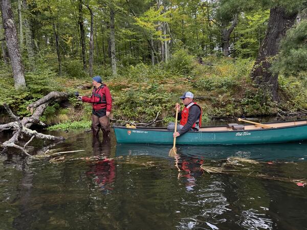
Identifying Groundwater Seeps in the Namekagon River in Wisconsin
Identifying Groundwater Seeps in the Namekagon River in WisconsinNational Park Service Great Lakes Inventory and Monitoring Network (GLKM) biologist Ted Gostomski uses a handheld thermal infrared sensor to identify cold groundwater seeps in the upper Namekagon River near Cable, Wisconsin. Al Kirschbaum, a remote sensing specialist with the NPS-GLKM, documents Gostomski's findings from the canoe.
Identifying Groundwater Seeps in the Namekagon River in Wisconsin
Identifying Groundwater Seeps in the Namekagon River in WisconsinNational Park Service Great Lakes Inventory and Monitoring Network (GLKM) biologist Ted Gostomski uses a handheld thermal infrared sensor to identify cold groundwater seeps in the upper Namekagon River near Cable, Wisconsin. Al Kirschbaum, a remote sensing specialist with the NPS-GLKM, documents Gostomski's findings from the canoe.
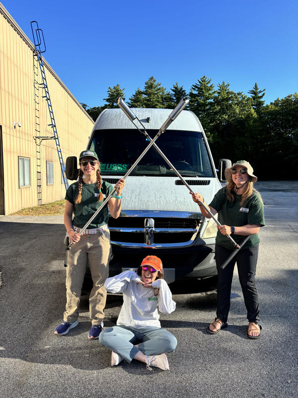
Connecticut Soils PFAS Team members
Members of the Connecticut Soils PFAS Team include (from left to right) Ashley Grengs, Leah Santangelo, Sydney Welch from the New England Water Science Center. A statewide survey of collecting soils was conducted to help establish baseline PFAS concentrations in the state of Connecticut throughout the summer and fall of 2025.
Members of the Connecticut Soils PFAS Team include (from left to right) Ashley Grengs, Leah Santangelo, Sydney Welch from the New England Water Science Center. A statewide survey of collecting soils was conducted to help establish baseline PFAS concentrations in the state of Connecticut throughout the summer and fall of 2025.
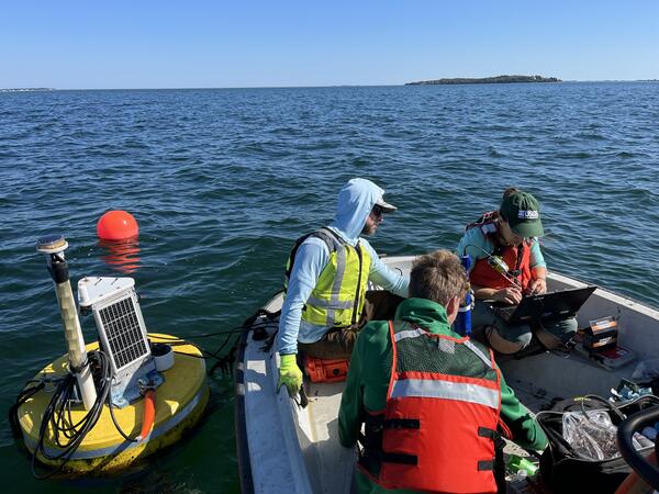
Cleaning Continuous Water Quality Instrumentation from a Buoy in Kingston Bay
Cleaning Continuous Water Quality Instrumentation from a Buoy in Kingston BayUSGS hydrologic technicians Nathan Roy (front), Brandan Crowley (left), and Kaitlin Laabs (right) clean the continuous water quality equipment that was deployed on a buoy Kingston Bay. The data collection is part of a larger water quality collection project involving several Massachusetts bays.
Cleaning Continuous Water Quality Instrumentation from a Buoy in Kingston Bay
Cleaning Continuous Water Quality Instrumentation from a Buoy in Kingston BayUSGS hydrologic technicians Nathan Roy (front), Brandan Crowley (left), and Kaitlin Laabs (right) clean the continuous water quality equipment that was deployed on a buoy Kingston Bay. The data collection is part of a larger water quality collection project involving several Massachusetts bays.
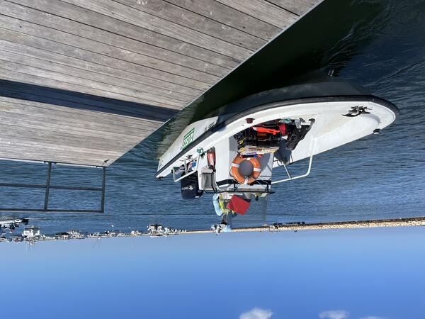
USGS Boat Docks in Kingston Bay, South Duxbury, Massachusetts
USGS Boat Docks in Kingston Bay, South Duxbury, MassachusettsUSGS hydrologic technician Brendan Crowley docks a boat in Kinston Bay after checking on continuous water quality monitoring equipment deployed in the area.
USGS Boat Docks in Kingston Bay, South Duxbury, Massachusetts
USGS Boat Docks in Kingston Bay, South Duxbury, MassachusettsUSGS hydrologic technician Brendan Crowley docks a boat in Kinston Bay after checking on continuous water quality monitoring equipment deployed in the area.