Installing a Groundwater Well in Franklin, Massachusetts
Installing a Groundwater Well in Franklin, MassachusettsUSGS hydrologic technicians Sam Banas and Curtis Yeager install a groundwater well (MA-F2W 80) in Franklin, Massachusetts.

Official websites use .gov
A .gov website belongs to an official government organization in the United States.
Secure .gov websites use HTTPS
A lock () or https:// means you’ve safely connected to the .gov website. Share sensitive information only on official, secure websites.
Click through our gallery of photographs showcasing New England Water Science Center research projects and monitoring work throughout the region.

USGS hydrologic technicians Sam Banas and Curtis Yeager install a groundwater well (MA-F2W 80) in Franklin, Massachusetts.
USGS hydrologic technicians Sam Banas and Curtis Yeager install a groundwater well (MA-F2W 80) in Franklin, Massachusetts.
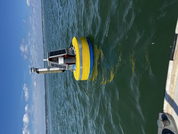
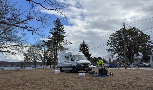
A buoy carrying water quality monitoring equipment is deployed in Kingston Bay in South Duxbury, Massachusetts, as part of a larger water-quality monitoring project.
A buoy carrying water quality monitoring equipment is deployed in Kingston Bay in South Duxbury, Massachusetts, as part of a larger water-quality monitoring project.
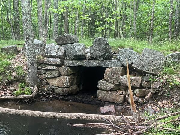
A culvert along Cromwell Brook under a forest road in Acadia National Park in Maine.
A culvert along Cromwell Brook under a forest road in Acadia National Park in Maine.
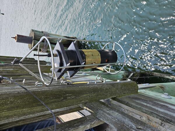
USGS staff deploy a carbon dioxide sensor (pCO2) from the Beverly Pier into the Danvers River in Beverly, Massachusetts. This water quality sensor deployment is a part of a larger data collection effort in several Massachusetts rivers and embayments.
USGS staff deploy a carbon dioxide sensor (pCO2) from the Beverly Pier into the Danvers River in Beverly, Massachusetts. This water quality sensor deployment is a part of a larger data collection effort in several Massachusetts rivers and embayments.
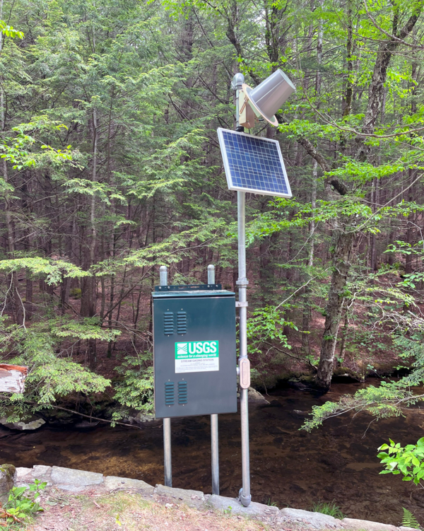
Newly established continuous streamgage on downstream right bank at Mill Brook at Plainfield, MA - 01178230. Gage is located on River Road.
Newly established continuous streamgage on downstream right bank at Mill Brook at Plainfield, MA - 01178230. Gage is located on River Road.

Re-established continuous streamgage on downstream left bank of Sudbury River at Ashland, MA - 01097480. Gage is located on Front Street.
Re-established continuous streamgage on downstream left bank of Sudbury River at Ashland, MA - 01097480. Gage is located on Front Street.
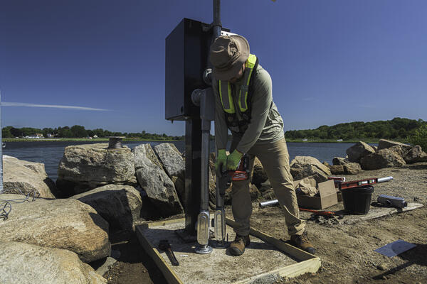
Nigel Pepin using a rotor hammer to install concrete anchors to secure a new gage to monitor the Poquonnock River in Bluff Point State Park, CT.
Summer 2025 Photo Contest Winner: Paul Solis, Honorable Mention category
Nigel Pepin using a rotor hammer to install concrete anchors to secure a new gage to monitor the Poquonnock River in Bluff Point State Park, CT.
Summer 2025 Photo Contest Winner: Paul Solis, Honorable Mention category
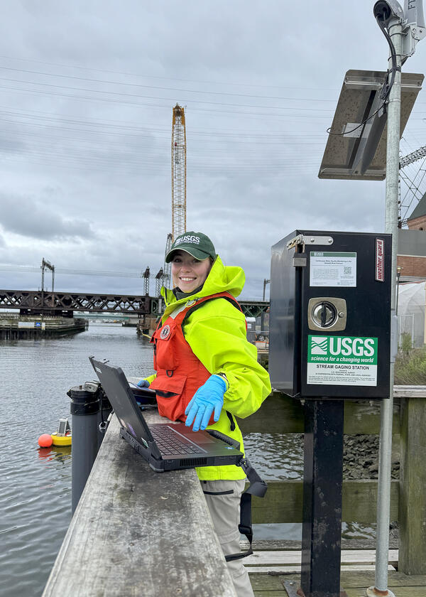
USGS Hydrologic Technician, Samantha Robinson, preforming a vertical profile and routine maintenance on continuous water quality monitors on the Norwalk River at Maritime Aquarium Near Southern Norwalk, CT (410606073245700) on May 21, 2025. Discrete water quality samples are also collected at this monitoring location.
USGS Hydrologic Technician, Samantha Robinson, preforming a vertical profile and routine maintenance on continuous water quality monitors on the Norwalk River at Maritime Aquarium Near Southern Norwalk, CT (410606073245700) on May 21, 2025. Discrete water quality samples are also collected at this monitoring location.

Newly established continuous streamgage downstream right bank on Martha's Vineyard at Tiasquam River at West Tisbury, MA - 412238070403701. Gage is located adjacent to State Road in Chilmark, MA.
Newly established continuous streamgage downstream right bank on Martha's Vineyard at Tiasquam River at West Tisbury, MA - 412238070403701. Gage is located adjacent to State Road in Chilmark, MA.

USGS staff installing a new streamgage on the island of Martha's Vineyard in Massachusetts. This streamgage is a part of the state’s cooperative hydrologic monitoring network with USGS.
USGS staff installing a new streamgage on the island of Martha's Vineyard in Massachusetts. This streamgage is a part of the state’s cooperative hydrologic monitoring network with USGS.
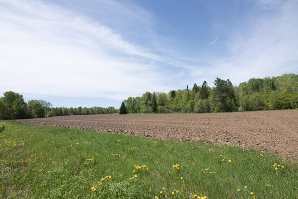
USGS, in cooperation with the U.S. Department of Agriculture and the University of Maine, is predicting the potential hydrological impacts based on these climatic changes using the USGS Precipitation Runoff Modeling System (PRMS) to inform the New England farming industry.
USGS, in cooperation with the U.S. Department of Agriculture and the University of Maine, is predicting the potential hydrological impacts based on these climatic changes using the USGS Precipitation Runoff Modeling System (PRMS) to inform the New England farming industry.
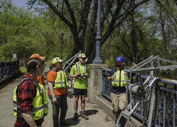
Members from the Massachusetts office of the New England Water Science Center conduct bridge crane training for water quality at Hockanum Road in East Hartford, CT, April 29, 2029.
Spring 2025 Photo Contest Winner: Paul Solis, Where We Work category
Members from the Massachusetts office of the New England Water Science Center conduct bridge crane training for water quality at Hockanum Road in East Hartford, CT, April 29, 2029.
Spring 2025 Photo Contest Winner: Paul Solis, Where We Work category

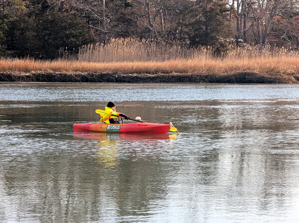
USGS hydrologic technician Virginia Stanley is towing an acoustic doppler current profiler (ADCP) behind a kayak on the Quinebaug River in Putnam, Connecticut, to capture streamflow measurements.
USGS hydrologic technician Virginia Stanley is towing an acoustic doppler current profiler (ADCP) behind a kayak on the Quinebaug River in Putnam, Connecticut, to capture streamflow measurements.
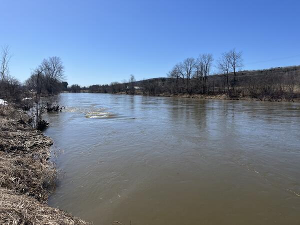
A view of the Missisquoi River from the perspective of streamgage 04293500 in East Berkshire, Vermont, in March 2025.
A view of the Missisquoi River from the perspective of streamgage 04293500 in East Berkshire, Vermont, in March 2025.

USGS staff outfit the inside of the metal enclosures for groundwater wells. These enclosures contain data loggers, sensor, battery and telemetry equipment that transit the real-time data collected at the well.
USGS staff outfit the inside of the metal enclosures for groundwater wells. These enclosures contain data loggers, sensor, battery and telemetry equipment that transit the real-time data collected at the well.

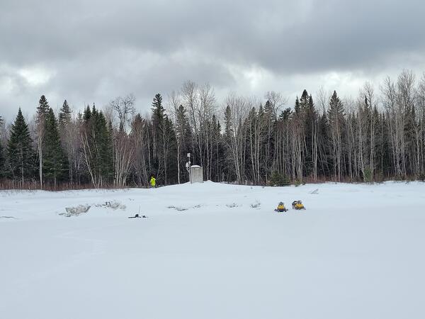
Hydrologic Technician Nathan Roy testing ice thickness prior to collecting a water quality sample in West Hartford, VT.
Winter 2025 Photo Contest Winner: Danny Hansen, Honorable Mention category
Hydrologic Technician Nathan Roy testing ice thickness prior to collecting a water quality sample in West Hartford, VT.
Winter 2025 Photo Contest Winner: Danny Hansen, Honorable Mention category
USGS Hydrologist John Mullaney collects groundwater samples from a USGS monitoring well on the Pine Grove peninsula in February 2025.
USGS Hydrologist John Mullaney collects groundwater samples from a USGS monitoring well on the Pine Grove peninsula in February 2025.

Hydrologic technician measuring discharge for nutrient load calculations at Wilbur Hollow Brook near Clayville, RI.
Hydrologic technician measuring discharge for nutrient load calculations at Wilbur Hollow Brook near Clayville, RI.
Streamgage 01010000 on the St. John River at Ninemile Bridge in Maine. This monitoring location is very remote; it was established in 1950.
Streamgage 01010000 on the St. John River at Ninemile Bridge in Maine. This monitoring location is very remote; it was established in 1950.
USGS hydrologic technician Ryan Botoroff anchored a kayak to position the attached acoustic doppler current profiler (ADCP) over a water quality sensor on the bottom of the Farm River installed to measure water velocity.
USGS hydrologic technician Ryan Botoroff anchored a kayak to position the attached acoustic doppler current profiler (ADCP) over a water quality sensor on the bottom of the Farm River installed to measure water velocity.

National Water Quality Network (NWQN) discrete water quality sample collection. Paul Solis (Left) Samantha Robinson (Right) driving to location on boat on the Connecticut River near Thompsonville, Connecticut.
Winter 2025 Photo Contest Winner: Allen Lyon, Honorable Mention
National Water Quality Network (NWQN) discrete water quality sample collection. Paul Solis (Left) Samantha Robinson (Right) driving to location on boat on the Connecticut River near Thompsonville, Connecticut.
Winter 2025 Photo Contest Winner: Allen Lyon, Honorable Mention