
Cactus blossom in the southeast Arizona grasslands, looking into Mexico.
Images
Below are images associated with SBSC's science and staff. Images appear according to the year they were taken. To search, type a keyword or select a year from the dropdown menu. Or, click through the pages using the arrows at the bottom of the page.
Filter Total Items: 703

Cactus blossom in the borderlands
Cactus blossom in the southeast Arizona grasslands, looking into Mexico.
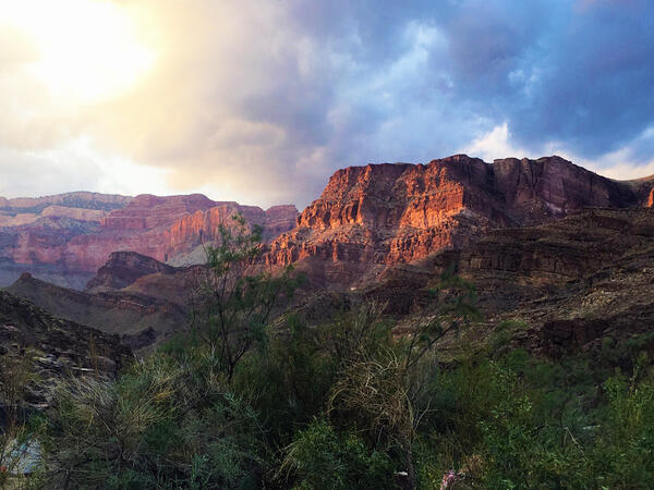
Sunset clouds above Grand Canyon's canyon walls, with riparian trees in the foreground
Sunset clouds above Grand Canyon's canyon walls, with riparian trees in the foregroundSunset clouds above Grand Canyon's colorful canyon walls, with riparian trees in the foreground. Photo by Emily Palmquist, USGS.

SBSC technician collects native seeds for data collecting and restoration near Moab, Utah
SBSC technician collects native seeds for data collecting and restoration near Moab, UtahSBSC technician Morgan Andrews collects native hairy false goldenaster (Heterotheca villosa) seeds for data and restoration research near Moab, UT in September 2021. Photo by Shannon Lencioni, SBSC, USGS.

Brown trout (Salmo trutta)
A photo of brown trout (Salmo trutta). Original image was from USGS NY Water Science Center, public domain.
A photo of brown trout (Salmo trutta). Original image was from USGS NY Water Science Center, public domain.
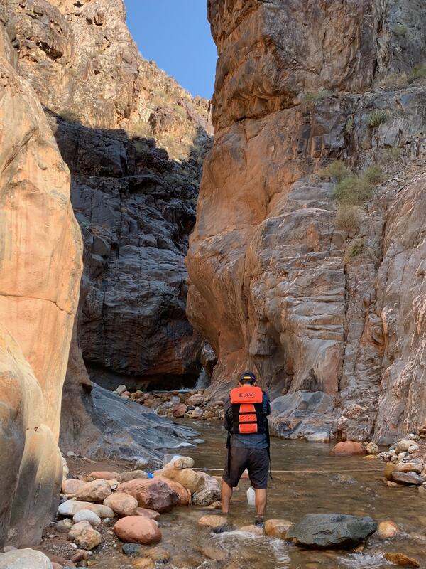
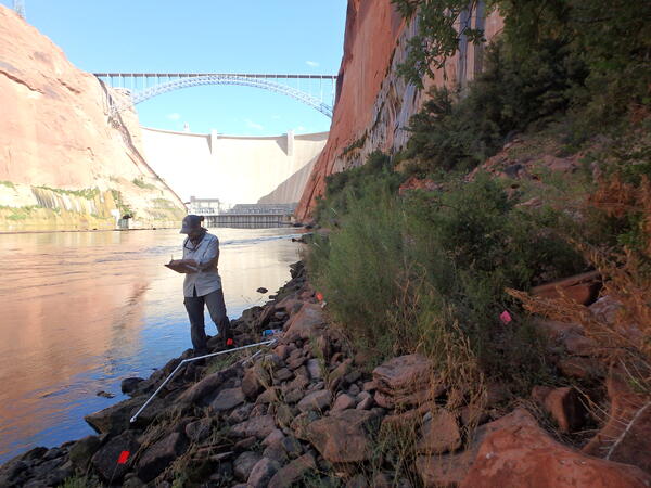
Nick Paretti measures water flow in a Grand Canyon tributary
Nick Paretti measures water flow in a Grand Canyon tributaryNick Paretti, Arizona Water Science Center (AZWSC), measures water flow at a tributary to the Colorado River in Grand Canyon. Photo courtesy of Kat Cooney, USGS, AZWSC.
Nick Paretti measures water flow in a Grand Canyon tributary
Nick Paretti measures water flow in a Grand Canyon tributaryNick Paretti, Arizona Water Science Center (AZWSC), measures water flow at a tributary to the Colorado River in Grand Canyon. Photo courtesy of Kat Cooney, USGS, AZWSC.
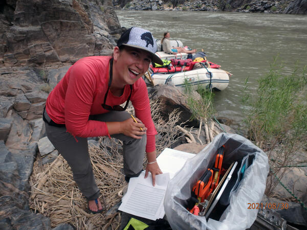
Research ecologist Emily Palmquist collecting plant data during riparian vegetation monitoring along the Colorado River
Research ecologist Emily Palmquist collecting plant data during riparian vegetation monitoring along the Colorado RiverResearch ecologist Emily Palmquist collecting plant data during riparian vegetation monitoring along the Colorado River.
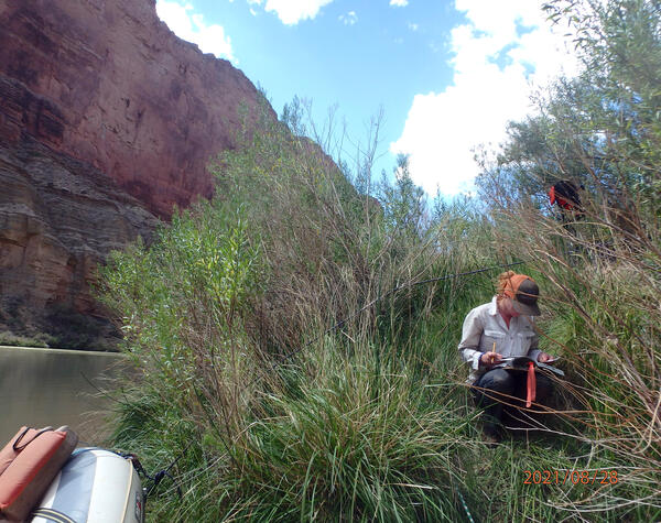
Keying riparian plants during riparian vegetation monitoring along the Colorado River in Grand Canyon
Keying riparian plants during riparian vegetation monitoring along the Colorado River in Grand CanyonJackie, a USGS technician, keys riparian plants along the Colorado River in Grand Canyon, AZ. The USGS Grand Canyon Monitoring and Research Center conducts vegetation monitoring as a science provider for the Glen Canyon Dam Adaptive Management Program. Photo by Emily Palmquist, USGS.

Colorado Plateau dryland habitat
Degraded dryland habitat on the Colorado Plateau. Photo by Shannon Lencioni, SBSC, USGS.
Degraded dryland habitat on the Colorado Plateau. Photo by Shannon Lencioni, SBSC, USGS.
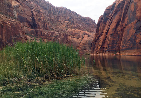
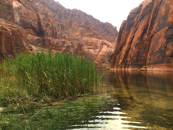
Common reed (Phragmites australis) along the Colorado River in Grand Canyon
Common reed (Phragmites australis) along the Colorado River in Grand CanyonNative common reed (Phragmites australis spp. americanus) at Colorado River Mile -7.7L, near Lunch Beach. Common reed is a culturally important species to the Tribes traditionally affiliated with this region. It plays a role in multiple emergence stories, is used in a wide variety of ceremonies, and has had many utilitarian uses.
Pluchea sericea (arrowweed) reeds on the bank of the Colorado River in Grand Canyon
Pluchea sericea (arrowweed) reeds on the bank of the Colorado River in Grand CanyonPluchea sericea (arrowweed) reeds on the bank of the Colorado River in Grand Canyon. Here they are inundated by the river. Photo by Emily Palmquist, taken during riparian vegetation monitoring by USGS Grand Canyon Monitoring and Research Center.
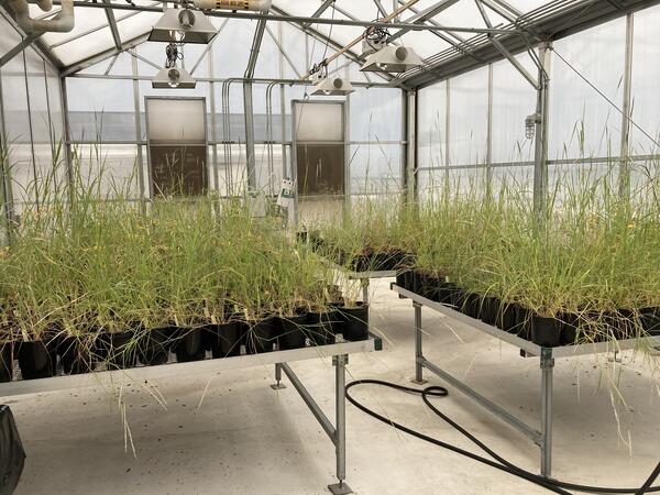
Greenhouse study comparing plant provenance for restoration
Greenhouse study comparing plant provenance for restorationRestoreNet is partnering with the Gornish lab at the University of Arizona to better understand how a plant’s source location (provenance) influences its performance in a restoration setting. This greenhouse experiment will be conducted by PhD student, Sierra Lauman.

Cathedral Valley, Capital Reef National Park, Utah
Cathedral Valley, Capital Reef National Park, UtahCathedral Valley, Capital Reef National Park, Utah. Photo by Chris Benson, USGS.
Cathedral Valley, Capital Reef National Park, Utah
Cathedral Valley, Capital Reef National Park, UtahCathedral Valley, Capital Reef National Park, Utah. Photo by Chris Benson, USGS.

A panorama of Cathedral Valley, Capital Reef National Park, Utah
A panorama of Cathedral Valley, Capital Reef National Park, UtahA panorama of Cathedral Valley, Capital Reef National Park, Utah. Photo by Chris Benson, USGS, 2021.
A panorama of Cathedral Valley, Capital Reef National Park, Utah
A panorama of Cathedral Valley, Capital Reef National Park, UtahA panorama of Cathedral Valley, Capital Reef National Park, Utah. Photo by Chris Benson, USGS, 2021.
A USGS botanist monitors riparian vegetation along the Colorado River just downstream of Glen Canyon Dam
A USGS botanist monitors riparian vegetation along the Colorado River just downstream of Glen Canyon DamA USGS research ecologist and botanist, Emily Palmquist, conducts riparian vegetation monitoring along the Colorado River just below Glen Canyon Dam. This work is part of the research conducted by the Southwest Biological Science Center's Grand Canyon Monitoring and Research Center as the science provider for the Glen Canyon Dam Adaptive Management Program.

Pre-construction monitoring of vegetation for the Gemini Solar Array
Pre-construction monitoring of vegetation for the Gemini Solar ArrayThe United States is developing renewable energy resources, especially solar, at a rapid rate.
Pre-construction monitoring of vegetation for the Gemini Solar Array
Pre-construction monitoring of vegetation for the Gemini Solar ArrayThe United States is developing renewable energy resources, especially solar, at a rapid rate.

Heavily grazed Colorado Plateau pinyon-juniper dryland habitat
Heavily grazed Colorado Plateau pinyon-juniper dryland habitatHeavily grazed pinyon-juniper habitat on the Colorado Plateau. Photo by Shannon Lencioni, SBSC, USGS.
Heavily grazed Colorado Plateau pinyon-juniper dryland habitat
Heavily grazed Colorado Plateau pinyon-juniper dryland habitatHeavily grazed pinyon-juniper habitat on the Colorado Plateau. Photo by Shannon Lencioni, SBSC, USGS.

Incubation experiment with Colorado River water and sediment
Incubation experiment with Colorado River water and sedimentClear glass incubation bottles with Colorado River water and sediment for an experiment on phosphorus cycling
Incubation experiment with Colorado River water and sediment
Incubation experiment with Colorado River water and sedimentClear glass incubation bottles with Colorado River water and sediment for an experiment on phosphorus cycling
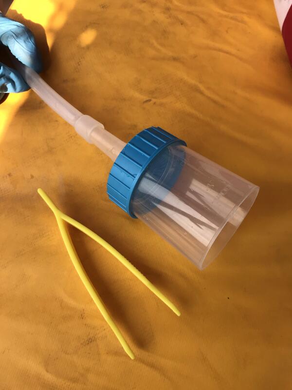
eDNA sampling equipment filter cup parts
eDNA sampling equipment filter cup parts.
eDNA sampling equipment filter cup parts.
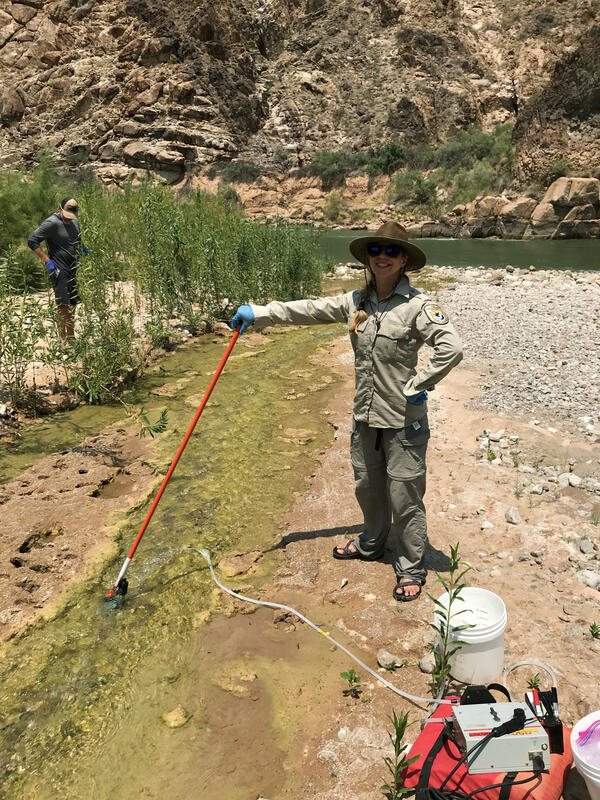
A USFWS colleague samples eDNA in Spencer Creek that flows into the Colorado River
A USFWS colleague samples eDNA in Spencer Creek that flows into the Colorado RiverThe USGS Southwest Biological Science Center (SBSC) is conducting environmental DNA (eDNA) research in and near the Colorado River in Grand Canyon to detect invasive fish species and other aquatic threats before they become established.

Greenhouse study comparing plant performance during drought.
Greenhouse study comparing plant performance during drought.Greenhouse study comparing plant performance during drought will help land managers choose plant species for restoring degraded lands. To find out more, follow the Restoration Assessment and Monitoring Program of the Southwest, housed at the Southwest Biolobigical Science Center. www.ugs.gov/sbsc/ramps
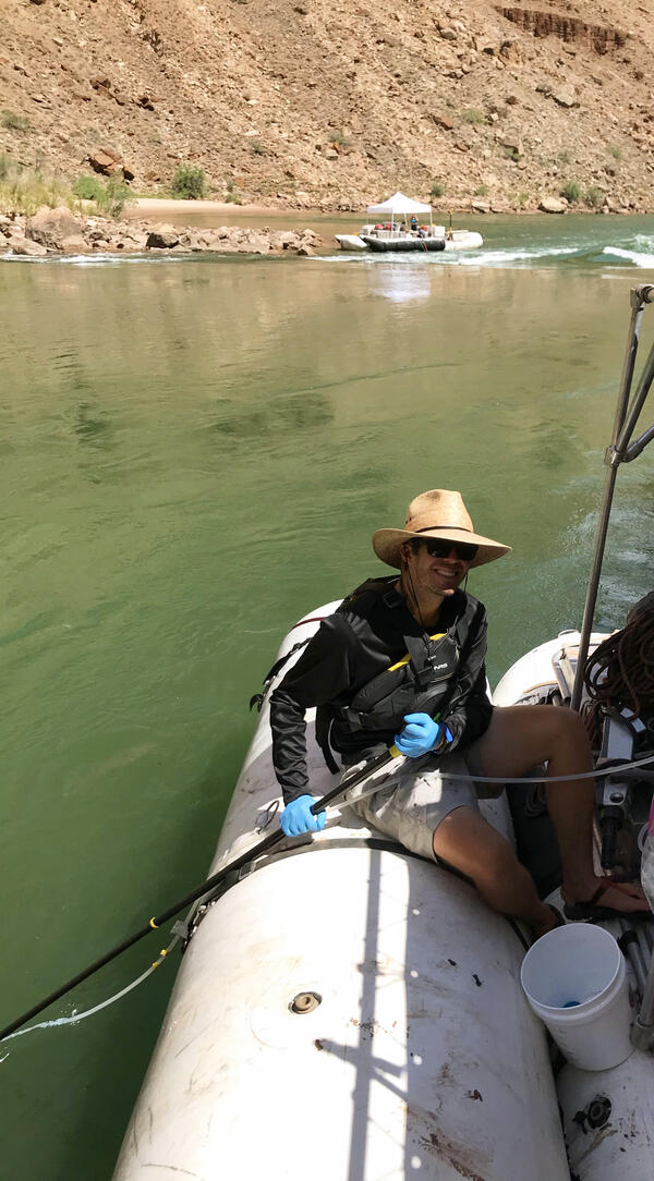
eDNA sampling in the Colorado River
A Bureau of Reclamation researcher, Kent Mosher, conducts eDNA sampling in the Colorado River to detect invasive aquatic species such as smallmouth bass.
A Bureau of Reclamation researcher, Kent Mosher, conducts eDNA sampling in the Colorado River to detect invasive aquatic species such as smallmouth bass.