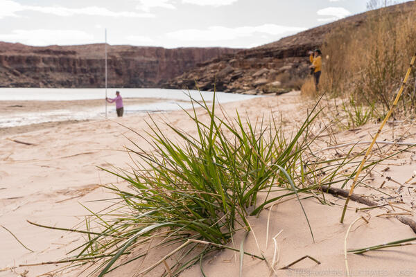
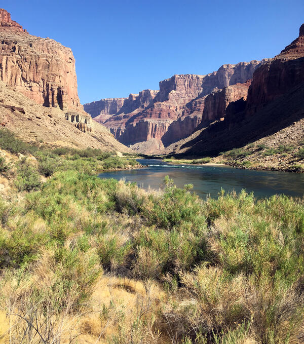
U.S. flag

An official website of the United States government

Images

Below are images associated with SBSC's science and staff. Images appear according to the year they were taken. To search, type a keyword or select a year from the dropdown menu. Or, click through the pages using the arrows at the bottom of the page. 

Filter Total Items: 683
A burned area from wildfire next to unburned yellow grasses in Agua Fria National Monument, AZ
Burned area from wildfire in Agua Fria National Monument, AZ

A burned area from wildfire in Agua Fria National Monument in central AZ. Photo by Katie Laushman, USGS.

Biocrust filaments
Biocrust filaments
Biocrust filaments
Biocrust filaments

Close-up of biocrust filaments. Taken by SBSC during surveys, in Utah, 2020. Photo courtesy of Erika Geiger.

Close-up of biocrust filaments. Taken by SBSC during surveys, in Utah, 2020. Photo courtesy of Erika Geiger.

Seedling germination in biocrust, Utah
Plant germination in biocrust, Utah

Biocrusts create a protective surface that retain soil moisture and protect seeds, facilitating seedling germination and survival. Photo courtesy of Erika Geiger, SBSC USGS, Utah, 2020.

Biocrusts create a protective surface that retain soil moisture and protect seeds, facilitating seedling germination and survival. Photo courtesy of Erika Geiger, SBSC USGS, Utah, 2020.

A group of people sit in a meeting around a big circle of tables.
RestoreNet Partner Meeting

Land managers representing National Park Service, Bureau of Land Management, US Forest Service, Navajo Nation, private ranches and farms attend the first RestoreNet stakeholder meeting at the USGS Southwest Biological Science Center in February 2020. 

Land managers representing National Park Service, Bureau of Land Management, US Forest Service, Navajo Nation, private ranches and farms attend the first RestoreNet stakeholder meeting at the USGS Southwest Biological Science Center in February 2020. 

A map with an area marked in red of Shay Mesa, UT, where pinyon-juniper clearing treatments are being evaluated
A map of Shay Mesa, Utah, showing an area of pinyon-juniper clearing treatments

A dynamic illustration of how pixel matching can be used for finding control points on a map of Shay Mesa, Utah, showing an area of pinyon-juniper clearing treatments. For more information, see the paper: What determines the effectiveness of Pinyon-Juniper clearing treatments?

A dynamic illustration of how pixel matching can be used for finding control points on a map of Shay Mesa, Utah, showing an area of pinyon-juniper clearing treatments. For more information, see the paper: What determines the effectiveness of Pinyon-Juniper clearing treatments?

Photo of USGS SBSC ecologist Emily Palmquist
USGS Plant ecologist Emily Palmquist

USGS Southwest Biological Science Center, Grand Canyon Monitoring and Research Center plant ecologist Emily Palmquist. Emily studies riparian plant ecology in drylands of the western U.S. with particular emphasis on providing scientific information that addresses land management and stakeholder needs.

USGS Southwest Biological Science Center, Grand Canyon Monitoring and Research Center plant ecologist Emily Palmquist. Emily studies riparian plant ecology in drylands of the western U.S. with particular emphasis on providing scientific information that addresses land management and stakeholder needs.

Drylands near Moab, Utah
Drylands outside Moab, Utah

A photo of drylands near Moab, Utah. Image taken by Erika Geiger, USGS. Public domain.

A photo of drylands near Moab, Utah. Image taken by Erika Geiger, USGS. Public domain.

Sandbar that had nonnative vegetation removal on the Colorado River in Grand Canyon
Colorado River sandbar/sand dune archaeological site vegetation removal

A research and monitoring area at a sandbar near an archaeological site along the Colorado River in Grand Canyon where encroaching vegetation has been removed. Photo courtesy of Joel Sankey, USGS, Southwest Biological Science Center, Grand Canyon Monitoring and Research Center.

A research and monitoring area at a sandbar near an archaeological site along the Colorado River in Grand Canyon where encroaching vegetation has been removed. Photo courtesy of Joel Sankey, USGS, Southwest Biological Science Center, Grand Canyon Monitoring and Research Center.

A group of people gather around a list of climate adaptation strategies inside of a conference room.
Collaborating on Climate Adaptation

RAMPS expands drought adaptation project with national parks in the 4-Corners area. National parks across the desert Southwest are experiencing ecological impacts due to climate change.

RAMPS expands drought adaptation project with national parks in the 4-Corners area. National parks across the desert Southwest are experiencing ecological impacts due to climate change.

A land manager examines a list of working  groups.
Collaborating on Climate Adaptation

RAMPS expands drought adaptation project with national parks in the 4-Corners area. National parks across the desert Southwest are experiencing ecological impacts due to climate change.

RAMPS expands drought adaptation project with national parks in the 4-Corners area. National parks across the desert Southwest are experiencing ecological impacts due to climate change.

BLM collaborator spreads straw mulch on experimental treatment
A BLM collaborator spreads straw mulch on experimental reclamation treatment

A BLM collaborator spreads straw mulch on experimental reclamation treatment near Vernal, Utah, in an oil and gas well pad reclamation experiment in collaboration with USGS Southwest Biological Science Center, November 2019. Photo by Rebecca Mann, USGS, SBSC.

A BLM collaborator spreads straw mulch on experimental reclamation treatment near Vernal, Utah, in an oil and gas well pad reclamation experiment in collaboration with USGS Southwest Biological Science Center, November 2019. Photo by Rebecca Mann, USGS, SBSC.

A group of people stand around a map laid out in the back of a truck while on a field trip.
Managing Fire on the US Mexico Borderlands

RAMPS met with DOI Office of Wildland Fire, US Customs and Border Patrol, and US Fish & Wildlife Service staff at Buenos Aires National Wildlife Refuge in southern AZ last November. The group is developing tools to reduce wildfire risk, conserve wildlife habitat and natural resources, and increase safety and security of border operations.

RAMPS met with DOI Office of Wildland Fire, US Customs and Border Patrol, and US Fish & Wildlife Service staff at Buenos Aires National Wildlife Refuge in southern AZ last November. The group is developing tools to reduce wildfire risk, conserve wildlife habitat and natural resources, and increase safety and security of border operations.

A grassland
Arid grassland
Arid grassland
Arid grassland

Arid grasslands in the U.S. Mexico border are fire adapted and used by diverse groups. Science from the Southwest Biological Science Center and the Restoration Assessment and Monitoring Program for the Southwest (RAMPS) is helping these groups find common ground to manage this dynamic landscape.

Arid grasslands in the U.S. Mexico border are fire adapted and used by diverse groups. Science from the Southwest Biological Science Center and the Restoration Assessment and Monitoring Program for the Southwest (RAMPS) is helping these groups find common ground to manage this dynamic landscape.

Three rainbow trout swimming upstream in the Colorado River
Rainbow trout in Lees Ferry, Colorado River

A group of rainbow trout swims upstream in the Lees Ferry fishery downstream of Glen Canyon Dam in the Colorado River. 

A person fishing in Lees Ferry on the Colorado River downstream of Glen Canyon Dam in the late afternoon
A person fishing for trout in Lees Ferry, Colorado River

A person fishing for rainbow trout or brown trout in the Lees Ferry fishery in the Colorado River downstream of Glen Canyon Dam in Grand Canyon National Park.

A flowering Arrowweed plant with a few clusters of pink flowers and stalks with thin, sage-green slightly fuzzy leaves
Flowering Arrowweed (Pluchea sericea), in a riparian plant experiment

Flowering Arrowweed (Pluchea sericea) in a riparian plant experiment in a greenhouse, to assess how flooding or drought can affect this native stream-dependent species. Arrowweed is one of the species that grows abundantly along the Colorado River in Grand Canyon. Photo by Emily Palmquist, USGS.

Flowering Arrowweed (Pluchea sericea) in a riparian plant experiment in a greenhouse, to assess how flooding or drought can affect this native stream-dependent species. Arrowweed is one of the species that grows abundantly along the Colorado River in Grand Canyon. Photo by Emily Palmquist, USGS.

Grassland in Canyonlands National Park

USGS scientists measure biological soil crust cover in the study grassland.

Biocrust study site
Biocrust survey study site

USGS SBSC staff surveying biocrust at a protected study site. Photo courtesy of Mike Duniway, Sept 2019.

USGS SBSC staff surveying biocrust at a protected study site. Photo courtesy of Mike Duniway, Sept 2019.

SBSC researchers conducting aquatic insect research by Glen Canyon Dam in the Colorado River
SBSC researchers conducting aquatic insect research in the Colorado River next to Glen Canyon Dam during "Bug Flows"

SBSC's foodbase team conducts aquatic insect studies downstream of Glen Canyon Dam in the Colorado River during "Bug Flows" - a modified flow regime designed to benefit insects.

Was this page helpful?