



USGS scientists created outdoor testing plots where large squares of biocrusts were exposed to different warming and precipitation factors over time.
Images
Below are images associated with SBSC's science and staff. Images appear according to the year they were taken. To search, type a keyword or select a year from the dropdown menu. Or, click through the pages using the arrows at the bottom of the page.
Filter Total Items: 711

Biocrust outdoor testing plots
USGS scientists created outdoor testing plots where large squares of biocrusts were exposed to different warming and precipitation factors over time.

USGS scientist Sasha Reed studys outdoor biocrust testing sites
USGS scientist Sasha Reed studys outdoor biocrust testing sitesUSGS scientist Sasha Reed studies sites where different climate conditions are being mimicked to determine effect on biocrusts.
USGS scientist Sasha Reed studys outdoor biocrust testing sites
USGS scientist Sasha Reed studys outdoor biocrust testing sitesUSGS scientist Sasha Reed studies sites where different climate conditions are being mimicked to determine effect on biocrusts.

Biocrust outdoor testing plots
USGS scientists created outdoor testing plots where large squares of biocrusts were exposed to different warming and precipitation factors over time.
USGS scientists created outdoor testing plots where large squares of biocrusts were exposed to different warming and precipitation factors over time.

Biocrust outdoor testing plots.
USGS scientists created outdoor testing plots where large squares of biocrusts were exposed to different warming and precipitation factors over time.
USGS scientists created outdoor testing plots where large squares of biocrusts were exposed to different warming and precipitation factors over time.

New tamarisk leaves re-grow after tamarisk leaf beetle defoliation
New tamarisk leaves re-grow after tamarisk leaf beetle defoliationTamarisk leaves regrow following defoliation by the biological control agent, tamarisk leaf beetle (Diorhabda spp.).
New tamarisk leaves re-grow after tamarisk leaf beetle defoliation
New tamarisk leaves re-grow after tamarisk leaf beetle defoliationTamarisk leaves regrow following defoliation by the biological control agent, tamarisk leaf beetle (Diorhabda spp.).

Defoliated nonnative tamarisk with native cottonwood trees
Defoliated nonnative tamarisk with native cottonwood treesNonnative tamarisk can form mixed stands with native trees, such as cottonwoods, and other nonnative trees, such as Russian olive.
Defoliated nonnative tamarisk with native cottonwood trees
Defoliated nonnative tamarisk with native cottonwood treesNonnative tamarisk can form mixed stands with native trees, such as cottonwoods, and other nonnative trees, such as Russian olive.

Nonnative tamarisk is fire resistant
Nonnative tamarisk is resistant to wildfire, in part due to its abilty to resprout from the its roots.
Nonnative tamarisk is resistant to wildfire, in part due to its abilty to resprout from the its roots.

Tamarisk re-grows new leaves after tamarisk leaf beetle defoliation
Tamarisk re-grows new leaves after tamarisk leaf beetle defoliationTamarisk can re-grow new leaves after being defoliated by the biocontrol agent tamarisk leaf beetle (Diorhabda spp.).
Tamarisk re-grows new leaves after tamarisk leaf beetle defoliation
Tamarisk re-grows new leaves after tamarisk leaf beetle defoliationTamarisk can re-grow new leaves after being defoliated by the biocontrol agent tamarisk leaf beetle (Diorhabda spp.).

Grand Canyon Base Map
Screen capture of Grand Canyon shaded relief base map used by the USGS's Grand Canyon Monitoring and Research Center.
Screen capture of Grand Canyon shaded relief base map used by the USGS's Grand Canyon Monitoring and Research Center.
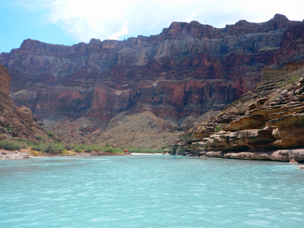
The Little Colorado River in Grand Canyon, with researchers in the distance
The Little Colorado River in Grand Canyon, with researchers in the distanceThe Little Colorado River in Grand Canyon, with researchers in the distance during a humpback chub monitoring trip. Photo by Maria Dzul, USGS, July 2016.
The Little Colorado River in Grand Canyon, with researchers in the distance
The Little Colorado River in Grand Canyon, with researchers in the distanceThe Little Colorado River in Grand Canyon, with researchers in the distance during a humpback chub monitoring trip. Photo by Maria Dzul, USGS, July 2016.
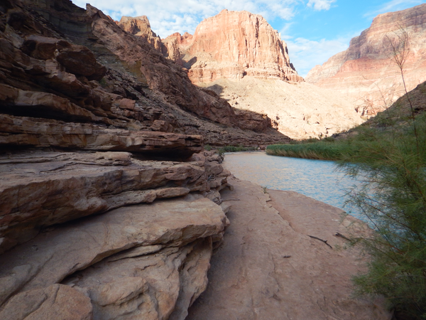
The Little Colorado River in Grand Canyon
The Little Colorado River winds through Grand Canyon. Photo by Maria Dzul, USGS, July 2016.
The Little Colorado River winds through Grand Canyon. Photo by Maria Dzul, USGS, July 2016.
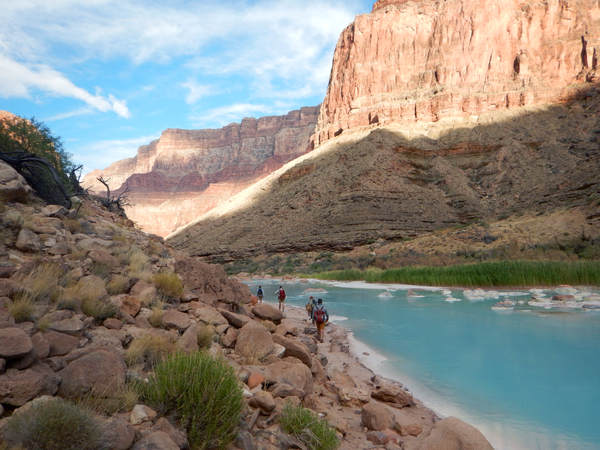
Researchers hike near the Little Colorado River to a humpback chub monitoring site
Researchers hike near the Little Colorado River to a humpback chub monitoring siteResearchers hike near the Little Colorado River to a humpback chub monitoring site. Photo by Maria Dzul, USGS, July 2016.
Researchers hike near the Little Colorado River to a humpback chub monitoring site
Researchers hike near the Little Colorado River to a humpback chub monitoring siteResearchers hike near the Little Colorado River to a humpback chub monitoring site. Photo by Maria Dzul, USGS, July 2016.
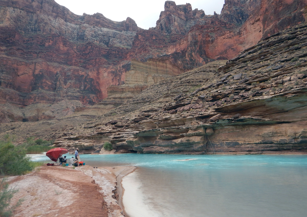
Researchers near the Little Colorado River during a humpback chub monitoring trip
Researchers near the Little Colorado River during a humpback chub monitoring tripResearchers process data near the Little Colorado River during a humpback chub monitoring trip. Photo by Maria Dzul, July 2016.
Researchers near the Little Colorado River during a humpback chub monitoring trip
Researchers near the Little Colorado River during a humpback chub monitoring tripResearchers process data near the Little Colorado River during a humpback chub monitoring trip. Photo by Maria Dzul, July 2016.
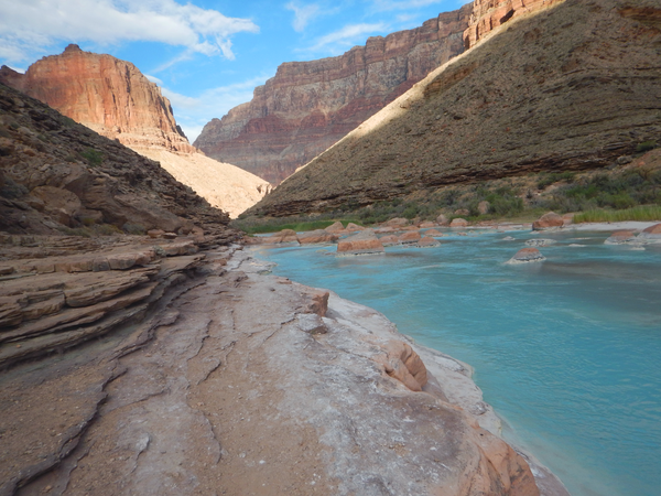
The Little Colorado River
The Little Colorado River in Grand Canyon. Photo by Maria Dzul, USGS, July 2016.
The Little Colorado River in Grand Canyon. Photo by Maria Dzul, USGS, July 2016.
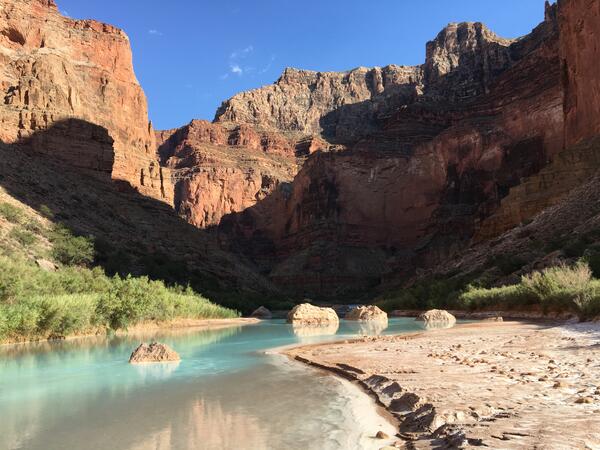
The Little Colorado River
The Little Colorado River near Grand Canyon. Photo by Lucas Bair, USGS, Southwest Biological Science Center.
The Little Colorado River near Grand Canyon. Photo by Lucas Bair, USGS, Southwest Biological Science Center.

Monitoring riparian vegetation along the Colorado River
Monitoring riparian vegetation along the Colorado RiverMonitoring riparian vegetation along the Colorado River downstream of Glen Canyon Dam
Monitoring riparian vegetation along the Colorado River
Monitoring riparian vegetation along the Colorado RiverMonitoring riparian vegetation along the Colorado River downstream of Glen Canyon Dam

Humpback Chub in the Colorado River, Grand Canyon
Humpback chub, a federally protected species, in habitat near the confluence of the Colorado River and Little Colorado Rivers in Grand Canyon. Photo by David Ward, USGS.
Humpback chub, a federally protected species, in habitat near the confluence of the Colorado River and Little Colorado Rivers in Grand Canyon. Photo by David Ward, USGS.

USGS Research Ecologist Jeff Lovich gets ready to release a male desert tortoise
USGS Research Ecologist Jeff Lovich gets ready to release a male desert tortoiseUSGS Research Ecologist Jeff Lovich gets ready to release a male desert tortoise into its cave-like shelter in southern Joshua Tree National Park after collecting data. Photo by Shellie Puffer, USGS, SBSC.
USGS Research Ecologist Jeff Lovich gets ready to release a male desert tortoise
USGS Research Ecologist Jeff Lovich gets ready to release a male desert tortoiseUSGS Research Ecologist Jeff Lovich gets ready to release a male desert tortoise into its cave-like shelter in southern Joshua Tree National Park after collecting data. Photo by Shellie Puffer, USGS, SBSC.
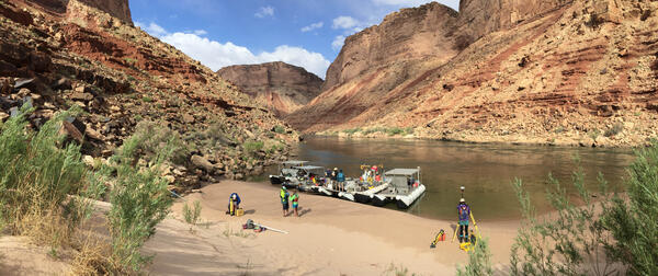
Sandbar beach on the Colorado River in Grand Canyon
Sandbar beach on the Colorado River in Grand CanyonRiver channel mapping boats on a sandbar beach on the Colorado River, in Grand Canyon, 2016. USGS photo, public domain.
Sandbar beach on the Colorado River in Grand Canyon
Sandbar beach on the Colorado River in Grand CanyonRiver channel mapping boats on a sandbar beach on the Colorado River, in Grand Canyon, 2016. USGS photo, public domain.
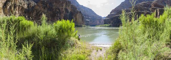
Repeat photograph taken along the Colorado River in 2016 that is a pseudo-match to an EC LaRue USGS 1923 Birdseye Expedition image
Repeat photograph taken along the Colorado River in 2016 that is a pseudo-match to an EC LaRue USGS 1923 Birdseye Expedition imageA USGS repeat photograph that is a pseudo-match to an E.C. LaRue USGS image from 1923, taken during the Birdseye Expedition, prior to Glen Canyon Dam construction upstream of this site on the Colorado River.
Repeat photograph taken along the Colorado River in 2016 that is a pseudo-match to an EC LaRue USGS 1923 Birdseye Expedition image
Repeat photograph taken along the Colorado River in 2016 that is a pseudo-match to an EC LaRue USGS 1923 Birdseye Expedition imageA USGS repeat photograph that is a pseudo-match to an E.C. LaRue USGS image from 1923, taken during the Birdseye Expedition, prior to Glen Canyon Dam construction upstream of this site on the Colorado River.
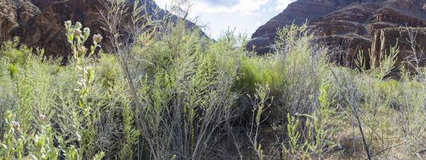
Repeat photograph taken along the Colorado River in 2016 that is a match to an EC LaRue USGS 1923 Birdseye Expedition image
Repeat photograph taken along the Colorado River in 2016 that is a match to an EC LaRue USGS 1923 Birdseye Expedition imageA USGS repeat photograph that is a match to an E.C. LaRue USGS image from 1923, taken during the Birdseye Expedition, prior to Glen Canyon Dam construction upstream of this site on the Colorado River in Grand Canyon.
Repeat photograph taken along the Colorado River in 2016 that is a match to an EC LaRue USGS 1923 Birdseye Expedition image
Repeat photograph taken along the Colorado River in 2016 that is a match to an EC LaRue USGS 1923 Birdseye Expedition imageA USGS repeat photograph that is a match to an E.C. LaRue USGS image from 1923, taken during the Birdseye Expedition, prior to Glen Canyon Dam construction upstream of this site on the Colorado River in Grand Canyon.