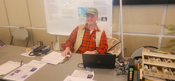
U.S. flag

An official website of the United States government

Images

Below are images associated with SBSC's science and staff. Images appear according to the year they were taken. To search, type a keyword or select a year from the dropdown menu. Or, click through the pages using the arrows at the bottom of the page. 

Filter Total Items: 641
ISCO pump samplers at a sediment gaging site, Fence Fault beach, Colorado River, Grand Canyon

ISCO pump samplers at a sediment gaging site, Fence Fault beach, looking downstream at the Colorado River, Grand Canyon. Photo taken February 2023 by Joe Thomas, USGS Southwest Biological Science Center, Grand Canyon Monitoring and Research Center.

ISCO pump samplers at a sediment gaging site, Fence Fault beach, looking downstream at the Colorado River, Grand Canyon. Photo taken February 2023 by Joe Thomas, USGS Southwest Biological Science Center, Grand Canyon Monitoring and Research Center.

Low Earth Orbit satellite receiver next to Geostationary satellite receiver at 61-mile gaging station, Grand Canyon
Low Earth Orbit satellite receiver next to Geostationary satellite receiver at 61-mile gaging station, Grand Canyon National Park

Testing of a Low Earth Orbit satellite receiver next to Geostationary satellite receiver at 61-mile gaging station, located just upstream of the confluence with the Little Colorado River at River Mile 61 on the Colorado River, Grand Canyon.

A raft containing equipment on a science field trip headed downstream on the Colorado River in Grand Canyon
A raft on a science field trip on the Colorado River in Grand Canyon

A raft containing gear on an SBSC Grand Canyon and Monitoring Research Center (GCMRC) science field trip headed downstream on the Colorado River, Marble Canyon, in Grand Canyon National Park. Photo taken February 2023 by Joe Thomas, SBSC, GCMRC.

A raft containing gear on an SBSC Grand Canyon and Monitoring Research Center (GCMRC) science field trip headed downstream on the Colorado River, Marble Canyon, in Grand Canyon National Park. Photo taken February 2023 by Joe Thomas, SBSC, GCMRC.

A raft with gear on a science field trip on the Colorado River in Grand Canyon
A raft with gear heading downstream into Marble Canyon on a science field trip on the Colorado River, Grand Canyon

A raft with gear heading downstream into Marble Canyon on a Southwest Biological Science Center (SBSC), Grand Canyon Monitoring and Research Center (GCMRC) science field trip on the Colorado River, Grand Canyon. Photo taken February 2023 by Joe Thomas, USGS, SBSC, GCMRC.

Historic Grand Canyon gage house as viewed from the river immediately below it, Colorado River, Grand Canyon
Grand Canyon gage house as viewed from the river immediately below it, Colorado River, Grand Canyon

The historic Grand Canyon gage house as viewed from the river immediately below it, Colorado River, Grand Canyon. Photo taken February 2023 by Joe Thomas, USGS Southwest Biological Science Center, Grand Canyon Monitoring and Research Center.

Low Earth Orbit satellite receiver at Fence Fault beach located in Upper Marble Canyon on the Colorado River, Grand Canyon
Low Earth Orbit (LEO) satellite receiver at Fence Fault beach in Upper Marble Canyon on the Colorado River, Grand Canyon

Testing of a Low Earth Orbit (LEO) satellite receiver at Fence Fault beach located in Upper Marble Canyon on the Colorado River, Grand Canyon National Park. Photo taken in February 2023 by Joe Thomas, USGS Southwest Biological Science Center, Grand Canyon Monitoring and Research Center.

Low Earth Orbit satellite receiver at 61-mile gaging station, River Mile 61 along Colorado River, Grand Canyon

Testing of a Low Earth Orbit satellite receiver at 61-mile gaging station, located just upstream of the confluence with the Little Colorado River at River Mile 61 along Colorado River, Grand Canyon. Photo taken February 2023 by Joe Thomas, USGS Southwest Biological Science Center, Grand Canyon Monitoring and Research Center.

Testing of a Low Earth Orbit satellite receiver at 61-mile gaging station, located just upstream of the confluence with the Little Colorado River at River Mile 61 along Colorado River, Grand Canyon. Photo taken February 2023 by Joe Thomas, USGS Southwest Biological Science Center, Grand Canyon Monitoring and Research Center.

A wide angle view of Grand Canyon gage house and the Colorado River in Grand Canyon, Arizona
Grand Canyon gage house, Colorado River, Grand Canyon, Arizona

A wide angle view of the historic Grand Canyon gage house, Colorado River, Grand Canyon, Arizona. Photo taken February 2023 by Joe Thomas, USGS Southwest Biological Science Center, Grand Canyon Monitoring and Research Center.

A wide angle view of the historic Grand Canyon gage house, Colorado River, Grand Canyon, Arizona. Photo taken February 2023 by Joe Thomas, USGS Southwest Biological Science Center, Grand Canyon Monitoring and Research Center.

Testing of Low Earth Orbit satellite receiver at 61-mile gaging station next to the Colorado River in Grand Canyon
Low Earth Orbit (LEO) satellite receiver at 61-mile gaging station, Colorado River, Grand Canyon

Testing of a Low Earth Orbit (LEO) satellite receiver at 61-mile gaging station, located just upstream of the confluence with the Little Colorado River next to the Colorado River in Grand Canyon National Park. Photo taken February 2023 by Ron Griffiths, USGS Southwest Biological Science Center Grand Canyon Monitoring and Research Center.

Testing of a Low Earth Orbit (LEO) satellite receiver at 61-mile gaging station, located just upstream of the confluence with the Little Colorado River next to the Colorado River in Grand Canyon National Park. Photo taken February 2023 by Ron Griffiths, USGS Southwest Biological Science Center Grand Canyon Monitoring and Research Center.

Low Earth Orbit satellite receiver at 61-mile gaging station, River Mile 61 along Colorado River, Grand Canyon

Testing of Low Earth Orbit satellite receiver at 61-mile gaging station, located just upstream of the confluence with the Little Colorado River at River Mile 61 along the Colorado River in Grand Canyon. Photo taken February 2023 by Joe Thomas, USGS Southwest Biological Science Center, Grand Canyon Monitoring and Research Center.

Testing of Low Earth Orbit satellite receiver at 61-mile gaging station, located just upstream of the confluence with the Little Colorado River at River Mile 61 along the Colorado River in Grand Canyon. Photo taken February 2023 by Joe Thomas, USGS Southwest Biological Science Center, Grand Canyon Monitoring and Research Center.

Grand Canyon gage house as viewed from the river below, Colorado River, Grand Canyon

The historic Grand Canyon gage house as viewed from the river below, Colorado River, Grand Canyon. Photo taken February 2023 by Joe Thomas, USGS Southwest Biological Science Center, Grand Canyon Monitoring and Research Center.

The historic Grand Canyon gage house as viewed from the river below, Colorado River, Grand Canyon. Photo taken February 2023 by Joe Thomas, USGS Southwest Biological Science Center, Grand Canyon Monitoring and Research Center.

Grand Canyon gage house as viewed from the river immediately below it, Colorado River, Grand Canyon

The historic Grand Canyon gage house as viewed from the river immediately below it, Colorado River, Grand Canyon. Photo taken February 2023 by Joe Thomas, USGS Southwest Biological Science Center, Grand Canyon Monitoring and Research Center.

Low Earth Orbit satellite receiver at 61-mile gaging station, River Mile 61 along the Colorado River, Grand Canyon

Testing of a Low Earth Orbit satellite receiver at 61-mile gaging station, located just upstream of the confluence with the Little Colorado River at River Mile 61 along the Colorado River, Grand Canyon. Photo taken February 2023 by Joe Thomas, USGS Southwest Biological Science Center, Grand Canyon Monitoring and Research Center.

Testing of a Low Earth Orbit satellite receiver at 61-mile gaging station, located just upstream of the confluence with the Little Colorado River at River Mile 61 along the Colorado River, Grand Canyon. Photo taken February 2023 by Joe Thomas, USGS Southwest Biological Science Center, Grand Canyon Monitoring and Research Center.

A scenic landscape with purple wildflowers in the foreground, mountains in the background
High Mesa Grassland Wilderness Study Area in Colorado

High Mesa Grassland Wilderness Study Area in Colorado with purple and orange wildflowers, Credit: Bob Wick, BLM.

RestoreNet V2.0 plots at Flying M Ranch. The plot in the foreground has four pits with several seedballs scattered in and around them.
RestoreNet 2.0 restoration experiment sites with pits with seedballs on Northern Arizona rangelands

In 2022, we piloted RestoreNet V2.0 testing soil inoculation from undegraded reference sites, seed balls (white balls in photo), and pitting treatments (small indentions). Soil inoculation with healthy soils is expected to increase beneficial microbes at the degraded restoration site. Soil microbes can help reduce water stress in plants. Photo by Hannah Farrell.

In 2022, we piloted RestoreNet V2.0 testing soil inoculation from undegraded reference sites, seed balls (white balls in photo), and pitting treatments (small indentions). Soil inoculation with healthy soils is expected to increase beneficial microbes at the degraded restoration site. Soil microbes can help reduce water stress in plants. Photo by Hannah Farrell.

Native plants seeded in a RestoreNet trial around a wire connectivity modified (ConMod) in the Sonoran Desert
RestoreNet ConMod with flowers in the Sonoran Desert

Diverse plants growing in a connectivity modified (ConMod) treatment in the Sonoran Desert. Photo by Molly McCormick.

A graphic showing Restoration outcomes on the Colorado Plateau are the product of many diverse, interconnected factors
Restoration outcomes on the Colorado Plateau are the product of many diverse, interconnected factors

Restoration outcomes are the product of many diverse, interconnected factors. The black textboxes in this illustration highlight key factors that directly and indirectly affect restoration success. The panels represent examples of a degraded dryland on the Colorado Plateau (left panel) and a restoration goal for that landscape (right panel).

Restoration outcomes are the product of many diverse, interconnected factors. The black textboxes in this illustration highlight key factors that directly and indirectly affect restoration success. The panels represent examples of a degraded dryland on the Colorado Plateau (left panel) and a restoration goal for that landscape (right panel).

A map from a USGS 2022 paper that illustrates BLM Native Plant Program land management boundaries, Colorado Plateau
A map from 2022 USGS paper that illustrates BLM Native Plant Program land management boundaries on the Colorado Plateau

A map from a USGS paper titled "Restoration research actions to address rapid change in drylands: Insights from the Colorado Plateau," that illustrates the Bureau of Land Management's (BLM) Native Plant Program land management boundaries on the Colorado Plateau with call-out photos that identify different reg

Cover of Open-File Report 2022-1097 that shows images taken with lidar monitoring in Grand Canyon
Cover of USGS Open-File Report, Terrestrial Lidar Monitoring of the Effects of Glen Canyon Dam Operations on the Geomorphic Condition of Archaeological Sites in Grand Canyon National Park, 2010–2020

Cover of USGS Open-File Report 2022-1097, "Terrestrial Lidar Monitoring of the Effects of Glen Canyon Dam Operations on the Geomorphic Condition of Archaeological Sites in Grand Canyon National Park, 2010–2020." The cover shows images taken during lidar monitoring in Grand Canyon. 

Adiantum capillusveneris (maidenhair fern) with bright green foliage drapes over a rock that has spring water seeping from it
Adiantum capillus-veneris, a type of maidenhair fern, in Grand Canyon

Adiantum capillus-veneris, a type of maidenhair fern, in Grand Canyon. Photo by Emily Palmquist, USGS Southwest Biological Science Center.

Panels stretch into the distance at the Gemini Solar Project, Nevada
Panels stretch into the distance at the Gemini Solar Project, NV

Gemini Solar Project panels stretch into the distance. Vegetation was left between the panels as a construction alternative to retain plant and soil habitat. Gemini developed measures to avoid, minimize and mitigate impacts to the environment during construction and operation. USGS collaborates with the Bureau of Land Management on research at this array.

Gemini Solar Project panels stretch into the distance. Vegetation was left between the panels as a construction alternative to retain plant and soil habitat. Gemini developed measures to avoid, minimize and mitigate impacts to the environment during construction and operation. USGS collaborates with the Bureau of Land Management on research at this array.

Was this page helpful?