



RestoreNet is a networked ecological restoration experiment spanning drylands of the American Southwest. It is engaging diverse partners to develop methods for successful revegetation projects that mitigate the effects of drought, invasion by non-native species, and land use practices.
Images
Below are images associated with SBSC's science and staff. Images appear according to the year they were taken. To search, type a keyword or select a year from the dropdown menu. Or, click through the pages using the arrows at the bottom of the page.
Filter Total Items: 711

RestoreNet Map
RestoreNet is a networked ecological restoration experiment spanning drylands of the American Southwest. It is engaging diverse partners to develop methods for successful revegetation projects that mitigate the effects of drought, invasion by non-native species, and land use practices.

Illustration of 3 native fish in the Colorado River, Grand Canyon: humpback chub, flannelmouth sucker and bluehead sucker
Illustration of 3 native fish in the Colorado River, Grand Canyon: humpback chub, flannelmouth sucker and bluehead suckerIllustration of 3 native fish in the Colorado River, Grand Canyon: humpback chub (Gila cypha, upper left), flannelmouth sucker (Catostomus latipinnis, middle), and bluehead sucker (Catostomus discobolus, lower right). Illustration by Lindsay Hansen, USGS.
Illustration of 3 native fish in the Colorado River, Grand Canyon: humpback chub, flannelmouth sucker and bluehead sucker
Illustration of 3 native fish in the Colorado River, Grand Canyon: humpback chub, flannelmouth sucker and bluehead suckerIllustration of 3 native fish in the Colorado River, Grand Canyon: humpback chub (Gila cypha, upper left), flannelmouth sucker (Catostomus latipinnis, middle), and bluehead sucker (Catostomus discobolus, lower right). Illustration by Lindsay Hansen, USGS.
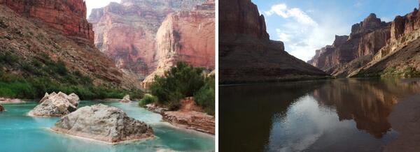
The Little Colorado River (left) and Colorado River (right), near the Little Colorado River confluence
The Little Colorado River (left) and Colorado River (right), near the Little Colorado River confluenceThe Little Colorado River (on left) and Colorado River (on right), near the Little Colorado River confluence, looking upstream.
The Little Colorado River (left) and Colorado River (right), near the Little Colorado River confluence
The Little Colorado River (left) and Colorado River (right), near the Little Colorado River confluenceThe Little Colorado River (on left) and Colorado River (on right), near the Little Colorado River confluence, looking upstream.

A Sonoran Desert RestoreNet site
A RestoreNet Field Trial Network restoration experiment site in the Sonoran Desert, Arizona, in spring 2024. Photo by Laura Shriver (USGS).
A RestoreNet Field Trial Network restoration experiment site in the Sonoran Desert, Arizona, in spring 2024. Photo by Laura Shriver (USGS).
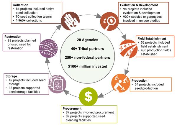
Accomplishments in Native Seed Development in 2022 and 2023
Accomplishments in Native Seed Development in 2022 and 2023Accomplishments in Native Seed Development.
Accomplishments in Native Seed Development in 2022 and 2023
Accomplishments in Native Seed Development in 2022 and 2023Accomplishments in Native Seed Development.

Canyonlands Research Center
Scenic view of the red rock mesas surrounding Canyonlands Research Center (The Nature Conservancy) in southern Utah.
Scenic view of the red rock mesas surrounding Canyonlands Research Center (The Nature Conservancy) in southern Utah.

RestoreNet livestock treatments
Cattle inside a grazing enclosure at Canyonlands Research Center (The Nature Conservancy) in southern Utah.
Cattle inside a grazing enclosure at Canyonlands Research Center (The Nature Conservancy) in southern Utah.
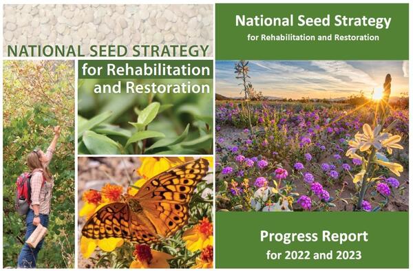
Covers of the National Seed Strategy and National Seed Strategy Progress Report for 2022 and 2023
Covers of the National Seed Strategy and National Seed Strategy Progress Report for 2022 and 2023Covers of the Plant Conservation Alliance National Seed Strategy Progress Report for 2022 and 2023 (left) and the National Seed Strategy for Rehabilitation and Restoration (right).
Covers of the National Seed Strategy and National Seed Strategy Progress Report for 2022 and 2023
Covers of the National Seed Strategy and National Seed Strategy Progress Report for 2022 and 2023Covers of the Plant Conservation Alliance National Seed Strategy Progress Report for 2022 and 2023 (left) and the National Seed Strategy for Rehabilitation and Restoration (right).

Southwest Biological Science Center (SBSC) research garden
Southwest Biological Science Center (SBSC) research gardenSouthwest Biological Science Center (SBSC) research garden hoop houses at the USGS Flagstaff campus. The hoop houses block natural precipitation, so the only water received is from treatments.
Southwest Biological Science Center (SBSC) research garden
Southwest Biological Science Center (SBSC) research gardenSouthwest Biological Science Center (SBSC) research garden hoop houses at the USGS Flagstaff campus. The hoop houses block natural precipitation, so the only water received is from treatments.

Native Phragmites (Phragmites australis spp. americanus), or common reed, along the Colorado River in Grand Canyon
Native Phragmites (Phragmites australis spp. americanus), or common reed, along the Colorado River in Grand CanyonNative Phragmites (Phragmites australis spp. americanus), or common reed, along the Colorado River near Tanner Rapids (part of the Tanner Trail), in Grand Canyon. Photo by Emily Palmquist, USGS Southwest Biological Science Center.
Native Phragmites (Phragmites australis spp. americanus), or common reed, along the Colorado River in Grand Canyon
Native Phragmites (Phragmites australis spp. americanus), or common reed, along the Colorado River in Grand CanyonNative Phragmites (Phragmites australis spp. americanus), or common reed, along the Colorado River near Tanner Rapids (part of the Tanner Trail), in Grand Canyon. Photo by Emily Palmquist, USGS Southwest Biological Science Center.

Desert marigold (Baileya multiradiata) blooming in a monitoring quadrat at a RestoreNet site
Desert marigold (Baileya multiradiata) blooming in a monitoring quadrat at a RestoreNet siteDesert marigold (Baileya multiradiata) blooming in a monitoring quadrat at a RestoreNet site in Northern Arizona. Photo by Laura Shriver (USGS).
Desert marigold (Baileya multiradiata) blooming in a monitoring quadrat at a RestoreNet site
Desert marigold (Baileya multiradiata) blooming in a monitoring quadrat at a RestoreNet siteDesert marigold (Baileya multiradiata) blooming in a monitoring quadrat at a RestoreNet site in Northern Arizona. Photo by Laura Shriver (USGS).
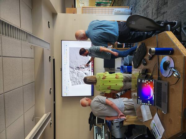
A USGS cartographer discusses planetary geology with the public
A USGS cartographer discusses planetary geology with the publicUSGS cartographer Ben Wheeler discusses planetary geology with the public in the Photogrammetry Lab at the Astrogeology building on the Flagstaff USGS science campus, during an Open House.
A USGS cartographer discusses planetary geology with the public
A USGS cartographer discusses planetary geology with the publicUSGS cartographer Ben Wheeler discusses planetary geology with the public in the Photogrammetry Lab at the Astrogeology building on the Flagstaff USGS science campus, during an Open House.
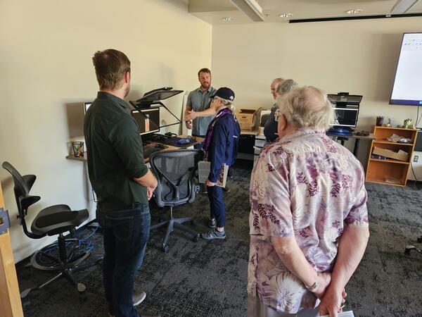
A USGS cartographer engages with the public in the Photogrammetry Lab at the Flagstaff USGS Open House
A USGS cartographer engages with the public in the Photogrammetry Lab at the Flagstaff USGS Open HouseUSGS cartographer Ben Wheeler engages with the public in the Photogrammetry Lab in the Astrogeology building at the 2024 USGS Flagstaff Open House. Photo by Lori Pigue, USGS.
A USGS cartographer engages with the public in the Photogrammetry Lab at the Flagstaff USGS Open House
A USGS cartographer engages with the public in the Photogrammetry Lab at the Flagstaff USGS Open HouseUSGS cartographer Ben Wheeler engages with the public in the Photogrammetry Lab in the Astrogeology building at the 2024 USGS Flagstaff Open House. Photo by Lori Pigue, USGS.
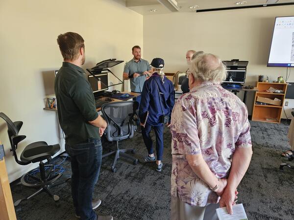
A USGS cartographer engages with the public in the Photogrammetry Lab at the USGS Flagstaff Open House
A USGS cartographer engages with the public in the Photogrammetry Lab at the USGS Flagstaff Open HouseUSGS cartographer Ben Wheeler engages with the public in the Photogrammetry Lab in the Astrogeology building at the 2024 USGS Flagstaff Open House. Photo by Lori Pigue, USGS.
A USGS cartographer engages with the public in the Photogrammetry Lab at the USGS Flagstaff Open House
A USGS cartographer engages with the public in the Photogrammetry Lab at the USGS Flagstaff Open HouseUSGS cartographer Ben Wheeler engages with the public in the Photogrammetry Lab in the Astrogeology building at the 2024 USGS Flagstaff Open House. Photo by Lori Pigue, USGS.
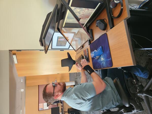
A USGS cartographer works in the Astrogeology Photogrammetry Lab
A USGS cartographer works in the Astrogeology Photogrammetry LabUSGS cartographer Ben Wheeler works in the Astrogeology Photogrammetry Lab at the USGS Flagstaff science campus.
A USGS cartographer works in the Astrogeology Photogrammetry Lab
A USGS cartographer works in the Astrogeology Photogrammetry LabUSGS cartographer Ben Wheeler works in the Astrogeology Photogrammetry Lab at the USGS Flagstaff science campus.

Illustration of Colorado River Basin, showing upper and lower basins
Illustration of Colorado River Basin, showing upper and lower basinsIllustration of Colorado River Basin, showing upper and lower basins with a red text box around the Colorado River in Grand Canyon. Reduced-size map of the Colorado River Basin from the USGS ASIST Initiative, Sept. 3, 2024.
Illustration of Colorado River Basin, showing upper and lower basins
Illustration of Colorado River Basin, showing upper and lower basinsIllustration of Colorado River Basin, showing upper and lower basins with a red text box around the Colorado River in Grand Canyon. Reduced-size map of the Colorado River Basin from the USGS ASIST Initiative, Sept. 3, 2024.

Long camelthorn rhizomes exposed in a wash at Wupatki National Monument
Long camelthorn rhizomes exposed in a wash at Wupatki National MonumentUSGS Biological Science Technician Claudia Dimartini poses with a long camelthorn (Alhagi maurorum) rhizome (underground root structure from which new plants can propagate that was exposed in a wash at the Deadman Wash Confluence Area. Photo by Laura Shriver (USGS).
Long camelthorn rhizomes exposed in a wash at Wupatki National Monument
Long camelthorn rhizomes exposed in a wash at Wupatki National MonumentUSGS Biological Science Technician Claudia Dimartini poses with a long camelthorn (Alhagi maurorum) rhizome (underground root structure from which new plants can propagate that was exposed in a wash at the Deadman Wash Confluence Area. Photo by Laura Shriver (USGS).
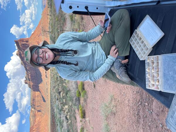
Collecting soil stability data
Sarah Costanzo (USGS) collects soil stability data prior to installing RestoreNet version 2.0 treatments at Canyonlands Research Center near Moab, UT. Photo by Laura Shriver (USGS).
Sarah Costanzo (USGS) collects soil stability data prior to installing RestoreNet version 2.0 treatments at Canyonlands Research Center near Moab, UT. Photo by Laura Shriver (USGS).

Zach Harrison collects a water quality sample at Willow Spring, AZ
Zach Harrison collects a water quality sample at Willow Spring, AZZach Harrison collects a water quality sample at Willow Spring, AZ. Photo courtesy of Kat Cooney, AZ Water Science Center.
Zach Harrison collects a water quality sample at Willow Spring, AZ
Zach Harrison collects a water quality sample at Willow Spring, AZZach Harrison collects a water quality sample at Willow Spring, AZ. Photo courtesy of Kat Cooney, AZ Water Science Center.
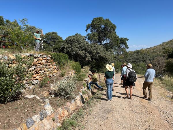
Pollinator garden tour
Albert Klein (University of Arizona) shows the pollinator garden designed and installed by University of Arizona students at the Santa Rita Experimental Range. Photo by Laura Shriver (USGS).
Albert Klein (University of Arizona) shows the pollinator garden designed and installed by University of Arizona students at the Santa Rita Experimental Range. Photo by Laura Shriver (USGS).

Kat Cooney runs an alkalinity titration in a mobile lab
Kat Cooney runs an alkalinity titration in a mobile labKat Cooney of the Arizona Water Science Center (AZWSC) runs an alkalinity titration in a mobile lab. Photo courtesy of Kat Cooney, USGS.
Kat Cooney runs an alkalinity titration in a mobile lab
Kat Cooney runs an alkalinity titration in a mobile labKat Cooney of the Arizona Water Science Center (AZWSC) runs an alkalinity titration in a mobile lab. Photo courtesy of Kat Cooney, USGS.