
Humpback chub swim together in Havasu Creek, a tributary to the Colorado River near Grand Canyon, AZ. Photo by David Herasimtschuk, Freshwaters Illustrated.
Images
Below are images associated with SBSC's science and staff. Images appear according to the year they were taken. To search, type a keyword or select a year from the dropdown menu. Or, click through the pages using the arrows at the bottom of the page.
Filter Total Items: 703
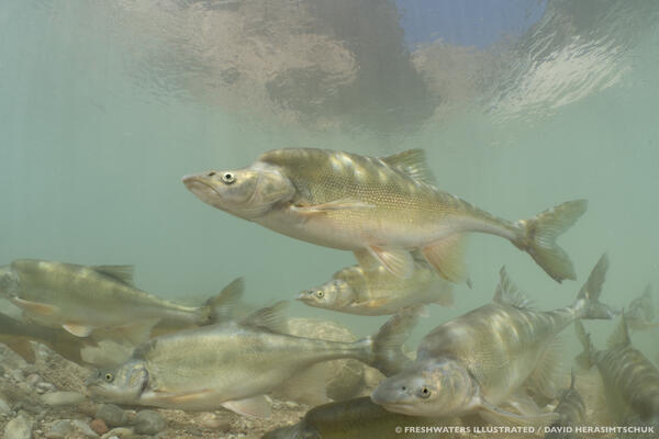
Humpback chub, Havasu Creek, AZ
Humpback chub swim together in Havasu Creek, a tributary to the Colorado River near Grand Canyon, AZ. Photo by David Herasimtschuk, Freshwaters Illustrated.

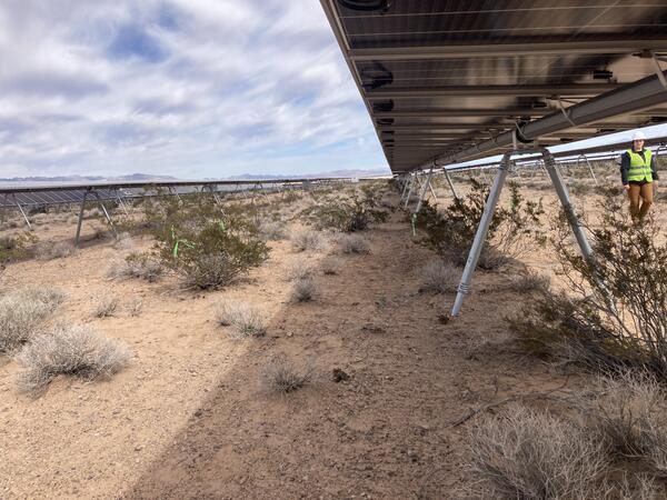
Researchers conducting vegetation and soil fieldwork in the Mojave Desert
Researchers conducting vegetation and soil fieldwork in the Mojave DesertResearchers conducting vegetation and soil fieldwork in the Mojave Desert, Nevada. Photo by Claire Karban, USGS, SBSC.
Researchers conducting vegetation and soil fieldwork in the Mojave Desert
Researchers conducting vegetation and soil fieldwork in the Mojave DesertResearchers conducting vegetation and soil fieldwork in the Mojave Desert, Nevada. Photo by Claire Karban, USGS, SBSC.
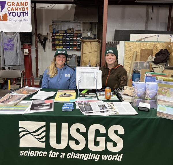
Erica Byerley and Shannon Sartain tabling at the Grand Canyon River Guides Training seminar
Erica Byerley and Shannon Sartain tabling at the Grand Canyon River Guides Training seminarErica Byerley and Shannon Sartain tabling at the Grand Canyon River Guides Training Seminar, April 2023. Photo by SBSC, Grand Canyon Monitoring and Research Center.
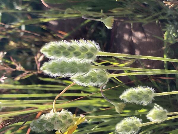
Woolly plantain (Plantago patagonica)
Stalks of Woolly plantain (Plantago patagonica) near Roosevelt Lake, AZ. Photo by Laura Shriver, USGS, SBSC.
Stalks of Woolly plantain (Plantago patagonica) near Roosevelt Lake, AZ. Photo by Laura Shriver, USGS, SBSC.
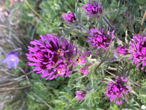
Purple Owl's Clover (Plantago patagonica) flowers
Purple owl's clover (Plantago patagonica) flowers in Arizona. Photo by Laura Shriver, USGS, SBSC.
Purple owl's clover (Plantago patagonica) flowers in Arizona. Photo by Laura Shriver, USGS, SBSC.

Low Earth Orbit (LEO) satellite receiver in Grand Canyon at historic Grand Canyon gage house overlooking the Colorado River
Low Earth Orbit (LEO) satellite receiver in Grand Canyon at historic Grand Canyon gage house overlooking the Colorado RiverA newly installed Low Earth Orbit (LEO) satellite receiver is connected to a suspended sediment concentration sensor at the historic Grand Canyon gaging station. In the background is the South Kaibab Trail bridge and Boat Beach located at Phantom Ranch.
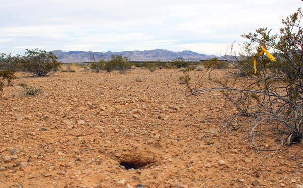
A desert tortoise burrow at the Gemini Solar Project in Nevada
A desert tortoise burrow at the Gemini Solar Project in NevadaA desert tortoise burrow at the Gemini Solar Project in Nevada. Desert tortoise burrows are also used by other wildlife. Gemini developed measures to avoid, minimize and mitigate impacts to the environment during construction and operation. USGS collaborates with the Bureau of Land Management on research at this array. Photo by Claire Karban, USGS.
The Gemini Solar Project in Nevada
The Gemini Solar Project in Nevada. Gemini developed measures to avoid, minimize and mitigate impacts to the environment during construction and operation. The USGS partners with the Bureau of Land Management on studies at the site. Photo by Claire Karban, USGS, public domain.
The Gemini Solar Project in Nevada. Gemini developed measures to avoid, minimize and mitigate impacts to the environment during construction and operation. The USGS partners with the Bureau of Land Management on studies at the site. Photo by Claire Karban, USGS, public domain.
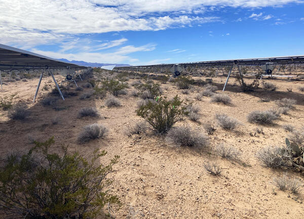
The Gemini Solar Project in Nevada
Shrubs growing in and around the arrays at the Gemini Solar Project in Nevada. Gemini developed measures to avoid, minimize and mitigate impacts to the environment during construction and operation. USGS collaborates with the Bureau of Land Management on research at this array. Photo by Claire Karban, USGS.
Shrubs growing in and around the arrays at the Gemini Solar Project in Nevada. Gemini developed measures to avoid, minimize and mitigate impacts to the environment during construction and operation. USGS collaborates with the Bureau of Land Management on research at this array. Photo by Claire Karban, USGS.

A close up of Sonoran Desert native wildflowers/forbs, including California poppy, lupines, and purple owl's clover
A close up of Sonoran Desert native wildflowers/forbs, including California poppy, lupines, and purple owl's cloverClose up of Sonoran Desert flowers, including California poppy, lupines, and purple owl's clover. Photo by Laura Shriver.
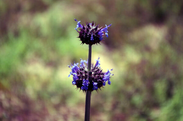
Chia sage (Salvia columnbariae) flowers
Chia sage (Salvia columnbariae) flowers at Lake Pleasant, AZ. Photo by Laura Shriver, USGS, SBSC.
Chia sage (Salvia columnbariae) flowers at Lake Pleasant, AZ. Photo by Laura Shriver, USGS, SBSC.

Biologists from RAMPS and McDowell Sonoran Preserve monitor a RestoreNet site in the Sonoran Desert
Biologists from RAMPS and McDowell Sonoran Preserve monitor a RestoreNet site in the Sonoran DesertBiologists from RAMPS and McDowell Sonoran Preserve monitor a RestoreNet restoration site in the Sonoran Desert. Photo by Laura Shriver.

Sphaeralcea ambigua thriving at a Sonoran Desert RestoreNet site
Sphaeralcea ambigua thriving at a Sonoran Desert RestoreNet siteSphaeralcea ambigua, a native plant seeded during RestoreNet experiments, thriving at the Lake Pleasant RestoreNet site in the Sonoran Desert. Photo by Laura Shriver.
Sphaeralcea ambigua thriving at a Sonoran Desert RestoreNet site
Sphaeralcea ambigua thriving at a Sonoran Desert RestoreNet siteSphaeralcea ambigua, a native plant seeded during RestoreNet experiments, thriving at the Lake Pleasant RestoreNet site in the Sonoran Desert. Photo by Laura Shriver.

Purple owl's clover blooming at a Sonoran Desert RestoreNet site
Purple owl's clover blooming at a Sonoran Desert RestoreNet siteThe RestoreNet plot at McDowell Sonoran Preserve was surrounded by blooming native wildflowers, including purple owl's clover (Castillejia exserta). Photo by Laura Shriver.
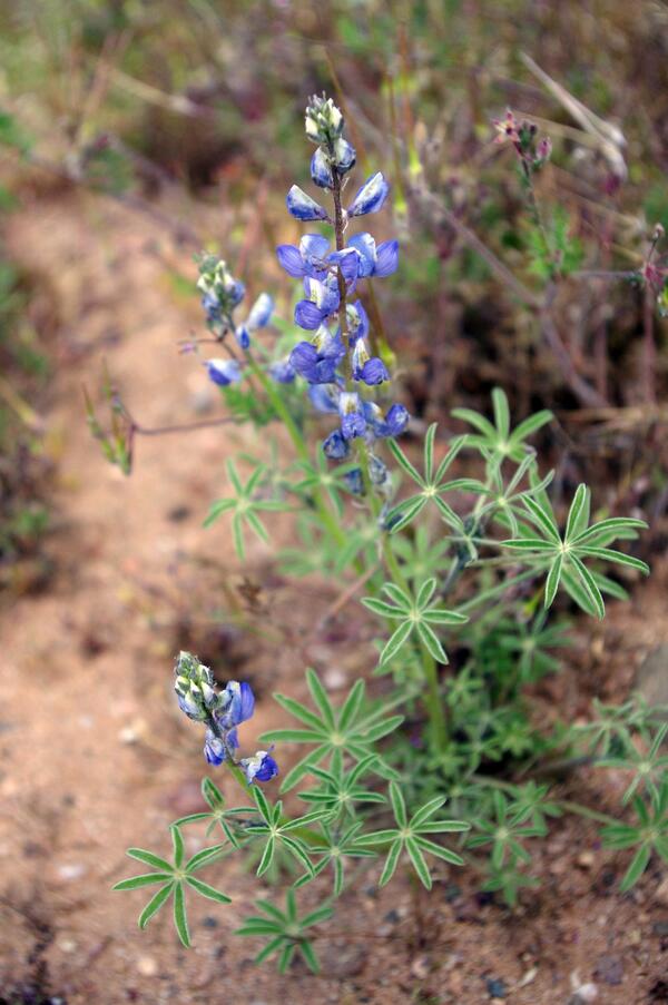
Coulter's Lupine or Desert Lupine (Lupinus sparsiflorus) flowers
Coulter's Lupine or Desert Lupine (Lupinus sparsiflorus) flowersCoulter's Lupine or Desert Lupine (Lupinus sparsiflorus) flowers at Lake Pleasant, AZ. Photo by Laura Shriver, USGS, SBSC.
Coulter's Lupine or Desert Lupine (Lupinus sparsiflorus) flowers
Coulter's Lupine or Desert Lupine (Lupinus sparsiflorus) flowersCoulter's Lupine or Desert Lupine (Lupinus sparsiflorus) flowers at Lake Pleasant, AZ. Photo by Laura Shriver, USGS, SBSC.

Testing of Low Earth Orbit satellite receiver at 61-mile gaging station, River Mile 61, Colorado River, Grand Canyon
Testing of Low Earth Orbit satellite receiver at 61-mile gaging station, River Mile 61, Colorado River, Grand CanyonTesting of Low Earth Orbit satellite receiver at 61-mile gaging station, located just upstream of the confluence with the Little Colorado River at River Mile 61, Colorado River, Grand Canyon. Photo taken February 2023 by Joe Thomas, USGS Southwest Biological Science Center, Grand Canyon Monitoring and Research Center.

Testing of a Low Earth Orbit satellite receiver at 61-Mile gaging station, Colorado River, Grand Canyon
Testing of a Low Earth Orbit satellite receiver at 61-Mile gaging station, Colorado River, Grand CanyonTesting of a Low Earth Orbit satellite receiver at 61-Mile gaging station, located at River Mile 61 just upstream of the confluence with the Little Colorado River, along the Colorado River, Grand Canyon. Photo taken February 2023 by Joe Thomas, USGS Southwest Biological Science Center, Grand Canyon Monitoring and Research Center.

Low Earth Orbit satellite receiver at 61-mile gaging station, upstream of the confluence with the Little Colorado River, Grand Canyon National Park
Low Earth Orbit satellite receiver at 61-mile gaging station, upstream of the confluence with the Little Colorado River, Grand Canyon National ParkTesting of Low Earth Orbit satellite receiver at 61-mile gaging station, located just upstream of the confluence with the Little Colorado River along the Colorado River in Grand Canyon National Park. Photo taken February 2023 by Joe Thomas, USGS Southwest Biological Science Center, Grand Canyon Monitoring and Research Center.

ISCO pump samplers at a sediment gaging site, Fence Fault beach, Colorado River, Grand Canyon
ISCO pump samplers at a sediment gaging site, Fence Fault beach, Colorado River, Grand CanyonISCO pump samplers at a sediment gaging site, Fence Fault beach, looking downstream at the Colorado River, Grand Canyon. Photo taken February 2023 by Joe Thomas, USGS Southwest Biological Science Center, Grand Canyon Monitoring and Research Center.

Low Earth Orbit satellite receiver next to Geostationary satellite receiver at 61-mile gaging station, Grand Canyon National Park
Low Earth Orbit satellite receiver next to Geostationary satellite receiver at 61-mile gaging station, Grand Canyon National ParkTesting of a Low Earth Orbit satellite receiver next to Geostationary satellite receiver at 61-mile gaging station, located just upstream of the confluence with the Little Colorado River at River Mile 61 on the Colorado River, Grand Canyon.

A raft on a science field trip on the Colorado River in Grand Canyon
A raft on a science field trip on the Colorado River in Grand CanyonA raft containing gear on an SBSC Grand Canyon and Monitoring Research Center (GCMRC) science field trip headed downstream on the Colorado River, Marble Canyon, in Grand Canyon National Park. Photo taken February 2023 by Joe Thomas, SBSC, GCMRC.