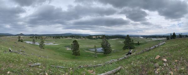
U.S. flag

An official website of the United States government

Images

Volcano Science Center images.

Filter Total Items: 551
Animated GIF of the Porcelain Basin and Nuphar Lake areas of Norris Geyser Basin

High-resolution satellite images of the Porcelain Basin and Nuphar Lake areas of Norris Geyser Basin acquired by Quickbird-2 on September 11, 2006 and WorldView-3 on March 30, 2022.  Note the change in color of Nuphar lake, from deep green to light blue, over time, as well as the increased evidence of flow from thermal features on the east side of Porcelain Bas

High-resolution satellite images of the Porcelain Basin and Nuphar Lake areas of Norris Geyser Basin acquired by Quickbird-2 on September 11, 2006 and WorldView-3 on March 30, 2022.  Note the change in color of Nuphar lake, from deep green to light blue, over time, as well as the increased evidence of flow from thermal features on the east side of Porcelain Bas

Comparison between the velocity structures outlining the Yellowstone’s upper-crustal magma reservoir at 5 km (3 mi) depth based on sparse (left) and dense (right) seismic networks
Velocity structures outlining the Yellowstone’s upper-crustal magma reservoir based on sparse (left) and dense (right) seismic networks

Comparison between the velocity structures outlining the Yellowstone’s upper-crustal magma reservoir at 5 km (3 mi) depth based on sparse (left) and dense (right) seismic networks. The open squares denote the locations of seismic sensors. Warmer color indicates lower velocity, representing higher melt fraction within the medium.

Color graphics of earthquakes
Map of American Samoa volcano-monitoring network.

Map of the American Samoa volcano-monitoring network (top). Data from Wake Island hydrograph (located about 4,500 km, or 2,900 miles, northwest of Taʻū Island) shows the general trend in the number of events during the 2022 earthquake swarm (bottom left). Locations for larger earthquakes (M2.5 and greater) are available starting August 20, 2022 (bottom right).

Map of the American Samoa volcano-monitoring network (top). Data from Wake Island hydrograph (located about 4,500 km, or 2,900 miles, northwest of Taʻū Island) shows the general trend in the number of events during the 2022 earthquake swarm (bottom left). Locations for larger earthquakes (M2.5 and greater) are available starting August 20, 2022 (bottom right).

Visible (top) and thermal (bottom) images of Porcelain Basin

Visible (top) and thermal (bottom) images of Porcelain Basin looking to the north from the old roadbed.  Nuphar Lake is off the photograph to the right.  Cool-water seeps into Porcelain Basin are clearly evident in the thermal image and appear to flow underground from Nuphar Lake.  USGS photos by Mike Poland, July 1, 2023.

Visible (top) and thermal (bottom) images of Porcelain Basin looking to the north from the old roadbed.  Nuphar Lake is off the photograph to the right.  Cool-water seeps into Porcelain Basin are clearly evident in the thermal image and appear to flow underground from Nuphar Lake.  USGS photos by Mike Poland, July 1, 2023.

People sitting on a lawn during a ceremony
Celebration for the creation of a new USGS facility

Federal, state, local and University of Hawai´i leaders and students celebrate the creation of a new facility that will monitor volcanoes and support conservation science.

Woman receiving lei from a man.
Interior Secretary, Deb Haaland, presented with lei.

Interior Secretary, Deb Haaland, presented with lei by David Phillips, Deputy Scientist-in-Charge of the USGS Hawaiian Volcano Observatory, during a ceremony to celebrate the creation of a new facility that will monitor volcanoes and support conservation science.

Interior Secretary, Deb Haaland, presented with lei by David Phillips, Deputy Scientist-in-Charge of the USGS Hawaiian Volcano Observatory, during a ceremony to celebrate the creation of a new facility that will monitor volcanoes and support conservation science.

Earthquake Lake and the Madison slide

Earthquake Lake, which formed when the Madison River was blocked by a landslide that occurred as a consequence of the Hebgen Lake earthquake in 1959.  The lake inundated existing forest, now marked by standing dead trees in the lake water. The landslide scar is visible on the side of the mountain at the far end of the lake.

Earthquake Lake, which formed when the Madison River was blocked by a landslide that occurred as a consequence of the Hebgen Lake earthquake in 1959.  The lake inundated existing forest, now marked by standing dead trees in the lake water. The landslide scar is visible on the side of the mountain at the far end of the lake.

Map of Geyser Hill, Upper Geyser Basin, Yellowstone National Park, with selected thermal features

Map of Geyser Hill, Upper Geyser Basin, Yellowstone National Park, showing selected thermal features, including new and reactivated features that were active during the May-June 2023 thermal unrest.  Map prepared by by Kiernan Folz-Donahue, Yellowstone National Park.

Green circular pool surrounded by barren ground and then trees beyond under a mostly cloudy sky
Hydrothermal explosion crater that has existed since at least 1954 located just southwest of The Gap in Norris Geyser Basin, Yellowstone National Park

Hydrothermal explosion crater that has existed since at least 1954 located just southwest of The Gap in Norris Geyser Basin, Yellowstone National Park. Photo taken in June 2023 by Lauren Harrison.

A small snake extends out from tall green grass over a stream.
Garter snake along Violet Creek near the Mary Mountain Trail in Hayden Valley, Yellowstone National Park

A garter snake along Violet Creek near the Mary Mountain Trail in Hayden Valley, Yellowstone National Park. This snake used the geothermally warmed creek to thermoregulate during near-freezing overnight conditions. USGS photo by Stanley Mordensky, June 2023.

Grassy bowl-like valley, with a few sporadic trees and pools of water. Dark clouds cover the sky.
Pocket Basin hydrothermal explosion crater, Yellowstone National Park

Panoramic view of the Pocket Basin hydrothermal explosion crater located in Lower Geyser BasinYellowstone National Park. The crater is approximately 365 by 800 meters (1200 by 2600 feet) and formed about 13,900 years ago, at the end of the most recent ice age.

Panoramic view of the Pocket Basin hydrothermal explosion crater located in Lower Geyser BasinYellowstone National Park. The crater is approximately 365 by 800 meters (1200 by 2600 feet) and formed about 13,900 years ago, at the end of the most recent ice age.

Map of ground deformation monitoring network in the Yellowstone region

Map of continuous Global Positioning System (GPS), semipermanent GPS, borehole strainmeters, and borehole tiltmeters that provide surface deformation monitoring capability in and around Yellowstone National Park. Red line denotes boundary of Yellowstone Caldera.

Map of continuous Global Positioning System (GPS), semipermanent GPS, borehole strainmeters, and borehole tiltmeters that provide surface deformation monitoring capability in and around Yellowstone National Park. Red line denotes boundary of Yellowstone Caldera.

Thermal feature UNNG-GHG-17a, Upper Geyser Basin, Yellowstone National Park, on May 31, 2023

Thermal feature UNNG-GHG-17a, not far from Sponge Geyser on Geyser Hill in Upper Geyser Basin, Yellowstone National Park.  The feature formed during a period of thermal unrest that began in May 2023 and threw debris and hot water onto the adjacent boardwalk, which was closed for safety.  National Park Service photo by Kiernan Folz-Donahue, May 31, 2023.

Thermal feature UNNG-GHG-17a, not far from Sponge Geyser on Geyser Hill in Upper Geyser Basin, Yellowstone National Park.  The feature formed during a period of thermal unrest that began in May 2023 and threw debris and hot water onto the adjacent boardwalk, which was closed for safety.  National Park Service photo by Kiernan Folz-Donahue, May 31, 2023.

Color map of crater floor temperature
May 23, 2023 — Kīlauea summit thermal map

A helicopter overflight on May 23, 2023, allowed for aerial visual and thermal imagery to be collected of Halema‘uma‘u crater at the summit of Kīlauea. No active lava was present in the crater, with only scattered warm spots on the crater floor.

A helicopter overflight on May 23, 2023, allowed for aerial visual and thermal imagery to be collected of Halema‘uma‘u crater at the summit of Kīlauea. No active lava was present in the crater, with only scattered warm spots on the crater floor.

Color photograph of GPS tripod on lava flow
May 23, 2023 — Mauna Loa GPS Campaign

Another GPS survey benchmark being occupied on Mauna Loa. The metal disk on the ground beneath the tripod is the benchmark, which is cemented to the lava flow surface.

Another GPS survey benchmark being occupied on Mauna Loa. The metal disk on the ground beneath the tripod is the benchmark, which is cemented to the lava flow surface.

Color photograph of GPS tripod on lava flow
May 23, 2023 — Mauna Loa GPS Campaign

During the annual Mauna Loa GPS campaign, scientists temporarily deploy a number of GPS instruments at established benchmarks; their recorded positions can be compared with those from previous years to discern subtle patterns of ground deformation associated with volcanic activity.

During the annual Mauna Loa GPS campaign, scientists temporarily deploy a number of GPS instruments at established benchmarks; their recorded positions can be compared with those from previous years to discern subtle patterns of ground deformation associated with volcanic activity.

Color photograph of cars in parking lot
May 23, 2023 — Vibroseis at Kīlauea

The Vibroseis vehicle has been operating on roads in Hawai‘i Volcanoes National Park and in the Kīlauea summit region for the past several weeks. The vehicle belongs to the Natural Hazards Engineering Research Infrastructure (NHERI) experimental facility at the University of Texas at Austin, which is supported with funding from the National Science Foundation.

The Vibroseis vehicle has been operating on roads in Hawai‘i Volcanoes National Park and in the Kīlauea summit region for the past several weeks. The vehicle belongs to the Natural Hazards Engineering Research Infrastructure (NHERI) experimental facility at the University of Texas at Austin, which is supported with funding from the National Science Foundation.

Color photograph of crater floor
May 23, 2023 — Kīlauea summit overflight

This aerial view, looking east across Halema‘uma‘u crater floor, shows the complex features formed during recent Kīlauea summit eruptions.

Was this page helpful?