
Priority Landscapes
Priority Landscapes
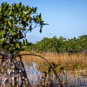
Much of the work done by USGS WARC scientists occurs in areas of management concern, such as the Mississippi River Delta and the Florida Everglades. This place-based research focuses on understanding the biological and physical processes that influence change to inform management strategies across these large geographic areas.
Filter Total Items: 100
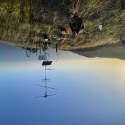
Western U.S. Using Networked Weather Radar and Wildlife Tracking Data
USGS scientists from the Wetland and Aquatic Research Center and the Western Ecological Research Center are collaborating to synthesize data on migratory bird use of Bureau of Land Management lands in the western U.S. to support permitting decisions.
Engaging Indigenous Communities to Co-Design a Web Application to Protect Everglades Tree Islands
The USGS collaborated with the Miccosukee and Seminole Tribes to co-design a dashboard mock-up for a real-time web application that monitors tree island health in the Everglades.
Evaluating Efficacy of Stewardship Actions for Vulnerable Gulf of America Coastal Birds Through Co-Production Between Scientists and Resource Managers
The USGS and partners will survey bird and human activity on beaches in Alabama, Mississippi, and Louisiana to determine breeding bird response to stewardship activities aimed at protecting and recovering bird populations.
Developing a Roadmap for the Future of Natural Resources in Everglades National Park
To sustain economic and ecologically viable ecosystems into the future, USGS is developing freshwater delivery targets for water flowing southward into Everglades National Park by integrating climate and sea level projections, hydrologic modeling, and ecological modeling to forecast ecosystem responses to future freshwater availability scenarios.
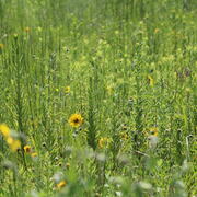
Coastal Prairie Restoration at WARC Supports Ecological Biodiversity and Provides an Opportunity for Education
The USGS Wetland and Aquatic Research Center (WARC) has created a refuge for biodiversity in Lafayette, Louisiana, through the restoration of coastal prairie, a unique and vital ecosystem that has almost vanished within the last 100 years.

Alabama Barrier Island Restoration Assessment at Dauphin Island
Dauphin Island, Alabama, is the only barrier island providing protection to much of Alabama's coastal natural resources. Severely impacted by repeated extreme events, like Hurricane Katrina and Deepwater Horizon oil spill, USGS and partners are conducting a joint study to evaluate the feasibility of certain alternatives to increase resiliency and sustainability of the island.

Spatial Analysis Support for Coastal Wetlands Planning, Protection and Restoration Act (Breaux Bill) Planning Activities
WARC first implemented geographic information systems (GIS) in 1980 to help monitor the nature and extent of wetland habitat changes. The center continues to use GIS, remote sensing, and other computer based technologies to address a wide range of natural resource related issues.

Geographic Information and Technical Support
USGS WARC first implemented geographic information systems (GIS) in 1980 to assist in monitoring the nature and extent of wetland habitat changes. Today, WARC geographers and support staff create, maintain, and use geospatial data to analyze restoration efforts in Louisiana.

Natural Resource Damage and Assessment (NRDA) Program Monitoring and Adaptive Management
State and Federal agencies, including USGS, are working together to assess the damage caused by the Deepwater Horizon oil spill and to determine appropriate restoration actions to restore natural resources, ecological services, and recreational services injured or lost due to the incident.

Louisiana’s Coastwide Reference Monitoring System (CRMS)
The Coastwise Reference Monitoring System was designed to monitor the effectiveness of restoration actions at individual sites, as well as across the entire Louisiana coast.

Spatial Analysis of Coastal Wetlands Planning, Protection and Restoration Act Projects
As the first federally mandated restoration program, Louisiana enacted the Coastal Wetlands Planning, Protection and Restoration Act (CWPPRA) to address Louisiana’s land loss crisis.

A Case Study Assessing the Cumulative Effects of Deepwater Horizon Restoration Projects on Barrier Island/Barrier Shoreline Ecosystem Resilience in the North-central Gulf
USGS and partners will assess the potential cumulative effects of restoration projects on the resiliency of barrier islands and barrier shorelines in the north-central Gulf.