
Coastal Ecology
Coastal Ecology
Filter Total Items: 70
Evaluating Efficacy of Stewardship Actions for Vulnerable Gulf of America Coastal Birds Through Co-Production Between Scientists and Resource Managers
The USGS and partners will survey bird and human activity on beaches in Alabama, Mississippi, and Louisiana to determine breeding bird response to stewardship activities aimed at protecting and recovering bird populations.
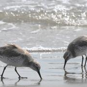
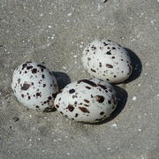
Winter Shorebird Surveys of Federally Protected Bird Species Following Restoration at West Belle Headland and Trinity-East Island, Louisiana
The USGS and the Barataria-Terrebonne National Estuary Program (BTNEP) conducted post-restoration monitoring of Piping Plovers and Red Knots to better understand how birds respond to coastal restoration.

Biological Vulnerability to Hypoxia Under a Warmer Climate in the Northern Gulf
USGS researchers are a developing a modeling framework to assess climate warming impacts on hypoxia-related stress to commercially and recreationally important Gulf species.

Alabama Barrier Island Restoration Assessment at Dauphin Island
Dauphin Island, Alabama, is the only barrier island providing protection to much of Alabama's coastal natural resources. Severely impacted by repeated extreme events, like Hurricane Katrina and Deepwater Horizon oil spill, USGS and partners are conducting a joint study to evaluate the feasibility of certain alternatives to increase resiliency and sustainability of the island.

Natural Resource Damage and Assessment (NRDA) Program Monitoring and Adaptive Management
State and Federal agencies, including USGS, are working together to assess the damage caused by the Deepwater Horizon oil spill and to determine appropriate restoration actions to restore natural resources, ecological services, and recreational services injured or lost due to the incident.

A Fresh Set of Tools: New Information for Managing Fisheries During Changes in River Discharge
USGS scientists are conducting research to understand how estuary fisheries are affected by the the timing and/or magnitude of freshwater discharge into Lake Pontchartrain in Louisiana.

Avifauna Surveys of the Northern Main Chandeleur Islands
USGS WARC ecologists are assisting partners in conducting avian surveys on Chandeleur Islands during the pre-restoration monitoring phase to document threatened and endangered species, species richness and diversity, species abundance, and habitat use.

A Case Study Assessing the Cumulative Effects of Deepwater Horizon Restoration Projects on Barrier Island/Barrier Shoreline Ecosystem Resilience in the North-central Gulf
USGS and partners will assess the potential cumulative effects of restoration projects on the resiliency of barrier islands and barrier shorelines in the north-central Gulf.

Barriers and Opportunities for Landward Migration of Coastal Wetlands along Texas' Upper and Middle Coast
Researchers at WARC will use data and models to produce probabilistic maps of current and future wetland inundation, coastal wetland extent, and coastal and wetland trangression.

Management of Gopher Tortoise (Gopherus polyphemus) Using Coastal Habitats
USGS researchers are conducting research on St. Vincent National Wildlife Refuge and throughout coastal habitat in Northwest Florida to inform future management decisions in the Refuge and contribute to the growing knowledge of the ecology of gopher tortoises using coastal habitats.

Coastal Wetland Vulnerability to Climate Change and Sea-Level Rise: Understanding Ecological Thresholds and Ecosystem Transformations
Eighteen USGS coastal scientists from all four coasts of the conterminous United States are working together to advance the understanding of climate change and sea-level rise impacts to coastal wetlands.
By
California Water Science Center, Chesapeake Bay Activities, Eastern Ecological Science Center, Florence Bascom Geoscience Center, Great Lakes Science Center, Pacific Coastal and Marine Science Center, St. Petersburg Coastal and Marine Science Center, Western Ecological Research Center (WERC), Western Geographic Science Center, Wetland and Aquatic Research Center , Woods Hole Coastal and Marine Science Center

Climate Change Effects on Coastal Marsh Foundation Species
Mangrove forests have migrated inland over the past few decades at many locations along the northern Gulf coast. This expansion has been attributed to factors associated with climate change, such as increased salinity resulting from sea-level rise and longer intervals between winter freezes, which can kill cold-intolerant mangrove species.