
Land Use / Land Cover Change
Land Use / Land Cover Change
Filter Total Items: 29
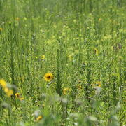
Coastal Prairie Restoration at WARC Supports Ecological Biodiversity and Provides an Opportunity for Education
The USGS Wetland and Aquatic Research Center (WARC) has created a refuge for biodiversity in Lafayette, Louisiana, through the restoration of coastal prairie, a unique and vital ecosystem that has almost vanished within the last 100 years.

Spatial Analysis Support for Coastal Wetlands Planning, Protection and Restoration Act (Breaux Bill) Planning Activities
WARC first implemented geographic information systems (GIS) in 1980 to help monitor the nature and extent of wetland habitat changes. The center continues to use GIS, remote sensing, and other computer based technologies to address a wide range of natural resource related issues.

Barriers and Opportunities for Landward Migration of Coastal Wetlands along Texas' Upper and Middle Coast
Researchers at WARC will use data and models to produce probabilistic maps of current and future wetland inundation, coastal wetland extent, and coastal and wetland trangression.

Understanding Ecosystem Response and Infrastructure Vulnerability to Sea-Level Rise for Gulf Islands National Seashore
USGS researchers will will survey elevation and vegetation in wetlands and vegetated dunes on Horn, Petite Bois, and Ship Islands; Correct the best available lidar-based digital elevation model; estimate inundation for the Gulf Islands National Seashore under various water levels and relative sea-level rise scenarios; and quantify and predict potential marsh migration for the Gulf Islands National...

Coastal Wetland Vulnerability to Climate Change and Sea-Level Rise: Understanding Ecological Thresholds and Ecosystem Transformations
Eighteen USGS coastal scientists from all four coasts of the conterminous United States are working together to advance the understanding of climate change and sea-level rise impacts to coastal wetlands.
By
California Water Science Center, Chesapeake Bay Activities, Eastern Ecological Science Center, Florence Bascom Geoscience Center, Great Lakes Science Center, Pacific Coastal and Marine Science Center, St. Petersburg Coastal and Marine Science Center, Western Ecological Research Center (WERC), Western Geographic Science Center, Wetland and Aquatic Research Center , Woods Hole Coastal and Marine Science Center

A Multiscale Approach to Understanding Migratory Landbird Habitat Use of Functional Stopover Habitat Types and Management Efforts
USGS scientists are using a spatially-explicit Bayesian network model to predict the difference between energetic value and energetic demand for stopover habitats for migrating landbirds.

Adapting to Climate Change: Trends and Severe Storm Responses by Migratory Landbirds and Their Habitats
USGS scientists will be analyzing weather surveillance radar observations of birds departing stopover habitats to measure responses to climate change.

Mississippi Coastal Improvements Program (MsCIP) - Adaptive Management and Monitoring Planning and Implementation
The Mississippi barrier islands are dynamic coastal landforms that are the first line of defense between the Gulf and the Mississippi mainland coast. These islands are experiencing changes in structure (land area and habitat) and geomorphic processes (erosion and accretion) due to frequent intense storms, relative rise in sea level, and changes in sediment supply. A long-term monitoring and...

Seasonal Surveys of Shorebird and Coastal Waterbird Utilization of Dredged Material Islands in the Baptiste Collette Bayou, U.S. Army Corps of Engineers (USACE) New Orleans District, Louisiana
To assess use of dredge material areas, avian ecologists from USGS WARC are conducting bird surveys across the annual life cycle.

Evaluating Population Viability and Habitat Suitability for the Cape Sable Seaside Sparrow Under Future Climate and Management Conditions
WARC will assess Cape Sable seaside sparrow population response and viability under different management and habitat change scenarios. The USGS EverSparrow model will be run on future scenarios, and differences in the predicted probability of presence and the efficacy of varying conservation strategies will be evaluated.

Vulnerability of Mole Skinks to Sea-Level Rise
Mole skinks that occur on Florida’s islands rely on sand beaches, beach berms, and dunes, making them particularly vulnerable to sea level rise and storm surge. USGS researchers predicted the impacts of sea level rise and storm surge on habitat for the Florida Keys mole skink ( Plestiodon egregius egregius), the Cedar Key mole skink ( P. e. insularis), and the Egmont Key mole skink (known from a...

Predicting Sea-Level Rise Impacts to Barrier Island Habitats
Researchers at WARC are determining if temporal mismatches between digital elevation models and land cover data can impact estimates of inundation of beach habitat for barrier islands and low-lying beaches off the Gulf Coast of Florida.