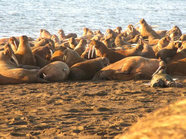
Dan Monson on the Beach with Tagged Walrus Near Pt Lay, AK
Dan Monson on the Beach with Tagged Walrus Near Pt Lay, AKWalruses gathered on Alaskan shores of the Chukchi Sea by the tens of thousands in late August and September of 2010 after the last of the sea ice dissipated.