
A male Blackbird in field grass.
Images
Images
Filter Total Items: 9449

Red-Winged Blackbird (Agelaius phoeniceus)

Squirrel Treefrog in Florida
A native squirrel treefrog in Florida.
A native squirrel treefrog in Florida.

Mountain of Salt
This photo shows a road salt storage stockpile that is awaiting use for pavement deicing, Port of Milwaukee, WI. The use of salt to deice pavement can be harmful to aquatic life in urban streams. The USGS is involved in studies that focus on the influence of winter runoff on aquatic ecosystems.
This photo shows a road salt storage stockpile that is awaiting use for pavement deicing, Port of Milwaukee, WI. The use of salt to deice pavement can be harmful to aquatic life in urban streams. The USGS is involved in studies that focus on the influence of winter runoff on aquatic ecosystems.

A Green Treefrog in Florida
A native green treefrog in Florida.
A native green treefrog in Florida.

Texas Orthorectified Landsat State Mosaic
This image was created using Tri-Decadal Global Landsat Orthorectified ETM+ Pan-Sharpened data, and draped with National Elevation Dataset (NED) data.
Visit the Landsat Missions website to learn more about Landsat.
This image was created using Tri-Decadal Global Landsat Orthorectified ETM+ Pan-Sharpened data, and draped with National Elevation Dataset (NED) data.
Visit the Landsat Missions website to learn more about Landsat.

Medina River Winter View at Bandera, TX
Clear cool water over a limestone rock and gravel riverbed is characteristic of many Texas Hill County Creeks and Rivers.
Clear cool water over a limestone rock and gravel riverbed is characteristic of many Texas Hill County Creeks and Rivers.

Lake Martin in Louisiana
Lake Martin, a popular spot for bird-watching, fishing and boating, is part of The Nature Conservancy’s Cypress Island Preserve. The site, located in St. Martin Parish, Louisiana, is a beautiful example of a bald cypress swamp. The first case of Snake Fungal Disease in a free-ranging wild snake in Louisiana was documented by a USGS scientist from there in 2015.
Lake Martin, a popular spot for bird-watching, fishing and boating, is part of The Nature Conservancy’s Cypress Island Preserve. The site, located in St. Martin Parish, Louisiana, is a beautiful example of a bald cypress swamp. The first case of Snake Fungal Disease in a free-ranging wild snake in Louisiana was documented by a USGS scientist from there in 2015.

Firefighters in Smoke
Firefighters surrounded by clouds of smoke and dust of the World Trade Center after the terrorist attacks of September 11, 2001. Photographer's Mate 2nd Class Jim Watson, U.S. Navy.
Firefighters surrounded by clouds of smoke and dust of the World Trade Center after the terrorist attacks of September 11, 2001. Photographer's Mate 2nd Class Jim Watson, U.S. Navy.

Crater Lake, Oregon
USGS scientist collecting samples at Crater Lake, Oregon.
USGS scientist collecting samples at Crater Lake, Oregon.

Sturgeon Egg
At 68 hours post fertilization, this laboratory produced sturgeon egg is about ready to hatch.
At 68 hours post fertilization, this laboratory produced sturgeon egg is about ready to hatch.

Landslide Sampling
Scientist Jonathan Godt samples a landslide headscarp in Alameda County, CA.
Scientist Jonathan Godt samples a landslide headscarp in Alameda County, CA.

Rocks and Vegetation
An array of rocks with vegetation interspersed.
An array of rocks with vegetation interspersed.

Ayers Rock (Uluru)
Ayers Rock (Uluru) and vegetation.
Ayers Rock (Uluru) and vegetation.

Stream Bordered by Snow-Covered Trees and Low-Lying Vegetation
Stream Bordered by Snow-Covered Trees and Low-Lying VegetationSnow covers the coniferous trees and low-lying vegetation on either side of a calm stream or river.
Stream Bordered by Snow-Covered Trees and Low-Lying Vegetation
Stream Bordered by Snow-Covered Trees and Low-Lying VegetationSnow covers the coniferous trees and low-lying vegetation on either side of a calm stream or river.

Stream Bordered by Snow-Covered Trees and Low-Lying Vegetation
Stream Bordered by Snow-Covered Trees and Low-Lying VegetationSnow covers the coniferous trees and low-lying vegetation on either side of a calm stream.
Stream Bordered by Snow-Covered Trees and Low-Lying Vegetation
Stream Bordered by Snow-Covered Trees and Low-Lying VegetationSnow covers the coniferous trees and low-lying vegetation on either side of a calm stream.

Marcellus Shale Storage Tanks
Storage tanks for produced water from natural gas drilling in the Marcellus Shale gas play of western Pennsylvania.
Storage tanks for produced water from natural gas drilling in the Marcellus Shale gas play of western Pennsylvania.

Irrigation ditch alongside an agricultural field in California's Central Valley
Irrigation ditch alongside an agricultural field in California's Central ValleyIrrigation systems in Central California Valley Ecoregion: Single-field irrigation ditch.
Irrigation ditch alongside an agricultural field in California's Central Valley
Irrigation ditch alongside an agricultural field in California's Central ValleyIrrigation systems in Central California Valley Ecoregion: Single-field irrigation ditch.

Grasslands and agricultural fields, with housing development on the hills beyond.
Grasslands and agricultural fields, with housing development on the hills beyond.Conversions of grassland/shrubland and agriculture to developed land were two common land-cover changes in Southern and Central California Chaparral and Oak Woodlands Ecoregion.
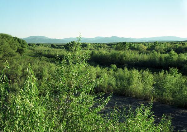
San Carlos River near Peridot, Southern Arizona - 2000
San Carlos River near Peridot, Southern Arizona - 2000The gaging station has been removed, but the approximate position of the original camera can be established from the background mountains.
San Carlos River near Peridot, Southern Arizona - 2000
San Carlos River near Peridot, Southern Arizona - 2000The gaging station has been removed, but the approximate position of the original camera can be established from the background mountains.

Malaspina Glacier
The tongue of the Malaspina Glacier, the largest glacier in Alaska, fills most of this image. The Malaspina lies west of Yakutat Bay and covers 1,500 sq mi (3,880 sq km).
The tongue of the Malaspina Glacier, the largest glacier in Alaska, fills most of this image. The Malaspina lies west of Yakutat Bay and covers 1,500 sq mi (3,880 sq km).