
Zoe Zyollewski handles an adult Atlantic salmon caught in the Connecticut River.
Images
Images
Filter Total Items: 9454

Atlantic Salmon (Salmo salar)
Zoe Zyollewski handles an adult Atlantic salmon caught in the Connecticut River.

Breach Through Barrier Island at Pine Beach
The island was severed by a breach that may have developed as the back bay drained excess water following the peak of the storm surge, although the breach could have been initiated by waves and surge from the Gulf side. More analyses are required to determine the forcing processes.
The island was severed by a breach that may have developed as the back bay drained excess water following the peak of the storm surge, although the breach could have been initiated by waves and surge from the Gulf side. More analyses are required to determine the forcing processes.

Earthquake and Landslides in the Union of the Comoros
Earthquake and Landslides in the Union of the ComorosA magnitude 4.8 earthquake struck the island of Anjouan in the Union of the Comoros on March 12, 2014. Heavy rainfall trigger landslides and damages were incurred to buildings, roads, and water supplies. As a precaution, more than 3,000 citizens living below the landslides were moved to a refugee camp.

Earthquake and Landslides in the Union of the Comoros
Earthquake and Landslides in the Union of the ComorosHeavy rains from a tropical cyclone struck the islands of the Comoros in March, 2014. On the island of Anjouan in the Union of Comoros, these rains triggered landslides that displaced over 3000 people to refugee camps. The USGS and the OFDA with USAID are providing support and research assistance on these events.

Capybara (Hydrochoerus hydrochaeris)
Capybara rests in its enclosure in a zoological park, it's the world's largest rodent.
Capybara rests in its enclosure in a zoological park, it's the world's largest rodent.

Prairie Pothole Region
Prairie Pothole Region landscape showing high wetland density.
Prairie Pothole Region landscape showing high wetland density.

Trawl Net Being Let Off From a Boat
Fishery biologists Gary Curtis and Renee Potter guide the trawl net as it is let out from the RV/Grayling into Lake Huron.
Fishery biologists Gary Curtis and Renee Potter guide the trawl net as it is let out from the RV/Grayling into Lake Huron.

Fredericksburg Geomagnetic Observatory
Fredericksburg geomagnetic observatory.
Fredericksburg geomagnetic observatory.

Zebra Mussel
Zebra Mussel (Dreissena polymorpha) vs Quagga Mussel (Dreissena rostriformis bugensis). The only two dreissenid mussels known to have been introduced into the US. Both the quagga mussel and zebra mussel are prolific breeders possibly contributing to their spread and abundance. The introduction of both dreissenid species into the
Zebra Mussel (Dreissena polymorpha) vs Quagga Mussel (Dreissena rostriformis bugensis). The only two dreissenid mussels known to have been introduced into the US. Both the quagga mussel and zebra mussel are prolific breeders possibly contributing to their spread and abundance. The introduction of both dreissenid species into the

Sea Otter Ready for a Nap
This southern sea otter is settling down to rest in a small patch of Egregia (feather boa kelp). Find more sea otter photos at the USFWS Ventura sea otter Flickr gallery.
This southern sea otter is settling down to rest in a small patch of Egregia (feather boa kelp). Find more sea otter photos at the USFWS Ventura sea otter Flickr gallery.

Wind Turbines and Forest
Two wind turbines in a New York forest.
Two wind turbines in a New York forest.

Sea Star Succumbing to Sea Star Wasting Disease
Unlike their smiling cartoon brethren on television, since 2013, real-life sea stars have been suffering from a wasting disease epidemic in which they lose limbs and literally disintegrate in a matter of days.
Unlike their smiling cartoon brethren on television, since 2013, real-life sea stars have been suffering from a wasting disease epidemic in which they lose limbs and literally disintegrate in a matter of days.

Yellow bellied flycatcher
Yellow bellied flycatcher in the Presidential Range, White Mountains, NH
Yellow bellied flycatcher in the Presidential Range, White Mountains, NH

Deploying Sensors During Hurricane Joaquin
USGS scientist Carlos Rodriguez, deploying a sensor at Newmarket Creek at Mercury Boulevard in Hampton, VA.
USGS scientist Carlos Rodriguez, deploying a sensor at Newmarket Creek at Mercury Boulevard in Hampton, VA.

Aphanizomenon Flos-aquae Bloom
Aphanizomenon is a common bloom-forming cyanobacteria, AKA, blue-green algae. Many strains produce saxitoxin and cylindrospermopsin.
Aphanizomenon is a common bloom-forming cyanobacteria, AKA, blue-green algae. Many strains produce saxitoxin and cylindrospermopsin.

Lake Michigan near Grand Haven, Michigan
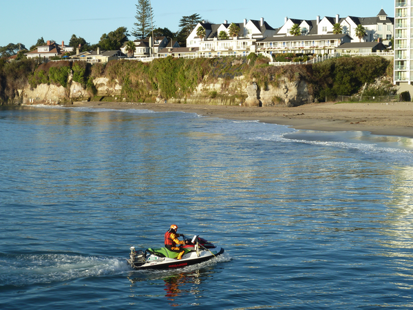
Surveying the nearshore in Santa Cruz

Surveying the nearshore in Santa Cruz

Climate Change and Snowshoe Hares Winter White Fur
Climate Change and Snowshoe Hares Winter White FurSnowshoe hare experiencing camouflage mismatch in the spring at the Seeley Lake, MT, study site.
Climate Change and Snowshoe Hares Winter White Fur
Climate Change and Snowshoe Hares Winter White FurSnowshoe hare experiencing camouflage mismatch in the spring at the Seeley Lake, MT, study site.