
Earthquakes Pose Risk to Global Mineral Supplies
USGS scientists study how seismicity could impact mineral commodity supplies like copper and rhenium.
Monitoring Kīlauea Volcano's Current Eruption
Eruptions within Hawaiʻi Volcanoes National Park have been intermittent since December 23, 2024.
Alarming Future for California's Coastline
Computer modeling and new research predict significant erosion by 2100.
Postfire Debris-Flow Hazard Assessments Help Manage Further Loss
This interactive dashboard shows the likelihood and potential severity for debris-flows.
Understanding Earth's Electrical Conductivity Helps Protect from Space Weather
The study can also help support mineral and geothermal resource assessment.
New USGS-FEMA study highlights economic earthquake risk in the United States
Natural Hazards Mission Area
Every year in the United States, natural hazards threaten lives and livelihoods and result in billions of dollars in damage. We work with many partners to monitor, assess, and conduct targeted research on a wide range of natural hazards so that policymakers and the public have the understanding they need to enhance preparedness, response, and resilience.
Office of Risk and Resilience

Working to ensure that relevant and actionable USGS hazards and risk information is developed and delivered in user-friendly ways to support risk-reduction efforts at a national scale.
Subduction Zone Science

The most powerful earthquakes, tsunamis, landslides, and volcanic eruptions occur in subduction zones, where two plates collide and one is thrust beneath another.
Get Notified
You can subscribe to USGS Hazards Data Alerts, Forecasts and other Earth Monitoring Information
News
USGS Releases Expedition Report for Samoa Basin Box Coring Effort
Hurricane Season Arrives
PCMSC’s Andy O’Neill Receives CSBPA’s Joe Johnson Outstanding Service Award
Publications
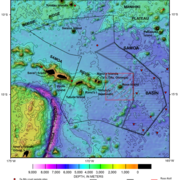
Preliminary geology of the North Meadow Creek Area, Tobacco Root Mountains, southwest Montana: The North Meadow Creek Fault Preliminary geology of the North Meadow Creek Area, Tobacco Root Mountains, southwest Montana: The North Meadow Creek Fault
Moment magnitude for small earthquakes in the Delaware basin of west Texas and southeast New Mexico, USA Moment magnitude for small earthquakes in the Delaware basin of west Texas and southeast New Mexico, USA
Predictable seismic cycles result from structural rupture barriers on oceanic transform faults Predictable seismic cycles result from structural rupture barriers on oceanic transform faults
Science

COAWST: A Coupled-Ocean-Atmosphere-Wave-Sediment Transport Modeling System
American Samoa Mapping Project
