
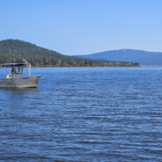
Oregon Water Science Center
Welcome to the USGS in Oregon. Our mission is to explore the natural world around us and provide reliable scientific information to help Federal, State, and local agencies, Tribes, and the public make well-informed decisions. Our research is widely used to manage Oregon's water resources for the benefit and safety of people and the environment.
For updates please subscribe to our newsletter!
Live Stream Conditions
Live Stream Conditions

See what is happening in streams near you. View real-time stream data for streams around Oregon.
Relevant Information
Relevant Information
See what the USGS is doing locally.
News
Updates to the Upper Klamath and Harney Basin interactive data mappers
Updates to the Upper Klamath and Harney Basin interactive data mappers
USGS Oregon Water Science Center remembers the 1996 flood
USGS Oregon Water Science Center remembers the 1996 flood
Message from the Director—Oregon Water Science Center, Winter 2026 Newsletter
Message from the Director—Oregon Water Science Center, Winter 2026 Newsletter
Publications
Lost in translation: Reconciling different streamflow permanence data products Lost in translation: Reconciling different streamflow permanence data products
The objective of this study is to provide a framework to reconcile streamflow permanence products that provide information on whether a stream is perennial or nonperennial. Accurate classification of streams as perennial or nonperennial is important for a variety of land and water resource management decisions. However, resource managers are challenged with how to reconcile different...
Post-wildfire water quality and aquatic ecosystem response in the U.S. Pacific Northwest: science and monitoring gaps Post-wildfire water quality and aquatic ecosystem response in the U.S. Pacific Northwest: science and monitoring gaps
An increase in the occurrence of large, high severity wildfires in the western Pacific Northwest (PNW), USA, has created an urgent need for science to better inform forest management and policy decisions to maintain source water quality in the region. The western PNW faces similar challenges to other regions with shifting wildfire regimes and large population centers reliant on surface...
Science
The Klamath Falls Field Office
The Oregon Water Science Center’s Klamath Falls Field Office provides surface-water and water-quality data to support the basin’s most pressing water-resource and ecosystem needs.

Water-quality monitoring during reservoir drawdowns
The USGS is monitoring water-quality above, within, and below Middle Fork Willamette and the South Santiam River dams using field-based and remote-sensing approaches to understand how reservoir drawdowns influence downstream water-quality conditions.

Oregon Water Science Center's Malheur Lake Portfolio
USGS scientists have partnered with local groups to learn about the processes affecting turbidity in Malheur Lake. Located in southeastern Oregon, Malheur Lake and the surrounding refuge provide critical habitat to birds migrating along the Pacific Flyway.