
Coastal Science
Coastal Science
Filter Total Items: 19

Saltwater Intrusion and Sea Level Rise Monitoring in New Jersey
Frequently, water withdrawals for public supply are made from the freshwater reaches of rivers and streams across new Jersey. Overall, there is a lack of scientific information describing the movement of saltwater upstream into the tributaries discharging into Delaware Bay. This project is beginning to collect water quality data along three selected tributaries in New Jersey to Delaware Bay in an...

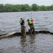
Long-term Water Monitoring Networks in New Jersey
The accurate, long-term monitoring networks of New Jersey Water Science Center provide valuable data in real-time and historical perspective to compare that data to. The longer a monitoring location is in operation, the more valuable it becomes, since more statistical comparisons can be performed. Our field technicians continuously make field measurements and maintain these networks.

Water Levels in the Ten Major Confined Aquifers of the New Jersey Coastal Plain
The Coastal Plain aquifers of New Jersey provide an important source of water for more than 3.5 million people. The USGS, in cooperation with the New Jersey Department of Environmental Protection, has been measuring water levels in the confined aquifers of the New Jersey Coastal Plain every five years beginning in 1978. Persistent, regionally extensive cones of depression are present in Ocean and...
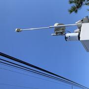
New Jersey Precipitation and Weather Networks
The New Jersey Water Science Center provides valuable data augmentation to many locations for: Precipitation, Water and Air Temperature, and even Wind Speed and Direction at some of our coastal sites. Our technicians continuously make field measurements and maintain these networks to ensure the accuracy of these data.

New Jersey Tide Network
The USGS operates the most extensive network of tide-gaging stations in the region, many of which form the backbone of flood-warning and storm-hazard warning systems. The New Jersey Water Science Center monitors data for estuary and back-bay areas all along the New Jersey coast and links to related projects with more information about coastal flood hazards, water quality, and other topics. This...
Novel Bacterial Monitoring of Urbanized Waterways in the Lower Delaware River and Passaic River Basins.
As part of the Urban Water Federal Partnership, the U.S. Geological Survey (USGS) New Jersey Water Science Center (NJWSC) is currently assessing the use of innovative, near real-time bacteria monitoring technology to provide rapid results on bacteria concentrations to water regulators. Traditional methods of collecting and quantifying fecal indicator bacteria (FIB) is labor intensive, expensive...

New Jersey: Coastal Flood Inundation Mapping
The U.S. Geological Survey (USGS) in cooperation with the New Jersey Department of Environmental Protection and New Jersey Office of Emergency Management conducted a study to produce flood-inundation maps for storm surge flooding scenarios in the coastal areas of 10 New Jersey counties. The coastal storm-surge inundation maps were created from data modelled in the FEMA Region II Coastal Storm...

Program to Maintain and Update Groundwater Models
The Model Maintenance program, in cooperation with the N.J. Department of Environmental Protection (NJDEP), archives, maintains, updates, and shares groundwater-flow models that have been developed by the New Jersey Water Science Center (NJWSC). The program was started in 1995 to maintain existing groundwater flow models, use standardized procedures to archive the models, update models with recent...

Monitoring Harmful Algal Blooms in a Coastal System to Identify the Factors that Affect HAB Production and the Downstream Transport of Cyanobacteria and Associated Cyanotoxins from Freshwater to Marine Environments
Across the nation, Cyanobacterial harmful algal blooms (HABs) in freshwater coastal lakes and ponds have become a major environmental and public health concern. Under the right conditions, cyanobacteria can produce cyanotoxins that can pose health risks to both animals and humans (U.S. Environmental Protection Agency (USEPA), 2020) and have been shown to have severe impacts on water quality...

Barnegat Bay Restoration Science
The U.S. Geological Survey (USGS), in cooperation with the New Jersey Department of Environmental Protection (NJDEP) and other partners, is conducting an extensive, coordinated study of physical, chemical, and biological processes in the Barnegat Bay-Little Egg Harbor estuary. The study integrates findings of teams from the USGS New Jersey Water Science Center and USGS Coastal and Marine Science...

Computing Flow Statistics in the Barnegat Bay Watershed as a Step Toward Developing Ecological Flow Targets
Ecological flows (also referred to as environmental flows) collectively describe the components of streamflow that are needed to ensure the structure and function of a stream ecosystem. Five major components of streamflow that are important in shaping ecological processes in streams are: magnitude, frequency, duration, timing, and rate of change. The US Geological Survey, in cooperation with the...

Hurricane Sandy Science, Ten-years Later
On October 29, 2012, Hurricane Sandy made landfall in New Jersey after several days of impacting the Atlantic coastline. Ten years later the impacted communities have recovered and rebuilt, and the New Jersey Water Science Center has expanded its scientific understanding of storm impacts on our state.