
U.S. flag

An official website of the United States government

Advanced Capabilities and Data Visualization

The NJWSC combines traditional hydrology with advanced scientific methods to produce innovative tools and technical capabilities to obtain and present scientific data. 

Filter Total Items: 45

Geospatial Applications at New Jersey Water Science Center

The New Jersey Water Science Center (NJWSC) leverages geospatial data to interpret and communicate U.S. Geological Survey (USGS) science to cooperators and the public. Several NJWSC-developed products and New Jersey/USGS datasets are linked below.
Geospatial Applications at New Jersey Water Science Center

Geospatial Applications at New Jersey Water Science Center

The New Jersey Water Science Center (NJWSC) leverages geospatial data to interpret and communicate U.S. Geological Survey (USGS) science to cooperators and the public. Several NJWSC-developed products and New Jersey/USGS datasets are linked below.
Learn More

Coastal Plain Chloride Network

Chloride levels in groundwater are measured in selected wells on a 5‑year cycle to provide early warning of saltwater intrusion and to delineate the 250 mg/L line of equal chloride concentration within the principal aquifers of the New Jersey Coastal Plain.
Coastal Plain Chloride Network

Coastal Plain Chloride Network

Chloride levels in groundwater are measured in selected wells on a 5‑year cycle to provide early warning of saltwater intrusion and to delineate the 250 mg/L line of equal chloride concentration within the principal aquifers of the New Jersey Coastal Plain.
Learn More

Manning's Roughness Coefficient for New Jersey Streams

Manning’s Roughness Coefficient ( n) is an input to the Manning’s Equation, which can be used for the computation of streamflow during times it is impractical or impossible to make a measurement. ​ Methods and regional equations for determining the value of n have largely been developed in the western United States; New Jersey is comparatively unstudied. New Jersey features a diverse range of...
Manning's Roughness Coefficient for New Jersey Streams

Manning's Roughness Coefficient for New Jersey Streams

Manning’s Roughness Coefficient ( n) is an input to the Manning’s Equation, which can be used for the computation of streamflow during times it is impractical or impossible to make a measurement. ​ Methods and regional equations for determining the value of n have largely been developed in the western United States; New Jersey is comparatively unstudied. New Jersey features a diverse range of...
Learn More

New Jersey Water Science Center Imagery Network

Static webcams have been installed at a number of real-time stream-gaging locations in New Jersey to allow you to view the current river-stage conditions. These webcams provide valuable information to the National Weather Service, emergency managers, and area residents to evaluate real-time conditions in river and coastal environments during storms.
New Jersey Water Science Center Imagery Network

New Jersey Water Science Center Imagery Network

Static webcams have been installed at a number of real-time stream-gaging locations in New Jersey to allow you to view the current river-stage conditions. These webcams provide valuable information to the National Weather Service, emergency managers, and area residents to evaluate real-time conditions in river and coastal environments during storms.
Learn More

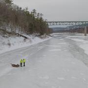
Delaware River at Montague Ice Affected Discharge Measurement

On February 11, 2026, a team of scientists from the New Jersey Water Science Center made a discharge measurement at the USGS 01438500 Delaware River at Montague, New Jersey monitoring site during ice cover conditions. This is the first time since February 1999 that this type of measurement was made at this site. Frigid winter weather conditions made the measurement both necessary and possible.
Delaware River at Montague Ice Affected Discharge Measurement

Delaware River at Montague Ice Affected Discharge Measurement

On February 11, 2026, a team of scientists from the New Jersey Water Science Center made a discharge measurement at the USGS 01438500 Delaware River at Montague, New Jersey monitoring site during ice cover conditions. This is the first time since February 1999 that this type of measurement was made at this site. Frigid winter weather conditions made the measurement both necessary and possible.
Learn More

Estimating Daily Upstream Location of the Freshwater-Saltwater Interface in New Jersey

Frequently, water withdrawals for public supply are made from the freshwater reaches of rivers and streams across New Jersey. Overall, there is a lack of scientific information describing the movement of saltwater upstream into the tributaries discharging into Delaware Bay. This project is collected water-quality data along two selected tributaries in New Jersey to Delaware Bay to develop a...
Estimating Daily Upstream Location of the Freshwater-Saltwater Interface in New Jersey

Estimating Daily Upstream Location of the Freshwater-Saltwater Interface in New Jersey

Frequently, water withdrawals for public supply are made from the freshwater reaches of rivers and streams across New Jersey. Overall, there is a lack of scientific information describing the movement of saltwater upstream into the tributaries discharging into Delaware Bay. This project is collected water-quality data along two selected tributaries in New Jersey to Delaware Bay to develop a...
Learn More

Water Levels in the Ten Major Confined Aquifers of the New Jersey Coastal Plain

The Coastal Plain aquifers of New Jersey provide an important source of water for more than 3.5 million people. The USGS, in cooperation with the New Jersey Department of Environmental Protection, has been measuring water levels in the confined aquifers of the New Jersey Coastal Plain every five years beginning in 1978. Persistent, regionally extensive cones of depression are present in Ocean and...
Water Levels in the Ten Major Confined Aquifers of the New Jersey Coastal Plain

Water Levels in the Ten Major Confined Aquifers of the New Jersey Coastal Plain

The Coastal Plain aquifers of New Jersey provide an important source of water for more than 3.5 million people. The USGS, in cooperation with the New Jersey Department of Environmental Protection, has been measuring water levels in the confined aquifers of the New Jersey Coastal Plain every five years beginning in 1978. Persistent, regionally extensive cones of depression are present in Ocean and...
Learn More

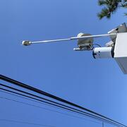
New Jersey Precipitation and Weather Networks

The New Jersey Water Science Center provides valuable data augmentation to many locations for: Precipitation, Water and Air Temperature, and even Wind Speed and Direction at some of our coastal sites. Our technicians continuously make field measurements and maintain these networks to ensure the accuracy of these data.
New Jersey Precipitation and Weather Networks

New Jersey Precipitation and Weather Networks

The New Jersey Water Science Center provides valuable data augmentation to many locations for: Precipitation, Water and Air Temperature, and even Wind Speed and Direction at some of our coastal sites. Our technicians continuously make field measurements and maintain these networks to ensure the accuracy of these data.
Learn More

City of Elizabeth Flood Mapping

To better protect the City of Elizabeth’s residents and assets, the U.S. Geological Survey (USGS) and Rutgers University proposed a joint collaboration to develop a reliable flood risk management platform with the cooperation of the City of Elizabeth and the New Jersey Office of Emergency Management. Our understanding is the broader goal for the City of Elizabeth is to accomplish three primary...
City of Elizabeth Flood Mapping

City of Elizabeth Flood Mapping

To better protect the City of Elizabeth’s residents and assets, the U.S. Geological Survey (USGS) and Rutgers University proposed a joint collaboration to develop a reliable flood risk management platform with the cooperation of the City of Elizabeth and the New Jersey Office of Emergency Management. Our understanding is the broader goal for the City of Elizabeth is to accomplish three primary...
Learn More

New Jersey Tide Network

The USGS operates the most extensive network of tide-gaging stations in the region, many of which form the backbone of flood-warning and storm-hazard warning systems. The New Jersey Water Science Center monitors data for estuary and back-bay areas all along the New Jersey coast and links to related projects with more information about coastal flood hazards, water quality, and other topics. This...
New Jersey Tide Network

New Jersey Tide Network

The USGS operates the most extensive network of tide-gaging stations in the region, many of which form the backbone of flood-warning and storm-hazard warning systems. The New Jersey Water Science Center monitors data for estuary and back-bay areas all along the New Jersey coast and links to related projects with more information about coastal flood hazards, water quality, and other topics. This...
Learn More

Flow Photo Explorer (FPE) Project in New Jersey

The Flow Photo Explorer (FPE) is a database, machine learning, and data visualization platform using timelapse images to develop new approaches for collecting hydrologic data in streams and other waterbodies where traditional monitoring methods are not feasible or cost-prohibitive. The Musconetcong River was chosen to participate in the early study, and we are expanding the work to other rivers.
Flow Photo Explorer (FPE) Project in New Jersey

Flow Photo Explorer (FPE) Project in New Jersey

The Flow Photo Explorer (FPE) is a database, machine learning, and data visualization platform using timelapse images to develop new approaches for collecting hydrologic data in streams and other waterbodies where traditional monitoring methods are not feasible or cost-prohibitive. The Musconetcong River was chosen to participate in the early study, and we are expanding the work to other rivers.
Learn More

Low-Flow Characteristics

Streamflow data collection and analysis are a necessary component of effective water resource management and planning. Low-flow statistics are needed to safely allow withdrawals from and discharges to surface waters in the State of New Jersey. Operating streamflow gaging stations at every water use location would be ideal but is cost prohibitive. Statistics help extend the utility of available...
Low-Flow Characteristics

Low-Flow Characteristics

Streamflow data collection and analysis are a necessary component of effective water resource management and planning. Low-flow statistics are needed to safely allow withdrawals from and discharges to surface waters in the State of New Jersey. Operating streamflow gaging stations at every water use location would be ideal but is cost prohibitive. Statistics help extend the utility of available...
Learn More
Was this page helpful?