
Groundwater and Streamflow Information
Surface-water Monitoring, Groundwater monitoring, and Flood Hazards
Surface-water Monitoring, Groundwater monitoring, and Flood Hazards
Water Use and Availability
Surface-water Modeling, Groundwater-flow Modeling, Hydrogeologic Characterization, Water Use, Flood Science, Climate Change
Surface-water Modeling, Groundwater-flow Modeling, Hydrogeologic Characterization, Water Use, Flood Science, Climate Change
Water Quality
Surface-water-quality Monitoring, Groundwater-quality Monitoring, Water-quality Modeling, Wetlands, Ecosystem Health
Surface-water-quality Monitoring, Groundwater-quality Monitoring, Water-quality Modeling, Wetlands, Ecosystem Health
Coastal Science
Beach and Barrier Dynamics, Flood Hazards, Nearshore Environmental Health, Tide and Wave Hydrodynamics, Wetlands, Climate and Land-Use Change
Beach and Barrier Dynamics, Flood Hazards, Nearshore Environmental Health, Tide and Wave Hydrodynamics, Wetlands, Climate and Land-Use Change
Ecosystem Health
Aquatic Community Health, Biogeochemical and Hydrologic Assessment, Climate Change, Ecological Assessment of Human and Natural Impacts
Aquatic Community Health, Biogeochemical and Hydrologic Assessment, Climate Change, Ecological Assessment of Human and Natural Impacts
New York Water Science Center
The New York Water Science Center will provide the hydrologic observations, research, and modeling needed for full integration of hydrogeologic, physiochemical, biological, and landscape processes across the freshwater to marine continuum.


NY WSC Quick Links
NY WSC Quick Links
Explore some of our most popular science topics, data, and tools
News
USGS Satellites and Test Tubes Meet to Ensure Safe Drinking Water
USGS Satellites and Test Tubes Meet to Ensure Safe Drinking Water
Advanced Quantitative Precipitation Information System Enhances Flood Prediction in San Francisco Bay Area
Advanced Quantitative Precipitation Information System Enhances Flood Prediction in San Francisco Bay Area
Native American Research Assistantship Student Learns USGS Water Science
Native American Research Assistantship Student Learns USGS Water Science
Publications
Hazard potential of compound flooding from rainfall, storm surge, and groundwater in coastal New York and Connecticut Hazard potential of compound flooding from rainfall, storm surge, and groundwater in coastal New York and Connecticut
Compound flood events, the co-occurrence of multiple flood drivers, can result in flood hazard potential exceeding that of any single driver alone. To evaluate compound flooding in a semi-urbanized coastal area, historical records dating back to 1970 are used to study the co-occurrences of high precipitation, storm surge, and shallow groundwater conditions along the coastlines of New...
Hydrologic investigation of water level fluctuations at Moreau Lake, Moreau Lake State Park, town of Moreau, New York Hydrologic investigation of water level fluctuations at Moreau Lake, Moreau Lake State Park, town of Moreau, New York
The causes of water level fluctuations at Moreau Lake, within Moreau Lake State Park in the town of Moreau, New York, were investigated from 2016 to 2021 after lake water levels dropped between 2015 and 2016, raising concerns about the loss of a shallow swimming area at the park beach. Annual variation in precipitation records from the area did not account for the lake water level...
Shallow hydrogeologic framework of the Tully Valley mudboil area, Onondaga County, New York Shallow hydrogeologic framework of the Tully Valley mudboil area, Onondaga County, New York
Mudboils have been documented in the Tully Valley in southern Onondaga County, New York, since the late 1890s. Sediment-laden water from the mudboils flows into Onondaga Creek, which empties into Onondaga Lake at Syracuse 15 miles to the north. Turbidity from the mudboils has degraded the water quality of Onondaga Creek despite a series of mitigation efforts that began in the early 1990s
Science

Well Selection Information for Homeowners and PWS Personnel
Well Selection Information for Homeowners and PWS Personnel
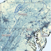
Evaluating the Risks of Tire-Derived Compounds to Fish in the Chesapeake Bay Watershed
Tires contain a chemical known as 6PPD which prevents them from quickly breaking down. Microscopic tire particles, generated mainly from the friction of tires on roads, release 6PPD-quinone (6PPDQ) when they come into contact with oxygen. During precipitation events, 6PPDQ can be washed off roads, harming fish in nearby waterways. In response to requests from fishery managers, the USGS is studying...
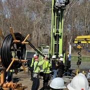
Interactive Products to Assist with Geothermal Drilling
Geothermal energy is a clean and renewable source of heat derived from the Earth's natural thermal resources. Geothermal borefields are utilized to extract this thermal energy, providing heating for buildings in the winter and cooling in the summer. In New York, the adoption of geothermal energy at both residential and community scales is on the rise and is expected to see significant growth in...