U.S. flag

An official website of the United States government

Images

Below are images associated with the Office of International Programs. 

Images appear according to the year they were taken. To search, type a keyword or use filters from the dropdown menu. 

Filter Total Items: 118
USGS scientists present remote sensing data for supporting water resource management

Dr. Lea Davidson (center) and Dr. John Lane (left) explain how USGS remote sensed data products can be processed to create a data visualization dashboard that supports water resource management in the Kyrgyz Republic. 
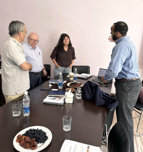
Dr. Lea Davidson (center) and Dr. John Lane (left) explain how USGS remote sensed data products can be processed to create a data visualization dashboard that supports water resource management in the Kyrgyz Republic. 
A post meeting discussion with Kyrgyz researchers
USGS scientist engages with Kyrgyz water researchers at National Academy of Sciences

Anteneh Sarbanes (right) in a post meeting discussion with Kyrgyz researchers from the Institute of Water Problems and Hydropower of the National Academy of Sciences of the Kyrgyz Republic.

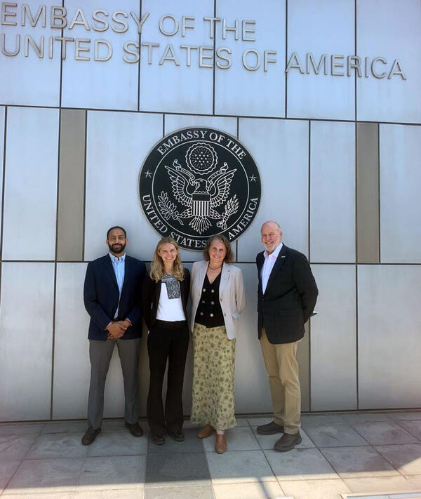
USGS scientists stand outside of Embassy Bishkek, Kyrgyz Republic
USGS team at Embassy Bishkek, Kyrgyz Republic

USGS scientists Anteneh Sarbanes, Dr. Lea Davidson, Kristina Masterson, and Dr. John Lane stand outside Embassy Bishkek, Kyrgyz Republic. 

USGS scientists Anteneh Sarbanes, Dr. Lea Davidson, Kristina Masterson, and Dr. John Lane stand outside Embassy Bishkek, Kyrgyz Republic. 

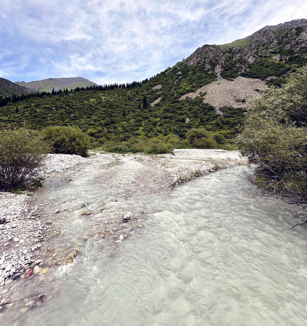
A glacier-fed river flows though Ala-Archa National Park in the Chuy Region of the Kyrgyz Republic
Ala-Archa River, Kyrgyz Republic

Ala-Archa River is a glacier-fed river that flows though Ala-Archa National Park in the Chuy Region of the Kyrgyz Republic.  This river is typical of many glacier and snow melt-fed rivers in the Kyrgyz Republic. Analysis of remote sensed data will provide insight to the extent of glaciers and snow cover that contribute to river flow. 
Ala-Archa River is a glacier-fed river that flows though Ala-Archa National Park in the Chuy Region of the Kyrgyz Republic.  This river is typical of many glacier and snow melt-fed rivers in the Kyrgyz Republic. Analysis of remote sensed data will provide insight to the extent of glaciers and snow cover that contribute to river flow. 
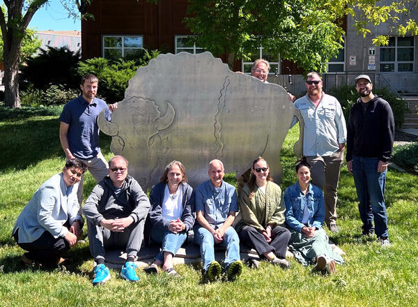
USGS and Kazakhstan MWRI Researchers Meet at the USGS Boise Campus
USGS and Kazakhstan researchers meet at the USGS Boise campus

Researchers from the U.S. Geological Survey and the Ministry of Water Resources and Irrigation of the Republic of Kazakhstan gather on the USGS Boise campus during a week‑long scientific and technical exchange focused on groundwater monitoring network  modernization.

Researchers from the U.S. Geological Survey and the Ministry of Water Resources and Irrigation of the Republic of Kazakhstan gather on the USGS Boise campus during a week‑long scientific and technical exchange focused on groundwater monitoring network  modernization.

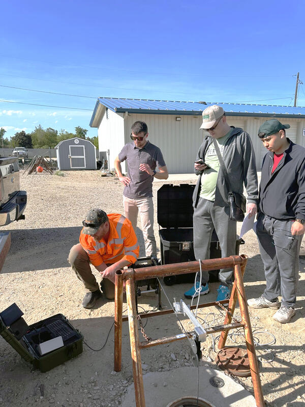
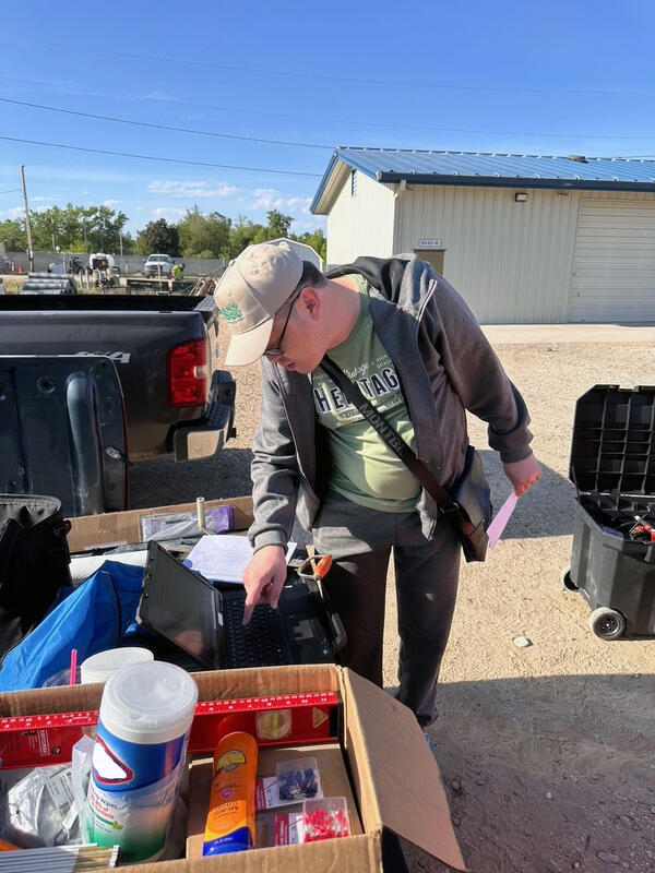
Field Setup for Groundwater Sensors
Demonstration of a borehole camera survey

USGS staff demonstrate how to conduct a borehole camera survey in a monitoring well for visiting researchers from the Ministry of Water Resources and Irrigation of the Republic of Kazakhstan. Borehole camera surveys provide valuable insight into conditions within the well such as fouling of the screen and leaky casing joints.

USGS staff demonstrate how to conduct a borehole camera survey in a monitoring well for visiting researchers from the Ministry of Water Resources and Irrigation of the Republic of Kazakhstan. Borehole camera surveys provide valuable insight into conditions within the well such as fouling of the screen and leaky casing joints.

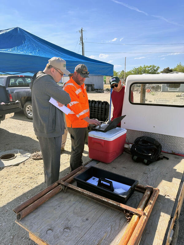
Reviewing Telemetry Data in the Field
Reviewing groundwater workflows in the field

USGS staff meet with researchers from Kazakhstan’s Ministry of Water Resources and Irrigation to provide an overview of groundwater workflows at continuous and real-time groundwater monitoring wells.

USGS staff meet with researchers from Kazakhstan’s Ministry of Water Resources and Irrigation to provide an overview of groundwater workflows at continuous and real-time groundwater monitoring wells.

Configuring Groundwater Dataloggers
Configuring a submersible pressure transducer to collect groundwater levels

Researchers from the Ministry of Water Resources and Irrigation of the Republic of Kazakhstan work with USGS staff to configure a submersible pressure transducer for collecting groundwater levels.

Researchers from the Ministry of Water Resources and Irrigation of the Republic of Kazakhstan work with USGS staff to configure a submersible pressure transducer for collecting groundwater levels.

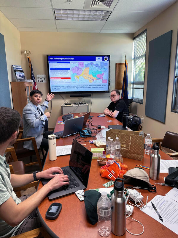
Hydrogeologists from Kazakhstan Discuss Groundwater Monitoring Systems
Hydrogeologists from Kazakhstan discuss groundwater monitoring systems

Hydrogeologists from the Ministry of Water Resources and Irrigation of the Republic of Kazakhstan provide an overview of Kazakhstan’s groundwater monitoring networks during a technical exchange meeting.

Hydrogeologists from the Ministry of Water Resources and Irrigation of the Republic of Kazakhstan provide an overview of Kazakhstan’s groundwater monitoring networks during a technical exchange meeting.

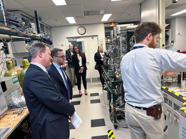
Geoscience Australia senior leaders visiting USGS Groundwater Age Dating Laboratory

During their time in Reston, the Geoscience Australia (GA) delegation met with USGS experts across minerals, energy, water, and Earth observation mission areas. They toured several USGS facilities, including the Groundwater Age Dating Laboratory in the Water Mission Area.

During their time in Reston, the Geoscience Australia (GA) delegation met with USGS experts across minerals, energy, water, and Earth observation mission areas. They toured several USGS facilities, including the Groundwater Age Dating Laboratory in the Water Mission Area.

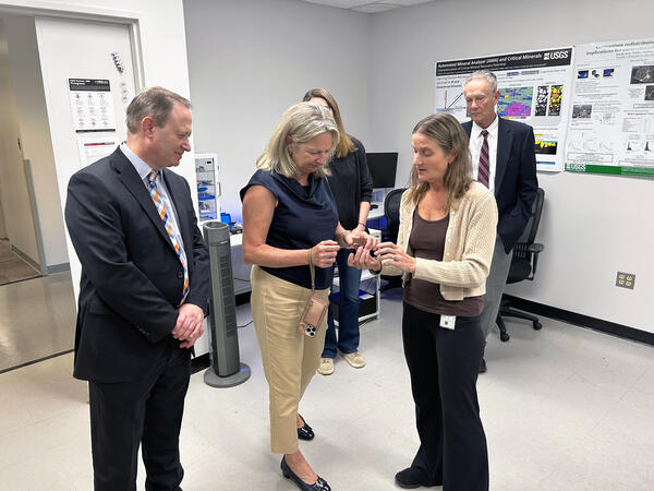
Geoscience Australia senior leaders visiting USGS Electron Microbeam Laboratory

During their time in Reston, the Geoscience Australia (GA) delegation met with USGS experts across minerals, energy, water, and Earth observation mission areas. They toured several USGS facilities, including Electron Microbeam Laboratory in the Geology, Energy, and Minerals Science Center.

During their time in Reston, the Geoscience Australia (GA) delegation met with USGS experts across minerals, energy, water, and Earth observation mission areas. They toured several USGS facilities, including Electron Microbeam Laboratory in the Geology, Energy, and Minerals Science Center.

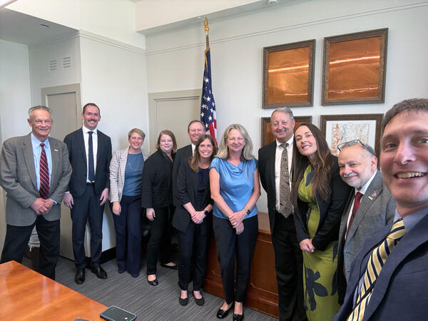
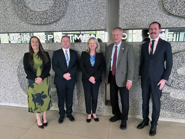
The USGS meets with partners from Geoscience Australia in Reston, VA

The USGS meets with partners from Geoscience Australia in Reston, Virginia, on April 15–16, 2026.

USGS Director meets with Geoscience Australia delegation
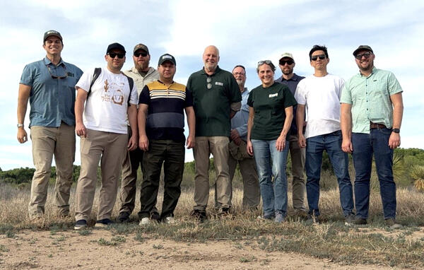
USGS and MinGeo Research Team in Arizona
USGS and Uzbek research team in Arizona

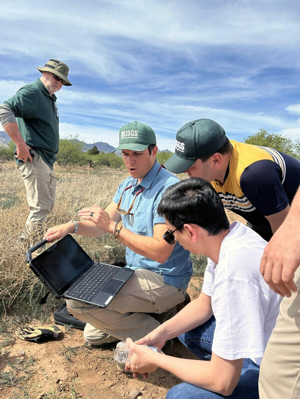
USGS and MinGeo Researchers in the San Pedro River valley in Southern Arizona, during a field visit to remote well sites. 

USGS and MinGeo Researchers in the San Pedro River valley in Southern Arizona, during a field visit to remote well sites. 

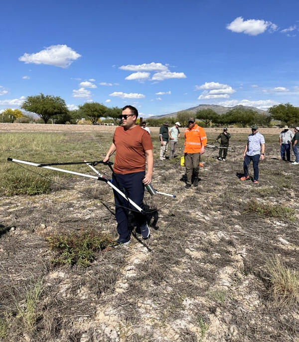
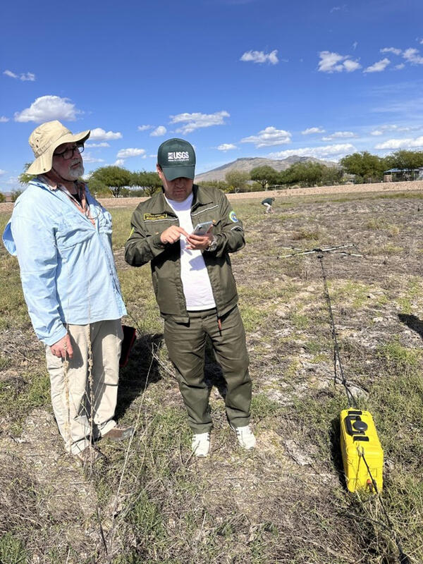
USGS hydrologist leads a field demonstration of a new subsurface geophysics tool
Field demonstration of subsurface geophysics tool

Eric White (Hydrologic Remote Sensing Branch, Water Resources Mission Area) leads a field demonstration of a new subsurface geophysics tool. 

Eric White (Hydrologic Remote Sensing Branch, Water Resources Mission Area) leads a field demonstration of a new subsurface geophysics tool. 

The USGS hydrologist demonstrates a new subsurface geophysics tool in the field
Field demonstration of subsurface geophysics tool

Eric White from the Hydrologic Remote Sensing Branch demonstrates a new subsurface geophysics tool in the field.

USGS staff demonstrate to Uzbek researchers the process of collecting and recording USGS groundwater data
Uzbekistan researchers learn USGS groundwater data collection procedures

David Morales (Arizona Water Science Center) demonstrates to Uzbek MinGeo researchers how USGS groundwater data are collected and recorded. 

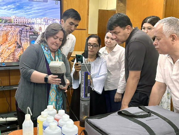
USGS hydrologist demonstrates Water Quality calibration to Uzbek researchers and students
Water Quality training at Uzbekistan’s Hydrometeorological Research Institute

At Hydrometeorological Research Institute’s Office in Tashkent, Uzbekistan, Cassi Crowe (Water Quality Specialist, Oklahoma-Texas Water Science Center) describes calibration procedures for water quality monitors to researchers and students.

At Hydrometeorological Research Institute’s Office in Tashkent, Uzbekistan, Cassi Crowe (Water Quality Specialist, Oklahoma-Texas Water Science Center) describes calibration procedures for water quality monitors to researchers and students.

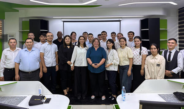
Group photo of the USGS hydrologist with Uzbek hydrometeorology faculty and students
USGS hydrologist with Uzbek hydrometeorology faculty and students

Kris Masterson (Supervisory Hydrologist, New York Water Science Center, second from right in second row) presented to National University of Uzbekistan Faculty of Hydrometeorology students and professors providing an overview of how USGS interdisciplinary science could be applied to the bilateral USGS-UzHydromet HMRI study of seasonal variability of hydrologic proce

Kris Masterson (Supervisory Hydrologist, New York Water Science Center, second from right in second row) presented to National University of Uzbekistan Faculty of Hydrometeorology students and professors providing an overview of how USGS interdisciplinary science could be applied to the bilateral USGS-UzHydromet HMRI study of seasonal variability of hydrologic proce

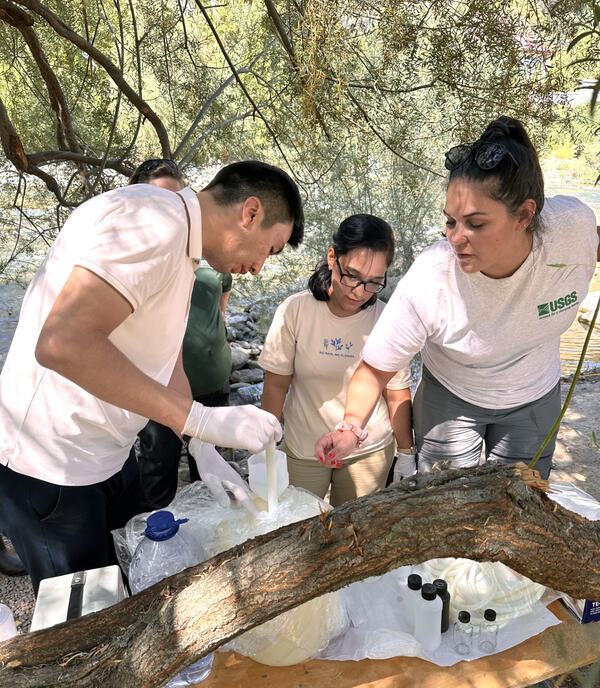
Discrete water sample processing at a monitoring site on the Ugam River, Uzbekistan

Monica Langhorst (Hydrologist, Oklahoma-Texas Water Science Center) trains Hydrometeorological Research Institute student researchers on discrete water sample processing at a monitoring site on the Ugam River at the National University of Uzbekistan Field campus located in the Chirchick River valley.

Monica Langhorst (Hydrologist, Oklahoma-Texas Water Science Center) trains Hydrometeorological Research Institute student researchers on discrete water sample processing at a monitoring site on the Ugam River at the National University of Uzbekistan Field campus located in the Chirchick River valley.

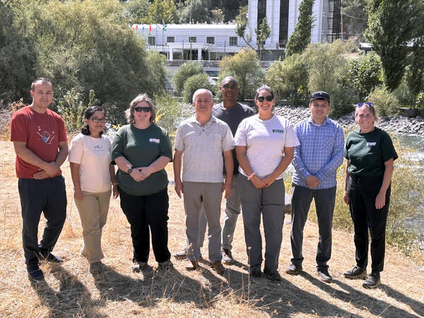
Group Photo of Researchers from Uzbekistan and the USGS
Researchers from Uzbekistan and the USGS

Cassi Crowe (Water Quality Specialist, Oklahoma-Texas Water Science Center), Monica Langhorst (Hydrologist, Oklahoma-Texas Water Science Center) and Kris Masterson (Supervisory Hydrologist, New York Water Science Center) provided training to National University of Uzbekistan and Hydrometeorological Research Institute researchers for

Cassi Crowe (Water Quality Specialist, Oklahoma-Texas Water Science Center), Monica Langhorst (Hydrologist, Oklahoma-Texas Water Science Center) and Kris Masterson (Supervisory Hydrologist, New York Water Science Center) provided training to National University of Uzbekistan and Hydrometeorological Research Institute researchers for

Was this page helpful?