
United Nations Headquarters in New York City. View looking up at United Nations headquarters building with flags in foreground.
Images
Below are images associated with the Office of International Programs.
Images appear according to the year they were taken. To search, type a keyword or use filters from the dropdown menu.
Filter Total Items: 109

United Nations Headquarters in New York City
United Nations Headquarters in New York City. View looking up at United Nations headquarters building with flags in foreground.

Erosion and landslides along the Rio Coca in Ecuador
Erosion and landslides along the Rio Coca in EcuadorErosion and landslides along the Rio Coca in Ecuador, February 9, 2023. (Amy East, USGS).
Erosion and landslides along the Rio Coca in Ecuador
Erosion and landslides along the Rio Coca in EcuadorErosion and landslides along the Rio Coca in Ecuador, February 9, 2023. (Amy East, USGS).

USGS meeting with National Agency for Water and Basic Sanitation (ANA) scientists in Brazil standing in front of flags
USGS meeting with National Agency for Water and Basic Sanitation (ANA) scientists in Brazil standing in front of flagsUSGS meeting with National Agency for Water and Basic Sanitation (ANA) scientists in Brazil, standing in front of three flags (L-R) American flag, Brazilian Flag, ANA logo flag.
(L-R) Mauricio Abijaodi, Brian McCallum, Filipe Sampaio, Joel Groten, Travis Knight, and Vitor Saback.
ANA (Agencia Nacional De Aguas E Saneamento Basico)

USGS meeting with National Agency for Water and Basic Sanitation (ANA) scientists in Brazil
USGS meeting with National Agency for Water and Basic Sanitation (ANA) scientists in BrazilUSGS meeting with National Agency for Water and Basic Sanitation (ANA) scientists in Brazil.
Top (L – R) ANA Scientists Vitor Saback, Brian McCallum, Mauricio Abijaodi
Bottom (L-R) USGS Hydrologists Travis Knight, Joel Groten, Filipe Sampaio
ANA (Agencia Nacional De Aguas E Saneamento Basico)

Picture of a dryland stream dam
Picture of a dam in a dry stream bed in Mexico for the aridland water harvesting study.
Picture of a dam in a dry stream bed in Mexico for the aridland water harvesting study.

Gold mining site along the Cuyuni River, Guyana
Permitted small-scale gold mining site along the Cuyuni River in northwestern Guyana, June 2022. The picture depicts two gold mining hydraulic “dredges” in an excavated pit approximately 1 hectare in size. (Pete Chirico, USGS).
Permitted small-scale gold mining site along the Cuyuni River in northwestern Guyana, June 2022. The picture depicts two gold mining hydraulic “dredges” in an excavated pit approximately 1 hectare in size. (Pete Chirico, USGS).

Rock gabion, La Paz, Baja California Sur
Rock gabion installed in arroyo in La Paz, Baja California Sur. (Laura Norman, USGS)
Rock gabion installed in arroyo in La Paz, Baja California Sur. (Laura Norman, USGS)
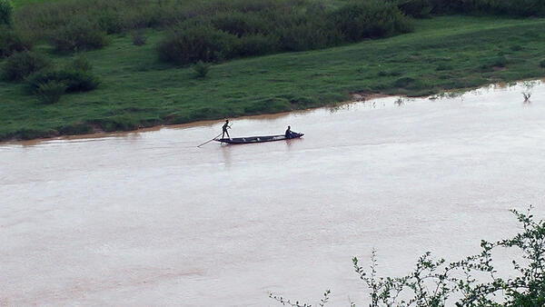
Local boaters on Niger River in Niamey, Niger
Distance photo showing a boat with local fisherfolk on the Niger River in Niamey, Niger.
Distance photo showing a boat with local fisherfolk on the Niger River in Niamey, Niger.
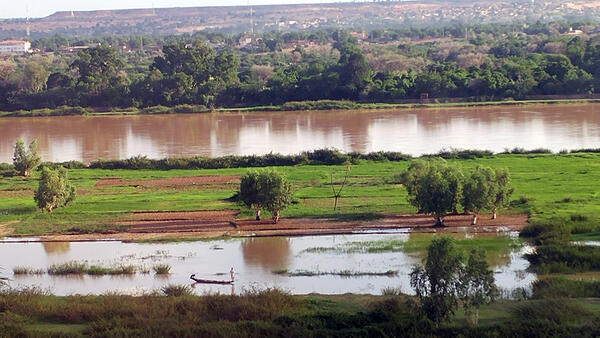
Niger River, Niamey, Niger
The Niger River flowing through Niamey, Niger. The Niger River is a major waterway in West Africa, and it passes through Niamey as it makes its way towards the Niger Delta and the Atlantic Ocean.
The Niger River flowing through Niamey, Niger. The Niger River is a major waterway in West Africa, and it passes through Niamey as it makes its way towards the Niger Delta and the Atlantic Ocean.

Kafrein reservoir captures runoff near the Dead Sea, Jordan
Kafrein reservoir captures runoff near the Dead Sea, JordanThe Kafrein Dam captures runoff from Jordan River side valley wadis, near the Dead Sea, Jordan. USGS hosted a field trip that included a stop at the dam in February, 2017 during a regional workshop on aquifer storage & recovery in the Middle East and North Africa (MENA) region, in cooperation with the U.S. Agency for International Development.

Kafrein reservoir, Jordan
Kafrein reservoir captures runoff in the lower Jordan Valley, near the Dead Sea, Jordan.
Kafrein reservoir captures runoff in the lower Jordan Valley, near the Dead Sea, Jordan.

Teaching International Scientists How to Set Up GPS Monitoring
Teaching International Scientists How to Set Up GPS MonitoringMike Poland (USGS Hawaiian Volcano Observatory) shows Marcellin Kasereka (Goma Volcanological Survey, Democratic Republic of Congo, red jacket) how to adjust the leg of a tripod, while Patricia Ponce (Colombia Geological Survey, white hat) keeps the GPS antenna rod steady.
Chain of Craters Road, Hawaii Volcanoes National Park, Hawaii
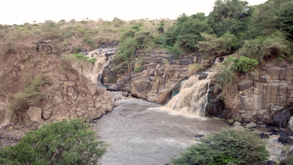
Awash Falls, Awash National Park, Ethiopia
Awash Falls on the Awash River in Awash National Park. Awash River is a major river in Ethiopia.
Awash Falls on the Awash River in Awash National Park. Awash River is a major river in Ethiopia.
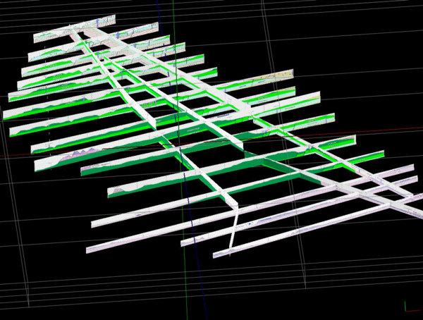
Fence Diagram of Cross Sections of the Ogaden area, eastern Ethiopia
Fence Diagram of Cross Sections of the Ogaden area, eastern EthiopiaA fence diagram made from cross section generated for the Ogaden area in eastern Ethiopia made in Rockworks.
Fence Diagram of Cross Sections of the Ogaden area, eastern Ethiopia
Fence Diagram of Cross Sections of the Ogaden area, eastern EthiopiaA fence diagram made from cross section generated for the Ogaden area in eastern Ethiopia made in Rockworks.

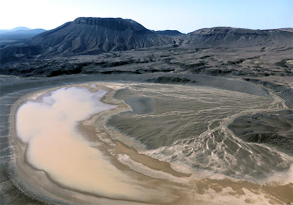
Spring flow towards the Dead Sea, Jordan
Photo of low-flow conditions in a wadi (stream) along the Jordan Rift Valley. Springflow generated by groundwater discharge at higher elevations eventually flows into the hypersaline Dead Sea.
Photo of low-flow conditions in a wadi (stream) along the Jordan Rift Valley. Springflow generated by groundwater discharge at higher elevations eventually flows into the hypersaline Dead Sea.
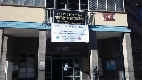
Capacity Building Banner at Addis Ababa University, Ethiopia
Capacity Building Banner at Addis Ababa University, EthiopiaA banner presenting the groundwater hydrology and remote sensing national training by the USGS at Addis Ababa University, Addis Ababa, Ethiopia.
Capacity Building Banner at Addis Ababa University, Ethiopia
Capacity Building Banner at Addis Ababa University, EthiopiaA banner presenting the groundwater hydrology and remote sensing national training by the USGS at Addis Ababa University, Addis Ababa, Ethiopia.
Um Junb lava dome, western Saudi Arabia
View south-southwest across maar crater of Gura 1 toward benmoreite lava dome and flow of Um Junb. Trachytic pyroclastic flow deposits of Gura 2 enter from upper right, mantling mugearite lava flow of Dabaa 1. Maar crater is about 0.7 kilometers across, and Um Junb stands about 250 meters above surroundings.
View south-southwest across maar crater of Gura 1 toward benmoreite lava dome and flow of Um Junb. Trachytic pyroclastic flow deposits of Gura 2 enter from upper right, mantling mugearite lava flow of Dabaa 1. Maar crater is about 0.7 kilometers across, and Um Junb stands about 250 meters above surroundings.

Well-withdrawal footprint map, Azraq Oasis, Jordan
Well-withdrawal footprint map, Azraq Oasis, JordanLarge groundwater withdrawals in the Azraq Oasis area, Jordan, have contributed to declining water levels in wells. This map shows the withdrawal footprint and observed water-level trends (labeled triangular symbols, from Goode et al. 2013).

Projected image of world landforms and shaded relief topography and ocean bathymetry
Projected image of world landforms and shaded relief topography and ocean bathymetryProjected image of world landforms and shaded relief topography and ocean bathymetry. (USGS)
Equirectangular projection of world land and ocean visible plus elevation data.

Arctic Sky
The clouds begin to thin over the Arctic Ocean Aug. 19, 2009.
The clouds begin to thin over the Arctic Ocean Aug. 19, 2009.

Copper Mine in the Republic of Georgia
An open-pit mine for volcanic-hosted copper deposits from the Bolnisi District of the Republic of Georgia.
An open-pit mine for volcanic-hosted copper deposits from the Bolnisi District of the Republic of Georgia.