U.S. flag

An official website of the United States government

Images

Below are images associated with the Office of International Programs. 

Images appear according to the year they were taken. To search, type a keyword or use filters from the dropdown menu. 

Filter Total Items: 118
Silver lattice bridge and slab of black asphalt in stream channel in mountain area with gray bolders and sediment
Bridge over Río Marker near the confluence with Río Loco near El Chaco, Ecuador Jan 2024

Erosion in the Río Coca valley upstream of the former waterfall location, showing major damage to the roadway over the Río Marker, a tributary to the Río Loco, and temporary roadway access bridge. (Molly Wood, USGS)

Photograph of stream channel with steep banks, sediment, and mountains with green ground cover
Río Coca near El Chaco, Ecuador with new canyon since 2020 (Jan 2024)

Erosion on the Río Coca upstream of the former San Rafael waterfall site, Ecuador, showing a newly opened canyon that has formed since 2020. (Molly Wood, USGS) 
  

Broken black asphalt roadway in foreground with white X mark and centerline with mountains and steep valleys in background
Collapsed E45 road on western side of the Río Coca river corridor, Ecuador Jan 2024

Damage to the E45 road caused by valley-wall erosion following the 2020 failure of a lava dam, Rio Coca valley, Ecuador, January 2024. (Amy East, USGS)

Dr. Cliff Taylor (retired USGS) in field with colleagues of the Botswana Geoscience
Dr. Cliff Taylor in field with colleagues of the Botswana Geoscience
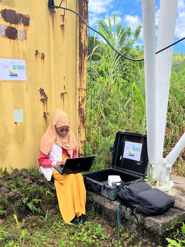
Downloading data from a seismic monitoring station established by the USGS in Comoros

Technician from the Karthala Volcano Observatory downloading data from a seismic monitoring station, established by the USGS in Comoros.

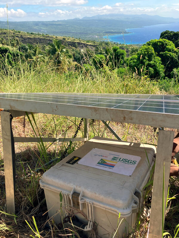
Seismic monitoring station established by the USGS for the Karthala Volcano Observatory in Comoros

Seismic monitoring station established by the USGS for the Karthala Volcano Observatory in Comoros. Photo taken near Samba-Madi, Grande Comore, Comoros.

gangway on left leads to a standpipe down to brown stream with forested hills and the brown stream in the background
Sediment and flow monitoring station on the Rio Quijos, Rio Coca watershed, Ecuador

Sediment and flow monitoring station on the Rio Quijos, Rio Coca watershed, Ecuador. Rio Quijos joins Rio Salado to form Rio Coca upstream of a hydropower facility. The station is jointly operated by the Ecuador National Institute of Meteorology and Hydrology and the Electric Corporation of Ecuador (CELEC). (Molly Wood, USGS)

Sediment and flow monitoring station on the Rio Quijos, Rio Coca watershed, Ecuador. Rio Quijos joins Rio Salado to form Rio Coca upstream of a hydropower facility. The station is jointly operated by the Ecuador National Institute of Meteorology and Hydrology and the Electric Corporation of Ecuador (CELEC). (Molly Wood, USGS)

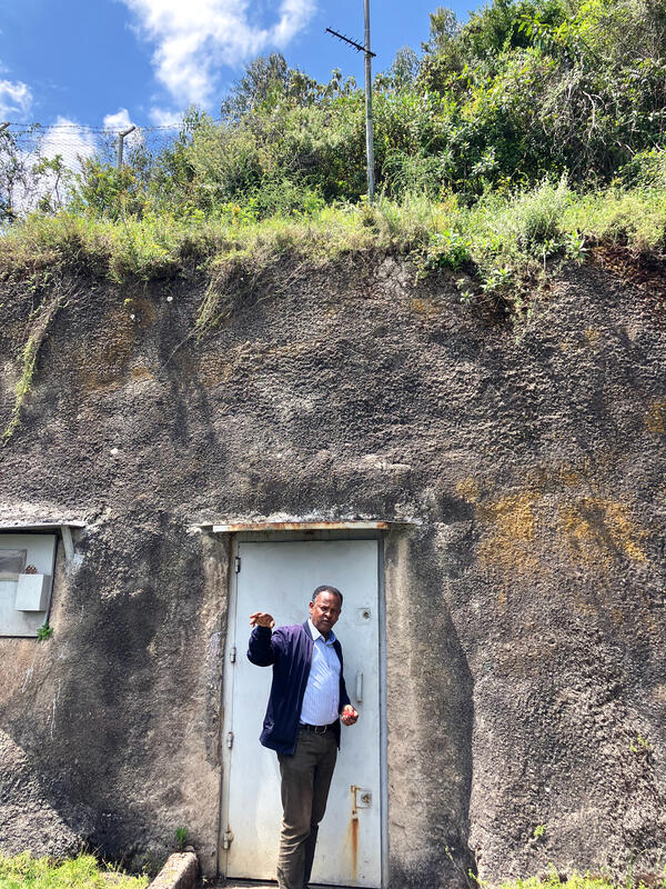
Dr. Ayele Atalay, Addis Ababa University, at entrance of USGS global seismic monitoring station, Mt. Furi, Ethiopia
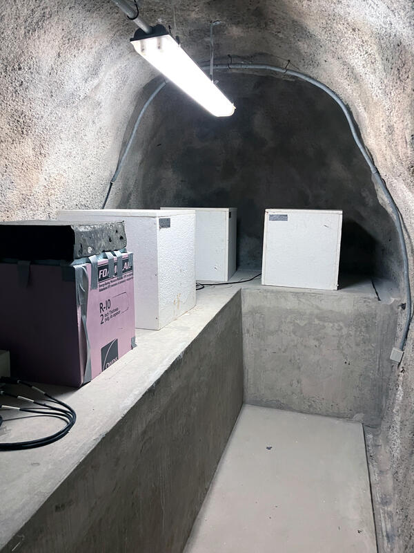
USGS global seismic monitoring station, Mt. Furi, Ethiopia

Dr. Ayele Atalay, Addis Ababa University, at entrance of USGS global seismic monitoring station, Mt. Furi, Ethiopia.

Rushing river, green vegetation and waterfalls in background
Iguazu Falls
Iguazu Falls
Iguazu Falls

Iguazu Falls on the border of Brazil and Argentina. A rushing river in the foreground is bordered by green vegetation, with waterfalls in background.

Iguazu Falls on the border of Brazil and Argentina. A rushing river in the foreground is bordered by green vegetation, with waterfalls in background.

Looking down into Iguazu Falls waterfalls from above. Flat horizon and white fluffy clouds on top half of photo.
Iguazu Falls from above

Iguazu Falls view from above, on the border of Brazil and Argentina. Green vegetation surrounds the waterfalls.

Boardwalk leading towards Iguazu Falls
Iguazu Falls boardwalk

Boardwalk leading towards Iguazu Falls viewpoint. Iguazu Falls on the border of Brazil and Argentina. A river in the foreground is bordered by green vegetation, with waterfalls in background.

Boardwalk leading towards Iguazu Falls viewpoint. Iguazu Falls on the border of Brazil and Argentina. A river in the foreground is bordered by green vegetation, with waterfalls in background.

Three people in hard hats and an orange reflective shirt stand on a rocky floor inside a dry dam
USGS employees inside Itaipu Binational Dam on Parana River bottom

(L to R) USGS's Brian McCallum, Joel Groten, and Molly Wood inside Itaipu Binational dam and standing on the original Paraná River bottom on the border of Brazil and Paraguay.

Dam spillway surrounded by green trees on either side
Itaipu Binacional Dam spillway

Itaipu Binacional Dam spillway. The binational dam is located on the Parana River on the border of Brazil and Paraguay.

Itaipu Binacional Dam spillway. The binational dam is located on the Parana River on the border of Brazil and Paraguay.

View looking up at Itaipu Binacional hydroelectric dam and sign from below
Itaipu Binacional hydroelectric dam

View looking up at Itaipu Binacional hydroelectric dam and sign from below. The binational dam is located on the border of Brazil and Paraguay.

View looking up at Itaipu Binacional hydroelectric dam and sign from below. The binational dam is located on the border of Brazil and Paraguay.

Was this page helpful?