U.S. flag

An official website of the United States government

Images

Below are images associated with the Office of International Programs. 

Images appear according to the year they were taken. To search, type a keyword or use filters from the dropdown menu. 

Filter Total Items: 114
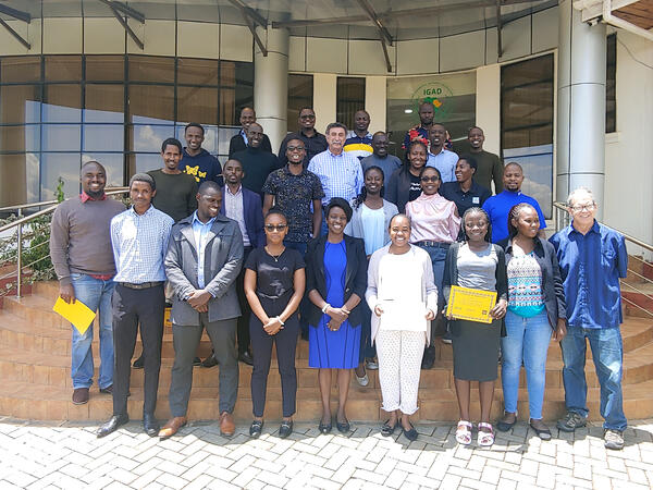
Trainees in the hydrogeology class in Mombasa, Kenya

The hydrogeology training was held in August and September 2024 at the Kenya School of Government (KSG) in Mombasa. It covered the analysis of aquifer testing results and an introduction to groundwater and surface water field methods. The training consisted of a series of lectures and hands-on exercises. 

The hydrogeology training was held in August and September 2024 at the Kenya School of Government (KSG) in Mombasa. It covered the analysis of aquifer testing results and an introduction to groundwater and surface water field methods. The training consisted of a series of lectures and hands-on exercises. 

The USGS Director talking to his Korean counterpart, President Kim from KIGAM
USGS Director and the President of the Korea Institute of Geoscience and Mineral Resources (KIGAM)

Director Applegate conversing with his Korean counterpart, President Kim from the Korea Institute of Geoscience and Mineral Resources (KIGAM).

Signing the Letter of Intent to collaborate on the science with USGS partners in Korea
Signing the Letter of Intent to collaborate on the science

The International Geological Congress 2024 held August 24-30 in Busan, Republic of Korea provided a unique opportunity for bilateral meetings to explore opportunities for collaboration.

The International Geological Congress 2024 held August 24-30 in Busan, Republic of Korea provided a unique opportunity for bilateral meetings to explore opportunities for collaboration.

The USGS Delegation visiting the APEC Climate Center in Busan, Korea

The USGS Delegation visiting the APEC Climate Center in Busan, Korea. Nine individuals from the USGS and APEC, including Dave Applegate and Bill Cunningham, stand in front of the modern APEC building.

The USGS Delegation visiting the APEC Climate Center in Busan, Korea. Nine individuals from the USGS and APEC, including Dave Applegate and Bill Cunningham, stand in front of the modern APEC building.

U.S. delegates stand with the International Geological Congress 2024 banner and sign
U.S. Delegates with the International Geological Congress 2024 banner and sign

Eight U.S. International Union of Geological Sciences (IUGS) Delegates (from the USGS, GSA, AGI, and academia) stand with the banner and sign at the International Geological Congress 2024 held August 24-30 in Busan, Republic of Korea. 

Eight U.S. International Union of Geological Sciences (IUGS) Delegates (from the USGS, GSA, AGI, and academia) stand with the banner and sign at the International Geological Congress 2024 held August 24-30 in Busan, Republic of Korea. 

Sign for the 2024 International Geologic Congress, in front of a display skeleton of a long-necked dinosaur.
The 2024 International Geologic Congress sign

The 2024 International Geologic Congress sign placed in front of a display skeleton of a long-necked dinosaur. The International Geological Congress 2024 was held August 24-30 in Busan, Republic of Korea.

The 2024 International Geologic Congress sign placed in front of a display skeleton of a long-necked dinosaur. The International Geological Congress 2024 was held August 24-30 in Busan, Republic of Korea.

USGS booth at the International Geological Congress 2024

USGS scientist Christine DeVera at the USGS booth at the International Geological Congress 2024 held August 24-30 in Busan, Republic of Korea.

USGS scientist Christine DeVera at the USGS booth at the International Geological Congress 2024 held August 24-30 in Busan, Republic of Korea.

Trainees displaying their completion certificates from Capacity Building classes at ICPAC, Ngong Town, Kenya
Capacity Building in Ngong Town, Kenya

Trainees displaying their completion certificates from Capacity Building classes (Remote Sensing and Hydrogeology) at ICPAC, Ngong Town, Kenya.

Trainees displaying their completion certificates from Capacity Building classes (Remote Sensing and Hydrogeology) at ICPAC, Ngong Town, Kenya.

coral reef with fish and blue water
Pacific Island Coral Reef and Fish

Coral reef fish assemblage in the Kealakekua Bay Marine Life Conservation District off the leeward side of Hawaiʻi Island, Hawaiʻi on 11 November 2016.

Coral reef fish assemblage in the Kealakekua Bay Marine Life Conservation District off the leeward side of Hawaiʻi Island, Hawaiʻi on 11 November 2016.

photograph of 2 person with brightly colored shirts in a conference room with white walls with black stripes
Matthew Andersen, USGS, and Sefanaia Nawadra, SPREP

Matthew Andersen, USGS, and the Director General of Secretariat for the Pacific Regional Environmental Programme (SPREP), Sefanaia Nawadra, at the 4th Pacific Ocean Pacific Climate Change Conference, sponsored by SPREP, the National University of Samoa, and Victoria University of Wellington, New Zealand, 20-24 May 2024.

Matthew Andersen, USGS, and the Director General of Secretariat for the Pacific Regional Environmental Programme (SPREP), Sefanaia Nawadra, at the 4th Pacific Ocean Pacific Climate Change Conference, sponsored by SPREP, the National University of Samoa, and Victoria University of Wellington, New Zealand, 20-24 May 2024.

Photograph of 2 persons at a table and 3 persons standing behind with papers and flags of the U.S. and Dominican Republic
USGS signs MOU with Dominican Republic Geological Survey

USGS and the National Geological Survey of the Dominican Republic signed a Memorandum of Understanding on March 12, 2024, in Reston, Virginia, for earth science cooperation.

USGS and the National Geological Survey of the Dominican Republic signed a Memorandum of Understanding on March 12, 2024, in Reston, Virginia, for earth science cooperation.

photograph tan loose ground with cactus and other desert plants under a partly cloudy blue sky
USGS scientists mapping vegetation and land use in Los Planes watershed, Baja California Sur, Mexico
photograph of black board with colored chalk showing drawings of clouds, water drops, plants, flowers, and the Earth
Caminos del Agua word cloud

A student chalkboard word cloud at the Caminos Del Agua Water Festival, Los Planes watershed, Baja California Sur, Mexico. (Víctor Sevilla Unda, Autonomous University of Baja California Sur)

A student chalkboard word cloud at the Caminos Del Agua Water Festival, Los Planes watershed, Baja California Sur, Mexico. (Víctor Sevilla Unda, Autonomous University of Baja California Sur)

Photograph of river valley with gray/brown rocks and sediment, and green landcover on mountains
Confluence of Rio Loco and Rio Coca near El Chaco, Ecuador Jan 2024

Erosion on the Rio Coca and its tributary, the Rio Loco (foreground), after a waterfall collapse, Ecuador. (Molly Wood, USGS)

Photograph of stream in mountain area with green ground cover and brown sediment, blue sky
Rio Coca (Ecuador) near erosion front Jan 2024

Rio Coca, Ecuador, near current (January, 2024) location of the erosion front, which is migrating upstream toward the intake of the Coca Codo Sinclair hydropower facility. (Molly Wood, USGS)

Rio Coca, Ecuador, near current (January, 2024) location of the erosion front, which is migrating upstream toward the intake of the Coca Codo Sinclair hydropower facility. (Molly Wood, USGS)

Photograph of two rows of people informally dressed and standing on a bridge with mountains with green landcover behind
Project group on bridge over the Río Coca near the Coca Codo Sinclair hydropower facility near Simón Bolivar, Ecuador Jan 2024

The international, interagency team during a field site visit to the Río Coca, January 24, 2024. The team includes members from the Electric Corporation of Ecuador (CELEC), US Army Corps of Engineers, and USGS. (Pablo Espinoza, Electric Corp. Ecuador (CELEC))

Photograph of stream channel with steep banks, sediment, and mountains with green ground cover
Río Coca near El Chaco, Ecuador with new canyon since 2020 (Jan 2024)

Erosion on the Río Coca upstream of the former San Rafael waterfall site, Ecuador, showing a newly opened canyon that has formed since 2020. (Molly Wood, USGS) 
  

Silver lattice bridge and slab of black asphalt in stream channel in mountain area with gray bolders and sediment
Bridge over Río Marker near the confluence with Río Loco near El Chaco, Ecuador Jan 2024

Erosion in the Río Coca valley upstream of the former waterfall location, showing major damage to the roadway over the Río Marker, a tributary to the Río Loco, and temporary roadway access bridge. (Molly Wood, USGS)

Broken black asphalt roadway in foreground with white X mark and centerline with mountains and steep valleys in background
Collapsed E45 road on western side of the Río Coca river corridor, Ecuador Jan 2024

Damage to the E45 road caused by valley-wall erosion following the 2020 failure of a lava dam, Rio Coca valley, Ecuador, January 2024. (Amy East, USGS)

Dr. Cliff Taylor (retired USGS) in field with colleagues of the Botswana Geoscience
Dr. Cliff Taylor in field with colleagues of the Botswana Geoscience
Was this page helpful?