¿Dónde Ocurren los Deslizamientos de Tierra?
(Mapa Nacional de Susceptibilidad a Deslizamientos de Tierra, 2024)

Official websites use .gov
A .gov website belongs to an official government organization in the United States.
Secure .gov websites use HTTPS
A lock () or https:// means you’ve safely connected to the .gov website. Share sensitive information only on official, secure websites.

¿Dónde Ocurren los Deslizamientos de Tierra?
(Mapa Nacional de Susceptibilidad a Deslizamientos de Tierra, 2024)
¿Dónde Ocurren los Deslizamientos de Tierra?
(Mapa Nacional de Susceptibilidad a Deslizamientos de Tierra, 2024)

A map of the United States including Hawaii, Alaska, and Puerto Rico shows landslide susceptibility from yellow (low) to red (high), where the areas without shading represent negligible potential for landslides.
A map of the United States including Hawaii, Alaska, and Puerto Rico shows landslide susceptibility from yellow (low) to red (high), where the areas without shading represent negligible potential for landslides.

This map, accessible to the public through the U.S. Geological Survey's Coastal Change Hazards Portal, depicts areas along the coasts of Texas, Louisiana and Mississippi that are forecast to experience sand dune erosion, overwash and inundation when Hurricane Francine strikes the U.S. on Wednesday, Sept. 11, 2024. (USGS image).
This map, accessible to the public through the U.S. Geological Survey's Coastal Change Hazards Portal, depicts areas along the coasts of Texas, Louisiana and Mississippi that are forecast to experience sand dune erosion, overwash and inundation when Hurricane Francine strikes the U.S. on Wednesday, Sept. 11, 2024. (USGS image).

Underwater footage of manganese nodules on seafloor, taken from a remotely operated vehicle.
Underwater footage of manganese nodules on seafloor, taken from a remotely operated vehicle.

Underwater footage of marine phosphorites on seafloor, taken from a remotely operated vehicle.
Underwater footage of marine phosphorites on seafloor, taken from a remotely operated vehicle.

Underwater footage of ferromanganese crust on seafloor, taken from a remotely operated vehicle.
Underwater footage of ferromanganese crust on seafloor, taken from a remotely operated vehicle.
")
Is it true that there's oil in Yellowstone? Watch this month's Yellowstone Monthly update and find out.
Is it true that there's oil in Yellowstone? Watch this month's Yellowstone Monthly update and find out.

At the USGS National Earthquake Information Center (NEIC), our team locates and researches earthquakes to provide information on how to reduce risk from earthquakes.
At the USGS National Earthquake Information Center (NEIC), our team locates and researches earthquakes to provide information on how to reduce risk from earthquakes.
At the USGS National Earthquake Information Center (NEIC), our team locates and researches earthquakes to provide information on how to reduce risk from earthquakes.
At the USGS National Earthquake Information Center (NEIC), our team locates and researches earthquakes to provide information on how to reduce risk from earthquakes.
")
In this month's video, we update you on the Biscuit Basin explosion on July 23, 2024, and discuss the 65th anniversary of the M7.3 Hegben Lake earthquake.
In this month's video, we update you on the Biscuit Basin explosion on July 23, 2024, and discuss the 65th anniversary of the M7.3 Hegben Lake earthquake.

Ever wonder what it is like to work as a USGS intern? Dive into these intern stories of how students are making science their superpower while studying earthquakes!
Ever wonder what it is like to work as a USGS intern? Dive into these intern stories of how students are making science their superpower while studying earthquakes!
")
What just happened at Biscuit Basin in Yellowstone National Park? Kaboom! Visitors witnessed a towering plume of steam, rock and mud rise several hundred feet into the air. The brief July 23 event was a classic example of a hydrothermal explosion, not a volcanic eruption.
What just happened at Biscuit Basin in Yellowstone National Park? Kaboom! Visitors witnessed a towering plume of steam, rock and mud rise several hundred feet into the air. The brief July 23 event was a classic example of a hydrothermal explosion, not a volcanic eruption.
USGS scientists remember where they were during the 1992 Landers earthquake in Southern California
USGS scientists remember where they were during the 1992 Landers earthquake in Southern California
USGS seismologist Susan Hough recalls what the 1992 Landers earthquake felt like from Pasadena, CA.
USGS seismologist Susan Hough recalls what the 1992 Landers earthquake felt like from Pasadena, CA.
USGS seismologist Andrew Michael talks about the remote location of the 1992 Landers earthquake and how researchers were able to use satellite data to better see the quake’s impacts.
USGS seismologist Andrew Michael talks about the remote location of the 1992 Landers earthquake and how researchers were able to use satellite data to better see the quake’s impacts.
USGS seismologist Susan Hough talks about her role following the 1992 Landers earthquake and seismic monitoring stations in Southern California.
USGS seismologist Susan Hough talks about her role following the 1992 Landers earthquake and seismic monitoring stations in Southern California.
USGS field technician Scott Lydeen recalls what the aftermath of the 1992 Landers earthquake looked like.
USGS field technician Scott Lydeen recalls what the aftermath of the 1992 Landers earthquake looked like.
USGS seismologist Susan Hough described the Southern California Seismic Network and how it was used for the 1992 Landers earthquake.
USGS seismologist Susan Hough described the Southern California Seismic Network and how it was used for the 1992 Landers earthquake.
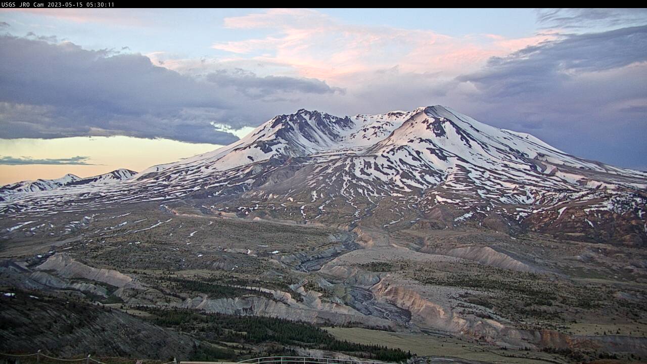
A debris flow in Mount St.

Most recent snapshot from Camera 2 at Madeira Beach, Florida. Camera hosted by Shoreline Island Resort.
Most recent snapshot from Camera 2 at Madeira Beach, Florida. Camera hosted by Shoreline Island Resort.

Two video cameras are installed atop a utility pole near the northernmost point of land in the United States at Nuvuk (Point Barrow), Alaska. The cameras point northwest toward the Arctic Ocean and the boundary between the Chukchi and Beaufort Seas. Every half hour during daylight hours, the cameras collect snapshots and video for 10 minutes.
Two video cameras are installed atop a utility pole near the northernmost point of land in the United States at Nuvuk (Point Barrow), Alaska. The cameras point northwest toward the Arctic Ocean and the boundary between the Chukchi and Beaufort Seas. Every half hour during daylight hours, the cameras collect snapshots and video for 10 minutes.

Two video cameras are installed atop a utility pole near the northernmost point of land in the United States at Nuvuk (Point Barrow), Alaska. The cameras point northwest toward the Arctic Ocean and the boundary between the Chukchi and Beaufort Seas. Every half hour during daylight hours, the cameras collect snapshots and video for 10 minutes.
Two video cameras are installed atop a utility pole near the northernmost point of land in the United States at Nuvuk (Point Barrow), Alaska. The cameras point northwest toward the Arctic Ocean and the boundary between the Chukchi and Beaufort Seas. Every half hour during daylight hours, the cameras collect snapshots and video for 10 minutes.

Two video cameras are installed atop a utility pole near the northernmost point of land in the United States at Nuvuk (Point Barrow), Alaska. The cameras point northwest toward the Arctic Ocean and the boundary between the Chukchi and Beaufort Seas. Every half hour during daylight hours, the cameras collect snapshots and video for 10 minutes.
Two video cameras are installed atop a utility pole near the northernmost point of land in the United States at Nuvuk (Point Barrow), Alaska. The cameras point northwest toward the Arctic Ocean and the boundary between the Chukchi and Beaufort Seas. Every half hour during daylight hours, the cameras collect snapshots and video for 10 minutes.

Two video cameras are installed atop a utility pole near the northernmost point of land in the United States at Nuvuk (Point Barrow), Alaska. The cameras point northwest toward the Arctic Ocean and the boundary between the Chukchi and Beaufort Seas. Every half hour during daylight hours, the cameras collect snapshots and video for 10 minutes.
Two video cameras are installed atop a utility pole near the northernmost point of land in the United States at Nuvuk (Point Barrow), Alaska. The cameras point northwest toward the Arctic Ocean and the boundary between the Chukchi and Beaufort Seas. Every half hour during daylight hours, the cameras collect snapshots and video for 10 minutes.
