U.S. flag

An official website of the United States government

National Water Census

Filter Total Items: 34

National Water Availability Assessments

The USGS National Water Availability Assessment consists of reports, which provide a scientific summary and interpretation of water quantity, quality and use, and the data companion, which delivers model-based estimates of water supply and demand.
link

National Water Availability Assessments

The USGS National Water Availability Assessment consists of reports, which provide a scientific summary and interpretation of water quantity, quality and use, and the data companion, which delivers model-based estimates of water supply and demand.
Learn More

Regional Water Availability Assessments

Regional Water Availability Assessments are scientific assessments of water availability in different hydrologic regions across the Nation. They are designed to capture a range of conditions in major drivers of water availability.
link

Regional Water Availability Assessments

Regional Water Availability Assessments are scientific assessments of water availability in different hydrologic regions across the Nation. They are designed to capture a range of conditions in major drivers of water availability.
Learn More

Integrated Water Availability Assessments

The USGS Water Resources Mission Area is assessing how much water is available for human and ecological needs in the United States and identifying where and when the Nation may have challenges meeting its demand for water.
link

Integrated Water Availability Assessments

The USGS Water Resources Mission Area is assessing how much water is available for human and ecological needs in the United States and identifying where and when the Nation may have challenges meeting its demand for water.
Learn More

Integrated Water Availability Assessments Fundamentals

The USGS Water Resources Mission Area is assessing how much water is available for human and ecological needs in the United States and identifying where and when the Nation may have challenges meeting its demand for water.
link

Integrated Water Availability Assessments Fundamentals

The USGS Water Resources Mission Area is assessing how much water is available for human and ecological needs in the United States and identifying where and when the Nation may have challenges meeting its demand for water.
Learn More

National Water Availability Assessment Data Companion

The National Water Availability Assessment Data Companion (NWDC) delivers model-based estimates of water supply and demand.
link

National Water Availability Assessment Data Companion

The National Water Availability Assessment Data Companion (NWDC) delivers model-based estimates of water supply and demand.
Learn More

Water Use

Through the Water Availability and Use Science Program, USGS will provide national information on withdrawal, conveyance, consumptive use, and return flow by water-use category at spatial and temporal resolutions important for risk-informed water management decisions. Water-use data provide a foundation for water managers to analyze trends over time, plan more strategically, identify, and...
link

Water Use

Through the Water Availability and Use Science Program, USGS will provide national information on withdrawal, conveyance, consumptive use, and return flow by water-use category at spatial and temporal resolutions important for risk-informed water management decisions. Water-use data provide a foundation for water managers to analyze trends over time, plan more strategically, identify, and...
Learn More

Water Use in the United States

Water use estimates for 2000 through 2020 are now available for the three largest categories of use in the United States: self-supplied thermoelectric power generation, self-supplied irrigation, and public supply. Five additional categories of use (self-supplied industrial, domestic, mining, livestock, and aquaculture) will be available in 2025.
link

Water Use in the United States

Water use estimates for 2000 through 2020 are now available for the three largest categories of use in the United States: self-supplied thermoelectric power generation, self-supplied irrigation, and public supply. Five additional categories of use (self-supplied industrial, domestic, mining, livestock, and aquaculture) will be available in 2025.
Learn More

Understanding Water Availability

The United States faces growing challenges to its water supply, and we need to know where there is not enough water, where we have more than we need, and the quality of the water. The USGS is charged with understanding and reporting on water availability including influences on water supply (how much water and of what quality) and water demand (how much water do humans and ecosystems need).
link

Understanding Water Availability

The United States faces growing challenges to its water supply, and we need to know where there is not enough water, where we have more than we need, and the quality of the water. The USGS is charged with understanding and reporting on water availability including influences on water supply (how much water and of what quality) and water demand (how much water do humans and ecosystems need).
Learn More

Drought Prediction Science

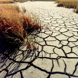
Drought is a prolonged and widespread deficit in available water supplies that creates multiple stressors across ecosystems and communities. The U.S. Geological Survey Water Mission Area conducts drought research and modeling to improve drought prediction capabilities. The research focus is on understanding the hydrological, ecological, and economic ramifications of drought. The modeling focus...
link

Drought Prediction Science

Drought is a prolonged and widespread deficit in available water supplies that creates multiple stressors across ecosystems and communities. The U.S. Geological Survey Water Mission Area conducts drought research and modeling to improve drought prediction capabilities. The research focus is on understanding the hydrological, ecological, and economic ramifications of drought. The modeling focus...
Learn More

Integrated Water Science (IWS) Basins

The U.S. Geological Survey is integrating its water science programs to better address the Nation’s greatest water resource challenges. At the heart of this effort are plans to intensively study at least 10 Integrated Water Science (IWS) basins — medium-sized watersheds (10,000-20,000 square miles) and underlying aquifers — over the next decade. The IWS basins will represent a wide range of...
link

Integrated Water Science (IWS) Basins

The U.S. Geological Survey is integrating its water science programs to better address the Nation’s greatest water resource challenges. At the heart of this effort are plans to intensively study at least 10 Integrated Water Science (IWS) basins — medium-sized watersheds (10,000-20,000 square miles) and underlying aquifers — over the next decade. The IWS basins will represent a wide range of...
Learn More

Principal Aquifers of the United States

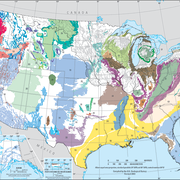
This website compiles USGS resources and data related to principal aquifers including Aquifer Basics, principal aquifers maps and GIS data, and the National Aquifer Code Reference List.
link

Principal Aquifers of the United States

This website compiles USGS resources and data related to principal aquifers including Aquifer Basics, principal aquifers maps and GIS data, and the National Aquifer Code Reference List.
Learn More

Total Water Use

The USGS has estimated water use for the United States every 5 years since 1950. Estimates are provided for groundwater and surface-water sources, for fresh and saline water quality, and by sector or category of use. Estimates have been made at the State level since 1950, and at the county level since 1985. Water-use estimates by watershed were made from 1950 through 1995, first at the water...
link

Total Water Use

The USGS has estimated water use for the United States every 5 years since 1950. Estimates are provided for groundwater and surface-water sources, for fresh and saline water quality, and by sector or category of use. Estimates have been made at the State level since 1950, and at the county level since 1985. Water-use estimates by watershed were made from 1950 through 1995, first at the water...
Learn More
Was this page helpful?