



Water Availability and Use
Water Availability and Use
Filter Total Items: 63

Withdrawals for Bottled Water
USGS is compiling data on locations and volumes of water withdrawals for bottled water production and learning how, when, and where bottled water withdrawals result in changes to groundwater levels, spring flows, and water quality.

USGS National Streamgaging Network
As of October 2024, the USGS Groundwater and Streamflow Information Program supports the collection and (or) delivery of both streamflow and water-level information at 8,705 sites and water-level information alone at 3,460 additional sites. The data are served online—most in near real-time—to meet many diverse needs including the protection of life, property, the environment, and our economy.

Integrated Water Prediction (IWP)
The USGS Integrated Water Prediction science program is focused on developing and improving model code, workflows, and applications of core water availability components at a national extent.

Hydrologic Instrumentation Facility (HIF) Construction
The U.S. Geological Survey, in partnership with the University of Alabama, is constructing a new Hydrologic Instrumentation Facility, a science and engineering facility that will support our water observing networks and research.

High-frequency Monitoring of Delta Island Drainage Waters
From the second half of the 19th century, land reclamation has transformed the Sacramento-San Joaquin Delta (Delta). The landscape of the Delta has gone from a network of shifting waterways and tidal marshland to channels and islands fixed in position by hardened levees.

Regional Water Availability Assessment: Upper Colorado River Basin
Regional Water Availability Assessments are scientific assessments of water availability in different hydrologic regions across the Nation. In the Upper Colorado River Basin, the USGS will conduct a focused assessment of how snowpack and snowmelt influence hydrology and water quality, and an integrated and comprehensive assessment of multiple water quantity, quality and use factors.

Regional Water Availability Assessment: Delaware River Basin
Regional Water Availability Assessments are scientific assessments of water availability in different hydrologic regions across the Nation. In the Delaware River Basin, the USGS will conduct a focused assessment of increasing freshwater salinity and an integrated and comprehensive assessment of multiple water quantity, quality and use factors.

Understanding Water Availability
The United States faces growing challenges to its water supply, and we need to know where there is not enough water, where we have more than we need, and the quality of the water. The USGS is charged with understanding and reporting on water availability including influences on water supply (how much water and of what quality) and water demand (how much water do humans and ecosystems need).
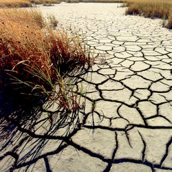
Drought Prediction Science
Drought is a prolonged and widespread deficit in available water supplies that creates multiple stressors across ecosystems and communities. The U.S. Geological Survey Water Mission Area conducts drought research and modeling to improve drought prediction capabilities. The research focus is on understanding the hydrological, ecological, and economic ramifications of drought. The modeling focus...

Future Streamflow Estimates for Tongue River to Enable Northern Cheyenne Data Driven Water Management and Planning
Atmospheric warming is driving: - a shift in precipitation from snow to rain - changing precipitation intensity and seasonality - increasing atmospheric demand for moisture in mountain river watersheds across the western United States (Seager and others, 2015). These changes will likely alter the timing and quantity of streamflow in rivers draining mountains. The Tongue River flows from the...

MODFLOW and Related Programs
MODFLOW is the USGS's modular hydrologic model. MODFLOW is considered an international standard for simulating and predicting groundwater conditions and groundwater/surface-water interactions. MODFLOW 6 is presently the core MODFLOW version distributed by the USGS.

Water-Use Data and Research (WUDR) program
The USGS Water-Use Data and Research (WUDR) program provides financial assistance through cooperative agreements with State water resource agencies to improve the availability, quality, compatibility, and delivery of water-use data that is collected or estimated by States.