Hawaiian Volcano Observatory
Find U.S. Volcano
Filters
Learn More
The map displays volcanoes, earthquakes, monitoring instruments, and past lava flows.
Earthquake Plots
To view an earthquake cross-sectional plot, click "Draw Plot" to start drawing on the map. Once the plot area is selected, click on "View Plot" to view chart or "Clear Plot" to start over.
Results
Filters
Learn More
The map displays volcanoes, earthquakes, monitoring instruments, and past lava flows.
Earthquake Plots
To view an earthquake cross-sectional plot, click "Draw Plot" to start drawing on the map. Once the plot area is selected, click on "View Plot" to view chart or "Clear Plot" to start over.
Settings
x
Map Legend
x
Map Legend
Results
Current Updates and Notifications
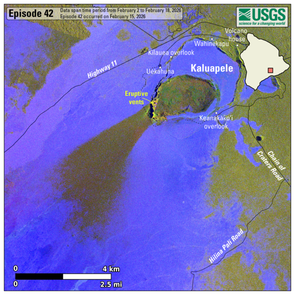
Kīlauea
orange WATCH, 2026-02-27 19:03:18 UTC
HVO monitors earthquakes and the active volcanoes in Hawaii, assesses their hazards, issues warnings, and advances scientific understanding to reduce the impacts of volcanic eruptions. Communicating the results of our work to the public, emergency managers, and the scientific community is an important aspect of the HVO mission.
Active Volcanoes in Hawaii
Active Volcanoes in Hawaii
Very High Threat Potential
Kīlauea
Mauna Loa
High Threat Potential
Hualālai
Moderate Threat Potential
Haleakalā
Mauna Kea
Not Ranked
Kama‘ehuakanaloa (Lō‘ihi Seamount)
View the threat rankings of US Volcanoes
News
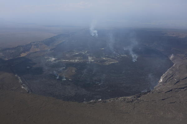
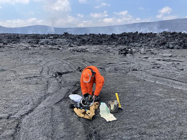
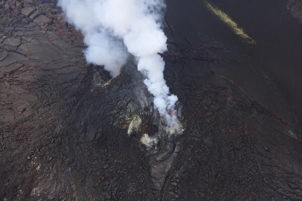
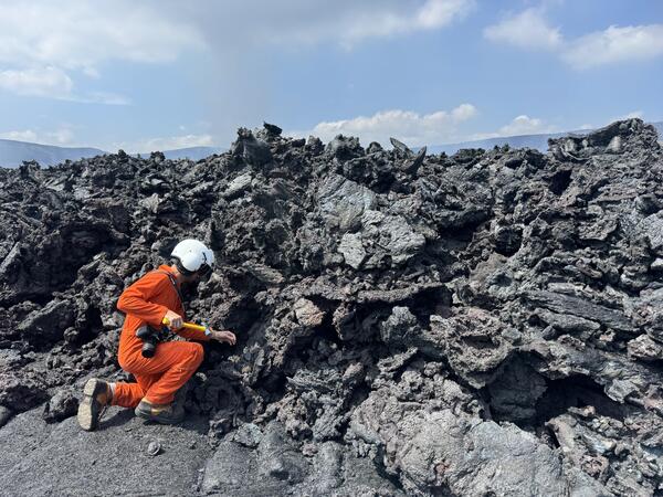
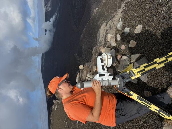
Photo & Video Chronology — February 26, 2026 — Kīlauea summit fieldwork and overflight
Photo & Video Chronology — February 26, 2026 — Kīlauea summit fieldwork and overflight
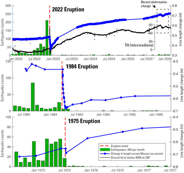
Volcano Watch — Mauna Loa has lessons to teach during quiet times
Volcano Watch — Mauna Loa has lessons to teach during quiet times
Volcano Watch — A sight to see: maintaining HVO’s webcams during a historic eruption