
A telephoto view of the northwestern point of the main island within Halema‘uma‘u crater, at Kīlauea summit. A rockfall scar (center left) remains after a small collapse of the island was observed by field geologists around 12:43 p.m. HST on April 20, 2021. A sliver of the active lava lake surface is visible at the bottom of this photo.
All Multimedia
Access all multimedia to include images, video, audio, webcams, before-after imagery, and more. Filter and explore with filtering options to refine search.
Filter Total Items: 24923

April 20, 2021 — Kīlauea lava lake and island
A telephoto view of the northwestern point of the main island within Halema‘uma‘u crater, at Kīlauea summit. A rockfall scar (center left) remains after a small collapse of the island was observed by field geologists around 12:43 p.m. HST on April 20, 2021. A sliver of the active lava lake surface is visible at the bottom of this photo.

April 20, 2021 — Kīlauea lava lake and rocks
A telephoto view of the southern lava lake crust and Halema‘uma‘u crater wall at the summit of Kīlauea. Many rockfalls from the steep and unstable crater walls of Halema‘uma‘u have deposited large boulders onto the stagnant lava surface over the past few months. This photo was taken from the west rim of Halema‘uma‘u looking southeast. USGS photo taken by L.
A telephoto view of the southern lava lake crust and Halema‘uma‘u crater wall at the summit of Kīlauea. Many rockfalls from the steep and unstable crater walls of Halema‘uma‘u have deposited large boulders onto the stagnant lava surface over the past few months. This photo was taken from the west rim of Halema‘uma‘u looking southeast. USGS photo taken by L.

April 20, 2021 — Kīlauea vent
A telephoto view of the west vent and lava lake inlet within Halema‘uma‘u crater at the summit of Kīlauea. Lava erupting from the west vent (upper left) continues to feed into the active lava lake through a wide inlet near the base of the cone (center right).
A telephoto view of the west vent and lava lake inlet within Halema‘uma‘u crater at the summit of Kīlauea. Lava erupting from the west vent (upper left) continues to feed into the active lava lake through a wide inlet near the base of the cone (center right).

April 21 - Halema‘uma‘u crater
A view of Halema‘uma‘u crater at the summit of Kīlauea Volcano, Island of Hawai‘i, showing the active western fissure with rising fumes, the active western portion of the lava lake (lighter colored area in the middle of the photo), and the big island within the lava lake (right).
A view of Halema‘uma‘u crater at the summit of Kīlauea Volcano, Island of Hawai‘i, showing the active western fissure with rising fumes, the active western portion of the lava lake (lighter colored area in the middle of the photo), and the big island within the lava lake (right).
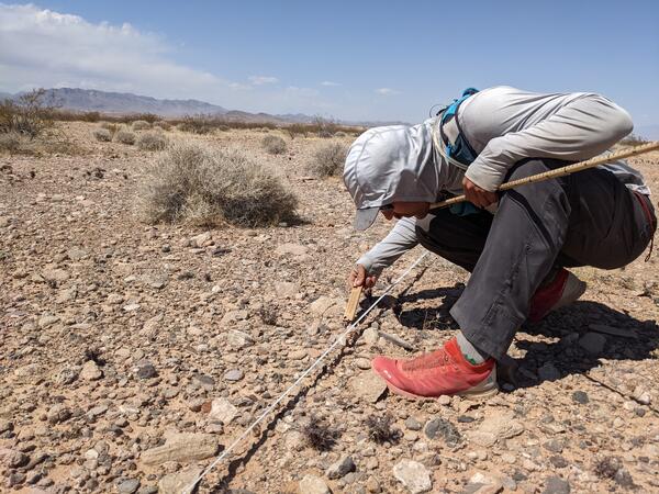
Pre-construction monitoring of vegetation for the Gemini Solar Array
Pre-construction monitoring of vegetation for the Gemini Solar ArrayThe United States is developing renewable energy resources, especially solar, at a rapid rate.
Pre-construction monitoring of vegetation for the Gemini Solar Array
Pre-construction monitoring of vegetation for the Gemini Solar ArrayThe United States is developing renewable energy resources, especially solar, at a rapid rate.

Kīlauea summit eruption four-month anniversary
April 20 was the four-month anniversary of Kīlauea's ongoing summit eruption in Halema‘uma‘u. This animated GIF features approximately one thermal image for each day of the eruption and demonstrates eruptive activity over the past four months. At 9:30 p.m.
April 20 was the four-month anniversary of Kīlauea's ongoing summit eruption in Halema‘uma‘u. This animated GIF features approximately one thermal image for each day of the eruption and demonstrates eruptive activity over the past four months. At 9:30 p.m.

Laser Flow in Storm Drain at Hampton Coliseum
The Region 1, April 2021 "Honorable Mention #1" Winner (by Chelsea Delsack)
The Region 1, April 2021 "Honorable Mention #1" Winner (by Chelsea Delsack)

Mitigating Hazards at Cascade Range Volcanoes
The 1980 eruption of Mount St. Helens was monumental in so many different ways. It had a huge impact on the geography of southwestern Washington, ash affected many people, lives were lost, and lessons were learned. The eruption also led to the creation of the USGS Cascades Volcano Observatory in Vancouver, Washington.
The 1980 eruption of Mount St. Helens was monumental in so many different ways. It had a huge impact on the geography of southwestern Washington, ash affected many people, lives were lost, and lessons were learned. The eruption also led to the creation of the USGS Cascades Volcano Observatory in Vancouver, Washington.

Photographs from a wild turkey found dead in Minnesota
Photographs from a wild turkey found dead in MinnesotaPhotographs from a wild turkey (Meleagris gallopavo) found dead in Minnesota, USA. (A) There are numerous multifocal to coalescing yellow proliferative lesions covering the eyelids, head, and neck with a region of ulceration and necrosis (*). (B) Yellow irregular plaques (arrow heads) multifocally cover the oral cavity.

Photomicrographs from a wild turkey found dead in Minnesota
Photomicrographs from a wild turkey found dead in MinnesotaPhotomicrographs from a wild turkey (Meleagris gallopavo) found dead in Minnesota, USA. (A) The normal epithelium becomes markedly thickened due to hyperplasia of the stratum spinosum (left to right) with regions of ulceration and crusting (arrow). H&E stain.
 Inspired Me to Become a Scientist?")
What (or who) Inspired Me to Become a Scientist?
Have you ever wondered what (or who) inspired our employees to become scientists? This video, created for the 2021 Bring a Kid to Work Day event, asks that question of a handful of USGS scientists.
Have you ever wondered what (or who) inspired our employees to become scientists? This video, created for the 2021 Bring a Kid to Work Day event, asks that question of a handful of USGS scientists.

What I Love About My Job
Have you ever wondered what it's like to work for the U.S. Geological Survey (USGS)? We asked a handful of our scientists what they love about their jobs. Here's what they had to say about that...
Have you ever wondered what it's like to work for the U.S. Geological Survey (USGS)? We asked a handful of our scientists what they love about their jobs. Here's what they had to say about that...

Eyes on Earth Episode 48 – Satellites and the Forest Census
Eyes on Earth Episode 48 – Satellites and the Forest CensusIt’s possible to map vegetation type with Landsat, but getting the maps right requires more than satellites alone. The teams behind LANDFIRE use an extensive network of ground control points to check their work, thereby bolstering the reliability and utility of their multi-layer GIS product suite.

Deciduous trees in Reston, Virginia
Decidous trees in Reston, Virginia. Photo taken for Arbor Day 2021 near USGS Headquarters.
Decidous trees in Reston, Virginia. Photo taken for Arbor Day 2021 near USGS Headquarters.
")
Kīlauea Lava Lake Inlet (April 17, 2021)
The lava lake in Halema‘uma‘u Crater, at the summit of Kīlauea Volcano, remains active. This video is shown at 20x speed and shows the lava supplying the lake from the western fissure.
The lava lake in Halema‘uma‘u Crater, at the summit of Kīlauea Volcano, remains active. This video is shown at 20x speed and shows the lava supplying the lake from the western fissure.
")
Kīlauea Summit Lava Lake (April 17, 2021)
The lava lake in Halema‘uma‘u Crater, at the summit of Kīlauea Volcano, remains active. This video is shown at 30x speed and shows the lava supplying the lake from the western fissure, with scattered crustal foundering across the lake surface.
The lava lake in Halema‘uma‘u Crater, at the summit of Kīlauea Volcano, remains active. This video is shown at 30x speed and shows the lava supplying the lake from the western fissure, with scattered crustal foundering across the lake surface.
")
Kīlauea West Fissure Spatter (April 17, 2021)
The lava lake in Halema‘uma‘u Crater, at the summit of Kīlauea Volcano, remains active. This video shows spattering from a small vent at the western fissure.
The lava lake in Halema‘uma‘u Crater, at the summit of Kīlauea Volcano, remains active. This video shows spattering from a small vent at the western fissure.

April 16, 2021: Overview of Halema‘uma‘u lava lake western portion
April 16, 2021: Overview of Halema‘uma‘u lava lake western portionDuring a Kīlauea summit helicopter overflight on Friday, April 16, an HVO scientist captured this photo of the erupting western fissure and surrounding lava lake within Halema‘uma‘u. The active western potion of the lava lake, as seen here, measured approximately 300 m (984 ft) from end-to-end at the time. USGS image.

April 19, 2021—Kīlauea summit eruption thermal map
April 19, 2021—Kīlauea summit eruption thermal mapA helicopter overflight on April 16, 2021, at approximately 12 p.m. HST allowed for aerial visual and thermal imagery to be collected of the eruption within Halema‘uma‘u crater at the summit of Kīlauea Volcano.

Halema‘uma‘u lava lake, Kīlauea summit eruption—April 16, 2021
Halema‘uma‘u lava lake, Kīlauea summit eruption—April 16, 2021A view of the lava lake from the east rim of Halema‘uma‘u Crater, at the summit of Kīlauea. The active portion of the lake is present at the far (western) end of the crater. USGS photo by M. Patrick on April 16, 2021.

Halema‘uma‘u lava lake, Kīlauea summit eruption—April 16, 2021
Halema‘uma‘u lava lake, Kīlauea summit eruption—April 16, 2021A view of the south margin of the perched lava lake in Halema‘uma‘u Crater, at the summit of Kīlauea. This photo was taken from the east rim of the crater, and shows the steep levee containing the lake. USGS photo by M. Patrick.