Zoomed image of a Sperm Whale (Physeter macrocephalus)
Zoomed image of a Sperm Whale (Physeter macrocephalus)Zoomed image of a Sperm Whale (Physeter macrocephalus) below the surface, with contrast increased for clarity.

Official websites use .gov
A .gov website belongs to an official government organization in the United States.
Secure .gov websites use HTTPS
A lock () or https:// means you’ve safely connected to the .gov website. Share sensitive information only on official, secure websites.
Access all multimedia to include images, video, audio, webcams, before-after imagery, and more. Filter and explore with filtering options to refine search.
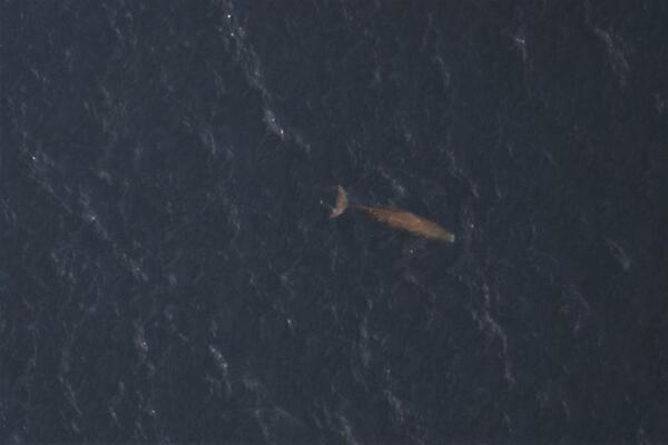
Zoomed image of a Sperm Whale (Physeter macrocephalus) below the surface, with contrast increased for clarity.
Zoomed image of a Sperm Whale (Physeter macrocephalus) below the surface, with contrast increased for clarity.

Annotated eruption photograph taken at 5 p.m. HST on December 30, 2020, from the south rim of Halemaʻumaʻu, Kīlauea Volcano summit. USGS photo by K. Lynn.
Annotated eruption photograph taken at 5 p.m. HST on December 30, 2020, from the south rim of Halemaʻumaʻu, Kīlauea Volcano summit. USGS photo by K. Lynn.

This video, taken with a telephoto lens from an observation location on the rim, shows a process called “foundering”, in which a segment of cool lava crust on the surface of the lava lake is overridden by less-dense liquid from below causing the crust to sink into the underlying lake lava.
This video, taken with a telephoto lens from an observation location on the rim, shows a process called “foundering”, in which a segment of cool lava crust on the surface of the lava lake is overridden by less-dense liquid from below causing the crust to sink into the underlying lake lava.

Video from a helicopter overflight of Kīlauea summit eruption on December 30, 2020, around 10:00 a.m., shows the western vents (area of bluish-colored gas emissions on left) erupting through crusted-over channels into a lava lake within Halema'uma'u crater.
Video from a helicopter overflight of Kīlauea summit eruption on December 30, 2020, around 10:00 a.m., shows the western vents (area of bluish-colored gas emissions on left) erupting through crusted-over channels into a lava lake within Halema'uma'u crater.

Photo Contest Winner | January 2021 | People
Jon Cohl ADCP at 01457400 Musconetcong Riegelsville
Photo Contest Winner | January 2021 | People
Jon Cohl ADCP at 01457400 Musconetcong Riegelsville

Watch the changes in the growing lava lake within Halema'uma'u crater in these thermal maps from December 21-30, 2020.
Watch the changes in the growing lava lake within Halema'uma'u crater in these thermal maps from December 21-30, 2020.

HVO field crews observed activity within Halema‘uma‘u, at Kīlauea Volcano's summit, overnight from within a closed area of Hawai‘i Volcanoes National Park. The area remains closed to the public for safety reasons and HVO field crews are equipped with a range of specialized safety gear and personal protective equipment.
HVO field crews observed activity within Halema‘uma‘u, at Kīlauea Volcano's summit, overnight from within a closed area of Hawai‘i Volcanoes National Park. The area remains closed to the public for safety reasons and HVO field crews are equipped with a range of specialized safety gear and personal protective equipment.

29 December 2020 - Kīlauea Volcano - US Geological Survey Hawaiian Volcano Observatory. This video, taken early morning on December 29, 2020, shows lava erupting from the west fissure in Halema‘uma‘u and pouring into the lava lake. Laser rangefinder measurements indicate that the opening lava pours from is 4-6 m (13-20 ft) wide. USGS video by H. Dietterich.
29 December 2020 - Kīlauea Volcano - US Geological Survey Hawaiian Volcano Observatory. This video, taken early morning on December 29, 2020, shows lava erupting from the west fissure in Halema‘uma‘u and pouring into the lava lake. Laser rangefinder measurements indicate that the opening lava pours from is 4-6 m (13-20 ft) wide. USGS video by H. Dietterich.

Incense cedar in the Sierra Nevada

This photo, taken at approximately 5:30 a.m. December 29, 2020, shows Kīlauea's ongoing summit eruption. The western vent in the wall of Halema‘uma‘u continued to erupt overnight, and the northern/eastern vent remained inactive. At approximately 3:45 a.m. HST today (Dec.
This photo, taken at approximately 5:30 a.m. December 29, 2020, shows Kīlauea's ongoing summit eruption. The western vent in the wall of Halema‘uma‘u continued to erupt overnight, and the northern/eastern vent remained inactive. At approximately 3:45 a.m. HST today (Dec.
")
Kīlauea Volcano, U.S. Geological Survey Hawaiian Volcano Observatory timelapse of thermal imagery showing Halema‘uma‘u west vents and lava entering the lava lake. This timelapse was taken over one hour, between approximately 10 and 11 p.m on December 29, 2020.
Kīlauea Volcano, U.S. Geological Survey Hawaiian Volcano Observatory timelapse of thermal imagery showing Halema‘uma‘u west vents and lava entering the lava lake. This timelapse was taken over one hour, between approximately 10 and 11 p.m on December 29, 2020.

HVO scientists monitor the ongoing Kīlauea summit eruption from within an area of Hawai‘i Volcanoes National Park that remains closed to the public for safety reasons. They are equipped with a range of specialized safety gear and personal protective equipment such as gas masks, helmets, gloves, and eye protection.
HVO scientists monitor the ongoing Kīlauea summit eruption from within an area of Hawai‘i Volcanoes National Park that remains closed to the public for safety reasons. They are equipped with a range of specialized safety gear and personal protective equipment such as gas masks, helmets, gloves, and eye protection.

This graphic depicts the changes to Kīlauea Volcano's summit resulting from the eruption that began on December 20, 2020. Pre-eruption topography of Halema'uma'u crater, collected in 2019, is shown on the left and compared to the topography at the summit on December 26, 2020.
This graphic depicts the changes to Kīlauea Volcano's summit resulting from the eruption that began on December 20, 2020. Pre-eruption topography of Halema'uma'u crater, collected in 2019, is shown on the left and compared to the topography at the summit on December 26, 2020.

Sunrise at the summit of Kīlauea, within Hawai‘i Volcanoes National Park, on the morning of December 28, 2020. Portions of Crater Rim Drive that down-dropped during Kīlauea's 2018 collapse events, are visible in the lower left. This area remains closed to the public due to hazardous conditions. USGS photo by C. Parcheta.
Sunrise at the summit of Kīlauea, within Hawai‘i Volcanoes National Park, on the morning of December 28, 2020. Portions of Crater Rim Drive that down-dropped during Kīlauea's 2018 collapse events, are visible in the lower left. This area remains closed to the public due to hazardous conditions. USGS photo by C. Parcheta.

A helicopter overflight yesterday (Dec. 28, 2020) at approximately 10:30 AM HST allowed for aerial visual and thermal imagery to be collected of the new eruption within Halema'uma'u crater at the summit of Kīlauea Volcano. This preliminary thermal map shows that the lake area has not changed significantly since the thermal map that was made on December 26.
A helicopter overflight yesterday (Dec. 28, 2020) at approximately 10:30 AM HST allowed for aerial visual and thermal imagery to be collected of the new eruption within Halema'uma'u crater at the summit of Kīlauea Volcano. This preliminary thermal map shows that the lake area has not changed significantly since the thermal map that was made on December 26.

Social scientists at the U.S. Geological Survey (USGS) Fort Collins Science Center – in collaboration with the USGS National Land Imaging Program – conduct Earth observation user case studies using qualitative research methods.
Social scientists at the U.S. Geological Survey (USGS) Fort Collins Science Center – in collaboration with the USGS National Land Imaging Program – conduct Earth observation user case studies using qualitative research methods.

Social scientists at the U.S. Geological Survey (USGS) Fort Collins Science Center – in collaboration with the USGS National Land Imaging Program – conduct Earth observation user case studies using qualitative research methods.
Social scientists at the U.S. Geological Survey (USGS) Fort Collins Science Center – in collaboration with the USGS National Land Imaging Program – conduct Earth observation user case studies using qualitative research methods.

HVO scientists use a laser rangefinder to measure the distance to the lava lake surface at Kīlauea's summit.
HVO scientists use a laser rangefinder to measure the distance to the lava lake surface at Kīlauea's summit.

HVO field crews observed the continuing eruption in Halema‘uma‘u at Kīlauea's summit early this morning. Overnight, the western vent in the wall of Halema‘uma‘u continued to erupt, and the northern/eastern vent remained inactive. At approximately 4:30 a.m. HST today (Dec. 28), HVO field crews measured the lava lake as 179 m (586 ft) deep.
HVO field crews observed the continuing eruption in Halema‘uma‘u at Kīlauea's summit early this morning. Overnight, the western vent in the wall of Halema‘uma‘u continued to erupt, and the northern/eastern vent remained inactive. At approximately 4:30 a.m. HST today (Dec. 28), HVO field crews measured the lava lake as 179 m (586 ft) deep.

The eruption with Halema‘uma‘u continues on the evening of December 28, 2020. This photo shows an HVO scientist making observations of Kīlauea's summit lava lake, with Mauna Loa in the background. HVO scientists have been monitoring the eruption from within an area of Hawai‘i Volcanoes National Park that remains closed to the public for safety reasons.
The eruption with Halema‘uma‘u continues on the evening of December 28, 2020. This photo shows an HVO scientist making observations of Kīlauea's summit lava lake, with Mauna Loa in the background. HVO scientists have been monitoring the eruption from within an area of Hawai‘i Volcanoes National Park that remains closed to the public for safety reasons.

Lava flowing from the western fissure vent feeds multiple channels. This video was taken by Hawaiian Volcano Observatory's geology field team on December 28, 2020, from 2:30 to 5:30 p.m. The team is located at an observation point on the rim of Halema‘uma‘u crater, and is using a telephoto lens to document fissure behavior.
Lava flowing from the western fissure vent feeds multiple channels. This video was taken by Hawaiian Volcano Observatory's geology field team on December 28, 2020, from 2:30 to 5:30 p.m. The team is located at an observation point on the rim of Halema‘uma‘u crater, and is using a telephoto lens to document fissure behavior.