
A Valentine's Day 2017 view of Kīlauea Volcano's summit lava lake, here the surface of the lake is about 21 m (69 ft) below the vent rim. The lake diameter is about 255 m or 840 ft. Careful tracking of the amount of ash emitted by lake processes suggest an important new insight into the supply of magma to Kīlauea's summit. USGS Photo.
Images
Explore our planet through photography and imagery, including climate change and water all the way back to the 1800s when the USGS was surveying the country by horse and buggy.
Filter Total Items: 21345

Pulsing magma supply detected at Kīlauea
A Valentine's Day 2017 view of Kīlauea Volcano's summit lava lake, here the surface of the lake is about 21 m (69 ft) below the vent rim. The lake diameter is about 255 m or 840 ft. Careful tracking of the amount of ash emitted by lake processes suggest an important new insight into the supply of magma to Kīlauea's summit. USGS Photo.

Sluggish breakout on Kīlauea's coastal plain remains active
Sluggish breakout on Kīlauea's coastal plain remains activeThe surface breakout that started on February 10 remains active on the coastal plain just east of the main episode 61g lava flow field. The flow front, pictured here, advanced to about 300 m (0.2 miles) from the emergency access road in Hawai‘i Volcanoes National Park, but appeared to be stalled this afternoon.

Sumner Dam
Sunset after installing an Acoustic Doppler Velocity Meter at Fort Sumner Main Canal near Fort Sumner, NM
Sunset after installing an Acoustic Doppler Velocity Meter at Fort Sumner Main Canal near Fort Sumner, NM

Hydro techs inspect water quality sensors
Hydrologic technicians Joe Beman and Hal Nelson remove a deployed sensor for cleaning and recalibration, as needed. This sensor is left in place to continuously log water quality parameters.
Hydrologic technicians Joe Beman and Hal Nelson remove a deployed sensor for cleaning and recalibration, as needed. This sensor is left in place to continuously log water quality parameters.

Hydro techs inspecting water quality sensor
Several New Mexico Water Science Center staff attended Continuous Water Quality Training, taught by Mike Nyman of the Texas Water Science Center and Lauren Sherson of the New Mexico Water Science Center. The course covered rationale for collecting continuous water quality data; field techniques for in
Several New Mexico Water Science Center staff attended Continuous Water Quality Training, taught by Mike Nyman of the Texas Water Science Center and Lauren Sherson of the New Mexico Water Science Center. The course covered rationale for collecting continuous water quality data; field techniques for in

Santa Maria River Flooding
A USGS hydrologic technician takes streamflow measurements during flooding of the Sisquoc River, a tributary of the Santa Maria River, near the town of Garey in Santa Barbara County.
A USGS hydrologic technician takes streamflow measurements during flooding of the Sisquoc River, a tributary of the Santa Maria River, near the town of Garey in Santa Barbara County.

USGS WERC scientist Emma Kelsey doing seabird monitoring research
USGS WERC scientist Emma Kelsey doing seabird monitoring researchUSGS WERC scientist Emily (Emma) Kelsey doing seabird monitoring research on Prisoner Rock.
USGS WERC scientist Emma Kelsey doing seabird monitoring research
USGS WERC scientist Emma Kelsey doing seabird monitoring researchUSGS WERC scientist Emily (Emma) Kelsey doing seabird monitoring research on Prisoner Rock.

Buras water tank, eye of Hurricane Katrina made its strongest landfall
Buras water tank, eye of Hurricane Katrina made its strongest landfallNew Orleans, La., July 29, 2008 -- Buras has become famous as the location where, on August 29, 2005, at 6:10 AM CDT, the eye of Hurricane Katrina, made its strongest landfall. The town's freshing painted water tower stands as a symbol of recovery for the state and the community. Jacinta Quesada/FEMA

Cracked mud flats in a small retention basin, near Jericho, West Bank
Cracked mud flats in a small retention basin, near Jericho, West BankCracked mud flats in retention basin, near Jericho, West Bank, showing raindrop impressions
Cracked mud flats in a small retention basin, near Jericho, West Bank
Cracked mud flats in a small retention basin, near Jericho, West BankCracked mud flats in retention basin, near Jericho, West Bank, showing raindrop impressions

R/V Barnes with USGS seismic system
University of Washington's research vessel R/V Barnes is loaded with the USGS multichannel seismic system components GeoEel, Chirp, and boom plates.
University of Washington's research vessel R/V Barnes is loaded with the USGS multichannel seismic system components GeoEel, Chirp, and boom plates.

San Francisco Bay and Delta DEM
High-resolution (10-meter per pixel) digital elevation model (DEM) of the Sacramento-San Joaquin Delta, using both bathymetry and topography data relative to current modern datum of North American Vertical Datum of 1988 (NAVD88). This DEM is the result of collaborative efforts of the U.S.
High-resolution (10-meter per pixel) digital elevation model (DEM) of the Sacramento-San Joaquin Delta, using both bathymetry and topography data relative to current modern datum of North American Vertical Datum of 1988 (NAVD88). This DEM is the result of collaborative efforts of the U.S.
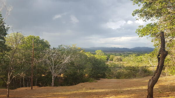
Dry Forest in Guanica
Dry Forest in southern Puerto Rico (Guánica municipality). Climate change is projected to make dry landscapes such as these even drier.
Dry Forest in southern Puerto Rico (Guánica municipality). Climate change is projected to make dry landscapes such as these even drier.

Kolobeh Vody pre Keti, The Water Cycle for Schools, Slovak
Kolobeh Vody pre Keti, The Water Cycle for Schools, SlovakKolobeh Vody pre školy, The Water Cycle for Schools, Slovakian
Geologická služba Spojených štátov (USGS) a Organizácia OSN pre vý živu a poĺnohospodárstvo (FAO) vytvorili pre deti a žiakov základných škôl schému kolobehu vody.

Vodni krog za otroke - The Water Cycle for Kids, Slovenian
Vodni krog za otroke - The Water Cycle for Kids, SlovenianVodni krog za otroke, The water cycle for kids, Slovene
U.S. Geological Survey (USGS) ter Organizacija Združenih narodov za prehrano in kmetijstvo (FAO) sta oblikovali diagram vodnega kroga za otroke ter za osnovne in srednje šole.

WERC Scientist Searches for Waterfowl Predators
USGS field scientist uses radio telemetry to search for skunks and raccoons tagged with lightweight radio collars. USGS is monitoring skunk and raccoon movements across California's inland marshes to understand how they are using different features of the landscape, like levee roads, to navigate to waterfowl nests.
USGS field scientist uses radio telemetry to search for skunks and raccoons tagged with lightweight radio collars. USGS is monitoring skunk and raccoon movements across California's inland marshes to understand how they are using different features of the landscape, like levee roads, to navigate to waterfowl nests.

ວັດທະຈັກ ນໍ້າ ສໍາລັບ ໂຮງຮຽນ - The Water Cycle, Lao
ວັດທະຈັກ ນໍ້າ ສໍາລັບ ໂຮງຮຽນ - The Water Cycle, Laoວັດທະຈັກ ນໍ້າ ສໍາລັບ ໂຮງຮຽນ - The Water Cycle, Lao
ການສໍາຫຼວດ ພູມສັນຖານ (USGS) ແລະ ອົງການອາຫານ ແລະ ການກະເສດ ຂອງ ສະຫະປະຊາຊາດ (FAO) ໄດ້ສ້າງ ຮູບພາບກ່ຽວກັບ ວັດທະຈັກ ນໍ້າ ສໍາລັບ ໂຮງຮຽນ
ວັດທະຈັກ ນໍ້າ ສໍາລັບ ໂຮງຮຽນ - The Water Cycle, Lao
ວັດທະຈັກ ນໍ້າ ສໍາລັບ ໂຮງຮຽນ - The Water Cycle, Laoວັດທະຈັກ ນໍ້າ ສໍາລັບ ໂຮງຮຽນ - The Water Cycle, Lao
ການສໍາຫຼວດ ພູມສັນຖານ (USGS) ແລະ ອົງການອາຫານ ແລະ ການກະເສດ ຂອງ ສະຫະປະຊາຊາດ (FAO) ໄດ້ສ້າງ ຮູບພາບກ່ຽວກັບ ວັດທະຈັກ ນໍ້າ ສໍາລັບ ໂຮງຮຽນ

Rainfall and Landslides in Northern CA
Shallow landslides damaged homes and closed many roads in the San Francisco East Bay region as a result of storms in January and February, 2017.
Shallow landslides damaged homes and closed many roads in the San Francisco East Bay region as a result of storms in January and February, 2017.

A USGS Hydrologic Technician installs a new streamgage
A USGS Hydrologic Technician installs a new streamgageU.S. Geological Survey Hydrologic Technician Patrick Anzman installs a new streamgage February 23 over the Schuylkill River in the Philadelphia neighborhood of Manayunk. Photo by Mason Manis, USGS.

Chopping several feet of ice to access Black Canyon Creek, Feb 2017
Chopping several feet of ice to access Black Canyon Creek, Feb 2017Chopping several feet of ice to access Black Canyon Creek
Chopping several feet of ice to access Black Canyon Creek, Feb 2017
Chopping several feet of ice to access Black Canyon Creek, Feb 2017Chopping several feet of ice to access Black Canyon Creek

Remotely measuring the temperature of Kīlauea lava
Remotely measuring the temperature of Kīlauea lavaA U.S. Geological Survey scientist used a custom-built, high-speed camera to remotely measure the temperature of spattering lava on the surface of Kīlauea Volcano's summit lava lake (background). This particular experiment, conducted from the Jaggar Museum overlook in Hawai‘i Volcanoes National Park on December 10, 2016, was part of a NASA-funded research project.

Scarlett Howell with Least Bell's Vireo
USGS ecologist Scarlett Howell holds an endangered Least Bell's Vireo in Baja California, Mexico.
USGS ecologist Scarlett Howell holds an endangered Least Bell's Vireo in Baja California, Mexico.