
As Florence rains, rivers keep rising, submerging some USGS instrument
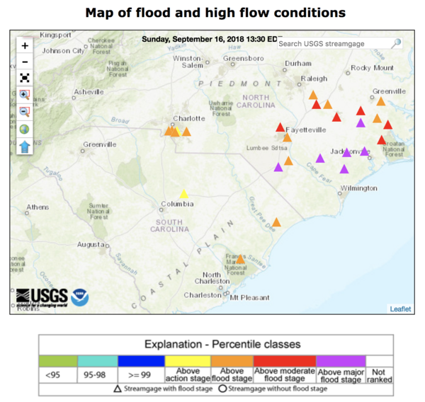
As Florence rains, rivers keep rising, submerging some USGS instrumentA WaterWatch web map shows streamgages in North and South Carolina that approached or exceeded major flood stage EST on September 19, 2018, as the former Hurricane Florence, now downgraded to a tropical depression, deluged the states with rain.


