
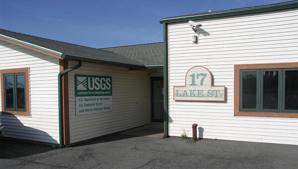
The Lake Erie Biological Station in Oswego, NY. Go to our Stations page to learn more.
Images
Explore our planet through photography and imagery, including climate change and water all the way back to the 1800s when the USGS was surveying the country by horse and buggy.
Filter Total Items: 21343
The Lake Ontario Biological Station
The Lake Erie Biological Station in Oswego, NY. Go to our Stations page to learn more.
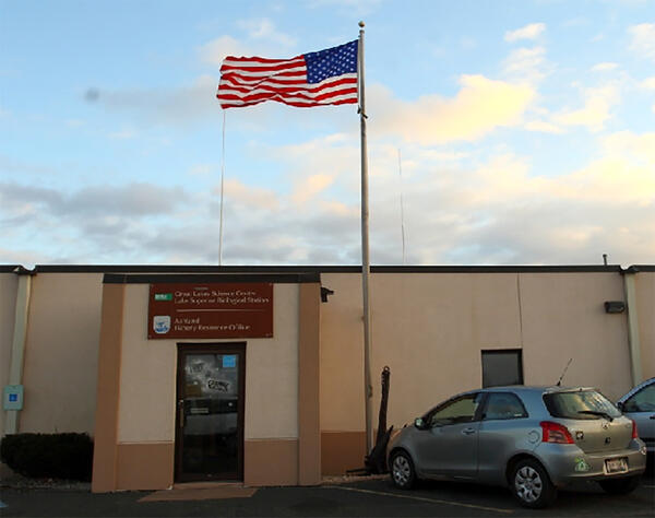
The Lake Superior Biological Station
The Lake Superior Biological Station. See our Location page for more information.
The Lake Superior Biological Station. See our Location page for more information.

Tunison Laboratory of Aquatic Science
The Tunison Laboratory of Aquatic Science. See our Locations page for more information.
The Tunison Laboratory of Aquatic Science. See our Locations page for more information.

USGS Bulletins at USGS Library in Reston
USGS Library has an extensive collection of USGS publications, including the bulletins pictured here.
By
USGS Library has an extensive collection of USGS publications, including the bulletins pictured here.
By

USGS Bulletins in USGS Library, Reston
Part of USGS Library collections is USGS publications, like the bulletins pictured here.
By
Part of USGS Library collections is USGS publications, like the bulletins pictured here.
By

Water Availability and Use Program Studies
Map of Water Availability and Use Program Studies from USGS Circular 1440 "Continuing Progress toward a national Assessment of Water Availability and Use."
Map of Water Availability and Use Program Studies from USGS Circular 1440 "Continuing Progress toward a national Assessment of Water Availability and Use."

Drainage area contributing to Big Creek below Lookout Creek, nr Apgar
Drainage area contributing to Big Creek below Lookout Creek, nr ApgarDrainage area contributing to Big Creek below Lookout Creek, near Apgar
Drainage area contributing to Big Creek below Lookout Creek, nr Apgar
Drainage area contributing to Big Creek below Lookout Creek, nr ApgarDrainage area contributing to Big Creek below Lookout Creek, near Apgar

Examining data aboard on boat
USGS scientist looking at laptop on boat
USGS scientist looking at laptop on boat

Hallowat Creek abv Kletomus Ck, nr Olney (12355342) streamgage
Hallowat Creek abv Kletomus Ck, nr Olney (12355342) streamgageHallowat Creek abv Kletomus Ck, nr Olney (12355342) streamgage
Hallowat Creek abv Kletomus Ck, nr Olney (12355342) streamgage
Hallowat Creek abv Kletomus Ck, nr Olney (12355342) streamgageHallowat Creek abv Kletomus Ck, nr Olney (12355342) streamgage

Hallowat Creek abv Kletomus Ck, nr Olney (12355342) streamgage
Hallowat Creek abv Kletomus Ck, nr Olney (12355342) streamgageHallowat Creek abv Kletomus Ck, nr Olney (12355342) streamgage
Hallowat Creek abv Kletomus Ck, nr Olney (12355342) streamgage
Hallowat Creek abv Kletomus Ck, nr Olney (12355342) streamgageHallowat Creek abv Kletomus Ck, nr Olney (12355342) streamgage

Hurricane Florence will erode or overwash beaches
The USGS Coastal Change Hazards Storm Team has forecast coast-wide levels of beach erosion, inundation and overwash due to Hurricane Florence's expected path and landgfall.
The USGS Coastal Change Hazards Storm Team has forecast coast-wide levels of beach erosion, inundation and overwash due to Hurricane Florence's expected path and landgfall.

Sea water levels to go up, stay up as Florence affects coast
Sea water levels to go up, stay up as Florence affects coastThe Coastal Change Hazards Storm Team has forecast changing water levels at specific locations over time.
Sea water levels to go up, stay up as Florence affects coast
Sea water levels to go up, stay up as Florence affects coastThe Coastal Change Hazards Storm Team has forecast changing water levels at specific locations over time.

Yellow Creek near Oak Grove, IN - downstream view
Yellow Creek near Oak Grove, IN - downstream view

Big Creek below Lookout Creek, near Apgar (site 12355347)
Big Creek below Lookout Creek, near Apgar (site 12355347)Big Creek below Lookout Creek, near Apgar (site 12355347)
Big Creek below Lookout Creek, near Apgar (site 12355347)
Big Creek below Lookout Creek, near Apgar (site 12355347)Big Creek below Lookout Creek, near Apgar (site 12355347)

USGS Scientists Get Ready for Hurricanes
A USGS hydrologic scientist installs a storm-tide sensor near the North Carolina coast as Hurricane Florence approaches.
A USGS hydrologic scientist installs a storm-tide sensor near the North Carolina coast as Hurricane Florence approaches.

USGS Storm-Tide Sensor for Hurricane Florence
A USGS storm-tide sensor, deployed in advance of Hurricane Florence's landfall. The sensors are housed in vented steel pipes a few inches wide and about a foot long. They are being installed on bridges, piers, and other structures that have a good chance of surviving the storm.
A USGS storm-tide sensor, deployed in advance of Hurricane Florence's landfall. The sensors are housed in vented steel pipes a few inches wide and about a foot long. They are being installed on bridges, piers, and other structures that have a good chance of surviving the storm.

USGS storm-tide sensor installed for Hurricane Florence
USGS storm-tide sensor installed for Hurricane FlorenceThis USGS storm-tide sensor was installed Sept. 9 in Dare County, North Carolina, in preparation for Hurricane Florence. Photo by Steve Harden, USGS.
USGS storm-tide sensor installed for Hurricane Florence
USGS storm-tide sensor installed for Hurricane FlorenceThis USGS storm-tide sensor was installed Sept. 9 in Dare County, North Carolina, in preparation for Hurricane Florence. Photo by Steve Harden, USGS.

Beetle Damage in the Black Hills
Mountain pine beetles are about the size of a grain of rice, so of course we can’t see them from space in satellite images. What is visible is what the beetles can do to a pine forest. The washed-out pink color indicates large areas of standing dead or damaged trees.
Mountain pine beetles are about the size of a grain of rice, so of course we can’t see them from space in satellite images. What is visible is what the beetles can do to a pine forest. The washed-out pink color indicates large areas of standing dead or damaged trees.

Peace at dusk
USGS oceanographer Shawn Harrison stands on the coastal bluff of Barter Island, Alaska at sunset. Shawn and his fellow researchers are studying how the highly erosive bluff changes under the varied conditions experienced by this stretch of coastline.
USGS oceanographer Shawn Harrison stands on the coastal bluff of Barter Island, Alaska at sunset. Shawn and his fellow researchers are studying how the highly erosive bluff changes under the varied conditions experienced by this stretch of coastline.

Geothermal seep that flows into Yellowstone River, LaDuke Hot Springs
Geothermal seep that flows into Yellowstone River, LaDuke Hot SpringsView of one of the geothermal seeps that flows into the Yellowstone River south of LaDuke Hot Spring.
Geothermal seep that flows into Yellowstone River, LaDuke Hot Springs
Geothermal seep that flows into Yellowstone River, LaDuke Hot SpringsView of one of the geothermal seeps that flows into the Yellowstone River south of LaDuke Hot Spring.

Landsat 8 image of the Apostle Islands in Lake Superior
Landsat 8 image of the Apostle Islands in Lake SuperiorCitation: Citation_Information: Originator: U.S.
Landsat 8 image of the Apostle Islands in Lake Superior
Landsat 8 image of the Apostle Islands in Lake SuperiorCitation: Citation_Information: Originator: U.S.