Kīlauea Volcano — Satellite View of Kīlauea Summit
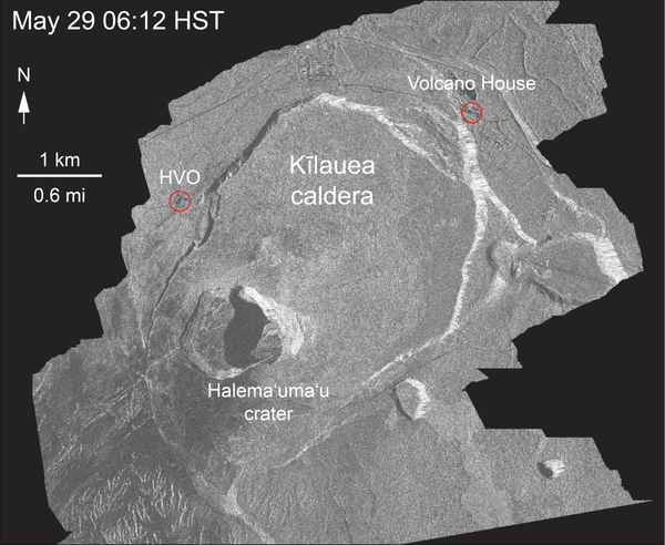
Kīlauea Volcano — Satellite View of Kīlauea SummitThe WorldView-3 satellite acquired this view of Kīlauea's summit on July 3. Despite a few clouds, the area of heaviest fractures in the caldera is clear. Views into the expanding Halema‘uma‘u crater reveal a pit floored by rubble. HVO, on the northwest caldera rim, is labeled.