U.S. flag

An official website of the United States government

Images

Explore our planet through photography and imagery, including climate change and water all the way back to the 1800s when the USGS was surveying the country by horse and buggy.

Filter Total Items: 21366
Der Wasserkreislauf für Kinder - The Water Cycle for Schools, German

Der Wasserkreislauf für Kinder

Du denkst vielleicht, jeder Regentropfen, der vom Himmel fällt, oder jedes Glas Wasser, das du trinkst, ist nagelneu, aber das asser ist schon immer da, und es ist Teil des Wasserkreislaufs.

Der Wasserkreislauf für Kinder

Du denkst vielleicht, jeder Regentropfen, der vom Himmel fällt, oder jedes Glas Wasser, das du trinkst, ist nagelneu, aber das asser ist schon immer da, und es ist Teil des Wasserkreislaufs.

Color photograph showing volcanic eruption and volcanic gas plume
Kīlauea LERZ fissure 8 on June 19, 2018

A thick, dense plume of SO2 and other volcanic gases billows from the lava fountains at fissure 8 on June 19, 2018. SO2 emission rates during the 2018 eruption of Kīlauea were so high that they required a new data analysis technique.

A thick, dense plume of SO2 and other volcanic gases billows from the lava fountains at fissure 8 on June 19, 2018. SO2 emission rates during the 2018 eruption of Kīlauea were so high that they required a new data analysis technique.

Kīlauea lower East Rift Zone lava flows and fissures, June 19, 1:00...
Kīlauea LERZ lava flows and fissures, June 19, 1:00 p.m.

Map as of 1:00 p.m. HST, June 19, 2018. Given the dynamic nature of Kīlauea's lower East Rift Zone eruption, with changing vent locations, fissures starting and stopping, and varying rates of lava effusion, map details shown here are accurate as of the date/time noted. Shaded purple areas indicate lava flows erupted in 1840, 1955, 1960, and 2014-2015.

Map as of 1:00 p.m. HST, June 19, 2018. Given the dynamic nature of Kīlauea's lower East Rift Zone eruption, with changing vent locations, fissures starting and stopping, and varying rates of lava effusion, map details shown here are accurate as of the date/time noted. Shaded purple areas indicate lava flows erupted in 1840, 1955, 1960, and 2014-2015.

Close up of an eruption
Kīlauea Volcano — Fissure 8 Eruption (June 18-19, 2018)

Fissure 8 vigor increased overnight June 18-19 with lava fountains reaching up to 60 m (200 ft). Spatter built up the cone to the east and into the channel.

Aerial view of lava channel coming from a lava fountain
Kīlauea Volcano — Fissure 8 Lava Channel

Fissure 8 cone, lava fountain, and channelized lava flow on the morning overflight - June 19 at about 6:10am HST. The lava channel is very full with many small overflows visible on the channel margins. Overflows are sluggish and move slowly downslope as they build up the levees.

Fissure 8 cone, lava fountain, and channelized lava flow on the morning overflight - June 19 at about 6:10am HST. The lava channel is very full with many small overflows visible on the channel margins. Overflows are sluggish and move slowly downslope as they build up the levees.

View of the lava channel
Kīlauea Volcano — Fissure 8 Lava Flow

The northern channel margin of the fissure 8 lava flow. Small hill in the distance is the site of our PGcam. Overflows from the channel can be seen producing shiny black to silver pahoehoeflows (incandescent red breakout visible in center of photo).

The northern channel margin of the fissure 8 lava flow. Small hill in the distance is the site of our PGcam. Overflows from the channel can be seen producing shiny black to silver pahoehoeflows (incandescent red breakout visible in center of photo).

Relict Acropora palmata coral-reef framework in the Dry Tortugas National Park
Relict Acropora palmata coral-reef framework in the Dry Tortugas

Acropora palmata coral-reef framework in the Dry Tortugas National Park, Florida Keys built more than 3000 years ago. That framework, which serves as the foundation for all of the critical ecosystem services reefs provide to society, is now rapidly eroding away.

Acropora palmata coral-reef framework in the Dry Tortugas National Park, Florida Keys built more than 3000 years ago. That framework, which serves as the foundation for all of the critical ecosystem services reefs provide to society, is now rapidly eroding away.

Relict Holocene coral-reef framework in the Dry Tortugas National Park

Relict Holocene coral-reef framework in the Florida Keys. Like many reefs in the western Atlantic, reefs here were just a few coral species: primary Acropora palmata and Orbicella spp. Recent disturbances have led to declines in the populations of those corals and relative increases in the abundance of more weedy taxa.

Relict Holocene coral-reef framework in the Florida Keys. Like many reefs in the western Atlantic, reefs here were just a few coral species: primary Acropora palmata and Orbicella spp. Recent disturbances have led to declines in the populations of those corals and relative increases in the abundance of more weedy taxa.

Diagram showing source and use of water in the U.S. in 2015, by category
Source and use of water in the U.S. in 2015

Source and Use of Water in the United States, 2015

This diagram uses a "cylinder and pipe" layout to show the source (surface water or groundwater) of the Nation's water and for what purposes the water was used in 2015. The data are broken out for each category of use by surface water and groundwater as the source.

Kīlauea lower East Rift Zone lava flows and fissures, June 18, 9:00...
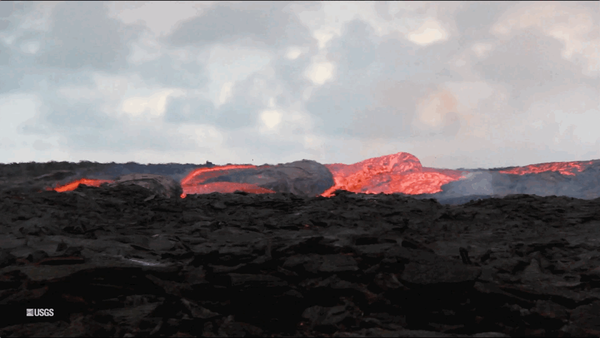
Kīlauea LERZ lava flows and fissures, June 18, 9:00 a.m.

Map as of 9:00 a.m. HST, June 18, 2018. Given the dynamic nature of Kīlauea's lower East Rift Zone eruption, with changing vent locations, fissures starting and stopping, and varying rates of lava effusion, map details shown here are accurate as of the date/time noted. Shaded purple areas indicate lava flows erupted in 1840, 1955, 1960, and 2014-2015.

Map as of 9:00 a.m. HST, June 18, 2018. Given the dynamic nature of Kīlauea's lower East Rift Zone eruption, with changing vent locations, fissures starting and stopping, and varying rates of lava effusion, map details shown here are accurate as of the date/time noted. Shaded purple areas indicate lava flows erupted in 1840, 1955, 1960, and 2014-2015.

Lava fountaining at night time.
Kīlauea Volcano —
Kīlauea Volcano —
Kīlauea Volcano —

Fissure 8 lava fountains obscured by a longer exposure photograph taken early morning on June 18. The incandescent spots along a horizontal line mark the edge of the lava channel.

Fissure 8 lava fountains obscured by a longer exposure photograph taken early morning on June 18. The incandescent spots along a horizontal line mark the edge of the lava channel.

Aerial view of fissure 6
Kīlauea Volcano — Fissure 6

Fissure 6 (photo center) showed signs of activity overnight, producing small amounts of spatter and feeding short lava flows. Fissure 6 is located about 2.2 km (1.4 mi) downrift from Fissure 8.

Fissure 6 (photo center) showed signs of activity overnight, producing small amounts of spatter and feeding short lava flows. Fissure 6 is located about 2.2 km (1.4 mi) downrift from Fissure 8.

Aerial view of lava channels
Kīlauea Volcano — Fissure 8 Lava Channels

Fissure 8 lava flows in an open channel all the way to the ocean. Kapoho Crater is the vegetated hill on the right side of the photograph.

Looking at a crater with steam rising from cracks
Kīlauea Volcano — Halema`uma`u Crater

North side of the growing Halema‘uma‘u crater, marked by large cracks and large blocks that have slumped into the crater.

Kīlauea Volcano — Halema`uma`u Crater (with HVO)

During the helicopter overflight on June 18, crews captured this image of the growing Halema‘uma‘u crater viewed to the southeast.

View of a crater with many cracks from slumping
Kīlauea Volcano — Halema‘uma‘u Crater (June 18, 2018)

Halema‘uma‘u viewed toward the west during the June 18 helicopter overflight. HVO and Jaggar Museum can barely be seen on the caldera rim in the upper right of the photograph.

Crater slumping with cracks
Kīlauea Volcano — Halema‘uma‘u Crater Slumping

An overflight of Kīlauea's summit on June 18 showed the continued dramatic slumping and collapse of the Halema‘uma‘u crater area. This photo shows the area north-northwest of Halema‘uma‘u near a GPS station, North Pit. This station has subsided about 60 m (197 ft) in the past week. 

An overflight of Kīlauea's summit on June 18 showed the continued dramatic slumping and collapse of the Halema‘uma‘u crater area. This photo shows the area north-northwest of Halema‘uma‘u near a GPS station, North Pit. This station has subsided about 60 m (197 ft) in the past week. 

Animated GIF showing lava flowing out of a fissure
Kīlauea Volcano — Lava Flow (GIF)

An animated GIF showing lava bubbling out of fissure 8 at Kīlauea Volcano, Hawaii. Clip is taken from the full b-roll video listed as the source.

An animated GIF showing lava bubbling out of fissure 8 at Kīlauea Volcano, Hawaii. Clip is taken from the full b-roll video listed as the source.

animated gif of radar images showing slumping at the crater over time
Kīlauea Volcano — Satellite Radar (Continued Slumping)

This animated GIF shows a sequence of radar amplitude images that were acquired by the Agenzia Spaziale Italiana CosmoSkyMed satellite system. The images illustrate changes to the caldera area of Kīlauea Volcano that occurred between May 5 and June 18 at about 6:00 a.m. HST.

This animated GIF shows a sequence of radar amplitude images that were acquired by the Agenzia Spaziale Italiana CosmoSkyMed satellite system. The images illustrate changes to the caldera area of Kīlauea Volcano that occurred between May 5 and June 18 at about 6:00 a.m. HST.

Geologist test temperature reading of a fissure crack
Kīlauea Volcano — Thermal Camera Measurement

An HVO geologist uses a thermal camera to measure the temperature (about 93 degrees C or 200 degrees F) of a ground crack near fissure 9.

Was this page helpful?