USGS Scientists John Dwyer and Tom Loveland from EROS discuss the major accomplishments of Landsat 8 as it reaches it's 5 year design life. The Landsat program started in 1972, and has a bright future thanks to these extraordinary satellites.
Videos
The USGS is a science organization that provides impartial information on the health of our ecosystems and environment, the natural hazards that threaten us, the natural resources we rely on, the impacts of climate and land-use change, and the core science systems that help us provide timely, relevant, and useable information.
USGS Scientists John Dwyer and Tom Loveland from EROS discuss the major accomplishments of Landsat 8 as it reaches it's 5 year design life. The Landsat program started in 1972, and has a bright future thanks to these extraordinary satellites.
 Image of the Week - Theewaterskloof Reservoir, South Africa
The Theewaterskloof Reservoir near Cape Town, South Africa is drying up as a result of a growing population and several dry years. Now at 13% capacity, the shortage could reach a crisis if the rainy season doesn't replenish water supplies.
The Theewaterskloof Reservoir near Cape Town, South Africa is drying up as a result of a growing population and several dry years. Now at 13% capacity, the shortage could reach a crisis if the rainy season doesn't replenish water supplies.
 Landsat in Action - Monitoring Crop Land with Martha Anderson
Martha Anderson with the US Department of Agriculture talks about the value of Landsat and its thermal data in studying agricultural land.
Martha Anderson with the US Department of Agriculture talks about the value of Landsat and its thermal data in studying agricultural land.
February 11 will mark the 5th anniversary of the launch of Landsat 8!
Since 2013, over 1.1 million scenes have been acquired, adding to the Landsat archive which started almost 45 years ago, and continue to help support studies in agriculture, forest and water quality/use/management, natural disasters, and land change.
Satellite images of the Hamrin Mountains in Iraq show burning oil wells. As ISIS is driven from the area, they are setting these wells on fire.
At the USGS EROS Center, we study land change, operate the Landsat satellites, and maintain the longest, continuously acquired collection of images of the Earth's land surface.
 Landsat in Action - Minnesota Lakes with Leif Olmanson
Leif Olmanson from the University of Minnesota talks about the value of Landsat data in monitoring the thousands of lakes in Minnesota.
Leif Olmanson from the University of Minnesota talks about the value of Landsat data in monitoring the thousands of lakes in Minnesota.
 USGS Joins Efforts in Montecito to Assess Debris-Flow Aftermath
A team of USGS geologists provide science support following Montecito post-fire debris-flow event.
A team of USGS geologists provide science support following Montecito post-fire debris-flow event.
 PubTalk 1/2018 — ShakeAlert: Path to West Coast EQ Early Warning
Title: ShakeAlert: The Path to West Coast Earthquake Early Warning ... how a few seconds can save lives and property
Title: ShakeAlert: The Path to West Coast Earthquake Early Warning ... how a few seconds can save lives and property
Welcome to the USGS GeoLog Locator, an online tool for viewing and downloading digital borehole geophysical logs. These borehole logs are used to answer scientific questions about things like groundwater availability, geologic structure of the Earth, and certain characteristics of the structure of the soil and rock formations.
Welcome to the USGS GeoLog Locator, an online tool for viewing and downloading digital borehole geophysical logs. These borehole logs are used to answer scientific questions about things like groundwater availability, geologic structure of the Earth, and certain characteristics of the structure of the soil and rock formations.
 Landsat in Action - Free & Open Landsat Archive with Barbara Ryan
Barbara Ryan, Director of GEO talks about the distribution of Landsat data, starting in 1972, and ultimately transitioning to the free and open policy of today.
Barbara Ryan, Director of GEO talks about the distribution of Landsat data, starting in 1972, and ultimately transitioning to the free and open policy of today.
 Rockfalls trigger explosions in Kīlauea Volcano's summit lava lake
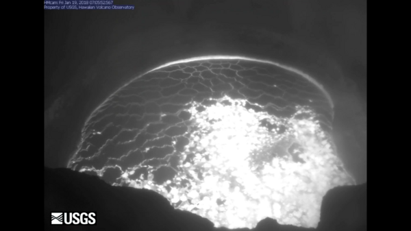
This video shows a rockfall and subsequent explosion that occurred at 7:03 a.m. HST today within the "Overlook crater" at the summit of Kīlauea. This collapse was followed by a smaller rockfall at 7:07 a.m. (not shown in video).
This video shows a rockfall and subsequent explosion that occurred at 7:03 a.m. HST today within the "Overlook crater" at the summit of Kīlauea. This collapse was followed by a smaller rockfall at 7:07 a.m. (not shown in video).
Antarctica's Pine Island Glacier has calved another iceberg. These Landsat images show the progression since just before the break in September until now.
At the USGS EROS Center, we study land change, operate the Landsat satellites, and maintain the longest, continuously acquired collection of images of the Earth's land surface.
 Landsat in Action - Monitoring Canada's Forest with Mike Wulder
Mike Wulder with Canada's Forest Service talks about the value Landsat images have for mapping and monitoring Canada's forested areas.
Mike Wulder with Canada's Forest Service talks about the value Landsat images have for mapping and monitoring Canada's forested areas.
 Landsat in Action - Tracking Water Changes with John Schott
John Schott with the Rochester Institute of Technology discusses using Landsat Data over the years, and how its Thermal data tracks temperature changes in water bodies.
John Schott with the Rochester Institute of Technology discusses using Landsat Data over the years, and how its Thermal data tracks temperature changes in water bodies.
 Image of the Week - Southern California Wildfires Update
After a month, the wildfires of Southern California are nearly contained. Landsat 8 imagery shows the dramatic burn scars left behind.
At the USGS EROS Center, we study land change, operate the Landsat satellites, and maintain the longest, continuously acquired collection of images of the Earth's land surface.
James Wamboldt (USGS – La Crosse, WI), Kelsie Murchy (University of Victoria - BC Canada), and Doug Blodgett (The Nature Conservancy- Illinois Rivers Office at Emiquon) testing an underwater acoustic deterrent for Asian Carp at the water control structure located at The Nature Conservancy’s Emiquon Preserve, Lewiston, Illinois in 2017.
James Wamboldt (USGS – La Crosse, WI), Kelsie Murchy (University of Victoria - BC Canada), and Doug Blodgett (The Nature Conservancy- Illinois Rivers Office at Emiquon) testing an underwater acoustic deterrent for Asian Carp at the water control structure located at The Nature Conservancy’s Emiquon Preserve, Lewiston, Illinois in 2017.
 Getting Started with MODIS Version 6 Therm. Anom. & Fire Data Part 1
This video focuses on the National Aeronautics and Space Administration’s (NASA) Terra and Aqua Moderate Resolution Imaging Spectroradiometer (MODIS) Version 6 Thermal Anomalies and Fire data distributed by NASA’s Land Processes Distributed Active Archive Center (LP DAAC).
This video focuses on the National Aeronautics and Space Administration’s (NASA) Terra and Aqua Moderate Resolution Imaging Spectroradiometer (MODIS) Version 6 Thermal Anomalies and Fire data distributed by NASA’s Land Processes Distributed Active Archive Center (LP DAAC).
 Getting Started with MODIS Version 6 Therm. Anom. & Fire Data Part 3
This video focuses on the National Aeronautics and Space Administration’s (NASA) Terra and Aqua Moderate Resolution Imaging Spectroradiometer (MODIS) Version 6 Thermal Anomalies and Fire data distributed by NASA’s Land Processes Distributed Active Archive Center (LP DAAC).
This video focuses on the National Aeronautics and Space Administration’s (NASA) Terra and Aqua Moderate Resolution Imaging Spectroradiometer (MODIS) Version 6 Thermal Anomalies and Fire data distributed by NASA’s Land Processes Distributed Active Archive Center (LP DAAC).
 Getting Started with MODIS Version 6 Therm. Anom. and Fire Data Part 2
This video focuses on the National Aeronautics and Space Administration’s (NASA) Terra and Aqua Moderate Resolution Imaging Spectroradiometer (MODIS) Version 6 Thermal Anomalies and Fire data distributed by NASA’s Land Processes Distributed Active Archive Center (LP DAAC).
This video focuses on the National Aeronautics and Space Administration’s (NASA) Terra and Aqua Moderate Resolution Imaging Spectroradiometer (MODIS) Version 6 Thermal Anomalies and Fire data distributed by NASA’s Land Processes Distributed Active Archive Center (LP DAAC).
USGS scientists, along with collaborators from the Marine Biological Laboratory, deployed a carbon flux tower on Great Marsh in 2017. Great Marsh is a 3800 acre salt marsh complex behind the Sandy Neck barrier beach in Barnstable, Cape Cod. This ecosystem is home to a variety of animals, including deer, fox, owls, and the rare Diamondback terrapin.
USGS scientists, along with collaborators from the Marine Biological Laboratory, deployed a carbon flux tower on Great Marsh in 2017. Great Marsh is a 3800 acre salt marsh complex behind the Sandy Neck barrier beach in Barnstable, Cape Cod. This ecosystem is home to a variety of animals, including deer, fox, owls, and the rare Diamondback terrapin.
 Groundwater use from the Ozark Plateaus aquifer system, 1900 to 2010
Groundwater use from the Ozark Plateaus aquifer system, 1900 to 2010” is a short video showing modeled groundwater withdrawal rates from the Ozark Plateaus aquifer system (Ozark system) in the central United States.
Groundwater use from the Ozark Plateaus aquifer system, 1900 to 2010” is a short video showing modeled groundwater withdrawal rates from the Ozark Plateaus aquifer system (Ozark system) in the central United States.


