



A current view of the most recent snapshot from a webcam located in Sand Key, Florida.
Webcams
The USGS maintains a variety of webcams across the U.S. These webcams provide valuable research information and data to the USGS scientists, the National Weather Service, emergency managers, and area residents to evaluate near, real-time conditions during natural hazard events (most webcams refresh every 5 - 20 minutes).
Filter Total Items: 351

Snapshot image for Sand Key, Florida
A current view of the most recent snapshot from a webcam located in Sand Key, Florida.

Time-averaged image at Madeira Beach, Florida, Camera 1
Time-averaged image at Madeira Beach, Florida, Camera 1Time-averaged images, which represent the time-mean of all the images collected during a video, are used to identify areas where waves are breaking, which show up as bright white bands in the image.
Time-averaged image at Madeira Beach, Florida, Camera 1
Time-averaged image at Madeira Beach, Florida, Camera 1Time-averaged images, which represent the time-mean of all the images collected during a video, are used to identify areas where waves are breaking, which show up as bright white bands in the image.
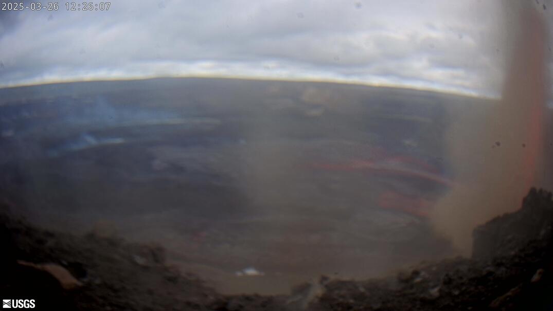
[KWcam] - Halemaʻumaʻu and down-dropped caldera floor; from the west rim of the summit caldera, looking southeast.
[KWcam] - Halemaʻumaʻu and down-dropped caldera floor; from the west rim of the summit caldera, looking southeast.Live Panorama of Halemaʻumaʻu and down-dropped caldera floor from the west rim of the summit caldera, looking southeast [KWcam].
Disclaimer
[KWcam] - Halemaʻumaʻu and down-dropped caldera floor; from the west rim of the summit caldera, looking southeast.
[KWcam] - Halemaʻumaʻu and down-dropped caldera floor; from the west rim of the summit caldera, looking southeast.Live Panorama of Halemaʻumaʻu and down-dropped caldera floor from the west rim of the summit caldera, looking southeast [KWcam].
Disclaimer

[MUcam] - Mauna Ulu Cam
This image is from a temporary research camera located on Mauna Ulu, looking northeast.
This image is from a temporary research camera located on Mauna Ulu, looking northeast.
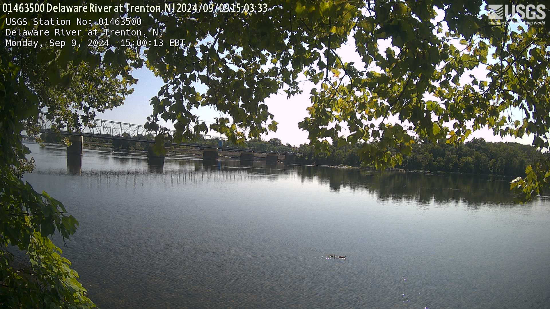
Streamgage 01463500 Delaware River at Trenton, NJ
Webcam at USGS Streamgage 01463500 Delaware River at Trenton NJ.
Visit the site page to access data for this site.
Webcam at USGS Streamgage 01463500 Delaware River at Trenton NJ.
Visit the site page to access data for this site.
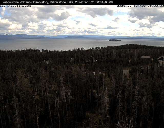
Webcam at Yellowstone Lake
The camera view is south-southeast over Yellowstone Lake from the cell phone tower near Fishing Bridge. Stevenson Island is visible within the lake on the right. The view extends down the Southeast Arm between the Promontory (low ridge rising from the lake) and the eastern shore.
The camera view is south-southeast over Yellowstone Lake from the cell phone tower near Fishing Bridge. Stevenson Island is visible within the lake on the right. The view extends down the Southeast Arm between the Promontory (low ridge rising from the lake) and the eastern shore.

Tres Palmas Video Camera Mid-Field Bright Image, 2
Tres Palmas Video Camera Mid-Field Bright Image, 2Video camera bright image at Tres Palmas in Rincón, on the west coast of Puerto Rico. [Larger version]
Learn more about the cameras and how we're using them to study wave dynamics.
Tres Palmas Video Camera Mid-Field Bright Image, 2
Tres Palmas Video Camera Mid-Field Bright Image, 2Video camera bright image at Tres Palmas in Rincón, on the west coast of Puerto Rico. [Larger version]
Learn more about the cameras and how we're using them to study wave dynamics.
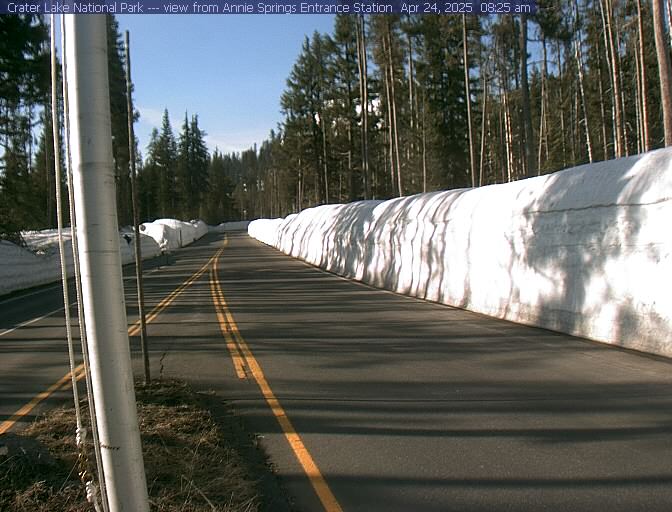
Annie Springs Entrance
Open year-round, Highway 62 provides access to Crater Lake's rim via Munson Valley Road. 7 miles long, Munson Valley Road takes visitors from Annie Spring entrance station (elevation 6000 ft) and climbs nearly 1100 feet to Rim Village. Image updates every 10 minutes.
By
Open year-round, Highway 62 provides access to Crater Lake's rim via Munson Valley Road. 7 miles long, Munson Valley Road takes visitors from Annie Spring entrance station (elevation 6000 ft) and climbs nearly 1100 feet to Rim Village. Image updates every 10 minutes.
By
Crater Lake National Park
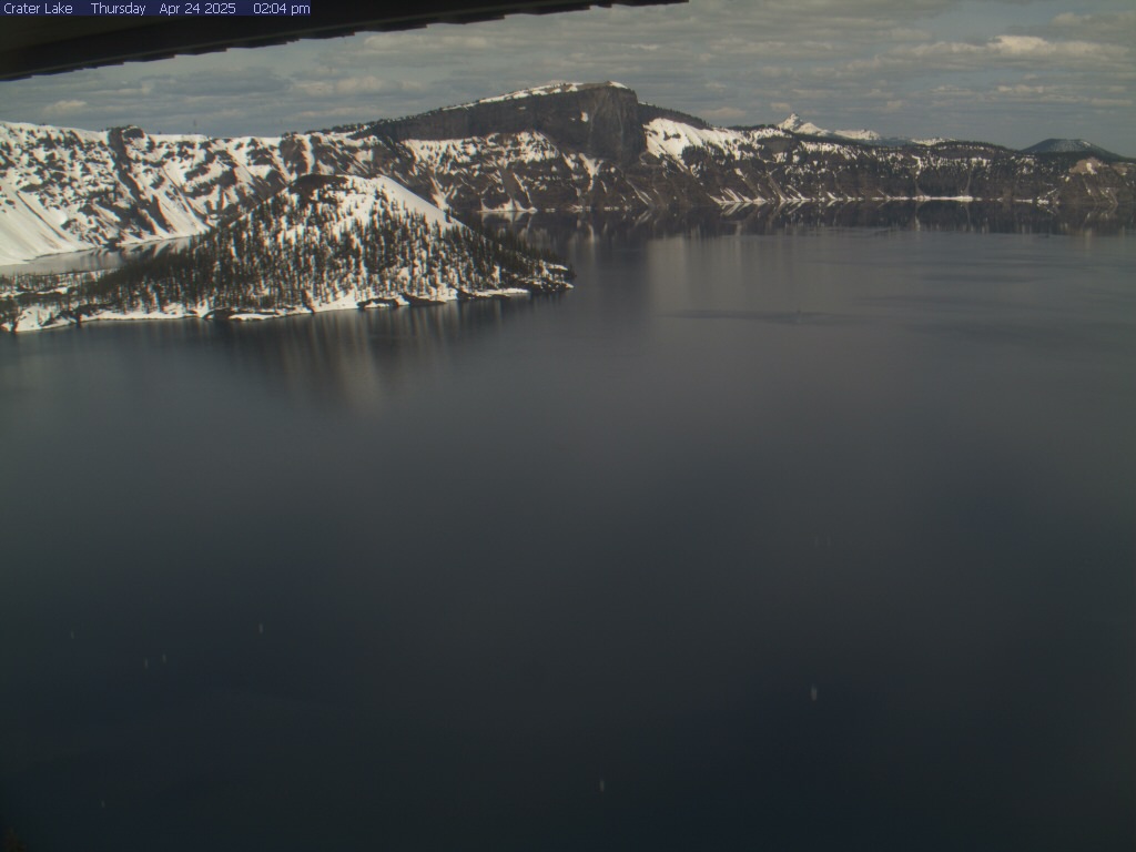
From the Sinnott Memorial Overlook webcam, 7,100 feet above sea level, you can view Wizard Island, Llao Rock, and at times you can see Mount Thielsen outside the park. Note: Up to 50% of the time in the winter the webcam is obscured by snow and clouds. The webcam updates every 10 minutes.
By
From the Sinnott Memorial Overlook webcam, 7,100 feet above sea level, you can view Wizard Island, Llao Rock, and at times you can see Mount Thielsen outside the park. Note: Up to 50% of the time in the winter the webcam is obscured by snow and clouds. The webcam updates every 10 minutes.
By
Pecos River Near Acme, NM
This is a webcam image of the Pecos River near Acme, New Mexico - Site #08386000
This is a webcam image of the Pecos River near Acme, New Mexico - Site #08386000
Steel Visitor Center
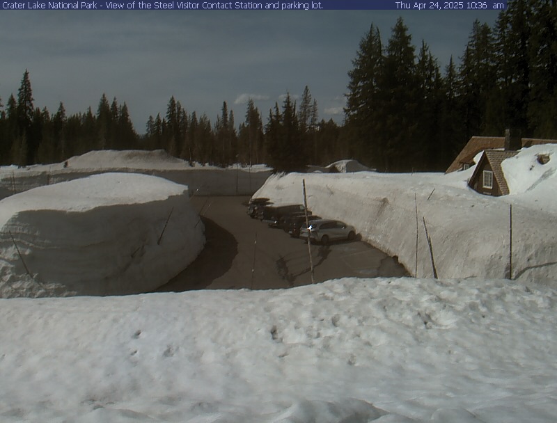
View of Steel Visitor Center at Crater Lake National Park headquarters, a few miles from Rim Village and the Crater Lake Lodge. The Steel Visitor Center is 6450 feet above sea level. Image updates every 10 minutes.
By
View of Steel Visitor Center at Crater Lake National Park headquarters, a few miles from Rim Village and the Crater Lake Lodge. The Steel Visitor Center is 6450 feet above sea level. Image updates every 10 minutes.
By

Santa Cruz Cowells Beach video camera bright image
Santa Cruz Cowells Beach video camera bright imageVideo camera bright image at Cowells Beach in Santa Cruz, California, looking southward. Learn more about the cameras and how we're using them to study coastal change.
Santa Cruz Cowells Beach video camera bright image
Santa Cruz Cowells Beach video camera bright imageVideo camera bright image at Cowells Beach in Santa Cruz, California, looking southward. Learn more about the cameras and how we're using them to study coastal change.

Santa Cruz Cowells Beach video camera dark image
Video camera dark image at Cowells Beach in Santa Cruz, California, looking southward. Learn more about the cameras and how we're using them to study coastal change.
Video camera dark image at Cowells Beach in Santa Cruz, California, looking southward. Learn more about the cameras and how we're using them to study coastal change.

Santa Cruz Cowells Beach video camera variance image
Santa Cruz Cowells Beach video camera variance imageVideo camera variance image at Cowells Beach in Santa Cruz, California, looking southward. Learn more about the cameras and how we're using them to study coastal change.
Santa Cruz Cowells Beach video camera variance image
Santa Cruz Cowells Beach video camera variance imageVideo camera variance image at Cowells Beach in Santa Cruz, California, looking southward. Learn more about the cameras and how we're using them to study coastal change.

Santa Cruz Main Beach video camera 1 snapshot
Video camera snapshot overlooking Main Beach in Santa Cruz, California, looking eastward. Learn more about the cameras and how we're using them to study coastal change.
Video camera snapshot overlooking Main Beach in Santa Cruz, California, looking eastward. Learn more about the cameras and how we're using them to study coastal change.
Santa Cruz Main Beach video camera bright image
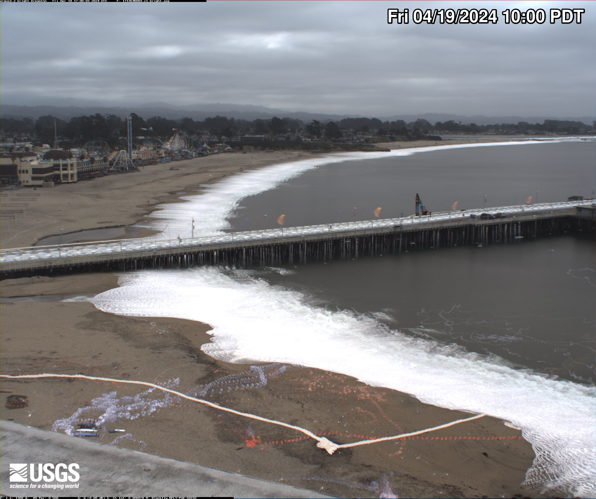
Video camera bright image at Main Beach in Santa Cruz, California, looking eastward. Learn more about the cameras and how we're using them to study coastal change.
Video camera bright image at Main Beach in Santa Cruz, California, looking eastward. Learn more about the cameras and how we're using them to study coastal change.

Santa Cruz Main Beach video camera dark image
Video camera dark image at Main Beach in Santa Cruz, California, looking eastward. Learn more about the cameras and how we're using them to study coastal change.
Video camera dark image at Main Beach in Santa Cruz, California, looking eastward. Learn more about the cameras and how we're using them to study coastal change.

Santa Cruz Main Beach video camera variance image
Video camera variance image at Main Beach in Santa Cruz, California, looking eastward. Learn more about the cameras and how we're using them to study coastal change.
Video camera variance image at Main Beach in Santa Cruz, California, looking eastward. Learn more about the cameras and how we're using them to study coastal change.

Unalakleet video camera 1 bright image
Two video cameras overlook the coast from atop a windmill tower in Unalakleet, Alaska where they look westward over Norton Sound. Every half hour during daylight hours, the cameras collect snapshots and video for 10 minutes. Today’s most recent image from camera 1 is shown here.
Two video cameras overlook the coast from atop a windmill tower in Unalakleet, Alaska where they look westward over Norton Sound. Every half hour during daylight hours, the cameras collect snapshots and video for 10 minutes. Today’s most recent image from camera 1 is shown here.

Unalakleet video camera 1 dark image
Two video cameras overlook the coast from atop a windmill tower in Unalakleet, Alaska where they look westward over Norton Sound. Every half hour during daylight hours, the cameras collect snapshots and video for 10 minutes. Today’s most recent image from camera 1 is shown here.
Two video cameras overlook the coast from atop a windmill tower in Unalakleet, Alaska where they look westward over Norton Sound. Every half hour during daylight hours, the cameras collect snapshots and video for 10 minutes. Today’s most recent image from camera 1 is shown here.
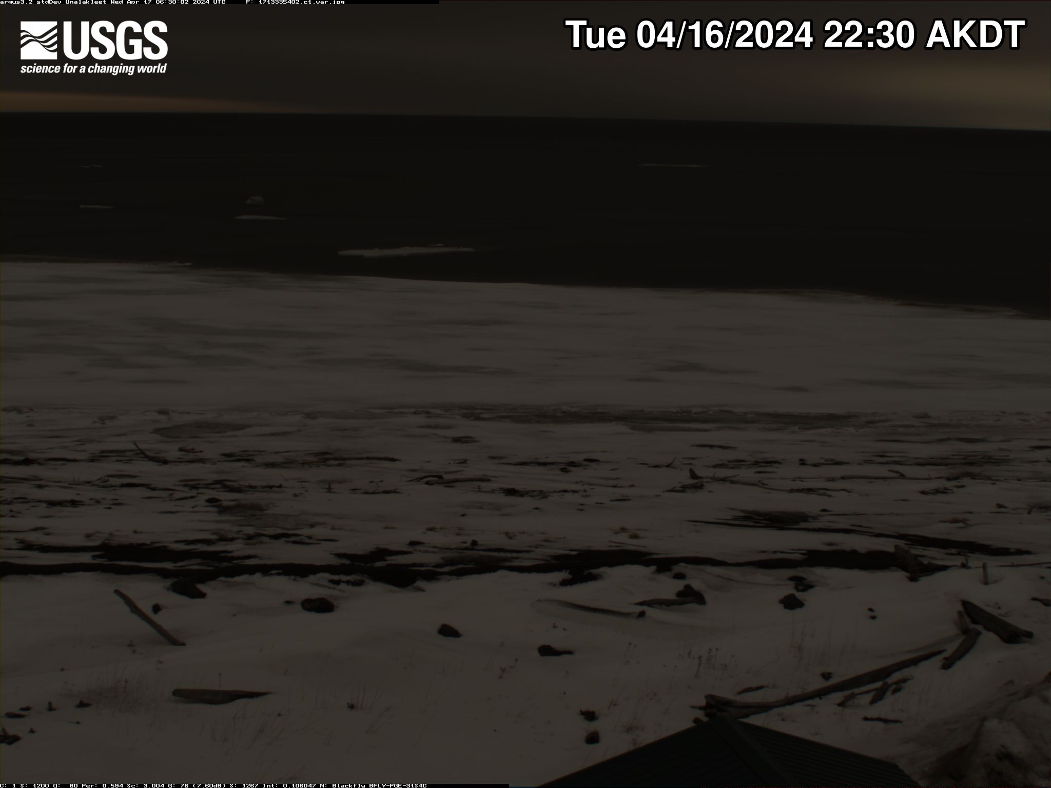
Unalakleet video camera 1 variance image
Two video cameras overlook the coast from atop a windmill tower in Unalakleet, Alaska where they look westward over Norton Sound. Every half hour during daylight hours, the cameras collect snapshots and video for 10 minutes. Today’s most recent image from camera 1 is shown here.
Two video cameras overlook the coast from atop a windmill tower in Unalakleet, Alaska where they look westward over Norton Sound. Every half hour during daylight hours, the cameras collect snapshots and video for 10 minutes. Today’s most recent image from camera 1 is shown here.