



Global Seabed Mineral Resources
Providing stakeholders with best available science regarding potential resources and environmental impacts associated with accessing those resources
Providing stakeholders with best available science regarding potential resources and environmental impacts associated with accessing those resources
Major Update to Satellite-Based Datasets Used to Assess Salt Marsh Vulnerability Nationwide
Seafloor Seismographs Rapidly Deployed Following Major Earthquake Offshore Northern California
Coral reef restoration
Cost-benefit study confirms coral reef restoration could be a cost-effective way to save lives and money
Cost-benefit study confirms coral reef restoration could be a cost-effective way to save lives and money
Ocean
USGS science improves our understanding of ocean processes, marine resources and submarine geohazards.
USGS science improves our understanding of ocean processes, marine resources and submarine geohazards.
Coasts
USGS provides critical science that informs risk reduction, protecting people, businesses, infrastructure, and resources along our coastlines, where 40% of our population lives.
USGS provides critical science that informs risk reduction, protecting people, businesses, infrastructure, and resources along our coastlines, where 40% of our population lives.
Meet the Coastal Science Navigator
Learn more about this new product to help you find useful USGS coastal data and tools
Learn more about this new product to help you find useful USGS coastal data and tools
Coastal and Marine Hazards and Resources Program
Scientists and staff study coastal and ocean processes, from shorelines to the deep sea, to identify hazards and provide critical information on our nation's resources. This work supports preparedness, emergency response, and the protection of people and resources in coastal and ocean environments.
Sound Waves Newsletter
Sound Waves Newsletter

Coastal and marine news from across the U.S. Geological Survey

News
PCMSC’s Andy O’Neill Receives CSBPA’s Joe Johnson Outstanding Service Award
PCMSC’s Andy O’Neill Receives CSBPA’s Joe Johnson Outstanding Service Award
Repeated Marine Heatwaves Have Dramatically Reshaped Coral Reefs in Hawaiʻi National Parks
Repeated Marine Heatwaves Have Dramatically Reshaped Coral Reefs in Hawaiʻi National Parks
Your Favorite Software for Calculating Shoreline Change Just Got Better
Your Favorite Software for Calculating Shoreline Change Just Got Better
Publications
Spatial heterogeneity of salt marsh vulnerability to sea-level rise: Dual controls of hydrological setting and salinity regime Spatial heterogeneity of salt marsh vulnerability to sea-level rise: Dual controls of hydrological setting and salinity regime
Salt marsh vulnerability to sea-level rise (SLR) is typically assessed using point measurements of vertical accretion, neglecting three-dimensionality of geomorphic evolution and spatial variability. Recent studies suggest links between vertical and horizontal vulnerability, with differences between oligohaline and polyhaline marshes, yet these relationships remain untested in estuary...
Woods Hole Coastal and Marine Science Center—2024 annual report Woods Hole Coastal and Marine Science Center—2024 annual report
The 2024 annual report of the U.S. Geological Survey Woods Hole Coastal and Marine Science Center highlights accomplishments of 2024, includes a list of 2024 publications, and summarizes the work of the center, as well as the work of each of its science groups. This product allows readers to gain a general understanding of the focus areas of the center’s scientific research and learn...
Compounding of 100-year coastal floods by rainfall in an urban environment Compounding of 100-year coastal floods by rainfall in an urban environment
Coastal and pluvial flooding are both becoming more prevalent and severe due to climate change and urbanization in floodplains. The co-occurrence of these flood drivers is generally assumed to exacerbate the resulting flood impacts, a result referred to as compound flooding. However, few observational or modeling studies have investigated the circumstances under which this occurs. Here...
Science
Coastal and Marine Science in Long Island Sound
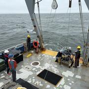
Long Island Sound is a highly productive estuary and vital natural resource bordering New York and Connecticut. It’s essential for its massive economic impact, generating billions annually by supporting recreation, fisheries, and transportation, as well as its biodiversity, serving as a critical habitat for thousands of marine species. USGS research in Long Island Sound helps protect these...
National Shoreline Change Data Publication Catalog
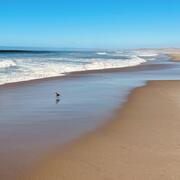
The U.S. Geological Survey (USGS) maintains shoreline positions for the United States from older sources, such as aerial photos and topographic surveys, and contemporary sources like digital elevation models (DEMs) and lidar elevation point cloud data. It's important to maintain, and make available, records of historical shoreline positions to allow monitoring of change over time, and to identify...
Offshore Analysis of Seafloor Instability and Sediments (OASIS)
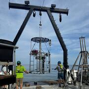
The Offshore Analysis of Seafloor Instability and Sediments (OASIS) project is an interagency partnership coordinated by the Bureau of Ocean Energy Management to better understand underwater mudslides and their impacts in the Mississippi River Delta Front. The USGS plays a central role in the project, contributing long-term expertise in coastal and marine geology, seafloor mapping, and geohazard...