
Forecasts and Models
Forecasts and Models
Filter Total Items: 47

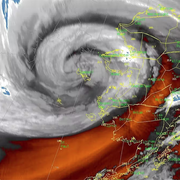
COAWST: A Coupled-Ocean-Atmosphere-Wave-Sediment Transport Modeling System
Understanding the processes responsible for coastal change is important for managing both our natural and economic coastal resources. Storms are one of the primary driving forces causing coastal change from a coupling of wave- and wind-driven flows. To better understand storm impacts and their effects on our coastlines, there is an international need to better predict storm paths and intensities...
Typhoon Merbok Disaster Recovery Project: Accomplishments
Supported by Title VII of Division N of the Consolidated Appropriations Act, 2023, the Typhoon Merbok Disaster Emergency Recovery Efforts project addresses critical data and capacity gaps in coastal Alaska by generating high resolution environmental datasets, hazard analyses, and monitoring tools needed to quantify erosion, flooding, and permafrost-related risks at the community scale.

Digital Shoreline Analysis System (DSAS)
Software for calculating positional boundary change over time The Digital Shoreline Analysis System (DSAS) version 6 is a standalone application that calculates shoreline or boundary change over time. The GIS of a user’s choice is used to prepare the data for DSAS. Like previous versions, DSAS v.6 enables a user to calculate rate-of-change statistics from multiple historical shoreline positions...

USGS CoastCams
The U.S. Geological Survey (USGS) uses a nationwide network of coastal observing cameras, or CoastCams, to monitor coastal conditions in near real-time and support research by the USGS and its partners into a variety of coastal processes and hazards. The most recent CoastCam images are made publicly available within minutes of data collection and can be accessed using the links below or by...

Remote Sensing Coastal Change
We use remote-sensing technologies—such as aerial photography, satellite imagery, structure-from-motion (SfM) photogrammetry, and lidar (laser-based surveying)—to measure coastal change along U.S. shorelines.

Coastal Climate Impacts
The impacts of climate change and sea-level rise around the Pacific and Arctic Oceans can vary tremendously. Thus far the vast majority of national and international impact assessments and models of coastal climate change have focused on low-relief coastlines that are not near seismically active zones. Furthermore, the degree to which extreme waves and wind will add further stress to coastal...

Using Video Imagery to Study Coastal Change: Santa Cruz Beaches
Two video cameras atop the Dream Inn hotel in Santa Cruz, California, overlook the coast in northern Monterey Bay. One camera looks eastward over Santa Cruz Main Beach and boardwalk, while the other looks southward over Cowells Beach.

PS-CoSMoS: Puget Sound Coastal Storm Modeling System
The CoSMoS model is currently available for most of the California coast and is now being expanded to support the 4.5 million coastal residents of the Puget Sound region, with emphasis on the communities bordering the sound.

Coastal Storm Modeling System (CoSMoS)
The Coastal Storm Modeling System (CoSMoS) makes detailed predictions of storm-induced coastal flooding, erosion, and cliff failures over large geographic scales. CoSMoS was developed for hindcast studies, operational applications and future climate scenarios to provide emergency responders and coastal planners with critical storm-hazards information that can be used to increase public safety...

Global Geoengineering Research
The Pacific Coastal and Marine Science Center geotechnical group investigates the causes of ground deformation and ground failure as a result of earthquakes, storms, and wave action

Probabilistic Forecasting of Earthquakes, Tsunamis, and Earthquake Effects in the Coastal Zone
The nation's coastlines are vulnerable to the interrelated hazards posed by earthquakes, landslides, and tsunamis. In the marine environment these events often occur in concert, and distant triggers can cause severe local effects, making the issue global in scope. As the population continues to migrate toward the coastlines, the social impacts of these hazards are expected to grow.

Using Video Imagery to Study Wave Dynamics: Unalakleet
USGS scientists installed two video cameras atop a windmill tower in Unalakleet, Alaska, pointing westward over Norton Sound, to observe and quantify coastal processes such as wave run-up, development of rip channels, bluff erosion, and movement of sandbars and ice floes.