



Evidence of damage to the Dujiangyan Tourist Information Center after the 12 May 2008 earthquake.
Images
Earthquake Hazards Program images.
Filter Total Items: 583

Dujiangyan
Evidence of damage to the Dujiangyan Tourist Information Center after the 12 May 2008 earthquake.

Dujiangyan
Emergency medical tents were set up on street corners in Dujiangyan after the 12 May 2008 earthquake.
Emergency medical tents were set up on street corners in Dujiangyan after the 12 May 2008 earthquake.

Dujiangyan
The 12 May 2008 earthquake caused these buildings in Dujiangyan significant structural damage.
The 12 May 2008 earthquake caused these buildings in Dujiangyan significant structural damage.

Dujiangyan
In Dujiangyan, machines are being used to clean up the rubble from the 12 May 2008 earthquake.
In Dujiangyan, machines are being used to clean up the rubble from the 12 May 2008 earthquake.

Dujiangyan
Some Dujiangyan citizens are living out of emergency tents after the 12 May 2008 earthquakes because their homes were rendered unsafe.
Some Dujiangyan citizens are living out of emergency tents after the 12 May 2008 earthquakes because their homes were rendered unsafe.

Dujiangyan
Evidence of damage to a building in Dujiangyan after the 12 May 2008 earthquake.
Evidence of damage to a building in Dujiangyan after the 12 May 2008 earthquake.

Dujiangyan
Rubble is piled roadside, leftover from the 12 May 2008 earthquake, in Dujiangyan.
Rubble is piled roadside, leftover from the 12 May 2008 earthquake, in Dujiangyan.

Dujiangyan
The 12 May 2008 earthquake was strong enough to damage this concrete wall in Dujiangyan.
The 12 May 2008 earthquake was strong enough to damage this concrete wall in Dujiangyan.

Dujiangyan
This building, in Dujiangyan, suffered significant structural damage after the 12 May 2008 earthquake.
This building, in Dujiangyan, suffered significant structural damage after the 12 May 2008 earthquake.

Dujiangyan
Debris leftover from the 12 May 2008 earthquake lines the sidewalks in Dujiangyan.
Debris leftover from the 12 May 2008 earthquake lines the sidewalks in Dujiangyan.

Dujiangyan
The 12 May 2008 earthquake was strong enough to destroy these buildings in Dujiangyan.
The 12 May 2008 earthquake was strong enough to destroy these buildings in Dujiangyan.

Seafloor map of Puerto Rico Trench
A NOAA image of the bathymetry north of Puerto Rico. Two ancient submarine landslides are visible as head scarps (labeled Loiza and Arecibo Amphitheaters). Seafloor fissures are indicated by black arrows, and dashed lines outline debris flows from past failures. Map annotated by Uri ten Brink, USGS
A NOAA image of the bathymetry north of Puerto Rico. Two ancient submarine landslides are visible as head scarps (labeled Loiza and Arecibo Amphitheaters). Seafloor fissures are indicated by black arrows, and dashed lines outline debris flows from past failures. Map annotated by Uri ten Brink, USGS
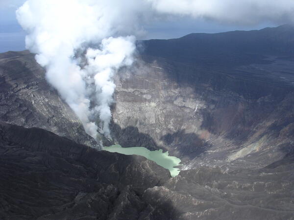
Anatahan active crater (Commonwealth of the Northern Mariana Islands) on May 29, 2006
Anatahan active crater (Commonwealth of the Northern Mariana Islands) on May 29, 2006This is an oblique, aerial view into the active crater of Anatahan on May 29, 2006, located on the eastern side of the island. Gas plumes were rising form new dome material within the crater where a small crater lake appears with a bright green color.
Anatahan active crater (Commonwealth of the Northern Mariana Islands) on May 29, 2006
Anatahan active crater (Commonwealth of the Northern Mariana Islands) on May 29, 2006This is an oblique, aerial view into the active crater of Anatahan on May 29, 2006, located on the eastern side of the island. Gas plumes were rising form new dome material within the crater where a small crater lake appears with a bright green color.
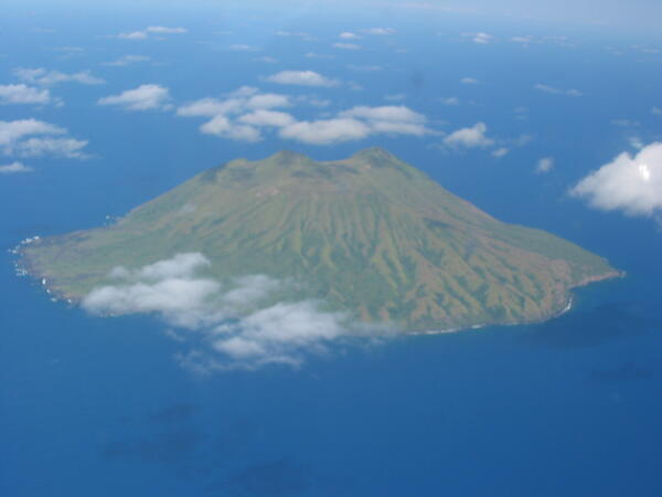
North shore view of Alamagan, CNMI
In this north shore view of Alamagan (Commonwealth of the Northern Mariana Islands) on May 21, 2006, sparse clouds were covering the shoreline. The photo was taken as scientists and volunteers from the Hawaiian Volcano Observatory returned from site visits on Pagan (located approximately 30 miles north of Alamagan).
In this north shore view of Alamagan (Commonwealth of the Northern Mariana Islands) on May 21, 2006, sparse clouds were covering the shoreline. The photo was taken as scientists and volunteers from the Hawaiian Volcano Observatory returned from site visits on Pagan (located approximately 30 miles north of Alamagan).
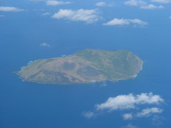
Guguan (Commonwealth of the Northern Mariana Islands) on May 21, 2006
Guguan (Commonwealth of the Northern Mariana Islands) on May 21, 2006In this west shore view of Guguan (Commonwealth of the Northern Mariana Islands) on May 21, 2006, cinder cones and lava flows are visible. The photo was taken as scientists and volunteers from the Hawaiian Volcano Observatory returned from site visits on Pagan (located approximately 50 miles north of Guguan).
Guguan (Commonwealth of the Northern Mariana Islands) on May 21, 2006
Guguan (Commonwealth of the Northern Mariana Islands) on May 21, 2006In this west shore view of Guguan (Commonwealth of the Northern Mariana Islands) on May 21, 2006, cinder cones and lava flows are visible. The photo was taken as scientists and volunteers from the Hawaiian Volcano Observatory returned from site visits on Pagan (located approximately 50 miles north of Guguan).
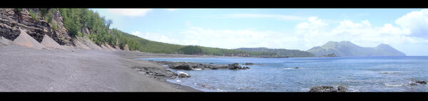
Togari Mountain and South Volcano of Pagan, CNMI
Along the west shore of Pagan Island, this is a view south-southwest to Togari Mountain (third highest peak) and South Volcano to the far right. Fieldwork by USGS Hawaiian Volcano Observatory scientists and volunteers spanned 10 days in the Northern Mariana Islands in May 2006.
Along the west shore of Pagan Island, this is a view south-southwest to Togari Mountain (third highest peak) and South Volcano to the far right. Fieldwork by USGS Hawaiian Volcano Observatory scientists and volunteers spanned 10 days in the Northern Mariana Islands in May 2006.
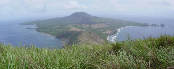
Mount Pagan on May 10, 2006
This view from Togari Mountain, looking north to the recently active Mount Pagan is a panoramic view from May 10, 2006. A team of Hawaiian Volcano scientists and volunteers assessed volcanic and seismic hazards in collaboration with the Saipan Emergency Management Office.
This view from Togari Mountain, looking north to the recently active Mount Pagan is a panoramic view from May 10, 2006. A team of Hawaiian Volcano scientists and volunteers assessed volcanic and seismic hazards in collaboration with the Saipan Emergency Management Office.
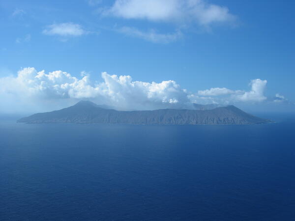
Anatahan (Commonwealth of the Northern Mariana Islands) on May 8, 2006
Anatahan (Commonwealth of the Northern Mariana Islands) on May 8, 2006In this south shore view of Anatahan (Commonwealth of the Northern Mariana Islands) on May 8, 2006, steam plumes were rising from the central crater. This was an early view of the island as scientists and volunteers from the Hawaiian Volcano Observatory prepared for site visits on Pagan (located approximately 116 miles north of Anatahan).
Anatahan (Commonwealth of the Northern Mariana Islands) on May 8, 2006
Anatahan (Commonwealth of the Northern Mariana Islands) on May 8, 2006In this south shore view of Anatahan (Commonwealth of the Northern Mariana Islands) on May 8, 2006, steam plumes were rising from the central crater. This was an early view of the island as scientists and volunteers from the Hawaiian Volcano Observatory prepared for site visits on Pagan (located approximately 116 miles north of Anatahan).
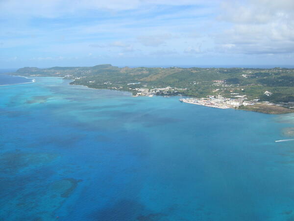
Saipan (Commonwealth of the Northern Mariana Islands) on May 8, 2006
Saipan (Commonwealth of the Northern Mariana Islands) on May 8, 2006View of the west coast of Saipan, looking at the Tanapag Harbor. Puntan Sabaneta (the area of Banzai Cliff) is at the far left of this photo (north part of the island). The active, subaerial volcanic island of Anatahan is about 70 miles north of Saipan. The active seamounts of Ruby and Esmeralda Bank are within 30 miles of Saipan to the southwest and northwest.
Saipan (Commonwealth of the Northern Mariana Islands) on May 8, 2006
Saipan (Commonwealth of the Northern Mariana Islands) on May 8, 2006View of the west coast of Saipan, looking at the Tanapag Harbor. Puntan Sabaneta (the area of Banzai Cliff) is at the far left of this photo (north part of the island). The active, subaerial volcanic island of Anatahan is about 70 miles north of Saipan. The active seamounts of Ruby and Esmeralda Bank are within 30 miles of Saipan to the southwest and northwest.

Schedule for news media interviews following Sumatra 2004 earthquake event
Schedule for news media interviews following Sumatra 2004 earthquake eventImage of schedule for news media interviews following Sumatra 2004 earthquake event.
Schedule for news media interviews following Sumatra 2004 earthquake event
Schedule for news media interviews following Sumatra 2004 earthquake eventImage of schedule for news media interviews following Sumatra 2004 earthquake event.

Sticky notes showing media interview requests following the 2004 Sumatra earthquake event.
Sticky notes showing media interview requests following the 2004 Sumatra earthquake event.Sticky notes showing media interview requests by journalists following the 2004 Sumatra earthquake event.
Sticky notes showing media interview requests following the 2004 Sumatra earthquake event.
Sticky notes showing media interview requests following the 2004 Sumatra earthquake event.Sticky notes showing media interview requests by journalists following the 2004 Sumatra earthquake event.