
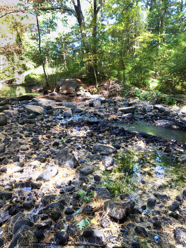
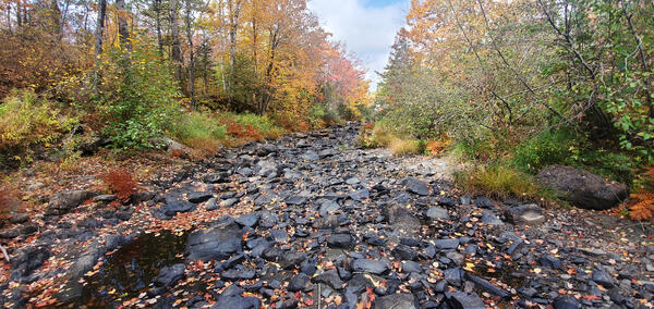
Photo Contest Winner | January 2021 | Where We Work
Ellis River, New Hampshire
Images
Images below come from a wide variety of USGS science activities in the Northeast Region. Science Center staff showcase what we do, who we are, and where we work conducting science that inform decision makers and addresses societal needs.
Filter Total Items: 2050

Ellis River New Hampshire
Photo Contest Winner | January 2021 | Where We Work
Ellis River, New Hampshire

Deploying the Autonomous Surf Vehicle at Pea Island
Deploying the Autonomous Surf Vehicle at Pea IslandThe USGS will be using an autonomous surf vehicle, built by Peter Traykovski of WHOI, to map the bathymetry of the Pea Island DUNEX Experiment Site.
Deploying the Autonomous Surf Vehicle at Pea Island
Deploying the Autonomous Surf Vehicle at Pea IslandThe USGS will be using an autonomous surf vehicle, built by Peter Traykovski of WHOI, to map the bathymetry of the Pea Island DUNEX Experiment Site.

Teaching techs how to count clicks
Photo Contest Winner | January 2021 | Honorable Mention 1
Teaching young techs how to count clicks
Photo Contest Winner | January 2021 | Honorable Mention 1
Teaching young techs how to count clicks

Neal Craig teaching new hydro tech Alice Mower at Fisherville, KY gage
Neal Craig teaching new hydro tech Alice Mower at Fisherville, KY gagePhoto Contest Winner | June 2021 | People
Neal Craig teaching new hydro tech Alice Mower at Fisherville, KY gage
Neal Craig teaching new hydro tech Alice Mower at Fisherville, KY gage
Neal Craig teaching new hydro tech Alice Mower at Fisherville, KY gagePhoto Contest Winner | June 2021 | People
Neal Craig teaching new hydro tech Alice Mower at Fisherville, KY gage

Sligo Creek Storm
Photo Contest Winner | January 2021 | Honorable Mention 2
Sligo Creek Storm
Photo Contest Winner | January 2021 | Honorable Mention 2
Sligo Creek Storm

USGS boat ready to collect water samples
USGS boat used to collect water samples in a PFAS-impacted lake on Cape Cod.
USGS boat used to collect water samples in a PFAS-impacted lake on Cape Cod.
2020 drought impact on Little River near Oxford, Massachusetts
2020 drought impact on Little River near Oxford, Massachusetts2020 drought impact on Little River near the USGS station 01124500 near Oxford, Massachusetts
2020 drought impact on Little River near Oxford, Massachusetts
2020 drought impact on Little River near Oxford, Massachusetts2020 drought impact on Little River near the USGS station 01124500 near Oxford, Massachusetts

Taking channel measurements from a canoe
Surface Water Modeling for FEMA Flood Insurance Rate Maps.
USGS employee in a canoe hold a prism and survey rod level while the channel point is collected with a total station from shore.
Surface Water Modeling for FEMA Flood Insurance Rate Maps.
USGS employee in a canoe hold a prism and survey rod level while the channel point is collected with a total station from shore.

Behind the Total Station
Surface Water Modeling for FEMA Flood Insurance Rate Maps.
Hydrologic Technician Gunther Schletter takes a channel measurement using a Total Station on a river near St. Johnsbury, VT.
Surface Water Modeling for FEMA Flood Insurance Rate Maps.
Hydrologic Technician Gunther Schletter takes a channel measurement using a Total Station on a river near St. Johnsbury, VT.

2020 drought impact on Cochituate Brook at Framingham, Massachusetts
2020 drought impact on Cochituate Brook at Framingham, MassachusettsThe New England Water Science Center continuously monitors the status of New England's principal rivers, reservoirs, and aquifers to compare current hydrologic conditions with normal and extreme recorded values. Displayed on the photo is a drought impact on Cochituate Brook at Framingham, Massachusetts.

Earth MRI Funds Critical Minerals Projects in West Virginia
Earth MRI Funds Critical Minerals Projects in West VirginiaUSGS map of Earth MRI projects in West Virginia announced in September 2020.
Earth MRI Funds Critical Minerals Projects in West Virginia
Earth MRI Funds Critical Minerals Projects in West VirginiaUSGS map of Earth MRI projects in West Virginia announced in September 2020.

Stony Brook near West Suffield, Connecticut during 2020 drought
Stony Brook near West Suffield, Connecticut during 2020 droughtStation 01184100 Stony Brook near West Suffield, Connecticut.
Stony Brook near West Suffield, Connecticut during 2020 drought
Stony Brook near West Suffield, Connecticut during 2020 droughtStation 01184100 Stony Brook near West Suffield, Connecticut.

2020 drought impact on Stony Brook near West Suffield, Connecticut
2020 drought impact on Stony Brook near West Suffield, ConnecticutStation 01184100 Stony Brook near West Suffield, Connecticut.
2020 drought impact on Stony Brook near West Suffield, Connecticut
2020 drought impact on Stony Brook near West Suffield, ConnecticutStation 01184100 Stony Brook near West Suffield, Connecticut.

USGS Hydrologic Technician Collecting Water Samples
USGS Hydrologic Technician Collecting Water SamplesUSGS Hydrologic Technician assisting with collection of downwelling porewater samples in a PFAS-impacted lake on Cape Cod.
USGS Hydrologic Technician Collecting Water Samples
USGS Hydrologic Technician Collecting Water SamplesUSGS Hydrologic Technician assisting with collection of downwelling porewater samples in a PFAS-impacted lake on Cape Cod.

Dry river bed during 2020 drought - Mill River, Cheshire, Connecticut
Dry river bed during 2020 drought - Mill River, Cheshire, ConnecticutStation 01196588 Mill River at Cook Hill Rd. in Cheshire, Connecticut.
Photo shows dry river channel at location of staff gage.
Dry river bed during 2020 drought - Mill River, Cheshire, Connecticut
Dry river bed during 2020 drought - Mill River, Cheshire, ConnecticutStation 01196588 Mill River at Cook Hill Rd. in Cheshire, Connecticut.
Photo shows dry river channel at location of staff gage.

2020 drought impact on Sudbury River in Saxonville, Massachusetts
2020 drought impact on Sudbury River in Saxonville, Massachusetts2020 drought impact on Sudbury River near the USGS station 01098530 in Saxonville, Massachusetts
2020 drought impact on Sudbury River in Saxonville, Massachusetts
2020 drought impact on Sudbury River in Saxonville, Massachusetts2020 drought impact on Sudbury River near the USGS station 01098530 in Saxonville, Massachusetts

Wildwood NJ Surf
Photo of the surf and clouds in Wildwood, NJ November 2019.
Photo of the surf and clouds in Wildwood, NJ November 2019.

2020 drought impact on Segreganset River near Dighton, Massachusetts
2020 drought impact on Segreganset River near Dighton, Massachusetts2020 drought impact on Segreganset River near USGS station 01109070, Dighton, Massachusetts
2020 drought impact on Segreganset River near Dighton, Massachusetts
2020 drought impact on Segreganset River near Dighton, Massachusetts2020 drought impact on Segreganset River near USGS station 01109070, Dighton, Massachusetts

Lake George in the Fall
Lake George, New York, in the fall with a dock and watercraft.
Lake George, New York, in the fall with a dock and watercraft.

Quinebaug River during 2020 drought, West Thompson, Connecticut
Quinebaug River during 2020 drought, West Thompson, ConnecticutQuinebaug River near West Thompson, Connecticut. Photo shows one of few deeper pools of water in the 01124151 station vicinity during drought.
Quinebaug River during 2020 drought, West Thompson, Connecticut
Quinebaug River during 2020 drought, West Thompson, ConnecticutQuinebaug River near West Thompson, Connecticut. Photo shows one of few deeper pools of water in the 01124151 station vicinity during drought.